USGS NWIS Stream/River/Lake Site 01398102: South Branch Raritan River at South Branch NJ
Map
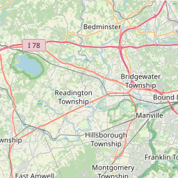
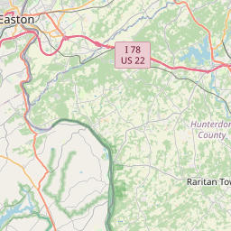


Leaflet | <a href="https://www.openstreetmap.org/copyright">© OpenStreetMap contributors</a>
Item
| Property | Value |
|---|---|
| id | 1039849 |
| cluster | None |
| dasqkm_diff | 2.60000000000002 |
| description | USGS NWIS Stream/River/Lake Site 01398102: South Branch Raritan River at South Branch NJ |
| fid | 186995 |
| gage_totdasqkm | 686.3 |
| mainstem_uri | https://geoconnex.us/ref/mainstems/2119768 |
| name | South Branch Raritan River at South Branch NJ |
| nhdpv2_comid | 9513394.0 |
| nhdpv2_link_source | https://www.epa.gov/waterdata/nhdplus-national-hydrography-dataset-plus |
| nhdpv2_offset_m | 37.3803096587515 |
| nhdpv2_reach_measure | 100.0 |
| nhdpv2_reachcode | 02030105000084 |
| nhdpv2_totdasqkm | 688.9 |
| nws_url | https://water.noaa.gov/gauges/SBNN4 |
| provider | https://waterdata.usgs.gov |
| provider_id | 01398102 |
| subjectof | https://waterdata.usgs.gov/monitoring-location/01398102 |
| uri | https://geoconnex.us/ref/gages/1039849 |