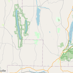
USGS NWIS Stream/River/Lake Site 0421469008: CAYUGA CREEK BELOW RIGHT BRANCH NEAR BENNINGTON NY
Map
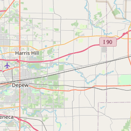

Leaflet | <a href="https://www.openstreetmap.org/copyright">© OpenStreetMap contributors</a>
Item
| Property | Value |
|---|---|
| id | 1046022 |
| cluster | None |
| dasqkm_diff | 4.0 |
| description | USGS NWIS Stream/River/Lake Site 0421469008: CAYUGA CREEK BELOW RIGHT BRANCH NEAR BENNINGTON NY |
| fid | 34753 |
| gage_totdasqkm | 81.6 |
| mainstem_uri | https://geoconnex.us/ref/mainstems/2077732 |
| name | CAYUGA CREEK BELOW RIGHT BRANCH NEAR BENNINGTON NY |
| nhdpv2_comid | 15575013.0 |
| nhdpv2_link_source | https://github.com/internetofwater/ref_gages |
| nhdpv2_offset_m | 32.4964645850448 |
| nhdpv2_reach_measure | 100.0 |
| nhdpv2_reachcode | 04120103000192 |
| nhdpv2_totdasqkm | 85.6 |
| nws_url | None |
| provider | https://waterdata.usgs.gov |
| provider_id | 0421469008 |
| subjectof | https://waterdata.usgs.gov/monitoring-location/0421469008 |
| uri | https://geoconnex.us/ref/gages/1046022 |