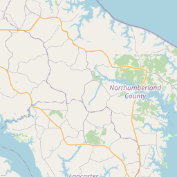
USGS NWIS Stream/River/Lake Site 01671160: NORTH ANNA RIVER AB SOUTH ANNA RIV NR ASHLAND, VA
Map
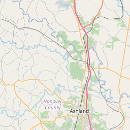


Leaflet | <a href="https://www.openstreetmap.org/copyright">© OpenStreetMap contributors</a>
Item
| Property | Value |
|---|---|
| id | 1063251 |
| cluster | None |
| dasqkm_diff | 1.5 |
| description | USGS NWIS Stream/River/Lake Site 01671160: NORTH ANNA RIVER AB SOUTH ANNA RIV NR ASHLAND, VA |
| fid | 55071 |
| gage_totdasqkm | 1538.5 |
| mainstem_uri | https://geoconnex.us/ref/mainstems/2173445 |
| name | NORTH ANNA RIVER AB SOUTH ANNA RIV NR ASHLAND, VA |
| nhdpv2_comid | 8505984.0 |
| nhdpv2_link_source | https://github.com/internetofwater/ref_gages |
| nhdpv2_offset_m | 25.9431939895292 |
| nhdpv2_reach_measure | 1.4344 |
| nhdpv2_reachcode | 02080106000132 |
| nhdpv2_totdasqkm | 1540.0 |
| nws_url | None |
| provider | https://waterdata.usgs.gov |
| provider_id | 01671160 |
| subjectof | https://waterdata.usgs.gov/monitoring-location/01671160 |
| uri | https://geoconnex.us/ref/gages/1063251 |