Item 1096195
Map
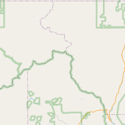

Leaflet | <a href="https://www.openstreetmap.org/copyright">© OpenStreetMap contributors</a>
Item
| Property | Value |
|---|---|
| id | 1096195 |
| cluster | https://geoconnex.us/ref/gages/1190333 |
| dasqkm_diff | None |
| description | None |
| fid | 85561 |
| gage_totdasqkm | None |
| mainstem_uri | None |
| name | None |
| nhdpv2_comid | 916805.0 |
| nhdpv2_link_source | https://github.com/internetofwater/ref_gages |
| nhdpv2_offset_m | 56.2548788707947 |
| nhdpv2_reach_measure | 98.0802 |
| nhdpv2_reachcode | 11020001001303 |
| nhdpv2_totdasqkm | 16.8 |
| nws_url | None |
| provider | https://waterdata.usgs.gov |
| provider_id | 09077500 |
| subjectof | None |
| uri | https://geoconnex.us/ref/gages/1096195 |