/
https://geoconnex.us/ref/hu08/10110201
JSON
JSON-LD
Resources
Collections
Processes
Documentation
Geoconnex Docs
API Definition
Conformance
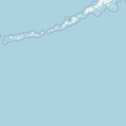
Upper Little Missouri
Map
+
−
Leaflet
| <a href="https://www.openstreetmap.org/copyright">© OpenStreetMap contributors</a>
Previous
Next
Item
Property
Value
id
10110201
fid
1306
gnis_id
None
gnis_url
hucs
https://geoconnex.us/iow/wqp/21NDHDWQ-553060
https://geoconnex.us/iow/wqp/11NPSWRD_WQX-DETO_NURE_0014
https://geoconnex.us/iow/wqp/11NPSWRD_WQX-DETO_NURE_0012
https://geoconnex.us/iow/wqp/MDEQ_WQ_WQX-Y27DUGND02
https://geoconnex.us/iow/wqp/USGS-453003103573201
https://geoconnex.us/iow/wqp/USGS-453122103582601
https://geoconnex.us/iow/wqp/USGS-452228103513901
https://geoconnex.us/iow/wqp/USGS-452609103483601
https://geoconnex.us/iow/wqp/USGS-445450104391502
https://geoconnex.us/iow/wqp/USGS-450057104425201
https://geoconnex.us/iow/wqp/USGS-461135103563001
https://geoconnex.us/iow/wqp/WYDEQ_WQX-NGP0170
https://geoconnex.us/iow/wqp/USGS-452305103495601
https://geoconnex.us/iow/wqp/USGS-452656103541201
https://geoconnex.us/iow/wqp/USGS-454210103472001
https://geoconnex.us/iow/wqp/MDEQ_WQ_WQX-Y27DUGND05
https://geoconnex.us/iow/wqp/MDEQ_WQ_WQX-Y27LBVRC12
https://geoconnex.us/iow/wqp/USGS-455310104324001
https://geoconnex.us/iow/wqp/11NPSWRD_WQX-DETO_NURE_0013
https://geoconnex.us/iow/wqp/11NPSWRD_WQX-DETO_NURE_0015
https://geoconnex.us/iow/wqp/21NDHDWQ-380925
https://geoconnex.us/iow/wqp/USGS-460327104111001
https://geoconnex.us/iow/wqp/USGS-455144103471001
https://geoconnex.us/iow/wqp/MDEQ_WQ_WQX-Y27LMSRR02
https://geoconnex.us/iow/wqp/USGS-461534103491701
https://geoconnex.us/iow/wqp/USGS-452222103513601
https://geoconnex.us/iow/wqp/USGS-453122103533401
https://geoconnex.us/iow/wqp/MONT_DEQ_WQX-1994TH06
https://geoconnex.us/iow/wqp/MDEQ_WQ_WQX-Y27BVRDC01
https://geoconnex.us/iow/wqp/USGS-453541104170001
https://geoconnex.us/iow/wqp/USGS-454905103473101
https://geoconnex.us/iow/wqp/MDEQ_WQ_WQX-Y27LMSRR05
https://geoconnex.us/iow/wqp/MDEQ_WQ_WQX-Y27THMPC01
https://geoconnex.us/iow/wqp/SDDENR_WQX-460955
https://geoconnex.us/iow/wqp/MDEQ_WQ_WQX-Y27LBVRC13
https://geoconnex.us/iow/wqp/USGS-452619104031301
https://geoconnex.us/iow/wqp/USGS-453332103574601
https://geoconnex.us/iow/wqp/USGS-452207103492401
https://geoconnex.us/iow/wqp/USGS-461130104142001
https://geoconnex.us/iow/wqp/MONT_DEQ_WQX-1993TH02
https://geoconnex.us/iow/wqp/USGS-455327103570301
https://geoconnex.us/iow/wqp/USGS-460518104040000
https://geoconnex.us/iow/wqp/USGS-461345103541601
https://geoconnex.us/iow/wqp/USGS-461348103394701
https://geoconnex.us/iow/wqp/USGS-451752103591301
https://geoconnex.us/iow/wqp/MDEQ_WQ_WQX-Y27LMSRR04
https://geoconnex.us/iow/wqp/MDEQ_WQ_WQX-Y27WILOC01
https://geoconnex.us/iow/wqp/NARS_WQX-WYS9-0935
https://geoconnex.us/iow/wqp/USGS-445410105065001
https://geoconnex.us/iow/wqp/MONT_DEQ_WQX-1994TH07
https://geoconnex.us/iow/wqp/USGS-452514103432201
https://geoconnex.us/iow/wqp/NARS_WQX-NDRF-0002
https://geoconnex.us/iow/wqp/USGS-455159103582301
https://geoconnex.us/iow/wqp/USGS-455215103541001
https://geoconnex.us/iow/wqp/USGS-461154103544701
https://geoconnex.us/iow/wqp/USGS-454121103541401
https://geoconnex.us/iow/wqp/USGS-454449104000001
https://geoconnex.us/iow/wqp/NARS_WQX-FW08WY090
https://geoconnex.us/iow/wqp/MDEQ_WQ_WQX-Y27LMSRR03
https://geoconnex.us/iow/wqp/MDEQ_WQ_WQX-Y27LBVRC02
https://geoconnex.us/iow/wqp/21NDHDWQ-380926
https://geoconnex.us/iow/wqp/USGS-445755104220001
https://geoconnex.us/iow/wqp/USGS-454742103460101
https://geoconnex.us/iow/wqp/MONT_DEQ_WQX-1994TH02
https://geoconnex.us/iow/wqp/MDEQ_WQ_WQX-Y27LBVRC05
https://geoconnex.us/iow/wqp/MONT_DEQ_WQX-2397LI01
https://geoconnex.us/iow/wqp/USGS-452233103561601
https://geoconnex.us/iow/wqp/USGS-460619103394201
https://geoconnex.us/iow/wqp/MDEQ_WQ_WQX-Y27LMSRR09
https://geoconnex.us/iow/wqp/MONT_DEQ_WQX-2093WI01
https://geoconnex.us/iow/wqp/USGS-453910103554001
https://geoconnex.us/iow/wqp/NARS_WQX-NLA06608-1578
https://geoconnex.us/iow/wqp/USGS-454207103592701
https://geoconnex.us/iow/wqp/USGS-451223104382301
https://geoconnex.us/iow/wqp/USGS-460001104220501
https://geoconnex.us/iow/wqp/USGS-454622103531801
https://geoconnex.us/iow/wqp/USGS-06335000
https://geoconnex.us/iow/wqp/MONT_DEQ_WQX-2497LI01
https://geoconnex.us/iow/wqp/USGS-444240105073001
https://geoconnex.us/iow/wqp/USGS-453946103472001
https://geoconnex.us/iow/wqp/USGS-452240104130701
https://geoconnex.us/iow/wqp/USGS-460955104194001
https://geoconnex.us/iow/wqp/USGS-455325104460801
https://geoconnex.us/iow/wqp/USGS-445800104470001
https://geoconnex.us/iow/wqp/USGS-452009103561601
https://geoconnex.us/iow/wqp/USGS-452329103591201
https://geoconnex.us/iow/wqp/USGS-455056103491901
https://geoconnex.us/iow/wqp/USGS-455333104323501
https://geoconnex.us/iow/wqp/USGS-452243104131501
https://geoconnex.us/iow/wqp/USGS-452533103521501
https://geoconnex.us/iow/wqp/USGS-444328105004801
https://geoconnex.us/iow/wqp/MONT_DEQ_WQX-3193LI01
https://geoconnex.us/iow/wqp/MDEQ_WQ_WQX-Y27LMOR01
https://geoconnex.us/iow/wqp/MDEQ_WQ_WQX-Y27FLETC01
https://geoconnex.us/iow/wqp/USGS-460910104272501
https://geoconnex.us/iow/wqp/USGS-450734104410701
https://geoconnex.us/iow/wqp/USGS-06334000
https://geoconnex.us/iow/wqp/USGS-460830104030001
https://geoconnex.us/iow/wqp/WYDEQ_WATERSHED-NGP0167
https://geoconnex.us/iow/wqp/USGS-460857103463801
https://geoconnex.us/iow/wqp/USGS-461309103393701
https://geoconnex.us/iow/wqp/USGS-455446104321201
https://geoconnex.us/iow/wqp/USGS-453657104340701
https://geoconnex.us/iow/wqp/USGS-454200103505601
https://geoconnex.us/iow/wqp/USGS-455606103483201
https://geoconnex.us/iow/wqp/USGS-451954103573701
https://geoconnex.us/iow/wqp/USGS-453516103555501
https://geoconnex.us/iow/wqp/WYDEQ_WQX-NGP0168
https://geoconnex.us/iow/wqp/USGS-450000104180101
https://geoconnex.us/iow/wqp/MDEQ_WQ_WQX-Y27LBVRC01
https://geoconnex.us/iow/wqp/21NDHDWQ-380927
https://geoconnex.us/iow/wqp/NARS_WQX-FW08SD056
https://geoconnex.us/iow/wqp/USGS-452156103541901
https://geoconnex.us/iow/wqp/MONT_DEQ_WQX-2094WI01
https://geoconnex.us/iow/wqp/USGS-454012103585101
https://geoconnex.us/iow/wqp/USGS-455615104314301
https://geoconnex.us/iow/wqp/USGS-454543103512801
https://geoconnex.us/iow/wqp/USGS-452327103590601
https://geoconnex.us/iow/wqp/WYDEQ_WQX-NGP0167
https://geoconnex.us/iow/wqp/USGS-460923103490001
https://geoconnex.us/iow/wqp/USGS-454214103563801
https://geoconnex.us/iow/wqp/USGS-454651103515401
https://geoconnex.us/iow/wqp/USGS-454530103451001
https://geoconnex.us/iow/wqp/MDEQ_WQ_WQX-Y27HDNWC01
https://geoconnex.us/iow/wqp/USGS-443515104562001
https://geoconnex.us/iow/wqp/USGS-452727103593801
https://geoconnex.us/iow/wqp/USGS-454850103563801
https://geoconnex.us/iow/wqp/USGS-455400103474901
https://geoconnex.us/iow/wqp/USGS-452517103431801
https://geoconnex.us/iow/wqp/USGS-452848103483601
https://geoconnex.us/iow/wqp/USGS-461738103585501
https://geoconnex.us/iow/wqp/USGS-453712103544301
https://geoconnex.us/iow/wqp/MDEQ_WQ_WQX-Y27THMPC02
https://geoconnex.us/iow/wqp/USGS-455305104325501
https://geoconnex.us/iow/wqp/MDEQ_WQ_WQX-Y27LMOR03
https://geoconnex.us/iow/wqp/21NDHDWQ-553094
https://geoconnex.us/iow/wqp/MDEQ_WQ_WQX-Y27LBVRC06
https://geoconnex.us/iow/wqp/USGS-452823104015301
https://geoconnex.us/iow/wqp/USGS-455638103510001
https://geoconnex.us/iow/wqp/WYDEQ_WATERSHED-NGP0170
https://geoconnex.us/iow/wqp/USGS-454213103472601
https://geoconnex.us/iow/wqp/USGS-454111103500401
https://geoconnex.us/iow/wqp/MONT_DEQ_WQX-1994TH01
https://geoconnex.us/iow/wqp/NARS_WQX-NDSS-1133
https://geoconnex.us/iow/wqp/MDEQ_WQ_WQX-Y27DUGND03
https://geoconnex.us/iow/wqp/USGS-454103103491301
https://geoconnex.us/iow/wqp/USGS-444327105004501
https://geoconnex.us/iow/wqp/21NDHDWQ_WQX-380925
https://geoconnex.us/iow/wqp/MDEQ_WQ_WQX-Y27DUGND01
https://geoconnex.us/iow/wqp/MDEQ_WQ_WQX-Y27ELKHC01
https://geoconnex.us/iow/wqp/USGS-445430105052001
https://geoconnex.us/iow/wqp/USGS-452519103431501
https://geoconnex.us/iow/wqp/MONT_DEQ_WQX-1994LI01
https://geoconnex.us/iow/wqp/USGS-453740103583701
https://geoconnex.us/iow/wqp/USGS-454727103465501
https://geoconnex.us/iow/wqp/USGS-450647104382701
https://geoconnex.us/iow/wqp/USGS-453054103512801
https://geoconnex.us/iow/wqp/MDEQ_WQ_WQX-Y27LBVRC17
https://geoconnex.us/iow/wqp/MDEQ_WQ_WQX-Y27LMSRR08
https://geoconnex.us/iow/wqp/USGS-455452104321201
https://geoconnex.us/iow/wqp/WYDEQ_WQX-NGP0169
https://geoconnex.us/iow/wqp/USGS-453008103591001
https://geoconnex.us/iow/wqp/USGS-454727103581201
https://geoconnex.us/iow/wqp/USGS-460638104025100
https://geoconnex.us/iow/wqp/USGS-460849103405902
https://geoconnex.us/iow/wqp/NARS-EPA01-0457
https://geoconnex.us/iow/wqp/USGS-452006103583701
https://geoconnex.us/iow/wqp/USGS-452530103541801
https://geoconnex.us/iow/wqp/USGS-460950103513101
https://geoconnex.us/iow/wqp/MDEQ_WQ_WQX-Y27DUGND04
https://geoconnex.us/iow/wqp/MDEQ_WQ_WQX-Y27LBVRC15
https://geoconnex.us/iow/wqp/MDEQ_WQ_WQX-Y27LMSRR01
https://geoconnex.us/iow/wqp/USGS-452612103522401
https://geoconnex.us/iow/wqp/USGS-460900104110501
https://geoconnex.us/iow/wqp/USGS-445100104443001
https://geoconnex.us/iow/wqp/USGS-452202103583701
https://geoconnex.us/iow/wqp/MONT_DEQ_WQX-1994LI02
https://geoconnex.us/iow/wqp/MDEQ_WQ_WQX-Y27LBVRC03
https://geoconnex.us/iow/wqp/USGS-06332800
https://geoconnex.us/iow/wqp/USGS-451459104113201
https://geoconnex.us/iow/wqp/USGS-445706105035101
https://geoconnex.us/iow/wqp/USGS-455555103450001
https://geoconnex.us/iow/wqp/USGS-454511103500101
https://geoconnex.us/iow/wqp/USGS-452539103521901
https://geoconnex.us/iow/wqp/USGS-454121103540301
https://geoconnex.us/iow/wqp/WYDEQ_WATERSHED-NGP0168
https://geoconnex.us/iow/wqp/USGS-454044103451401
https://geoconnex.us/iow/wqp/NARS_WQX-FW08WY070
https://geoconnex.us/iow/wqp/USGS-452909103504201
https://geoconnex.us/iow/wqp/USGS-460658104223701
https://geoconnex.us/iow/wqp/USGS-453023103495501
https://geoconnex.us/iow/wqp/MDEQ_WQ_WQX-Y27NCWDC01
https://geoconnex.us/iow/wqp/USGS-460448103402901
https://geoconnex.us/iow/wqp/USGS-452931103595201
https://geoconnex.us/iow/wqp/NARS_WQX-FW08RND010456
https://geoconnex.us/iow/wqp/MDEQ_WQ_WQX-Y27HAYC01
https://geoconnex.us/iow/wqp/MDEQ_WQ_WQX-Y27HRSEC01
https://geoconnex.us/iow/wqp/MDEQ_WQ_WQX-Y27LBVRC14
https://geoconnex.us/iow/wqp/MDEQ_WQ_WQX-Y27LMSRR06
https://geoconnex.us/iow/wqp/SDDENR_WQX-SD_10039
https://geoconnex.us/iow/wqp/USGS-451522104283500
https://geoconnex.us/iow/wqp/USGS-453715103514301
https://geoconnex.us/iow/wqp/USGS-460429103415301
https://geoconnex.us/iow/wqp/WYDEQ_WATERSHED-NGP0169
https://geoconnex.us/iow/wqp/USGS-450256104274101
https://geoconnex.us/iow/wqp/MONT_DEQ_WQX-2196LI01
https://geoconnex.us/iow/wqp/NARS_WQX-FW08ND042
https://geoconnex.us/iow/wqp/USGS-452106103571201
https://geoconnex.us/iow/wqp/NARS_WQX-NRS_SD-10453
https://geoconnex.us/iow/wqp/USGS-455430103484001
https://geoconnex.us/iow/wqp/MDEQ_WQ_WQX-Y27LMOR02
https://geoconnex.us/iow/wqp/USGS-455042103521901
https://geoconnex.us/iow/wqp/USGS-461305104143001
https://geoconnex.us/iow/wqp/USGS-452954104015101
https://geoconnex.us/iow/wqp/USGS-454742103493001
https://geoconnex.us/iow/wqp/USGS-443245104575901
https://geoconnex.us/iow/wqp/USGS-461738103581701
https://geoconnex.us/iow/wqp/USGS-452808103541801
https://geoconnex.us/iow/wqp/MDEQ_WQ_WQX-Y27SCWDC01
https://geoconnex.us/iow/wqp/MONT_DEQ_WQX-1994TH08
https://geoconnex.us/iow/wqp/USGS-460455103434601
https://geoconnex.us/iow/wqp/USGS-452508103431501
https://geoconnex.us/iow/wqp/USGS-460125103463201
https://geoconnex.us/iow/wqp/MDEQ_WQ_WQX-Y27LBVRC07
https://geoconnex.us/iow/wqp/MDEQ_WQ_WQX-Y27CTWDC01
https://geoconnex.us/iow/wqp/MONT_DEQ_WQX-1994TH05
https://geoconnex.us/iow/wqp/USGS-444626104590301
https://geoconnex.us/iow/wqp/USGS-06334500
https://geoconnex.us/iow/wqp/USGS-453908103531901
https://geoconnex.us/iow/wqp/USGS-461502103432101
https://geoconnex.us/iow/wqp/USGS-452151103543601
https://geoconnex.us/iow/wqp/USGS-461225104194502
https://geoconnex.us/iow/wqp/MDEQ_WQ_WQX-Y27LBVRC16
https://geoconnex.us/iow/wqp/USGS-452835104013101
https://geoconnex.us/iow/wqp/NARS_WQX-NRS_WY-10524
https://geoconnex.us/iow/wqp/USGS-453936103495101
https://geoconnex.us/iow/wqp/USGS-460720104030300
https://geoconnex.us/iow/wqp/MDEQ_WQ_WQX-Y27LBVRC08
https://geoconnex.us/iow/wqp/MDEQ_WQ_WQX-Y27LBVRC09
https://geoconnex.us/iow/wqp/USGS-453938103565601
https://geoconnex.us/iow/wqp/MDEQ_WQ_WQX-Y27THMPC03
https://geoconnex.us/iow/wqp/USGS-452540103522201
https://geoconnex.us/iow/wqp/21NDHDWQ_WQX-380928
https://geoconnex.us/iow/wqp/MDEQ_WQ_WQX-Y27THMPC04
https://geoconnex.us/iow/wqp/USGS-454655103542501
https://geoconnex.us/iow/wqp/USGS-461225104194501
https://geoconnex.us/iow/wqp/USGS-454744103460701
https://geoconnex.us/iow/wqp/USGS-452414103561301
https://geoconnex.us/iow/wqp/MONT_DEQ_WQX-3093RU01
https://geoconnex.us/iow/wqp/MDEQ_WQ_WQX-Y27LBVRC04
https://geoconnex.us/iow/wqp/MDEQ_WQ_WQX-Y27LBVRC10
https://geoconnex.us/iow/wqp/MDEQ_WQ_WQX-Y27LMSRR10
https://geoconnex.us/iow/wqp/USGS-452522104000001
https://geoconnex.us/iow/wqp/USGS-443943104581201
https://geoconnex.us/iow/wqp/USGS-445546104382701
https://geoconnex.us/iow/wqp/MDEQ_WQ_WQX-Y27LMSRR07
https://geoconnex.us/iow/wqp/USGS-452812103542201
https://geoconnex.us/iow/wqp/USGS-445840104301001
https://geoconnex.us/iow/wqp/USGS-452009103584101
https://geoconnex.us/iow/wqp/MONT_DEQ_WQX-1994LI03
https://geoconnex.us/iow/wqp/USGS-452221103572501
https://geoconnex.us/iow/wqp/USGS-455307104284701
https://geoconnex.us/iow/wqp/USGS-445730104312501
https://geoconnex.us/iow/wqp/MDEQ_WQ_WQX-Y27BDCSF01
https://geoconnex.us/ref/hu10/1011020101
https://geoconnex.us/ref/hu10/1011020102
https://geoconnex.us/ref/hu10/1011020103
https://geoconnex.us/ref/hu10/1011020104
https://geoconnex.us/ref/hu10/1011020105
https://geoconnex.us/ref/hu10/1011020106
https://geoconnex.us/ref/hu10/1011020107
https://geoconnex.us/ref/hu10/1011020108
https://geoconnex.us/ref/hu10/1011020109
https://geoconnex.us/ref/hu10/1011020110
https://geoconnex.us/ref/hu10/1011020111
loaddate
2012-06-11 12:54:56+00:00
name
Upper Little Missouri
uri
https://geoconnex.us/ref/hu08/10110201