/
https://geoconnex.us/ref/hu08/19020101
JSON
JSON-LD
Resources
Collections
Processes
Documentation
Geoconnex Docs
API Definition
Conformance
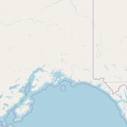
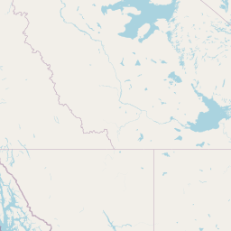
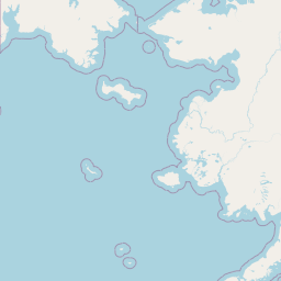
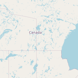
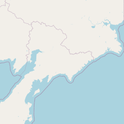
Upper Copper River
Map
+
−
Leaflet
| <a href="https://www.openstreetmap.org/copyright">© OpenStreetMap contributors</a>
Previous
Next
Item
Property
Value
id
19020101
fid
2211
gnis_id
None
gnis_url
hucs
https://geoconnex.us/ref/hu10/1902010109
https://geoconnex.us/ref/hu10/1902010108
https://geoconnex.us/ref/hu10/1902010117
https://geoconnex.us/ref/hu10/1902010102
https://geoconnex.us/ref/hu10/1902010114
https://geoconnex.us/ref/hu10/1902010104
https://geoconnex.us/ref/hu10/1902010112
https://geoconnex.us/ref/hu10/1902010107
https://geoconnex.us/ref/hu10/1902010118
https://geoconnex.us/ref/hu10/1902010101
https://geoconnex.us/ref/hu10/1902010111
https://geoconnex.us/ref/hu10/1902010113
https://geoconnex.us/ref/hu10/1902010110
https://geoconnex.us/ref/hu10/1902010103
https://geoconnex.us/ref/hu10/1902010116
https://geoconnex.us/ref/hu10/1902010106
https://geoconnex.us/ref/hu10/1902010115
https://geoconnex.us/ref/hu10/1902010105
loaddate
2012-06-11 12:54:56+00:00
name
Upper Copper River
uri
https://geoconnex.us/ref/hu08/19020101