South Fork McKenzie River
Map
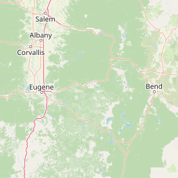


Leaflet | <a href="https://www.openstreetmap.org/copyright">© OpenStreetMap contributors</a>
Item
| Property | Value |
|---|---|
| id | 1434860 |
| downstream_mainstem_id | https://geoconnex.us/ref/mainstems/1428723 |
| encompassing_mainstem_basins | ['https://geoconnex.us/ref/mainstems/1428723', 'https://geoconnex.us/ref/mainstems/1426120', 'https://geoconnex.us/ref/mainstems/1423587'] |
| featuretype | ['https://www.opengis.net/def/schema/hy_features/hyf/HY_FlowPath', 'https://www.opengis.net/def/schema/hy_features/hyf/HY_WaterBody'] |
| fid | 31204 |
| head_2020huc12 | 170900040301 |
| head_nhdpv1_comid | 23774841 |
| head_nhdpv2_comid | https://geoconnex.us/nhdplusv2/comid/23774841 |
| head_nhdpv2huc12 | https://geoconnex.us/nhdplusv2/huc12/170900040301 |
| head_rf1id | 52710 |
| lengthkm | 58.0 |
| name_at_outlet | South Fork McKenzie River |
| name_at_outlet_gnis_id | 1149990 |
| new_mainstemid | |
| outlet_2020huc12 | 170900040308 |
| outlet_drainagearea_sqkm | 522.4 |
| outlet_nhdpv1_comid | 23773005 |
| outlet_nhdpv2_comid | https://geoconnex.us/nhdplusv2/comid/23773005 |
| outlet_nhdpv2huc12 | https://geoconnex.us/nhdplusv2/huc12/170900040308 |
| outlet_rf1id | 52701 |
| superseded | False |
| uri | https://geoconnex.us/ref/mainstems/1434860 |
Graph Results
| monitoringLocation | https://sta.geoconnex.dev/collections/USGS/Things/items/'USGS-14159410' |
|---|---|
| siteName | USGS-14159410 |
| datasetDescription | Gage height / USGS-14159410-8fc6c68bb8e54386a524213312729384 |
| type | Stream |
| url | https://waterdata.usgs.gov/monitoring-location/14159410/#parameterCode=00065 |
| variableMeasured | Gage height / USGS-14159410-8fc6c68bb8e54386a524213312729384 |
| variableUnit | ft |
| measurementTechnique | observation |
| temporalCoverage | 2024-08-30T09:30:00Z/2024-09-09T18:30:00Z |
| distributionName | USGS Instantaneous Values Service |
| distributionURL | https://waterservices.usgs.gov/nwis/iv/?sites=USGS:14159410¶meterCd=00065&format=rdb |
| distributionFormat | text/tab-separated-values |
| wkt | POINT (-122.243588888889 44.1305472222222) |
| monitoringLocation | https://sta.geoconnex.dev/collections/USGS/Things/items/'USGS-14159410' |
|---|---|
| siteName | USGS-14159410 |
| datasetDescription | Gage height / USGS-14159410-8fc6c68bb8e54386a524213312729384 |
| type | Stream |
| url | https://waterdata.usgs.gov/monitoring-location/14159410/#parameterCode=00065 |
| variableMeasured | Gage height / USGS-14159410-8fc6c68bb8e54386a524213312729384 |
| variableUnit | ft |
| measurementTechnique | observation |
| temporalCoverage | 2024-08-30T09:30:00Z/2024-09-09T18:30:00Z |
| distributionName | USGS SensorThings API |
| distributionURL | https://labs.waterdata.usgs.gov/sta/v1.1/Datastreams('8fc6c68bb8e54386a524213312729384')?$expand=Thing,Observations |
| distributionFormat | application/json |
| wkt | POINT (-122.243588888889 44.1305472222222) |
| monitoringLocation | https://sta.geoconnex.dev/collections/USGS/Things/items/'USGS-14159500' |
|---|---|
| siteName | USGS-14159500 |
| datasetDescription | pH / USGS-14159500-e6fb6dd10eae40bb81f9ebe8c54cb6c8 |
| type | Stream |
| url | https://waterdata.usgs.gov/monitoring-location/14159500/#parameterCode=00400 |
| variableMeasured | pH / USGS-14159500-e6fb6dd10eae40bb81f9ebe8c54cb6c8 |
| variableUnit | pH Units |
| measurementTechnique | observation |
| temporalCoverage | 2024-08-30T09:30:00Z/2024-09-09T18:00:00Z |
| distributionName | USGS Instantaneous Values Service |
| distributionURL | https://waterservices.usgs.gov/nwis/iv/?sites=USGS:14159500¶meterCd=00400&format=rdb |
| distributionFormat | text/tab-separated-values |
| wkt | POINT (-122.248390979198 44.1359581695523) |
| monitoringLocation | https://sta.geoconnex.dev/collections/USGS/Things/items/'USGS-14159500' |
|---|---|
| siteName | USGS-14159500 |
| datasetDescription | pH / USGS-14159500-e6fb6dd10eae40bb81f9ebe8c54cb6c8 |
| type | Stream |
| url | https://waterdata.usgs.gov/monitoring-location/14159500/#parameterCode=00400 |
| variableMeasured | pH / USGS-14159500-e6fb6dd10eae40bb81f9ebe8c54cb6c8 |
| variableUnit | pH Units |
| measurementTechnique | observation |
| temporalCoverage | 2024-08-30T09:30:00Z/2024-09-09T18:00:00Z |
| distributionName | USGS SensorThings API |
| distributionURL | https://labs.waterdata.usgs.gov/sta/v1.1/Datastreams('e6fb6dd10eae40bb81f9ebe8c54cb6c8')?$expand=Thing,Observations |
| distributionFormat | application/json |
| wkt | POINT (-122.248390979198 44.1359581695523) |
| monitoringLocation | https://sta.geoconnex.dev/collections/USGS/Things/items/'USGS-14159500' |
|---|---|
| siteName | USGS-14159500 |
| datasetDescription | Air pressure / USGS-14159500-2db7d328c21440fb8a3d82e42aa3a5b1 |
| type | Stream |
| url | https://waterdata.usgs.gov/monitoring-location/14159500/#parameterCode=00025 |
| variableMeasured | Air pressure / USGS-14159500-2db7d328c21440fb8a3d82e42aa3a5b1 |
| variableUnit | mmHg |
| measurementTechnique | observation |
| temporalCoverage | 2024-08-30T10:00:00Z/2024-09-09T18:00:00Z |
| distributionName | USGS SensorThings API |
| distributionURL | https://labs.waterdata.usgs.gov/sta/v1.1/Datastreams('2db7d328c21440fb8a3d82e42aa3a5b1')?$expand=Thing,Observations |
| distributionFormat | application/json |
| wkt | POINT (-122.248390979198 44.1359581695523) |
| monitoringLocation | https://sta.geoconnex.dev/collections/USGS/Things/items/'USGS-14159500' |
|---|---|
| siteName | USGS-14159500 |
| datasetDescription | Air pressure / USGS-14159500-2db7d328c21440fb8a3d82e42aa3a5b1 |
| type | Stream |
| url | https://waterdata.usgs.gov/monitoring-location/14159500/#parameterCode=00025 |
| variableMeasured | Air pressure / USGS-14159500-2db7d328c21440fb8a3d82e42aa3a5b1 |
| variableUnit | mmHg |
| measurementTechnique | observation |
| temporalCoverage | 2024-08-30T10:00:00Z/2024-09-09T18:00:00Z |
| distributionName | USGS Instantaneous Values Service |
| distributionURL | https://waterservices.usgs.gov/nwis/iv/?sites=USGS:14159500¶meterCd=00025&format=rdb |
| distributionFormat | text/tab-separated-values |
| wkt | POINT (-122.248390979198 44.1359581695523) |
| monitoringLocation | https://sta.geoconnex.dev/collections/USGS/Things/items/'USGS-14159500' |
|---|---|
| siteName | USGS-14159500 |
| datasetDescription | Phycocyanin relative fluorescence (fPC), water, in situ, relative fluorescence units (RFU) / USGS-14159500-9a3335d0e6234038b768de47b3ab61b6 |
| type | Stream |
| url | https://waterdata.usgs.gov/monitoring-location/14159500/#parameterCode=32321 |
| variableMeasured | Phycocyanin relative fluorescence (fPC) |
| variableUnit | RFU |
| measurementTechnique | observation |
| temporalCoverage | 2024-08-30T09:30:00Z/2024-09-09T18:00:00Z |
| distributionName | USGS Instantaneous Values Service |
| distributionURL | https://waterservices.usgs.gov/nwis/iv/?sites=USGS:14159500¶meterCd=32321&format=rdb |
| distributionFormat | text/tab-separated-values |
| wkt | POINT (-122.248390979198 44.1359581695523) |
| monitoringLocation | https://sta.geoconnex.dev/collections/USGS/Things/items/'USGS-14159500' |
|---|---|
| siteName | USGS-14159500 |
| datasetDescription | Phycocyanin relative fluorescence (fPC), water, in situ, relative fluorescence units (RFU) / USGS-14159500-9a3335d0e6234038b768de47b3ab61b6 |
| type | Stream |
| url | https://waterdata.usgs.gov/monitoring-location/14159500/#parameterCode=32321 |
| variableMeasured | Phycocyanin relative fluorescence (fPC) |
| variableUnit | RFU |
| measurementTechnique | observation |
| temporalCoverage | 2024-08-30T09:30:00Z/2024-09-09T18:00:00Z |
| distributionName | USGS SensorThings API |
| distributionURL | https://labs.waterdata.usgs.gov/sta/v1.1/Datastreams('9a3335d0e6234038b768de47b3ab61b6')?$expand=Thing,Observations |
| distributionFormat | application/json |
| wkt | POINT (-122.248390979198 44.1359581695523) |
| monitoringLocation | https://sta.geoconnex.dev/collections/USGS/Things/items/'USGS-14159500' |
|---|---|
| siteName | USGS-14159500 |
| datasetDescription | Gage height / USGS-14159500-a5365da8495c439881524c95e7e0f8af |
| type | Stream |
| url | https://waterdata.usgs.gov/monitoring-location/14159500/#parameterCode=00065 |
| variableMeasured | Gage height / USGS-14159500-a5365da8495c439881524c95e7e0f8af |
| variableUnit | ft |
| measurementTechnique | observation |
| temporalCoverage | 2024-08-30T09:10:00Z/2024-09-09T18:50:00Z |
| distributionName | USGS Instantaneous Values Service |
| distributionURL | https://waterservices.usgs.gov/nwis/iv/?sites=USGS:14159500¶meterCd=00065&format=rdb |
| distributionFormat | text/tab-separated-values |
| wkt | POINT (-122.248390979198 44.1359581695523) |
| monitoringLocation | https://sta.geoconnex.dev/collections/USGS/Things/items/'USGS-14159500' |
|---|---|
| siteName | USGS-14159500 |
| datasetDescription | Gage height / USGS-14159500-a5365da8495c439881524c95e7e0f8af |
| type | Stream |
| url | https://waterdata.usgs.gov/monitoring-location/14159500/#parameterCode=00065 |
| variableMeasured | Gage height / USGS-14159500-a5365da8495c439881524c95e7e0f8af |
| variableUnit | ft |
| measurementTechnique | observation |
| temporalCoverage | 2024-08-30T09:10:00Z/2024-09-09T18:50:00Z |
| distributionName | USGS SensorThings API |
| distributionURL | https://labs.waterdata.usgs.gov/sta/v1.1/Datastreams('a5365da8495c439881524c95e7e0f8af')?$expand=Thing,Observations |
| distributionFormat | application/json |
| wkt | POINT (-122.248390979198 44.1359581695523) |
| monitoringLocation | https://sta.geoconnex.dev/collections/USGS/Things/items/'USGS-14159500' |
|---|---|
| siteName | USGS-14159500 |
| datasetDescription | Dissolved oxygen / USGS-14159500-3f156d0c55b34fef8ebb15b2ecb80042 |
| type | Stream |
| url | https://waterdata.usgs.gov/monitoring-location/14159500/#parameterCode=00300 |
| variableMeasured | Dissolved oxygen / USGS-14159500-3f156d0c55b34fef8ebb15b2ecb80042 |
| variableUnit | mg/l |
| measurementTechnique | observation |
| temporalCoverage | 2024-08-30T09:30:00Z/2024-09-09T18:00:00Z |
| distributionName | USGS SensorThings API |
| distributionURL | https://labs.waterdata.usgs.gov/sta/v1.1/Datastreams('3f156d0c55b34fef8ebb15b2ecb80042')?$expand=Thing,Observations |
| distributionFormat | application/json |
| wkt | POINT (-122.248390979198 44.1359581695523) |
| monitoringLocation | https://sta.geoconnex.dev/collections/USGS/Things/items/'USGS-14159500' |
|---|---|
| siteName | USGS-14159500 |
| datasetDescription | Dissolved oxygen / USGS-14159500-3f156d0c55b34fef8ebb15b2ecb80042 |
| type | Stream |
| url | https://waterdata.usgs.gov/monitoring-location/14159500/#parameterCode=00300 |
| variableMeasured | Dissolved oxygen / USGS-14159500-3f156d0c55b34fef8ebb15b2ecb80042 |
| variableUnit | mg/l |
| measurementTechnique | observation |
| temporalCoverage | 2024-08-30T09:30:00Z/2024-09-09T18:00:00Z |
| distributionName | USGS Instantaneous Values Service |
| distributionURL | https://waterservices.usgs.gov/nwis/iv/?sites=USGS:14159500¶meterCd=00300&format=rdb |
| distributionFormat | text/tab-separated-values |
| wkt | POINT (-122.248390979198 44.1359581695523) |
| monitoringLocation | https://sta.geoconnex.dev/collections/USGS/Things/items/'USGS-14159500' |
|---|---|
| siteName | USGS-14159500 |
| datasetDescription | Total partial pressure of dissolved gases, water, unfiltered, percent of saturation / USGS-14159500-32cbd2d810d84bacaab81a942af96a97 |
| type | Stream |
| url | https://waterdata.usgs.gov/monitoring-location/14159500/#parameterCode=00048 |
| variableMeasured | Total partial pressure of dissolved gases |
| variableUnit | % |
| measurementTechnique | observation |
| temporalCoverage | 2024-08-30T10:00:00Z/2024-09-09T18:00:00Z |
| distributionName | USGS SensorThings API |
| distributionURL | https://labs.waterdata.usgs.gov/sta/v1.1/Datastreams('32cbd2d810d84bacaab81a942af96a97')?$expand=Thing,Observations |
| distributionFormat | application/json |
| wkt | POINT (-122.248390979198 44.1359581695523) |
| monitoringLocation | https://sta.geoconnex.dev/collections/USGS/Things/items/'USGS-14159500' |
|---|---|
| siteName | USGS-14159500 |
| datasetDescription | Total partial pressure of dissolved gases, water, unfiltered, percent of saturation / USGS-14159500-32cbd2d810d84bacaab81a942af96a97 |
| type | Stream |
| url | https://waterdata.usgs.gov/monitoring-location/14159500/#parameterCode=00048 |
| variableMeasured | Total partial pressure of dissolved gases |
| variableUnit | % |
| measurementTechnique | observation |
| temporalCoverage | 2024-08-30T10:00:00Z/2024-09-09T18:00:00Z |
| distributionName | USGS Instantaneous Values Service |
| distributionURL | https://waterservices.usgs.gov/nwis/iv/?sites=USGS:14159500¶meterCd=00048&format=rdb |
| distributionFormat | text/tab-separated-values |
| wkt | POINT (-122.248390979198 44.1359581695523) |
| monitoringLocation | https://sta.geoconnex.dev/collections/USGS/Things/items/'USGS-14159500' |
|---|---|
| siteName | USGS-14159500 |
| datasetDescription | Total partial pressure of dissolved gases, water, unfiltered, millimeters of mercury / USGS-14159500-1d7b673547ad44eb872ee71c671a3eb5 |
| type | Stream |
| url | https://waterdata.usgs.gov/monitoring-location/14159500/#parameterCode=00047 |
| variableMeasured | Total partial pressure of dissolved gases |
| variableUnit | mmHg |
| measurementTechnique | observation |
| temporalCoverage | 2024-08-30T10:00:00Z/2024-09-09T18:00:00Z |
| distributionName | USGS Instantaneous Values Service |
| distributionURL | https://waterservices.usgs.gov/nwis/iv/?sites=USGS:14159500¶meterCd=00047&format=rdb |
| distributionFormat | text/tab-separated-values |
| wkt | POINT (-122.248390979198 44.1359581695523) |
| monitoringLocation | https://sta.geoconnex.dev/collections/USGS/Things/items/'USGS-14159500' |
|---|---|
| siteName | USGS-14159500 |
| datasetDescription | Total partial pressure of dissolved gases, water, unfiltered, millimeters of mercury / USGS-14159500-1d7b673547ad44eb872ee71c671a3eb5 |
| type | Stream |
| url | https://waterdata.usgs.gov/monitoring-location/14159500/#parameterCode=00047 |
| variableMeasured | Total partial pressure of dissolved gases |
| variableUnit | mmHg |
| measurementTechnique | observation |
| temporalCoverage | 2024-08-30T10:00:00Z/2024-09-09T18:00:00Z |
| distributionName | USGS SensorThings API |
| distributionURL | https://labs.waterdata.usgs.gov/sta/v1.1/Datastreams('1d7b673547ad44eb872ee71c671a3eb5')?$expand=Thing,Observations |
| distributionFormat | application/json |
| wkt | POINT (-122.248390979198 44.1359581695523) |
| monitoringLocation | https://sta.geoconnex.dev/collections/USGS/Things/items/'USGS-14159500' |
|---|---|
| siteName | USGS-14159500 |
| datasetDescription | Dissolved organic matter fluorescence (fDOM), water, in situ, concentration estimated from reference material, micrograms per liter as quinine sulfate equivalents (QSE) / USGS-14159500-2402037b7f2a4396b0ef4a9bfa593a3b |
| type | Stream |
| url | https://waterdata.usgs.gov/monitoring-location/14159500/#parameterCode=32295 |
| variableMeasured | Dissolved organic matter fluorescence (fDOM) |
| variableUnit | QSE |
| measurementTechnique | observation |
| temporalCoverage | 2024-08-30T09:30:00Z/2024-09-09T18:00:00Z |
| distributionName | USGS Instantaneous Values Service |
| distributionURL | https://waterservices.usgs.gov/nwis/iv/?sites=USGS:14159500¶meterCd=32295&format=rdb |
| distributionFormat | text/tab-separated-values |
| wkt | POINT (-122.248390979198 44.1359581695523) |
| monitoringLocation | https://sta.geoconnex.dev/collections/USGS/Things/items/'USGS-14159500' |
|---|---|
| siteName | USGS-14159500 |
| datasetDescription | Dissolved organic matter fluorescence (fDOM), water, in situ, concentration estimated from reference material, micrograms per liter as quinine sulfate equivalents (QSE) / USGS-14159500-2402037b7f2a4396b0ef4a9bfa593a3b |
| type | Stream |
| url | https://waterdata.usgs.gov/monitoring-location/14159500/#parameterCode=32295 |
| variableMeasured | Dissolved organic matter fluorescence (fDOM) |
| variableUnit | QSE |
| measurementTechnique | observation |
| temporalCoverage | 2024-08-30T09:30:00Z/2024-09-09T18:00:00Z |
| distributionName | USGS SensorThings API |
| distributionURL | https://labs.waterdata.usgs.gov/sta/v1.1/Datastreams('2402037b7f2a4396b0ef4a9bfa593a3b')?$expand=Thing,Observations |
| distributionFormat | application/json |
| wkt | POINT (-122.248390979198 44.1359581695523) |
| monitoringLocation | https://sta.geoconnex.dev/collections/USGS/Things/items/'USGS-14159500' |
|---|---|
| siteName | USGS-14159500 |
| datasetDescription | Temperature, water, degrees Celsius / USGS-14159500-2a246a86295c4b828169f72775b90a3e |
| type | Stream |
| url | https://waterdata.usgs.gov/monitoring-location/14159500/#parameterCode=00010 |
| variableMeasured | Temperature |
| variableUnit | degC |
| measurementTechnique | observation |
| temporalCoverage | 2024-08-30T09:15:00Z/2024-09-09T18:45:00Z |
| distributionName | USGS SensorThings API |
| distributionURL | https://labs.waterdata.usgs.gov/sta/v1.1/Datastreams('2a246a86295c4b828169f72775b90a3e')?$expand=Thing,Observations |
| distributionFormat | application/json |
| wkt | POINT (-122.248390979198 44.1359581695523) |
| monitoringLocation | https://sta.geoconnex.dev/collections/USGS/Things/items/'USGS-14159500' |
|---|---|
| siteName | USGS-14159500 |
| datasetDescription | Temperature, water, degrees Celsius / USGS-14159500-2a246a86295c4b828169f72775b90a3e |
| type | Stream |
| url | https://waterdata.usgs.gov/monitoring-location/14159500/#parameterCode=00010 |
| variableMeasured | Temperature |
| variableUnit | degC |
| measurementTechnique | observation |
| temporalCoverage | 2024-08-30T09:15:00Z/2024-09-09T18:45:00Z |
| distributionName | USGS Instantaneous Values Service |
| distributionURL | https://waterservices.usgs.gov/nwis/iv/?sites=USGS:14159500¶meterCd=00010&format=rdb |
| distributionFormat | text/tab-separated-values |
| wkt | POINT (-122.248390979198 44.1359581695523) |
| monitoringLocation | https://sta.geoconnex.dev/collections/USGS/Things/items/'USGS-14159500' |
|---|---|
| siteName | USGS-14159500 |
| datasetDescription | Discharge / USGS-14159500-6f863ac9dbc743159a91761c0bcdb21f |
| type | Stream |
| url | https://waterdata.usgs.gov/monitoring-location/14159500/#parameterCode=00060 |
| variableMeasured | Discharge / USGS-14159500-6f863ac9dbc743159a91761c0bcdb21f |
| variableUnit | ft^3/s |
| measurementTechnique | observation |
| temporalCoverage | 2024-08-30T09:10:00Z/2024-09-09T18:50:00Z |
| distributionName | USGS Instantaneous Values Service |
| distributionURL | https://waterservices.usgs.gov/nwis/iv/?sites=USGS:14159500¶meterCd=00060&format=rdb |
| distributionFormat | text/tab-separated-values |
| wkt | POINT (-122.248390979198 44.1359581695523) |
| monitoringLocation | https://sta.geoconnex.dev/collections/USGS/Things/items/'USGS-14159500' |
|---|---|
| siteName | USGS-14159500 |
| datasetDescription | Discharge / USGS-14159500-6f863ac9dbc743159a91761c0bcdb21f |
| type | Stream |
| url | https://waterdata.usgs.gov/monitoring-location/14159500/#parameterCode=00060 |
| variableMeasured | Discharge / USGS-14159500-6f863ac9dbc743159a91761c0bcdb21f |
| variableUnit | ft^3/s |
| measurementTechnique | observation |
| temporalCoverage | 2024-08-30T09:10:00Z/2024-09-09T18:50:00Z |
| distributionName | USGS SensorThings API |
| distributionURL | https://labs.waterdata.usgs.gov/sta/v1.1/Datastreams('6f863ac9dbc743159a91761c0bcdb21f')?$expand=Thing,Observations |
| distributionFormat | application/json |
| wkt | POINT (-122.248390979198 44.1359581695523) |
| monitoringLocation | https://sta.geoconnex.dev/collections/USGS/Things/items/'USGS-14159500' |
|---|---|
| siteName | USGS-14159500 |
| datasetDescription | Turbidity, FNU / USGS-14159500-7c0a84fa7c8c41a5a199044932d54750 |
| type | Stream |
| url | https://waterdata.usgs.gov/monitoring-location/14159500/#parameterCode=63680 |
| variableMeasured | Turbidity |
| variableUnit | _FNU |
| measurementTechnique | observation |
| temporalCoverage | 2024-08-30T09:30:00Z/2024-09-09T18:00:00Z |
| distributionName | USGS Instantaneous Values Service |
| distributionURL | https://waterservices.usgs.gov/nwis/iv/?sites=USGS:14159500¶meterCd=63680&format=rdb |
| distributionFormat | text/tab-separated-values |
| wkt | POINT (-122.248390979198 44.1359581695523) |
| monitoringLocation | https://sta.geoconnex.dev/collections/USGS/Things/items/'USGS-14159500' |
|---|---|
| siteName | USGS-14159500 |
| datasetDescription | Turbidity, FNU / USGS-14159500-7c0a84fa7c8c41a5a199044932d54750 |
| type | Stream |
| url | https://waterdata.usgs.gov/monitoring-location/14159500/#parameterCode=63680 |
| variableMeasured | Turbidity |
| variableUnit | _FNU |
| measurementTechnique | observation |
| temporalCoverage | 2024-08-30T09:30:00Z/2024-09-09T18:00:00Z |
| distributionName | USGS SensorThings API |
| distributionURL | https://labs.waterdata.usgs.gov/sta/v1.1/Datastreams('7c0a84fa7c8c41a5a199044932d54750')?$expand=Thing,Observations |
| distributionFormat | application/json |
| wkt | POINT (-122.248390979198 44.1359581695523) |
| monitoringLocation | https://sta.geoconnex.dev/collections/USGS/Things/items/'USGS-14159500' |
|---|---|
| siteName | USGS-14159500 |
| datasetDescription | Specific cond at 25C / USGS-14159500-85136097bb76466cba785a569ca4df70 |
| type | Stream |
| url | https://waterdata.usgs.gov/monitoring-location/14159500/#parameterCode=00095 |
| variableMeasured | Specific cond at 25C / USGS-14159500-85136097bb76466cba785a569ca4df70 |
| variableUnit | uS/cm |
| measurementTechnique | observation |
| temporalCoverage | 2024-08-30T09:30:00Z/2024-09-09T18:00:00Z |
| distributionName | USGS SensorThings API |
| distributionURL | https://labs.waterdata.usgs.gov/sta/v1.1/Datastreams('85136097bb76466cba785a569ca4df70')?$expand=Thing,Observations |
| distributionFormat | application/json |
| wkt | POINT (-122.248390979198 44.1359581695523) |
| monitoringLocation | https://sta.geoconnex.dev/collections/USGS/Things/items/'USGS-14159500' |
|---|---|
| siteName | USGS-14159500 |
| datasetDescription | Specific cond at 25C / USGS-14159500-85136097bb76466cba785a569ca4df70 |
| type | Stream |
| url | https://waterdata.usgs.gov/monitoring-location/14159500/#parameterCode=00095 |
| variableMeasured | Specific cond at 25C / USGS-14159500-85136097bb76466cba785a569ca4df70 |
| variableUnit | uS/cm |
| measurementTechnique | observation |
| temporalCoverage | 2024-08-30T09:30:00Z/2024-09-09T18:00:00Z |
| distributionName | USGS Instantaneous Values Service |
| distributionURL | https://waterservices.usgs.gov/nwis/iv/?sites=USGS:14159500¶meterCd=00095&format=rdb |
| distributionFormat | text/tab-separated-values |
| wkt | POINT (-122.248390979198 44.1359581695523) |
| monitoringLocation | https://sta.geoconnex.dev/collections/USGS/Things/items/'USGS-14159500' |
|---|---|
| siteName | USGS-14159500 |
| datasetDescription | Chlorophyll relative fluorescence (fChl), water, in situ, relative fluorescence units (RFU) / USGS-14159500-f19ddedc98af49fcbaa2aa802439e5aa |
| type | Stream |
| url | https://waterdata.usgs.gov/monitoring-location/14159500/#parameterCode=32315 |
| variableMeasured | Chlorophyll relative fluorescence (fChl) |
| variableUnit | RFU |
| measurementTechnique | observation |
| temporalCoverage | 2024-08-30T09:30:00Z/2024-09-09T18:00:00Z |
| distributionName | USGS Instantaneous Values Service |
| distributionURL | https://waterservices.usgs.gov/nwis/iv/?sites=USGS:14159500¶meterCd=32315&format=rdb |
| distributionFormat | text/tab-separated-values |
| wkt | POINT (-122.248390979198 44.1359581695523) |
| monitoringLocation | https://sta.geoconnex.dev/collections/USGS/Things/items/'USGS-14159500' |
|---|---|
| siteName | USGS-14159500 |
| datasetDescription | Chlorophyll relative fluorescence (fChl), water, in situ, relative fluorescence units (RFU) / USGS-14159500-f19ddedc98af49fcbaa2aa802439e5aa |
| type | Stream |
| url | https://waterdata.usgs.gov/monitoring-location/14159500/#parameterCode=32315 |
| variableMeasured | Chlorophyll relative fluorescence (fChl) |
| variableUnit | RFU |
| measurementTechnique | observation |
| temporalCoverage | 2024-08-30T09:30:00Z/2024-09-09T18:00:00Z |
| distributionName | USGS SensorThings API |
| distributionURL | https://labs.waterdata.usgs.gov/sta/v1.1/Datastreams('f19ddedc98af49fcbaa2aa802439e5aa')?$expand=Thing,Observations |
| distributionFormat | application/json |
| wkt | POINT (-122.248390979198 44.1359581695523) |
| monitoringLocation | https://sta.geoconnex.dev/collections/USGS/Things/items/'USGS-14159200' |
|---|---|
| siteName | USGS-14159200 |
| datasetDescription | Gage height / USGS-14159200-3537b82496344432859ed3c7c140adf8 |
| type | Stream |
| url | https://waterdata.usgs.gov/monitoring-location/14159200/#parameterCode=00065 |
| variableMeasured | Gage height / USGS-14159200-3537b82496344432859ed3c7c140adf8 |
| variableUnit | ft |
| measurementTechnique | observation |
| temporalCoverage | 2024-08-30T09:15:00Z/2024-09-09T18:00:00Z |
| distributionName | USGS Instantaneous Values Service |
| distributionURL | https://waterservices.usgs.gov/nwis/iv/?sites=USGS:14159200¶meterCd=00065&format=rdb |
| distributionFormat | text/tab-separated-values |
| wkt | POINT (-122.217824536089 44.0470670436432) |
| monitoringLocation | https://sta.geoconnex.dev/collections/USGS/Things/items/'USGS-14159200' |
|---|---|
| siteName | USGS-14159200 |
| datasetDescription | Gage height / USGS-14159200-3537b82496344432859ed3c7c140adf8 |
| type | Stream |
| url | https://waterdata.usgs.gov/monitoring-location/14159200/#parameterCode=00065 |
| variableMeasured | Gage height / USGS-14159200-3537b82496344432859ed3c7c140adf8 |
| variableUnit | ft |
| measurementTechnique | observation |
| temporalCoverage | 2024-08-30T09:15:00Z/2024-09-09T18:00:00Z |
| distributionName | USGS SensorThings API |
| distributionURL | https://labs.waterdata.usgs.gov/sta/v1.1/Datastreams('3537b82496344432859ed3c7c140adf8')?$expand=Thing,Observations |
| distributionFormat | application/json |
| wkt | POINT (-122.217824536089 44.0470670436432) |
| monitoringLocation | https://sta.geoconnex.dev/collections/USGS/Things/items/'USGS-14159200' |
|---|---|
| siteName | USGS-14159200 |
| datasetDescription | Temperature, water / USGS-14159200-c5671f2304774747a85e3082d0acb77a |
| type | Stream |
| url | https://waterdata.usgs.gov/monitoring-location/14159200/#parameterCode=00010 |
| variableMeasured | Temperature |
| variableUnit | degC |
| measurementTechnique | observation |
| temporalCoverage | 2024-08-30T09:15:00Z/2024-09-09T18:00:00Z |
| distributionName | USGS SensorThings API |
| distributionURL | https://labs.waterdata.usgs.gov/sta/v1.1/Datastreams('c5671f2304774747a85e3082d0acb77a')?$expand=Thing,Observations |
| distributionFormat | application/json |
| wkt | POINT (-122.217824536089 44.0470670436432) |
| monitoringLocation | https://sta.geoconnex.dev/collections/USGS/Things/items/'USGS-14159200' |
|---|---|
| siteName | USGS-14159200 |
| datasetDescription | Temperature, water / USGS-14159200-c5671f2304774747a85e3082d0acb77a |
| type | Stream |
| url | https://waterdata.usgs.gov/monitoring-location/14159200/#parameterCode=00010 |
| variableMeasured | Temperature |
| variableUnit | degC |
| measurementTechnique | observation |
| temporalCoverage | 2024-08-30T09:15:00Z/2024-09-09T18:00:00Z |
| distributionName | USGS Instantaneous Values Service |
| distributionURL | https://waterservices.usgs.gov/nwis/iv/?sites=USGS:14159200¶meterCd=00010&format=rdb |
| distributionFormat | text/tab-separated-values |
| wkt | POINT (-122.217824536089 44.0470670436432) |
| monitoringLocation | https://sta.geoconnex.dev/collections/USGS/Things/items/'USGS-14159200' |
|---|---|
| siteName | USGS-14159200 |
| datasetDescription | Discharge / USGS-14159200-ef7ab679a0a54be2b1c07baf30073e28 |
| type | Stream |
| url | https://waterdata.usgs.gov/monitoring-location/14159200/#parameterCode=00060 |
| variableMeasured | Discharge / USGS-14159200-ef7ab679a0a54be2b1c07baf30073e28 |
| variableUnit | ft^3/s |
| measurementTechnique | observation |
| temporalCoverage | 2024-08-30T09:15:00Z/2024-09-09T18:00:00Z |
| distributionName | USGS Instantaneous Values Service |
| distributionURL | https://waterservices.usgs.gov/nwis/iv/?sites=USGS:14159200¶meterCd=00060&format=rdb |
| distributionFormat | text/tab-separated-values |
| wkt | POINT (-122.217824536089 44.0470670436432) |
| monitoringLocation | https://sta.geoconnex.dev/collections/USGS/Things/items/'USGS-14159200' |
|---|---|
| siteName | USGS-14159200 |
| datasetDescription | Discharge / USGS-14159200-ef7ab679a0a54be2b1c07baf30073e28 |
| type | Stream |
| url | https://waterdata.usgs.gov/monitoring-location/14159200/#parameterCode=00060 |
| variableMeasured | Discharge / USGS-14159200-ef7ab679a0a54be2b1c07baf30073e28 |
| variableUnit | ft^3/s |
| measurementTechnique | observation |
| temporalCoverage | 2024-08-30T09:15:00Z/2024-09-09T18:00:00Z |
| distributionName | USGS SensorThings API |
| distributionURL | https://labs.waterdata.usgs.gov/sta/v1.1/Datastreams('ef7ab679a0a54be2b1c07baf30073e28')?$expand=Thing,Observations |
| distributionFormat | application/json |
| wkt | POINT (-122.217824536089 44.0470670436432) |