Camas Creek
Map
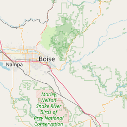

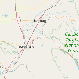
Leaflet | <a href="https://www.openstreetmap.org/copyright">© OpenStreetMap contributors</a>
Item
| Property | Value |
|---|---|
| id | 1435631 |
| downstream_mainstem_id | https://geoconnex.us/ref/mainstems/1428305 |
| encompassing_mainstem_basins | ['https://geoconnex.us/ref/mainstems/1428305', 'https://geoconnex.us/ref/mainstems/1423796', 'https://geoconnex.us/ref/mainstems/1423587'] |
| featuretype | ['https://www.opengis.net/def/schema/hy_features/hyf/HY_FlowPath', 'https://www.opengis.net/def/schema/hy_features/hyf/HY_WaterBody'] |
| fid | 29712 |
| head_2020huc12 | 170402200101 |
| head_nhdpv1_comid | None |
| head_nhdpv2_comid | https://geoconnex.us/nhdplusv2/comid/23263658 |
| head_nhdpv2huc12 | https://geoconnex.us/nhdplusv2/huc12/170402200101 |
| head_rf1id | 48567 |
| lengthkm | 97.1 |
| name_at_outlet | Camas Creek |
| name_at_outlet_gnis_id | 378736 |
| new_mainstemid | |
| outlet_2020huc12 | 170402200504 |
| outlet_drainagearea_sqkm | 1780.0 |
| outlet_nhdpv1_comid | None |
| outlet_nhdpv2_comid | https://geoconnex.us/nhdplusv2/comid/23251873 |
| outlet_nhdpv2huc12 | https://geoconnex.us/nhdplusv2/huc12/170402200504 |
| outlet_rf1id | 48606 |
| superseded | False |
| uri | https://geoconnex.us/ref/mainstems/1435631 |
Graph Results
| monitoringLocation | https://sta.geoconnex.dev/collections/USGS/Things/items/'USGS-13141500' |
|---|---|
| siteName | USGS-13141500 |
| datasetDescription | Discharge / USGS-13141500-957fdfa72875483f8ce0e27c49bfb0f4 |
| type | Stream |
| url | https://waterdata.usgs.gov/monitoring-location/13141500/#parameterCode=00060 |
| variableMeasured | Discharge / USGS-13141500-957fdfa72875483f8ce0e27c49bfb0f4 |
| variableUnit | ft^3/s |
| measurementTechnique | observation |
| temporalCoverage | 2024-08-30T09:15:00Z/2024-09-09T18:45:00Z |
| distributionName | USGS SensorThings API |
| distributionURL | https://labs.waterdata.usgs.gov/sta/v1.1/Datastreams('957fdfa72875483f8ce0e27c49bfb0f4')?$expand=Thing,Observations |
| distributionFormat | application/json |
| wkt | POINT (-114.541944444444 43.3327777777778) |
| monitoringLocation | https://sta.geoconnex.dev/collections/USGS/Things/items/'USGS-13141500' |
|---|---|
| siteName | USGS-13141500 |
| datasetDescription | Discharge / USGS-13141500-957fdfa72875483f8ce0e27c49bfb0f4 |
| type | Stream |
| url | https://waterdata.usgs.gov/monitoring-location/13141500/#parameterCode=00060 |
| variableMeasured | Discharge / USGS-13141500-957fdfa72875483f8ce0e27c49bfb0f4 |
| variableUnit | ft^3/s |
| measurementTechnique | observation |
| temporalCoverage | 2024-08-30T09:15:00Z/2024-09-09T18:45:00Z |
| distributionName | USGS Instantaneous Values Service |
| distributionURL | https://waterservices.usgs.gov/nwis/iv/?sites=USGS:13141500¶meterCd=00060&format=rdb |
| distributionFormat | text/tab-separated-values |
| wkt | POINT (-114.541944444444 43.3327777777778) |
| monitoringLocation | https://sta.geoconnex.dev/collections/USGS/Things/items/'USGS-13141500' |
|---|---|
| siteName | USGS-13141500 |
| datasetDescription | Gage height / USGS-13141500-671b5c37fcf14be3b3589dc63eeccfcc |
| type | Stream |
| url | https://waterdata.usgs.gov/monitoring-location/13141500/#parameterCode=00065 |
| variableMeasured | Gage height / USGS-13141500-671b5c37fcf14be3b3589dc63eeccfcc |
| variableUnit | ft |
| measurementTechnique | observation |
| temporalCoverage | 2024-08-30T09:15:00Z/2024-09-09T18:45:00Z |
| distributionName | USGS Instantaneous Values Service |
| distributionURL | https://waterservices.usgs.gov/nwis/iv/?sites=USGS:13141500¶meterCd=00065&format=rdb |
| distributionFormat | text/tab-separated-values |
| wkt | POINT (-114.541944444444 43.3327777777778) |
| monitoringLocation | https://sta.geoconnex.dev/collections/USGS/Things/items/'USGS-13141500' |
|---|---|
| siteName | USGS-13141500 |
| datasetDescription | Gage height / USGS-13141500-671b5c37fcf14be3b3589dc63eeccfcc |
| type | Stream |
| url | https://waterdata.usgs.gov/monitoring-location/13141500/#parameterCode=00065 |
| variableMeasured | Gage height / USGS-13141500-671b5c37fcf14be3b3589dc63eeccfcc |
| variableUnit | ft |
| measurementTechnique | observation |
| temporalCoverage | 2024-08-30T09:15:00Z/2024-09-09T18:45:00Z |
| distributionName | USGS SensorThings API |
| distributionURL | https://labs.waterdata.usgs.gov/sta/v1.1/Datastreams('671b5c37fcf14be3b3589dc63eeccfcc')?$expand=Thing,Observations |
| distributionFormat | application/json |
| wkt | POINT (-114.541944444444 43.3327777777778) |