Mission Creek
Map
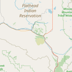
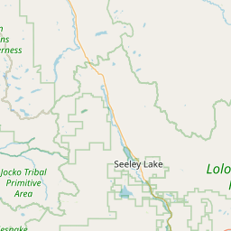
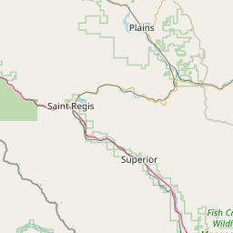
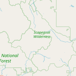
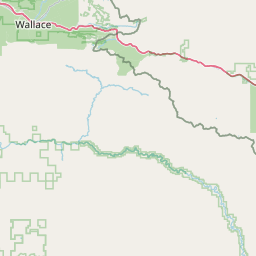
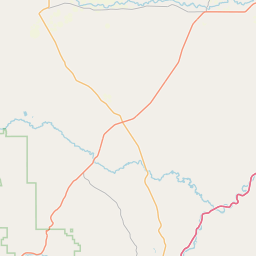
Leaflet | <a href="https://www.openstreetmap.org/copyright">© OpenStreetMap contributors</a>
Item
| Property | Value |
|---|---|
| id | 1435801 |
| downstream_mainstem_id | https://geoconnex.us/ref/mainstems/1426261 |
| encompassing_mainstem_basins | ['https://geoconnex.us/ref/mainstems/1426261', 'https://geoconnex.us/ref/mainstems/1423587'] |
| featuretype | ['https://www.opengis.net/def/schema/hy_features/hyf/HY_FlowPath', 'https://www.opengis.net/def/schema/hy_features/hyf/HY_WaterBody'] |
| fid | 28871 |
| head_2020huc12 | 170102120503 |
| head_nhdpv1_comid | 24361383 |
| head_nhdpv2_comid | https://geoconnex.us/nhdplusv2/comid/24361383 |
| head_nhdpv2huc12 | https://geoconnex.us/nhdplusv2/huc12/170102120503 |
| head_rf1id | 46547 |
| lengthkm | 45.9 |
| name_at_outlet | Mission Creek |
| name_at_outlet_gnis_id | 774288 |
| new_mainstemid | |
| outlet_2020huc12 | 170102120710 |
| outlet_drainagearea_sqkm | 681.7 |
| outlet_nhdpv1_comid | 24356189 |
| outlet_nhdpv2_comid | https://geoconnex.us/nhdplusv2/comid/24356189 |
| outlet_nhdpv2huc12 | https://geoconnex.us/nhdplusv2/huc12/170102120710 |
| outlet_rf1id | 46543 |
| superseded | False |
| uri | https://geoconnex.us/ref/mainstems/1435801 |
Graph Results
| monitoringLocation | https://sta.geoconnex.dev/collections/USGS/Things/items/'USGS-12377150' |
|---|---|
| siteName | USGS-12377150 |
| datasetDescription | Discharge, cubic feet per second / USGS-12377150-3164e64c30464bbfaae0e4818b3da0c2 |
| type | Stream |
| url | https://waterdata.usgs.gov/monitoring-location/12377150/#parameterCode=00060 |
| variableMeasured | Discharge |
| variableUnit | ft^3/s |
| measurementTechnique | observation |
| temporalCoverage | 2024-08-30T09:15:00Z/2024-09-09T18:15:00Z |
| distributionName | USGS Instantaneous Values Service |
| distributionURL | https://waterservices.usgs.gov/nwis/iv/?sites=USGS:12377150¶meterCd=00060&format=rdb |
| distributionFormat | text/tab-separated-values |
| wkt | POINT (-113.979380555556 47.3228222222222) |
| monitoringLocation | https://sta.geoconnex.dev/collections/USGS/Things/items/'USGS-12377150' |
|---|---|
| siteName | USGS-12377150 |
| datasetDescription | Discharge, cubic feet per second / USGS-12377150-3164e64c30464bbfaae0e4818b3da0c2 |
| type | Stream |
| url | https://waterdata.usgs.gov/monitoring-location/12377150/#parameterCode=00060 |
| variableMeasured | Discharge |
| variableUnit | ft^3/s |
| measurementTechnique | observation |
| temporalCoverage | 2024-08-30T09:15:00Z/2024-09-09T18:15:00Z |
| distributionName | USGS SensorThings API |
| distributionURL | https://labs.waterdata.usgs.gov/sta/v1.1/Datastreams('3164e64c30464bbfaae0e4818b3da0c2')?$expand=Thing,Observations |
| distributionFormat | application/json |
| wkt | POINT (-113.979380555556 47.3228222222222) |
| monitoringLocation | https://sta.geoconnex.dev/collections/USGS/Things/items/'USGS-12377150' |
|---|---|
| siteName | USGS-12377150 |
| datasetDescription | Gage height / USGS-12377150-67a0ec5c55d8436091611fb87cb49055 |
| type | Stream |
| url | https://waterdata.usgs.gov/monitoring-location/12377150/#parameterCode=00065 |
| variableMeasured | Gage height / USGS-12377150-67a0ec5c55d8436091611fb87cb49055 |
| variableUnit | ft |
| measurementTechnique | observation |
| temporalCoverage | 2024-08-30T09:15:00Z/2024-09-09T18:15:00Z |
| distributionName | USGS Instantaneous Values Service |
| distributionURL | https://waterservices.usgs.gov/nwis/iv/?sites=USGS:12377150¶meterCd=00065&format=rdb |
| distributionFormat | text/tab-separated-values |
| wkt | POINT (-113.979380555556 47.3228222222222) |
| monitoringLocation | https://sta.geoconnex.dev/collections/USGS/Things/items/'USGS-12377150' |
|---|---|
| siteName | USGS-12377150 |
| datasetDescription | Gage height / USGS-12377150-67a0ec5c55d8436091611fb87cb49055 |
| type | Stream |
| url | https://waterdata.usgs.gov/monitoring-location/12377150/#parameterCode=00065 |
| variableMeasured | Gage height / USGS-12377150-67a0ec5c55d8436091611fb87cb49055 |
| variableUnit | ft |
| measurementTechnique | observation |
| temporalCoverage | 2024-08-30T09:15:00Z/2024-09-09T18:15:00Z |
| distributionName | USGS SensorThings API |
| distributionURL | https://labs.waterdata.usgs.gov/sta/v1.1/Datastreams('67a0ec5c55d8436091611fb87cb49055')?$expand=Thing,Observations |
| distributionFormat | application/json |
| wkt | POINT (-113.979380555556 47.3228222222222) |