Bull Run River
Map
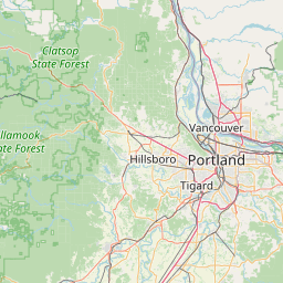
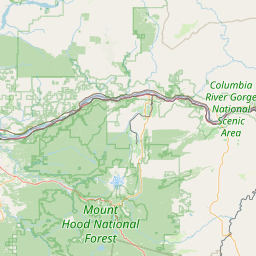
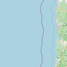
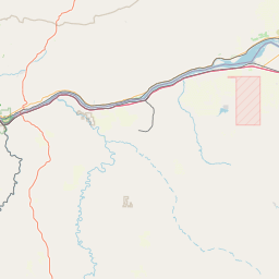

Leaflet | <a href="https://www.openstreetmap.org/copyright">© OpenStreetMap contributors</a>
Item
| Property | Value |
|---|---|
| id | 1440892 |
| downstream_mainstem_id | https://geoconnex.us/ref/mainstems/1434453 |
| encompassing_mainstem_basins | ['https://geoconnex.us/ref/mainstems/1434453', 'https://geoconnex.us/ref/mainstems/1423587'] |
| featuretype | ['https://www.opengis.net/def/schema/hy_features/hyf/HY_FlowPath', 'https://www.opengis.net/def/schema/hy_features/hyf/HY_WaterBody'] |
| fid | 31054 |
| head_2020huc12 | 170800010502 |
| head_nhdpv1_comid | None |
| head_nhdpv2_comid | https://geoconnex.us/nhdplusv2/comid/23737773 |
| head_nhdpv2huc12 | https://geoconnex.us/nhdplusv2/huc12/170800010502 |
| head_rf1id | 52296 |
| lengthkm | 43.3 |
| name_at_outlet | Bull Run River |
| name_at_outlet_gnis_id | 1138921 |
| new_mainstemid | |
| outlet_2020huc12 | 170800010506 |
| outlet_drainagearea_sqkm | 360.2 |
| outlet_nhdpv1_comid | None |
| outlet_nhdpv2_comid | https://geoconnex.us/nhdplusv2/comid/23735983 |
| outlet_nhdpv2huc12 | https://geoconnex.us/nhdplusv2/huc12/170800010506 |
| outlet_rf1id | 52292 |
| superseded | False |
| uri | https://geoconnex.us/ref/mainstems/1440892 |
Graph Results
| monitoringLocation | https://sta.geoconnex.dev/collections/USGS/Things/items/'USGS-14140020' |
|---|---|
| siteName | USGS-14140020 |
| datasetDescription | Temperature water / USGS-14140020-fb02059175034717bd22f87186c081b5 |
| type | Stream |
| url | https://waterdata.usgs.gov/monitoring-location/14140020/#parameterCode=00010 |
| variableMeasured | Temperature |
| variableUnit | degC |
| measurementTechnique | observation |
| temporalCoverage | 2024-08-30T09:15:00Z/2024-09-09T18:45:00Z |
| distributionName | USGS Instantaneous Values Service |
| distributionURL | https://waterservices.usgs.gov/nwis/iv/?sites=USGS:14140020¶meterCd=00010&format=rdb |
| distributionFormat | text/tab-separated-values |
| wkt | POINT (-122.195420055121 45.4317590597684) |
| monitoringLocation | https://sta.geoconnex.dev/collections/USGS/Things/items/'USGS-14140020' |
|---|---|
| siteName | USGS-14140020 |
| datasetDescription | Temperature water / USGS-14140020-fb02059175034717bd22f87186c081b5 |
| type | Stream |
| url | https://waterdata.usgs.gov/monitoring-location/14140020/#parameterCode=00010 |
| variableMeasured | Temperature |
| variableUnit | degC |
| measurementTechnique | observation |
| temporalCoverage | 2024-08-30T09:15:00Z/2024-09-09T18:45:00Z |
| distributionName | USGS SensorThings API |
| distributionURL | https://labs.waterdata.usgs.gov/sta/v1.1/Datastreams('fb02059175034717bd22f87186c081b5')?$expand=Thing,Observations |
| distributionFormat | application/json |
| wkt | POINT (-122.195420055121 45.4317590597684) |
| monitoringLocation | https://sta.geoconnex.dev/collections/USGS/Things/items/'USGS-14139940' |
|---|---|
| siteName | USGS-14139940 |
| datasetDescription | Specific conductance water unfiltered microsiemens per centimeter at 25 degrees Celsius / USGS-14139940-f8904ba0951c4dfb8946aab405ea1fe8 |
| type | Stream |
| url | https://waterdata.usgs.gov/monitoring-location/14139940/#parameterCode=00095 |
| variableMeasured | Specific conductance |
| variableUnit | uS/cm |
| measurementTechnique | observation |
| temporalCoverage | 2024-08-30T09:10:00Z/2024-09-09T18:55:00Z |
| distributionName | USGS Instantaneous Values Service |
| distributionURL | https://waterservices.usgs.gov/nwis/iv/?sites=USGS:14139940¶meterCd=00095&format=rdb |
| distributionFormat | text/tab-separated-values |
| wkt | POINT (-122.155194444444 45.4485277777778) |
| monitoringLocation | https://sta.geoconnex.dev/collections/USGS/Things/items/'USGS-14139940' |
|---|---|
| siteName | USGS-14139940 |
| datasetDescription | Specific conductance water unfiltered microsiemens per centimeter at 25 degrees Celsius / USGS-14139940-f8904ba0951c4dfb8946aab405ea1fe8 |
| type | Stream |
| url | https://waterdata.usgs.gov/monitoring-location/14139940/#parameterCode=00095 |
| variableMeasured | Specific conductance |
| variableUnit | uS/cm |
| measurementTechnique | observation |
| temporalCoverage | 2024-08-30T09:10:00Z/2024-09-09T18:55:00Z |
| distributionName | USGS SensorThings API |
| distributionURL | https://labs.waterdata.usgs.gov/sta/v1.1/Datastreams('f8904ba0951c4dfb8946aab405ea1fe8')?$expand=Thing,Observations |
| distributionFormat | application/json |
| wkt | POINT (-122.155194444444 45.4485277777778) |
| monitoringLocation | https://sta.geoconnex.dev/collections/USGS/Things/items/'USGS-14139940' |
|---|---|
| siteName | USGS-14139940 |
| datasetDescription | Temperature water degrees Celsius / USGS-14139940-5f76c9bc2fab4e6d9b05c7e116658c3d |
| type | Stream |
| url | https://waterdata.usgs.gov/monitoring-location/14139940/#parameterCode=00010 |
| variableMeasured | Temperature |
| variableUnit | degC |
| measurementTechnique | observation |
| temporalCoverage | 2024-08-30T09:10:00Z/2024-09-09T18:55:00Z |
| distributionName | USGS Instantaneous Values Service |
| distributionURL | https://waterservices.usgs.gov/nwis/iv/?sites=USGS:14139940¶meterCd=00010&format=rdb |
| distributionFormat | text/tab-separated-values |
| wkt | POINT (-122.155194444444 45.4485277777778) |
| monitoringLocation | https://sta.geoconnex.dev/collections/USGS/Things/items/'USGS-14139940' |
|---|---|
| siteName | USGS-14139940 |
| datasetDescription | Temperature water degrees Celsius / USGS-14139940-5f76c9bc2fab4e6d9b05c7e116658c3d |
| type | Stream |
| url | https://waterdata.usgs.gov/monitoring-location/14139940/#parameterCode=00010 |
| variableMeasured | Temperature |
| variableUnit | degC |
| measurementTechnique | observation |
| temporalCoverage | 2024-08-30T09:10:00Z/2024-09-09T18:55:00Z |
| distributionName | USGS SensorThings API |
| distributionURL | https://labs.waterdata.usgs.gov/sta/v1.1/Datastreams('5f76c9bc2fab4e6d9b05c7e116658c3d')?$expand=Thing,Observations |
| distributionFormat | application/json |
| wkt | POINT (-122.155194444444 45.4485277777778) |
| monitoringLocation | https://sta.geoconnex.dev/collections/USGS/Things/items/'USGS-14139940' |
|---|---|
| siteName | USGS-14139940 |
| datasetDescription | Gage height feet / USGS-14139940-eef87c7d314f4a55b0c4a633c37147ce |
| type | Stream |
| url | https://waterdata.usgs.gov/monitoring-location/14139940/#parameterCode=00065 |
| variableMeasured | Gage height |
| variableUnit | ft |
| measurementTechnique | observation |
| temporalCoverage | 2024-08-30T09:10:00Z/2024-09-09T18:55:00Z |
| distributionName | USGS Instantaneous Values Service |
| distributionURL | https://waterservices.usgs.gov/nwis/iv/?sites=USGS:14139940¶meterCd=00065&format=rdb |
| distributionFormat | text/tab-separated-values |
| wkt | POINT (-122.155194444444 45.4485277777778) |
| monitoringLocation | https://sta.geoconnex.dev/collections/USGS/Things/items/'USGS-14139940' |
|---|---|
| siteName | USGS-14139940 |
| datasetDescription | Gage height feet / USGS-14139940-eef87c7d314f4a55b0c4a633c37147ce |
| type | Stream |
| url | https://waterdata.usgs.gov/monitoring-location/14139940/#parameterCode=00065 |
| variableMeasured | Gage height |
| variableUnit | ft |
| measurementTechnique | observation |
| temporalCoverage | 2024-08-30T09:10:00Z/2024-09-09T18:55:00Z |
| distributionName | USGS SensorThings API |
| distributionURL | https://labs.waterdata.usgs.gov/sta/v1.1/Datastreams('eef87c7d314f4a55b0c4a633c37147ce')?$expand=Thing,Observations |
| distributionFormat | application/json |
| wkt | POINT (-122.155194444444 45.4485277777778) |
| monitoringLocation | https://sta.geoconnex.dev/collections/USGS/Things/items/'USGS-14140000' |
|---|---|
| siteName | USGS-14140000 |
| datasetDescription | Discharge / USGS-14140000-be0a0d184a714f73aa7b12ea9f246770 |
| type | Stream |
| url | https://waterdata.usgs.gov/monitoring-location/14140000/#parameterCode=00060 |
| variableMeasured | Discharge / USGS-14140000-be0a0d184a714f73aa7b12ea9f246770 |
| variableUnit | ft^3/s |
| measurementTechnique | observation |
| temporalCoverage | 2024-08-30T09:15:00Z/2024-09-09T18:45:00Z |
| distributionName | USGS Instantaneous Values Service |
| distributionURL | https://waterservices.usgs.gov/nwis/iv/?sites=USGS:14140000¶meterCd=00060&format=rdb |
| distributionFormat | text/tab-separated-values |
| wkt | POINT (-122.179655555556 45.4373) |
| monitoringLocation | https://sta.geoconnex.dev/collections/USGS/Things/items/'USGS-14140000' |
|---|---|
| siteName | USGS-14140000 |
| datasetDescription | Discharge / USGS-14140000-be0a0d184a714f73aa7b12ea9f246770 |
| type | Stream |
| url | https://waterdata.usgs.gov/monitoring-location/14140000/#parameterCode=00060 |
| variableMeasured | Discharge / USGS-14140000-be0a0d184a714f73aa7b12ea9f246770 |
| variableUnit | ft^3/s |
| measurementTechnique | observation |
| temporalCoverage | 2024-08-30T09:15:00Z/2024-09-09T18:45:00Z |
| distributionName | USGS SensorThings API |
| distributionURL | https://labs.waterdata.usgs.gov/sta/v1.1/Datastreams('be0a0d184a714f73aa7b12ea9f246770')?$expand=Thing,Observations |
| distributionFormat | application/json |
| wkt | POINT (-122.179655555556 45.4373) |
| monitoringLocation | https://sta.geoconnex.dev/collections/USGS/Things/items/'USGS-14140000' |
|---|---|
| siteName | USGS-14140000 |
| datasetDescription | Gage height / USGS-14140000-784e7882d6e64bf08d2c1bb09ef8c444 |
| type | Stream |
| url | https://waterdata.usgs.gov/monitoring-location/14140000/#parameterCode=00065 |
| variableMeasured | Gage height / USGS-14140000-784e7882d6e64bf08d2c1bb09ef8c444 |
| variableUnit | ft |
| measurementTechnique | observation |
| temporalCoverage | 2024-08-30T09:15:00Z/2024-09-09T18:45:00Z |
| distributionName | USGS Instantaneous Values Service |
| distributionURL | https://waterservices.usgs.gov/nwis/iv/?sites=USGS:14140000¶meterCd=00065&format=rdb |
| distributionFormat | text/tab-separated-values |
| wkt | POINT (-122.179655555556 45.4373) |
| monitoringLocation | https://sta.geoconnex.dev/collections/USGS/Things/items/'USGS-14140000' |
|---|---|
| siteName | USGS-14140000 |
| datasetDescription | Gage height / USGS-14140000-784e7882d6e64bf08d2c1bb09ef8c444 |
| type | Stream |
| url | https://waterdata.usgs.gov/monitoring-location/14140000/#parameterCode=00065 |
| variableMeasured | Gage height / USGS-14140000-784e7882d6e64bf08d2c1bb09ef8c444 |
| variableUnit | ft |
| measurementTechnique | observation |
| temporalCoverage | 2024-08-30T09:15:00Z/2024-09-09T18:45:00Z |
| distributionName | USGS SensorThings API |
| distributionURL | https://labs.waterdata.usgs.gov/sta/v1.1/Datastreams('784e7882d6e64bf08d2c1bb09ef8c444')?$expand=Thing,Observations |
| distributionFormat | application/json |
| wkt | POINT (-122.179655555556 45.4373) |
| monitoringLocation | https://sta.geoconnex.dev/collections/USGS/Things/items/'USGS-14138720' |
|---|---|
| siteName | USGS-14138720 |
| datasetDescription | Discharge / USGS-14138720-ccc3a2c299d94d11ab36b53a437e507f |
| type | Stream |
| url | https://waterdata.usgs.gov/monitoring-location/14138720/#parameterCode=00060 |
| variableMeasured | Discharge / USGS-14138720-ccc3a2c299d94d11ab36b53a437e507f |
| variableUnit | ft^3/s |
| measurementTechnique | observation |
| temporalCoverage | 2024-08-30T09:15:00Z/2024-09-09T18:30:00Z |
| distributionName | USGS Instantaneous Values Service |
| distributionURL | https://waterservices.usgs.gov/nwis/iv/?sites=USGS:14138720¶meterCd=00060&format=rdb |
| distributionFormat | text/tab-separated-values |
| wkt | POINT (-121.865356741951 45.4709515076195) |
| monitoringLocation | https://sta.geoconnex.dev/collections/USGS/Things/items/'USGS-14138720' |
|---|---|
| siteName | USGS-14138720 |
| datasetDescription | Discharge / USGS-14138720-ccc3a2c299d94d11ab36b53a437e507f |
| type | Stream |
| url | https://waterdata.usgs.gov/monitoring-location/14138720/#parameterCode=00060 |
| variableMeasured | Discharge / USGS-14138720-ccc3a2c299d94d11ab36b53a437e507f |
| variableUnit | ft^3/s |
| measurementTechnique | observation |
| temporalCoverage | 2024-08-30T09:15:00Z/2024-09-09T18:30:00Z |
| distributionName | USGS SensorThings API |
| distributionURL | https://labs.waterdata.usgs.gov/sta/v1.1/Datastreams('ccc3a2c299d94d11ab36b53a437e507f')?$expand=Thing,Observations |
| distributionFormat | application/json |
| wkt | POINT (-121.865356741951 45.4709515076195) |
| monitoringLocation | https://sta.geoconnex.dev/collections/USGS/Things/items/'USGS-14138720' |
|---|---|
| siteName | USGS-14138720 |
| datasetDescription | Specific cond at 25C / USGS-14138720-0ec6845828a34377a28065e0669eff33 |
| type | Stream |
| url | https://waterdata.usgs.gov/monitoring-location/14138720/#parameterCode=00095 |
| variableMeasured | Specific cond at 25C / USGS-14138720-0ec6845828a34377a28065e0669eff33 |
| variableUnit | uS/cm |
| measurementTechnique | observation |
| temporalCoverage | 2024-08-30T09:15:00Z/2024-09-09T18:30:00Z |
| distributionName | USGS Instantaneous Values Service |
| distributionURL | https://waterservices.usgs.gov/nwis/iv/?sites=USGS:14138720¶meterCd=00095&format=rdb |
| distributionFormat | text/tab-separated-values |
| wkt | POINT (-121.865356741951 45.4709515076195) |
| monitoringLocation | https://sta.geoconnex.dev/collections/USGS/Things/items/'USGS-14138720' |
|---|---|
| siteName | USGS-14138720 |
| datasetDescription | Specific cond at 25C / USGS-14138720-0ec6845828a34377a28065e0669eff33 |
| type | Stream |
| url | https://waterdata.usgs.gov/monitoring-location/14138720/#parameterCode=00095 |
| variableMeasured | Specific cond at 25C / USGS-14138720-0ec6845828a34377a28065e0669eff33 |
| variableUnit | uS/cm |
| measurementTechnique | observation |
| temporalCoverage | 2024-08-30T09:15:00Z/2024-09-09T18:30:00Z |
| distributionName | USGS SensorThings API |
| distributionURL | https://labs.waterdata.usgs.gov/sta/v1.1/Datastreams('0ec6845828a34377a28065e0669eff33')?$expand=Thing,Observations |
| distributionFormat | application/json |
| wkt | POINT (-121.865356741951 45.4709515076195) |
| monitoringLocation | https://sta.geoconnex.dev/collections/USGS/Things/items/'USGS-14138720' |
|---|---|
| siteName | USGS-14138720 |
| datasetDescription | Temperature water / USGS-14138720-a2e6e949e35b47cb82e50f6624e3a1d6 |
| type | Stream |
| url | https://waterdata.usgs.gov/monitoring-location/14138720/#parameterCode=00010 |
| variableMeasured | Temperature |
| variableUnit | degC |
| measurementTechnique | observation |
| temporalCoverage | 2024-08-30T09:15:00Z/2024-09-09T18:30:00Z |
| distributionName | USGS Instantaneous Values Service |
| distributionURL | https://waterservices.usgs.gov/nwis/iv/?sites=USGS:14138720¶meterCd=00010&format=rdb |
| distributionFormat | text/tab-separated-values |
| wkt | POINT (-121.865356741951 45.4709515076195) |
| monitoringLocation | https://sta.geoconnex.dev/collections/USGS/Things/items/'USGS-14138720' |
|---|---|
| siteName | USGS-14138720 |
| datasetDescription | Temperature water / USGS-14138720-a2e6e949e35b47cb82e50f6624e3a1d6 |
| type | Stream |
| url | https://waterdata.usgs.gov/monitoring-location/14138720/#parameterCode=00010 |
| variableMeasured | Temperature |
| variableUnit | degC |
| measurementTechnique | observation |
| temporalCoverage | 2024-08-30T09:15:00Z/2024-09-09T18:30:00Z |
| distributionName | USGS SensorThings API |
| distributionURL | https://labs.waterdata.usgs.gov/sta/v1.1/Datastreams('a2e6e949e35b47cb82e50f6624e3a1d6')?$expand=Thing,Observations |
| distributionFormat | application/json |
| wkt | POINT (-121.865356741951 45.4709515076195) |
| monitoringLocation | https://sta.geoconnex.dev/collections/USGS/Things/items/'USGS-14138720' |
|---|---|
| siteName | USGS-14138720 |
| datasetDescription | Gage height / USGS-14138720-7b68f1df80af49cbaa08e401eb7eef65 |
| type | Stream |
| url | https://waterdata.usgs.gov/monitoring-location/14138720/#parameterCode=00065 |
| variableMeasured | Gage height / USGS-14138720-7b68f1df80af49cbaa08e401eb7eef65 |
| variableUnit | ft |
| measurementTechnique | observation |
| temporalCoverage | 2024-08-30T09:15:00Z/2024-09-09T18:30:00Z |
| distributionName | USGS Instantaneous Values Service |
| distributionURL | https://waterservices.usgs.gov/nwis/iv/?sites=USGS:14138720¶meterCd=00065&format=rdb |
| distributionFormat | text/tab-separated-values |
| wkt | POINT (-121.865356741951 45.4709515076195) |
| monitoringLocation | https://sta.geoconnex.dev/collections/USGS/Things/items/'USGS-14138720' |
|---|---|
| siteName | USGS-14138720 |
| datasetDescription | Gage height / USGS-14138720-7b68f1df80af49cbaa08e401eb7eef65 |
| type | Stream |
| url | https://waterdata.usgs.gov/monitoring-location/14138720/#parameterCode=00065 |
| variableMeasured | Gage height / USGS-14138720-7b68f1df80af49cbaa08e401eb7eef65 |
| variableUnit | ft |
| measurementTechnique | observation |
| temporalCoverage | 2024-08-30T09:15:00Z/2024-09-09T18:30:00Z |
| distributionName | USGS SensorThings API |
| distributionURL | https://labs.waterdata.usgs.gov/sta/v1.1/Datastreams('7b68f1df80af49cbaa08e401eb7eef65')?$expand=Thing,Observations |
| distributionFormat | application/json |
| wkt | POINT (-121.865356741951 45.4709515076195) |