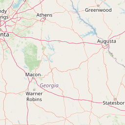
Bear Creek
Map


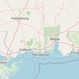


Leaflet | <a href="https://www.openstreetmap.org/copyright">© OpenStreetMap contributors</a>
Item
| Property | Value |
|---|---|
| id | 1675220 |
| downstream_mainstem_id | https://geoconnex.us/ref/mainstems/1673964 |
| encompassing_mainstem_basins | ['https://geoconnex.us/ref/mainstems/1673964', 'https://geoconnex.us/ref/mainstems/1673552', 'https://geoconnex.us/ref/mainstems/1673188'] |
| featuretype | ['https://www.opengis.net/def/schema/hy_features/hyf/HY_FlowPath', 'https://www.opengis.net/def/schema/hy_features/hyf/HY_WaterBody'] |
| fid | 4864 |
| head_2020huc12 | 031300070401 |
| head_nhdpv1_comid | 6457527 |
| head_nhdpv2_comid | https://geoconnex.us/nhdplusv2/comid/6457527 |
| head_nhdpv2huc12 | https://geoconnex.us/nhdplusv2/huc12/031300070401 |
| head_rf1id | 7681 |
| lengthkm | 39.3 |
| name_at_outlet | Bear Creek |
| name_at_outlet_gnis_id | 354500 |
| new_mainstemid | |
| outlet_2020huc12 | 031300070404 |
| outlet_drainagearea_sqkm | 194.7 |
| outlet_nhdpv1_comid | 6459805 |
| outlet_nhdpv2_comid | https://geoconnex.us/nhdplusv2/comid/6459805 |
| outlet_nhdpv2huc12 | https://geoconnex.us/nhdplusv2/huc12/031300070404 |
| outlet_rf1id | 7681 |
| superseded | False |
| uri | https://geoconnex.us/ref/mainstems/1675220 |