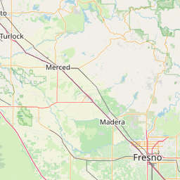
Miami Creek
Map
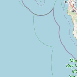
Leaflet | <a href="https://www.openstreetmap.org/copyright">© OpenStreetMap contributors</a>
Item
| Property | Value |
|---|---|
| id | 1811496 |
| downstream_mainstem_id | https://geoconnex.us/ref/mainstems/1871237 |
| encompassing_mainstem_basins | ['https://geoconnex.us/ref/mainstems/1871237', 'https://geoconnex.us/ref/mainstems/1806728', 'https://geoconnex.us/ref/mainstems/1805899'] |
| featuretype | ['https://www.opengis.net/def/schema/hy_features/hyf/HY_FlowPath', 'https://www.opengis.net/def/schema/hy_features/hyf/HY_WaterBody'] |
| fid | 32854 |
| head_2020huc12 | 180400070102 |
| head_nhdpv1_comid | 17099649 |
| head_nhdpv2_comid | https://geoconnex.us/nhdplusv2/comid/17099649 |
| head_nhdpv2huc12 | https://geoconnex.us/nhdplusv2/huc12/180400070102 |
| head_rf1id | 57833 |
| lengthkm | 21.2 |
| name_at_outlet | Miami Creek |
| name_at_outlet_gnis_id | 263485 |
| new_mainstemid | |
| outlet_2020huc12 | 180400070102 |
| outlet_drainagearea_sqkm | 81.1 |
| outlet_nhdpv1_comid | 17099879 |
| outlet_nhdpv2_comid | https://geoconnex.us/nhdplusv2/comid/17099879 |
| outlet_nhdpv2huc12 | https://geoconnex.us/nhdplusv2/huc12/180400070102 |
| outlet_rf1id | 57833 |
| superseded | False |
| uri | https://geoconnex.us/ref/mainstems/1811496 |