Tecate Creek
Map
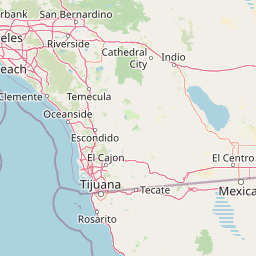

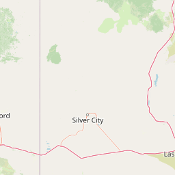
Leaflet | <a href="https://www.openstreetmap.org/copyright">© OpenStreetMap contributors</a>
Item
| Property | Value |
|---|---|
| id | 1853951 |
| downstream_mainstem_id | https://geoconnex.us/ref/mainstems/1853884 |
| encompassing_mainstem_basins | ['https://geoconnex.us/ref/mainstems/1853884'] |
| featuretype | ['https://www.opengis.net/def/schema/hy_features/hyf/HY_FlowPath', 'https://www.opengis.net/def/schema/hy_features/hyf/HY_WaterBody'] |
| fid | 33274 |
| head_2020huc12 | 180703051101 |
| head_nhdpv1_comid | 20326385 |
| head_nhdpv2_comid | https://geoconnex.us/nhdplusv2/comid/20326385 |
| head_nhdpv2huc12 | |
| head_rf1id | None |
| lengthkm | 63.9 |
| name_at_outlet | Tecate Creek |
| name_at_outlet_gnis_id | 250289 |
| new_mainstemid | |
| outlet_2020huc12 | 180703051105 |
| outlet_drainagearea_sqkm | 429.7 |
| outlet_nhdpv1_comid | 20326437 |
| outlet_nhdpv2_comid | https://geoconnex.us/nhdplusv2/comid/20326437 |
| outlet_nhdpv2huc12 | |
| outlet_rf1id | None |
| superseded | False |
| uri | https://geoconnex.us/ref/mainstems/1853951 |
Graph Results
| monitoringLocation | https://sta.geoconnex.dev/collections/USGS/Things/items/'USGS-11012500' |
|---|---|
| siteName | USGS-11012500 |
| datasetDescription | Discharge / USGS-11012500-dd2df312136644a880049bcfd61aa405 |
| type | Stream |
| url | https://waterdata.usgs.gov/monitoring-location/11012500/#parameterCode=00060 |
| variableMeasured | Discharge / USGS-11012500-dd2df312136644a880049bcfd61aa405 |
| variableUnit | ft^3/s |
| measurementTechnique | observation |
| temporalCoverage | 2024-08-30T09:15:00Z/2024-09-09T18:00:00Z |
| distributionName | USGS Instantaneous Values Service |
| distributionURL | https://waterservices.usgs.gov/nwis/iv/?sites=USGS:11012500¶meterCd=00060&format=rdb |
| distributionFormat | text/tab-separated-values |
| wkt | POINT (-116.525571961125 32.5911720009718) |
| monitoringLocation | https://sta.geoconnex.dev/collections/USGS/Things/items/'USGS-11012500' |
|---|---|
| siteName | USGS-11012500 |
| datasetDescription | Discharge / USGS-11012500-dd2df312136644a880049bcfd61aa405 |
| type | Stream |
| url | https://waterdata.usgs.gov/monitoring-location/11012500/#parameterCode=00060 |
| variableMeasured | Discharge / USGS-11012500-dd2df312136644a880049bcfd61aa405 |
| variableUnit | ft^3/s |
| measurementTechnique | observation |
| temporalCoverage | 2024-08-30T09:15:00Z/2024-09-09T18:00:00Z |
| distributionName | USGS SensorThings API |
| distributionURL | https://labs.waterdata.usgs.gov/sta/v1.1/Datastreams('dd2df312136644a880049bcfd61aa405')?$expand=Thing,Observations |
| distributionFormat | application/json |
| wkt | POINT (-116.525571961125 32.5911720009718) |
| monitoringLocation | https://sta.geoconnex.dev/collections/USGS/Things/items/'USGS-11012500' |
|---|---|
| siteName | USGS-11012500 |
| datasetDescription | Gage height / USGS-11012500-efa628bf95bc40038155760f2a868a60 |
| type | Stream |
| url | https://waterdata.usgs.gov/monitoring-location/11012500/#parameterCode=00065 |
| variableMeasured | Gage height / USGS-11012500-efa628bf95bc40038155760f2a868a60 |
| variableUnit | ft |
| measurementTechnique | observation |
| temporalCoverage | 2024-08-30T09:15:00Z/2024-09-09T18:00:00Z |
| distributionName | USGS Instantaneous Values Service |
| distributionURL | https://waterservices.usgs.gov/nwis/iv/?sites=USGS:11012500¶meterCd=00065&format=rdb |
| distributionFormat | text/tab-separated-values |
| wkt | POINT (-116.525571961125 32.5911720009718) |
| monitoringLocation | https://sta.geoconnex.dev/collections/USGS/Things/items/'USGS-11012500' |
|---|---|
| siteName | USGS-11012500 |
| datasetDescription | Gage height / USGS-11012500-efa628bf95bc40038155760f2a868a60 |
| type | Stream |
| url | https://waterdata.usgs.gov/monitoring-location/11012500/#parameterCode=00065 |
| variableMeasured | Gage height / USGS-11012500-efa628bf95bc40038155760f2a868a60 |
| variableUnit | ft |
| measurementTechnique | observation |
| temporalCoverage | 2024-08-30T09:15:00Z/2024-09-09T18:00:00Z |
| distributionName | USGS SensorThings API |
| distributionURL | https://labs.waterdata.usgs.gov/sta/v1.1/Datastreams('efa628bf95bc40038155760f2a868a60')?$expand=Thing,Observations |
| distributionFormat | application/json |
| wkt | POINT (-116.525571961125 32.5911720009718) |