Kettle Creek
Map

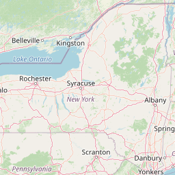


Leaflet | <a href="https://www.openstreetmap.org/copyright">© OpenStreetMap contributors</a>
Item
| Property | Value |
|---|---|
| id | 195409 |
| downstream_mainstem_id | https://geoconnex.us/ref/mainstems/194819 |
| encompassing_mainstem_basins | ['https://geoconnex.us/ref/mainstems/194819', 'https://geoconnex.us/ref/mainstems/194408'] |
| featuretype | ['https://www.opengis.net/def/schema/hy_features/hyf/HY_FlowPath', 'https://www.opengis.net/def/schema/hy_features/hyf/HY_WaterBody'] |
| fid | 1596 |
| head_2020huc12 | 020502030102 |
| head_nhdpv1_comid | 8133756 |
| head_nhdpv2_comid | https://geoconnex.us/nhdplusv2/comid/8133756 |
| head_nhdpv2huc12 | https://geoconnex.us/nhdplusv2/huc12/020502030102 |
| head_rf1id | 3277 |
| lengthkm | 75.0 |
| name_at_outlet | Kettle Creek |
| name_at_outlet_gnis_id | 1198971 |
| new_mainstemid | |
| outlet_2020huc12 | 020502030106 |
| outlet_drainagearea_sqkm | 638.4 |
| outlet_nhdpv1_comid | 8135560 |
| outlet_nhdpv2_comid | https://geoconnex.us/nhdplusv2/comid/8135560 |
| outlet_nhdpv2huc12 | https://geoconnex.us/nhdplusv2/huc12/020502030106 |
| outlet_rf1id | 3276 |
| superseded | False |
| uri | https://geoconnex.us/ref/mainstems/195409 |
Graph Results
| monitoringLocation | https://sta.geoconnex.dev/collections/USGS/Things/items/'USGS-01545000' |
|---|---|
| siteName | USGS-01545000 |
| datasetDescription | Stream water level elevation above NAVD 1988, in feet / USGS-01545000-102aee064bc0457b9127e9b4a81f1357 |
| type | Stream |
| url | https://waterdata.usgs.gov/monitoring-location/01545000/#parameterCode=63160 |
| variableMeasured | Stream water level elevation above NAVD 1988 |
| variableUnit | ft |
| measurementTechnique | observation |
| temporalCoverage | 2024-08-30T09:15:00Z/2024-09-09T18:00:00Z |
| distributionName | USGS Instantaneous Values Service |
| distributionURL | https://waterservices.usgs.gov/nwis/iv/?sites=USGS:01545000¶meterCd=63160&format=rdb |
| distributionFormat | text/tab-separated-values |
| wkt | POINT (-77.87385866636578 41.3194509847916) |
| monitoringLocation | https://sta.geoconnex.dev/collections/USGS/Things/items/'USGS-01545000' |
|---|---|
| siteName | USGS-01545000 |
| datasetDescription | Stream water level elevation above NAVD 1988, in feet / USGS-01545000-102aee064bc0457b9127e9b4a81f1357 |
| type | Stream |
| url | https://waterdata.usgs.gov/monitoring-location/01545000/#parameterCode=63160 |
| variableMeasured | Stream water level elevation above NAVD 1988 |
| variableUnit | ft |
| measurementTechnique | observation |
| temporalCoverage | 2024-08-30T09:15:00Z/2024-09-09T18:00:00Z |
| distributionName | USGS SensorThings API |
| distributionURL | https://labs.waterdata.usgs.gov/sta/v1.1/Datastreams('102aee064bc0457b9127e9b4a81f1357')?$expand=Thing,Observations |
| distributionFormat | application/json |
| wkt | POINT (-77.87385866636578 41.3194509847916) |
| monitoringLocation | https://sta.geoconnex.dev/collections/USGS/Things/items/'USGS-01545000' |
|---|---|
| siteName | USGS-01545000 |
| datasetDescription | Gage height, feet / USGS-01545000-e7fa831d6c494dc2b0f14ce0554c7d40 |
| type | Stream |
| url | https://waterdata.usgs.gov/monitoring-location/01545000/#parameterCode=00065 |
| variableMeasured | Gage height |
| variableUnit | ft |
| measurementTechnique | observation |
| temporalCoverage | 2024-08-30T09:15:00Z/2024-09-09T18:00:00Z |
| distributionName | USGS Instantaneous Values Service |
| distributionURL | https://waterservices.usgs.gov/nwis/iv/?sites=USGS:01545000¶meterCd=00065&format=rdb |
| distributionFormat | text/tab-separated-values |
| wkt | POINT (-77.87385866636578 41.3194509847916) |
| monitoringLocation | https://sta.geoconnex.dev/collections/USGS/Things/items/'USGS-01545000' |
|---|---|
| siteName | USGS-01545000 |
| datasetDescription | Gage height, feet / USGS-01545000-e7fa831d6c494dc2b0f14ce0554c7d40 |
| type | Stream |
| url | https://waterdata.usgs.gov/monitoring-location/01545000/#parameterCode=00065 |
| variableMeasured | Gage height |
| variableUnit | ft |
| measurementTechnique | observation |
| temporalCoverage | 2024-08-30T09:15:00Z/2024-09-09T18:00:00Z |
| distributionName | USGS SensorThings API |
| distributionURL | https://labs.waterdata.usgs.gov/sta/v1.1/Datastreams('e7fa831d6c494dc2b0f14ce0554c7d40')?$expand=Thing,Observations |
| distributionFormat | application/json |
| wkt | POINT (-77.87385866636578 41.3194509847916) |
| monitoringLocation | https://sta.geoconnex.dev/collections/USGS/Things/items/'USGS-01545000' |
|---|---|
| siteName | USGS-01545000 |
| datasetDescription | Discharge / USGS-01545000-08acf84aa07a485baf60f22aab75a7f2 |
| type | Stream |
| url | https://waterdata.usgs.gov/monitoring-location/01545000/#parameterCode=00060 |
| variableMeasured | Discharge / USGS-01545000-08acf84aa07a485baf60f22aab75a7f2 |
| variableUnit | ft^3/s |
| measurementTechnique | observation |
| temporalCoverage | 2024-08-30T09:15:00Z/2024-09-09T18:00:00Z |
| distributionName | USGS Instantaneous Values Service |
| distributionURL | https://waterservices.usgs.gov/nwis/iv/?sites=USGS:01545000¶meterCd=00060&format=rdb |
| distributionFormat | text/tab-separated-values |
| wkt | POINT (-77.87385866636578 41.3194509847916) |
| monitoringLocation | https://sta.geoconnex.dev/collections/USGS/Things/items/'USGS-01545000' |
|---|---|
| siteName | USGS-01545000 |
| datasetDescription | Discharge / USGS-01545000-08acf84aa07a485baf60f22aab75a7f2 |
| type | Stream |
| url | https://waterdata.usgs.gov/monitoring-location/01545000/#parameterCode=00060 |
| variableMeasured | Discharge / USGS-01545000-08acf84aa07a485baf60f22aab75a7f2 |
| variableUnit | ft^3/s |
| measurementTechnique | observation |
| temporalCoverage | 2024-08-30T09:15:00Z/2024-09-09T18:00:00Z |
| distributionName | USGS SensorThings API |
| distributionURL | https://labs.waterdata.usgs.gov/sta/v1.1/Datastreams('08acf84aa07a485baf60f22aab75a7f2')?$expand=Thing,Observations |
| distributionFormat | application/json |
| wkt | POINT (-77.87385866636578 41.3194509847916) |
| monitoringLocation | https://sta.geoconnex.dev/collections/USGS/Things/items/'USGS-01544500' |
|---|---|
| siteName | USGS-01544500 |
| datasetDescription | Discharge / USGS-01544500-bb4a8d6fdb57498495564e0d2915daf5 |
| type | Stream |
| url | https://waterdata.usgs.gov/monitoring-location/01544500/#parameterCode=00060 |
| variableMeasured | Discharge / USGS-01544500-bb4a8d6fdb57498495564e0d2915daf5 |
| variableUnit | ft^3/s |
| measurementTechnique | observation |
| temporalCoverage | 2024-08-30T09:15:00Z/2024-09-09T18:00:00Z |
| distributionName | USGS Instantaneous Values Service |
| distributionURL | https://waterservices.usgs.gov/nwis/iv/?sites=USGS:01544500¶meterCd=00060&format=rdb |
| distributionFormat | text/tab-separated-values |
| wkt | POINT (-77.82580078407982 41.475838293895336) |
| monitoringLocation | https://sta.geoconnex.dev/collections/USGS/Things/items/'USGS-01544500' |
|---|---|
| siteName | USGS-01544500 |
| datasetDescription | Discharge / USGS-01544500-bb4a8d6fdb57498495564e0d2915daf5 |
| type | Stream |
| url | https://waterdata.usgs.gov/monitoring-location/01544500/#parameterCode=00060 |
| variableMeasured | Discharge / USGS-01544500-bb4a8d6fdb57498495564e0d2915daf5 |
| variableUnit | ft^3/s |
| measurementTechnique | observation |
| temporalCoverage | 2024-08-30T09:15:00Z/2024-09-09T18:00:00Z |
| distributionName | USGS SensorThings API |
| distributionURL | https://labs.waterdata.usgs.gov/sta/v1.1/Datastreams('bb4a8d6fdb57498495564e0d2915daf5')?$expand=Thing,Observations |
| distributionFormat | application/json |
| wkt | POINT (-77.82580078407982 41.475838293895336) |
| monitoringLocation | https://sta.geoconnex.dev/collections/USGS/Things/items/'USGS-01544500' |
|---|---|
| siteName | USGS-01544500 |
| datasetDescription | Stream water level elevation above NAVD 1988, in feet / USGS-01544500-18b75ccff0ee4f7c9db451e91391e98d |
| type | Stream |
| url | https://waterdata.usgs.gov/monitoring-location/01544500/#parameterCode=63160 |
| variableMeasured | Stream water level elevation above NAVD 1988 |
| variableUnit | ft |
| measurementTechnique | observation |
| temporalCoverage | 2024-08-30T09:15:00Z/2024-09-09T18:00:00Z |
| distributionName | USGS Instantaneous Values Service |
| distributionURL | https://waterservices.usgs.gov/nwis/iv/?sites=USGS:01544500¶meterCd=63160&format=rdb |
| distributionFormat | text/tab-separated-values |
| wkt | POINT (-77.82580078407982 41.475838293895336) |
| monitoringLocation | https://sta.geoconnex.dev/collections/USGS/Things/items/'USGS-01544500' |
|---|---|
| siteName | USGS-01544500 |
| datasetDescription | Stream water level elevation above NAVD 1988, in feet / USGS-01544500-18b75ccff0ee4f7c9db451e91391e98d |
| type | Stream |
| url | https://waterdata.usgs.gov/monitoring-location/01544500/#parameterCode=63160 |
| variableMeasured | Stream water level elevation above NAVD 1988 |
| variableUnit | ft |
| measurementTechnique | observation |
| temporalCoverage | 2024-08-30T09:15:00Z/2024-09-09T18:00:00Z |
| distributionName | USGS SensorThings API |
| distributionURL | https://labs.waterdata.usgs.gov/sta/v1.1/Datastreams('18b75ccff0ee4f7c9db451e91391e98d')?$expand=Thing,Observations |
| distributionFormat | application/json |
| wkt | POINT (-77.82580078407982 41.475838293895336) |
| monitoringLocation | https://sta.geoconnex.dev/collections/USGS/Things/items/'USGS-01544500' |
|---|---|
| siteName | USGS-01544500 |
| datasetDescription | Dissolved oxygen, water, unfiltered, milligrams per liter / USGS-01544500-6ab2697d56ec4907bcb6f4f0a9ae6df0 |
| type | Stream |
| url | https://waterdata.usgs.gov/monitoring-location/01544500/#parameterCode=00300 |
| variableMeasured | Dissolved oxygen |
| variableUnit | mg/l |
| measurementTechnique | observation |
| temporalCoverage | 2024-08-30T09:15:00Z/2024-09-09T18:00:00Z |
| distributionName | USGS SensorThings API |
| distributionURL | https://labs.waterdata.usgs.gov/sta/v1.1/Datastreams('6ab2697d56ec4907bcb6f4f0a9ae6df0')?$expand=Thing,Observations |
| distributionFormat | application/json |
| wkt | POINT (-77.82580078407982 41.475838293895336) |
| monitoringLocation | https://sta.geoconnex.dev/collections/USGS/Things/items/'USGS-01544500' |
|---|---|
| siteName | USGS-01544500 |
| datasetDescription | Dissolved oxygen, water, unfiltered, milligrams per liter / USGS-01544500-6ab2697d56ec4907bcb6f4f0a9ae6df0 |
| type | Stream |
| url | https://waterdata.usgs.gov/monitoring-location/01544500/#parameterCode=00300 |
| variableMeasured | Dissolved oxygen |
| variableUnit | mg/l |
| measurementTechnique | observation |
| temporalCoverage | 2024-08-30T09:15:00Z/2024-09-09T18:00:00Z |
| distributionName | USGS Instantaneous Values Service |
| distributionURL | https://waterservices.usgs.gov/nwis/iv/?sites=USGS:01544500¶meterCd=00300&format=rdb |
| distributionFormat | text/tab-separated-values |
| wkt | POINT (-77.82580078407982 41.475838293895336) |
| monitoringLocation | https://sta.geoconnex.dev/collections/USGS/Things/items/'USGS-01544500' |
|---|---|
| siteName | USGS-01544500 |
| datasetDescription | Specific cond at 25C / USGS-01544500-84814e508d8e41a1864a3fab48eff993 |
| type | Stream |
| url | https://waterdata.usgs.gov/monitoring-location/01544500/#parameterCode=00095 |
| variableMeasured | Specific cond at 25C / USGS-01544500-84814e508d8e41a1864a3fab48eff993 |
| variableUnit | uS/cm |
| measurementTechnique | observation |
| temporalCoverage | 2024-08-30T09:15:00Z/2024-09-09T18:00:00Z |
| distributionName | USGS Instantaneous Values Service |
| distributionURL | https://waterservices.usgs.gov/nwis/iv/?sites=USGS:01544500¶meterCd=00095&format=rdb |
| distributionFormat | text/tab-separated-values |
| wkt | POINT (-77.82580078407982 41.475838293895336) |
| monitoringLocation | https://sta.geoconnex.dev/collections/USGS/Things/items/'USGS-01544500' |
|---|---|
| siteName | USGS-01544500 |
| datasetDescription | Specific cond at 25C / USGS-01544500-84814e508d8e41a1864a3fab48eff993 |
| type | Stream |
| url | https://waterdata.usgs.gov/monitoring-location/01544500/#parameterCode=00095 |
| variableMeasured | Specific cond at 25C / USGS-01544500-84814e508d8e41a1864a3fab48eff993 |
| variableUnit | uS/cm |
| measurementTechnique | observation |
| temporalCoverage | 2024-08-30T09:15:00Z/2024-09-09T18:00:00Z |
| distributionName | USGS SensorThings API |
| distributionURL | https://labs.waterdata.usgs.gov/sta/v1.1/Datastreams('84814e508d8e41a1864a3fab48eff993')?$expand=Thing,Observations |
| distributionFormat | application/json |
| wkt | POINT (-77.82580078407982 41.475838293895336) |
| monitoringLocation | https://sta.geoconnex.dev/collections/USGS/Things/items/'USGS-01544500' |
|---|---|
| siteName | USGS-01544500 |
| datasetDescription | Temperature, water, degrees Celsius / USGS-01544500-ce85bdf7b0304c6d95c81df80d3209ee |
| type | Stream |
| url | https://waterdata.usgs.gov/monitoring-location/01544500/#parameterCode=00010 |
| variableMeasured | Temperature |
| variableUnit | degC |
| measurementTechnique | observation |
| temporalCoverage | 2024-08-30T09:15:00Z/2024-09-09T18:00:00Z |
| distributionName | USGS SensorThings API |
| distributionURL | https://labs.waterdata.usgs.gov/sta/v1.1/Datastreams('ce85bdf7b0304c6d95c81df80d3209ee')?$expand=Thing,Observations |
| distributionFormat | application/json |
| wkt | POINT (-77.82580078407982 41.475838293895336) |
| monitoringLocation | https://sta.geoconnex.dev/collections/USGS/Things/items/'USGS-01544500' |
|---|---|
| siteName | USGS-01544500 |
| datasetDescription | Temperature, water, degrees Celsius / USGS-01544500-ce85bdf7b0304c6d95c81df80d3209ee |
| type | Stream |
| url | https://waterdata.usgs.gov/monitoring-location/01544500/#parameterCode=00010 |
| variableMeasured | Temperature |
| variableUnit | degC |
| measurementTechnique | observation |
| temporalCoverage | 2024-08-30T09:15:00Z/2024-09-09T18:00:00Z |
| distributionName | USGS Instantaneous Values Service |
| distributionURL | https://waterservices.usgs.gov/nwis/iv/?sites=USGS:01544500¶meterCd=00010&format=rdb |
| distributionFormat | text/tab-separated-values |
| wkt | POINT (-77.82580078407982 41.475838293895336) |
| monitoringLocation | https://sta.geoconnex.dev/collections/USGS/Things/items/'USGS-01544500' |
|---|---|
| siteName | USGS-01544500 |
| datasetDescription | Gage height / USGS-01544500-cf9ab37fb58d4d3a946e45d390553b65 |
| type | Stream |
| url | https://waterdata.usgs.gov/monitoring-location/01544500/#parameterCode=00065 |
| variableMeasured | Gage height / USGS-01544500-cf9ab37fb58d4d3a946e45d390553b65 |
| variableUnit | ft |
| measurementTechnique | observation |
| temporalCoverage | 2024-08-30T09:15:00Z/2024-09-09T18:00:00Z |
| distributionName | USGS Instantaneous Values Service |
| distributionURL | https://waterservices.usgs.gov/nwis/iv/?sites=USGS:01544500¶meterCd=00065&format=rdb |
| distributionFormat | text/tab-separated-values |
| wkt | POINT (-77.82580078407982 41.475838293895336) |
| monitoringLocation | https://sta.geoconnex.dev/collections/USGS/Things/items/'USGS-01544500' |
|---|---|
| siteName | USGS-01544500 |
| datasetDescription | Gage height / USGS-01544500-cf9ab37fb58d4d3a946e45d390553b65 |
| type | Stream |
| url | https://waterdata.usgs.gov/monitoring-location/01544500/#parameterCode=00065 |
| variableMeasured | Gage height / USGS-01544500-cf9ab37fb58d4d3a946e45d390553b65 |
| variableUnit | ft |
| measurementTechnique | observation |
| temporalCoverage | 2024-08-30T09:15:00Z/2024-09-09T18:00:00Z |
| distributionName | USGS SensorThings API |
| distributionURL | https://labs.waterdata.usgs.gov/sta/v1.1/Datastreams('cf9ab37fb58d4d3a946e45d390553b65')?$expand=Thing,Observations |
| distributionFormat | application/json |
| wkt | POINT (-77.82580078407982 41.475838293895336) |
| monitoringLocation | https://sta.geoconnex.dev/collections/USGS/Things/items/'USGS-01544500' |
|---|---|
| siteName | USGS-01544500 |
| datasetDescription | pH, water, unfiltered, field, standard units / USGS-01544500-d6b41c0b60774b0d844a04b26fc425e3 |
| type | Stream |
| url | https://waterdata.usgs.gov/monitoring-location/01544500/#parameterCode=00400 |
| variableMeasured | pH |
| variableUnit | pH Units |
| measurementTechnique | observation |
| temporalCoverage | 2024-08-30T09:15:00Z/2024-09-09T18:00:00Z |
| distributionName | USGS Instantaneous Values Service |
| distributionURL | https://waterservices.usgs.gov/nwis/iv/?sites=USGS:01544500¶meterCd=00400&format=rdb |
| distributionFormat | text/tab-separated-values |
| wkt | POINT (-77.82580078407982 41.475838293895336) |
| monitoringLocation | https://sta.geoconnex.dev/collections/USGS/Things/items/'USGS-01544500' |
|---|---|
| siteName | USGS-01544500 |
| datasetDescription | pH, water, unfiltered, field, standard units / USGS-01544500-d6b41c0b60774b0d844a04b26fc425e3 |
| type | Stream |
| url | https://waterdata.usgs.gov/monitoring-location/01544500/#parameterCode=00400 |
| variableMeasured | pH |
| variableUnit | pH Units |
| measurementTechnique | observation |
| temporalCoverage | 2024-08-30T09:15:00Z/2024-09-09T18:00:00Z |
| distributionName | USGS SensorThings API |
| distributionURL | https://labs.waterdata.usgs.gov/sta/v1.1/Datastreams('d6b41c0b60774b0d844a04b26fc425e3')?$expand=Thing,Observations |
| distributionFormat | application/json |
| wkt | POINT (-77.82580078407982 41.475838293895336) |