Aughwick Creek
Map

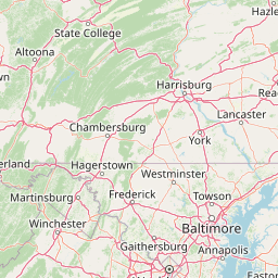

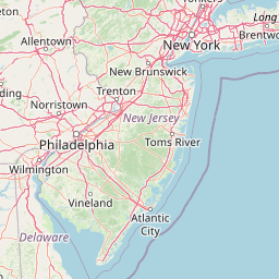

Leaflet | <a href="https://www.openstreetmap.org/copyright">© OpenStreetMap contributors</a>
Item
| Property | Value |
|---|---|
| id | 195597 |
| downstream_mainstem_id | https://geoconnex.us/ref/mainstems/194806 |
| encompassing_mainstem_basins | ['https://geoconnex.us/ref/mainstems/194806', 'https://geoconnex.us/ref/mainstems/194408'] |
| featuretype | ['https://www.opengis.net/def/schema/hy_features/hyf/HY_FlowPath', 'https://www.opengis.net/def/schema/hy_features/hyf/HY_WaterBody'] |
| fid | 1718 |
| head_2020huc12 | |
| head_nhdpv1_comid | None |
| head_nhdpv2_comid | https://geoconnex.us/nhdplusv2/comid/4700457 |
| head_nhdpv2huc12 | |
| head_rf1id | 3365 |
| lengthkm | 92.3 |
| name_at_outlet | Aughwick Creek |
| name_at_outlet_gnis_id | 1168507 |
| new_mainstemid | |
| outlet_2020huc12 | |
| outlet_drainagearea_sqkm | 836.7 |
| outlet_nhdpv1_comid | None |
| outlet_nhdpv2_comid | https://geoconnex.us/nhdplusv2/comid/4700091 |
| outlet_nhdpv2huc12 | |
| outlet_rf1id | 3362 |
| superseded | False |
| uri | https://geoconnex.us/ref/mainstems/195597 |
Graph Results
| monitoringLocation | https://sta.geoconnex.dev/collections/USGS/Things/items/'USGS-01564500' |
|---|---|
| siteName | USGS-01564500 |
| datasetDescription | Gage height, feet / USGS-01564500-c7c7d4c51ea8489b830257df8a8ca36d |
| type | Stream |
| url | https://waterdata.usgs.gov/monitoring-location/01564500/#parameterCode=00065 |
| variableMeasured | Gage height |
| variableUnit | ft |
| measurementTechnique | observation |
| temporalCoverage | 2024-08-30T09:15:00Z/2024-09-09T18:00:00Z |
| distributionName | USGS SensorThings API |
| distributionURL | https://labs.waterdata.usgs.gov/sta/v1.1/Datastreams('c7c7d4c51ea8489b830257df8a8ca36d')?$expand=Thing,Observations |
| distributionFormat | application/json |
| wkt | POINT (-77.9252764374762 40.2125814442497) |
| monitoringLocation | https://sta.geoconnex.dev/collections/USGS/Things/items/'USGS-01564500' |
|---|---|
| siteName | USGS-01564500 |
| datasetDescription | Gage height, feet / USGS-01564500-c7c7d4c51ea8489b830257df8a8ca36d |
| type | Stream |
| url | https://waterdata.usgs.gov/monitoring-location/01564500/#parameterCode=00065 |
| variableMeasured | Gage height |
| variableUnit | ft |
| measurementTechnique | observation |
| temporalCoverage | 2024-08-30T09:15:00Z/2024-09-09T18:00:00Z |
| distributionName | USGS Instantaneous Values Service |
| distributionURL | https://waterservices.usgs.gov/nwis/iv/?sites=USGS:01564500¶meterCd=00065&format=rdb |
| distributionFormat | text/tab-separated-values |
| wkt | POINT (-77.9252764374762 40.2125814442497) |
| monitoringLocation | https://sta.geoconnex.dev/collections/USGS/Things/items/'USGS-01564500' |
|---|---|
| siteName | USGS-01564500 |
| datasetDescription | Discharge / USGS-01564500-e988253103bd419587846bd85a4646f4 |
| type | Stream |
| url | https://waterdata.usgs.gov/monitoring-location/01564500/#parameterCode=00060 |
| variableMeasured | Discharge / USGS-01564500-e988253103bd419587846bd85a4646f4 |
| variableUnit | ft^3/s |
| measurementTechnique | observation |
| temporalCoverage | 2024-08-30T09:15:00Z/2024-09-09T18:00:00Z |
| distributionName | USGS Instantaneous Values Service |
| distributionURL | https://waterservices.usgs.gov/nwis/iv/?sites=USGS:01564500¶meterCd=00060&format=rdb |
| distributionFormat | text/tab-separated-values |
| wkt | POINT (-77.9252764374762 40.2125814442497) |
| monitoringLocation | https://sta.geoconnex.dev/collections/USGS/Things/items/'USGS-01564500' |
|---|---|
| siteName | USGS-01564500 |
| datasetDescription | Discharge / USGS-01564500-e988253103bd419587846bd85a4646f4 |
| type | Stream |
| url | https://waterdata.usgs.gov/monitoring-location/01564500/#parameterCode=00060 |
| variableMeasured | Discharge / USGS-01564500-e988253103bd419587846bd85a4646f4 |
| variableUnit | ft^3/s |
| measurementTechnique | observation |
| temporalCoverage | 2024-08-30T09:15:00Z/2024-09-09T18:00:00Z |
| distributionName | USGS SensorThings API |
| distributionURL | https://labs.waterdata.usgs.gov/sta/v1.1/Datastreams('e988253103bd419587846bd85a4646f4')?$expand=Thing,Observations |
| distributionFormat | application/json |
| wkt | POINT (-77.9252764374762 40.2125814442497) |