Codorus Creek
Map
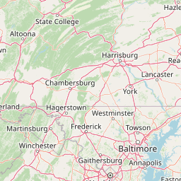


Leaflet | <a href="https://www.openstreetmap.org/copyright">© OpenStreetMap contributors</a>
Item
| Property | Value |
|---|---|
| id | 196682 |
| downstream_mainstem_id | https://geoconnex.us/ref/mainstems/194408 |
| encompassing_mainstem_basins | ['https://geoconnex.us/ref/mainstems/194408'] |
| featuretype | ['https://www.opengis.net/def/schema/hy_features/hyf/HY_FlowPath', 'https://www.opengis.net/def/schema/hy_features/hyf/HY_WaterBody'] |
| fid | 1775 |
| head_2020huc12 | 020503060703 |
| head_nhdpv1_comid | 4726203 |
| head_nhdpv2_comid | https://geoconnex.us/nhdplusv2/comid/4726203 |
| head_nhdpv2huc12 | https://geoconnex.us/nhdplusv2/huc12/020503060703 |
| head_rf1id | 3411 |
| lengthkm | 66.1 |
| name_at_outlet | Codorus Creek |
| name_at_outlet_gnis_id | 1172123 |
| new_mainstemid | |
| outlet_2020huc12 | 020503060707 |
| outlet_drainagearea_sqkm | 719.7 |
| outlet_nhdpv1_comid | 4722259 |
| outlet_nhdpv2_comid | https://geoconnex.us/nhdplusv2/comid/4722259 |
| outlet_nhdpv2huc12 | https://geoconnex.us/nhdplusv2/huc12/020503060707 |
| outlet_rf1id | 3410 |
| superseded | False |
| uri | https://geoconnex.us/ref/mainstems/196682 |
Graph Results
| monitoringLocation | https://sta.geoconnex.dev/collections/USGS/Things/items/'USGS-01575500' |
|---|---|
| siteName | USGS-01575500 |
| datasetDescription | Gage height / USGS-01575500-3678685ef2ab44e3bd005caeb423a42c |
| type | Stream |
| url | https://waterdata.usgs.gov/monitoring-location/01575500/#parameterCode=00065 |
| variableMeasured | Gage height / USGS-01575500-3678685ef2ab44e3bd005caeb423a42c |
| variableUnit | ft |
| measurementTechnique | observation |
| temporalCoverage | 2024-08-30T09:15:00Z/2024-09-09T18:00:00Z |
| distributionName | USGS Instantaneous Values Service |
| distributionURL | https://waterservices.usgs.gov/nwis/iv/?sites=USGS:01575500¶meterCd=00065&format=rdb |
| distributionFormat | text/tab-separated-values |
| wkt | POINT (-76.7552458503363 39.9462097467989) |
| monitoringLocation | https://sta.geoconnex.dev/collections/USGS/Things/items/'USGS-01575500' |
|---|---|
| siteName | USGS-01575500 |
| datasetDescription | Gage height / USGS-01575500-3678685ef2ab44e3bd005caeb423a42c |
| type | Stream |
| url | https://waterdata.usgs.gov/monitoring-location/01575500/#parameterCode=00065 |
| variableMeasured | Gage height / USGS-01575500-3678685ef2ab44e3bd005caeb423a42c |
| variableUnit | ft |
| measurementTechnique | observation |
| temporalCoverage | 2024-08-30T09:15:00Z/2024-09-09T18:00:00Z |
| distributionName | USGS SensorThings API |
| distributionURL | https://labs.waterdata.usgs.gov/sta/v1.1/Datastreams('3678685ef2ab44e3bd005caeb423a42c')?$expand=Thing,Observations |
| distributionFormat | application/json |
| wkt | POINT (-76.7552458503363 39.9462097467989) |
| monitoringLocation | https://sta.geoconnex.dev/collections/USGS/Things/items/'USGS-01575500' |
|---|---|
| siteName | USGS-01575500 |
| datasetDescription | Discharge / USGS-01575500-82dc588b4df14694ab30c446df549b05 |
| type | Stream |
| url | https://waterdata.usgs.gov/monitoring-location/01575500/#parameterCode=00060 |
| variableMeasured | Discharge / USGS-01575500-82dc588b4df14694ab30c446df549b05 |
| variableUnit | ft^3/s |
| measurementTechnique | observation |
| temporalCoverage | 2024-08-30T09:15:00Z/2024-09-09T18:00:00Z |
| distributionName | USGS SensorThings API |
| distributionURL | https://labs.waterdata.usgs.gov/sta/v1.1/Datastreams('82dc588b4df14694ab30c446df549b05')?$expand=Thing,Observations |
| distributionFormat | application/json |
| wkt | POINT (-76.7552458503363 39.9462097467989) |
| monitoringLocation | https://sta.geoconnex.dev/collections/USGS/Things/items/'USGS-01575500' |
|---|---|
| siteName | USGS-01575500 |
| datasetDescription | Discharge / USGS-01575500-82dc588b4df14694ab30c446df549b05 |
| type | Stream |
| url | https://waterdata.usgs.gov/monitoring-location/01575500/#parameterCode=00060 |
| variableMeasured | Discharge / USGS-01575500-82dc588b4df14694ab30c446df549b05 |
| variableUnit | ft^3/s |
| measurementTechnique | observation |
| temporalCoverage | 2024-08-30T09:15:00Z/2024-09-09T18:00:00Z |
| distributionName | USGS Instantaneous Values Service |
| distributionURL | https://waterservices.usgs.gov/nwis/iv/?sites=USGS:01575500¶meterCd=00060&format=rdb |
| distributionFormat | text/tab-separated-values |
| wkt | POINT (-76.7552458503363 39.9462097467989) |
| monitoringLocation | https://sta.geoconnex.dev/collections/USGS/Things/items/'USGS-01575598' |
|---|---|
| siteName | USGS-01575598 |
| datasetDescription | Temperature, water / USGS-01575598-8a056e300cc542d1b4a9017629bd728c |
| type | Stream |
| url | https://waterdata.usgs.gov/monitoring-location/01575598/#parameterCode=00010 |
| variableMeasured | Temperature |
| variableUnit | degC |
| measurementTechnique | observation |
| temporalCoverage | 2024-08-30T09:15:00Z/2024-09-09T17:45:00Z |
| distributionName | USGS Instantaneous Values Service |
| distributionURL | https://waterservices.usgs.gov/nwis/iv/?sites=USGS:01575598¶meterCd=00010&format=rdb |
| distributionFormat | text/tab-separated-values |
| wkt | POINT (-76.6544444444445 40.0522222222222) |
| monitoringLocation | https://sta.geoconnex.dev/collections/USGS/Things/items/'USGS-01575598' |
|---|---|
| siteName | USGS-01575598 |
| datasetDescription | Temperature, water / USGS-01575598-8a056e300cc542d1b4a9017629bd728c |
| type | Stream |
| url | https://waterdata.usgs.gov/monitoring-location/01575598/#parameterCode=00010 |
| variableMeasured | Temperature |
| variableUnit | degC |
| measurementTechnique | observation |
| temporalCoverage | 2024-08-30T09:15:00Z/2024-09-09T17:45:00Z |
| distributionName | USGS SensorThings API |
| distributionURL | https://labs.waterdata.usgs.gov/sta/v1.1/Datastreams('8a056e300cc542d1b4a9017629bd728c')?$expand=Thing,Observations |
| distributionFormat | application/json |
| wkt | POINT (-76.6544444444445 40.0522222222222) |
| monitoringLocation | https://sta.geoconnex.dev/collections/USGS/Things/items/'USGS-01575598' |
|---|---|
| siteName | USGS-01575598 |
| datasetDescription | Turbidity, FNU / USGS-01575598-f7d9111faf9c419ab3272bd59897a51d |
| type | Stream |
| url | https://waterdata.usgs.gov/monitoring-location/01575598/#parameterCode=63680 |
| variableMeasured | Turbidity |
| variableUnit | _FNU |
| measurementTechnique | observation |
| temporalCoverage | 2024-08-30T09:15:00Z/2024-09-09T17:45:00Z |
| distributionName | USGS Instantaneous Values Service |
| distributionURL | https://waterservices.usgs.gov/nwis/iv/?sites=USGS:01575598¶meterCd=63680&format=rdb |
| distributionFormat | text/tab-separated-values |
| wkt | POINT (-76.6544444444445 40.0522222222222) |
| monitoringLocation | https://sta.geoconnex.dev/collections/USGS/Things/items/'USGS-01575598' |
|---|---|
| siteName | USGS-01575598 |
| datasetDescription | Turbidity, FNU / USGS-01575598-f7d9111faf9c419ab3272bd59897a51d |
| type | Stream |
| url | https://waterdata.usgs.gov/monitoring-location/01575598/#parameterCode=63680 |
| variableMeasured | Turbidity |
| variableUnit | _FNU |
| measurementTechnique | observation |
| temporalCoverage | 2024-08-30T09:15:00Z/2024-09-09T17:45:00Z |
| distributionName | USGS SensorThings API |
| distributionURL | https://labs.waterdata.usgs.gov/sta/v1.1/Datastreams('f7d9111faf9c419ab3272bd59897a51d')?$expand=Thing,Observations |
| distributionFormat | application/json |
| wkt | POINT (-76.6544444444445 40.0522222222222) |
| monitoringLocation | https://sta.geoconnex.dev/collections/USGS/Things/items/'USGS-01575598' |
|---|---|
| siteName | USGS-01575598 |
| datasetDescription | Suspended sediment concentration, water, unfiltered, estimated by regression equation, milligrams per liter / USGS-01575598-891af9d48a0945f98f77c5dbbfb0f56b |
| type | Stream |
| url | https://waterdata.usgs.gov/monitoring-location/01575598/#parameterCode=99409 |
| variableMeasured | Suspended sediment concentration |
| variableUnit | mg/l |
| measurementTechnique | observation |
| temporalCoverage | 2024-08-30T09:15:00Z/2024-09-09T17:45:00Z |
| distributionName | USGS Instantaneous Values Service |
| distributionURL | https://waterservices.usgs.gov/nwis/iv/?sites=USGS:01575598¶meterCd=99409&format=rdb |
| distributionFormat | text/tab-separated-values |
| wkt | POINT (-76.6544444444445 40.0522222222222) |
| monitoringLocation | https://sta.geoconnex.dev/collections/USGS/Things/items/'USGS-01575598' |
|---|---|
| siteName | USGS-01575598 |
| datasetDescription | Suspended sediment concentration, water, unfiltered, estimated by regression equation, milligrams per liter / USGS-01575598-891af9d48a0945f98f77c5dbbfb0f56b |
| type | Stream |
| url | https://waterdata.usgs.gov/monitoring-location/01575598/#parameterCode=99409 |
| variableMeasured | Suspended sediment concentration |
| variableUnit | mg/l |
| measurementTechnique | observation |
| temporalCoverage | 2024-08-30T09:15:00Z/2024-09-09T17:45:00Z |
| distributionName | USGS SensorThings API |
| distributionURL | https://labs.waterdata.usgs.gov/sta/v1.1/Datastreams('891af9d48a0945f98f77c5dbbfb0f56b')?$expand=Thing,Observations |
| distributionFormat | application/json |
| wkt | POINT (-76.6544444444445 40.0522222222222) |
| monitoringLocation | https://sta.geoconnex.dev/collections/USGS/Things/items/'USGS-01575598' |
|---|---|
| siteName | USGS-01575598 |
| datasetDescription | Nitrate plus nitrite, water, in situ, milligrams per liter as nitrogen / USGS-01575598-77bea9e12a9f4d08aeed9e80d3cbc4c2 |
| type | Stream |
| url | https://waterdata.usgs.gov/monitoring-location/01575598/#parameterCode=99133 |
| variableMeasured | Nitrate plus nitrite |
| variableUnit | mg/l |
| measurementTechnique | observation |
| temporalCoverage | 2024-08-30T09:15:00Z/2024-09-09T17:45:00Z |
| distributionName | USGS SensorThings API |
| distributionURL | https://labs.waterdata.usgs.gov/sta/v1.1/Datastreams('77bea9e12a9f4d08aeed9e80d3cbc4c2')?$expand=Thing,Observations |
| distributionFormat | application/json |
| wkt | POINT (-76.6544444444445 40.0522222222222) |
| monitoringLocation | https://sta.geoconnex.dev/collections/USGS/Things/items/'USGS-01575598' |
|---|---|
| siteName | USGS-01575598 |
| datasetDescription | Nitrate plus nitrite, water, in situ, milligrams per liter as nitrogen / USGS-01575598-77bea9e12a9f4d08aeed9e80d3cbc4c2 |
| type | Stream |
| url | https://waterdata.usgs.gov/monitoring-location/01575598/#parameterCode=99133 |
| variableMeasured | Nitrate plus nitrite |
| variableUnit | mg/l |
| measurementTechnique | observation |
| temporalCoverage | 2024-08-30T09:15:00Z/2024-09-09T17:45:00Z |
| distributionName | USGS Instantaneous Values Service |
| distributionURL | https://waterservices.usgs.gov/nwis/iv/?sites=USGS:01575598¶meterCd=99133&format=rdb |
| distributionFormat | text/tab-separated-values |
| wkt | POINT (-76.6544444444445 40.0522222222222) |
| monitoringLocation | https://sta.geoconnex.dev/collections/USGS/Things/items/'USGS-01575598' |
|---|---|
| siteName | USGS-01575598 |
| datasetDescription | Discharge / USGS-01575598-e7154ccbee8049e0b968f7b086ba571f |
| type | Stream |
| url | https://waterdata.usgs.gov/monitoring-location/01575598/#parameterCode=00060 |
| variableMeasured | Discharge / USGS-01575598-e7154ccbee8049e0b968f7b086ba571f |
| variableUnit | ft^3/s |
| measurementTechnique | observation |
| temporalCoverage | 2024-08-30T09:15:00Z/2024-09-09T17:45:00Z |
| distributionName | USGS Instantaneous Values Service |
| distributionURL | https://waterservices.usgs.gov/nwis/iv/?sites=USGS:01575598¶meterCd=00060&format=rdb |
| distributionFormat | text/tab-separated-values |
| wkt | POINT (-76.6544444444445 40.0522222222222) |
| monitoringLocation | https://sta.geoconnex.dev/collections/USGS/Things/items/'USGS-01575598' |
|---|---|
| siteName | USGS-01575598 |
| datasetDescription | Discharge / USGS-01575598-e7154ccbee8049e0b968f7b086ba571f |
| type | Stream |
| url | https://waterdata.usgs.gov/monitoring-location/01575598/#parameterCode=00060 |
| variableMeasured | Discharge / USGS-01575598-e7154ccbee8049e0b968f7b086ba571f |
| variableUnit | ft^3/s |
| measurementTechnique | observation |
| temporalCoverage | 2024-08-30T09:15:00Z/2024-09-09T17:45:00Z |
| distributionName | USGS SensorThings API |
| distributionURL | https://labs.waterdata.usgs.gov/sta/v1.1/Datastreams('e7154ccbee8049e0b968f7b086ba571f')?$expand=Thing,Observations |
| distributionFormat | application/json |
| wkt | POINT (-76.6544444444445 40.0522222222222) |
| monitoringLocation | https://sta.geoconnex.dev/collections/USGS/Things/items/'USGS-01575598' |
|---|---|
| siteName | USGS-01575598 |
| datasetDescription | Phosphorus, water, unfiltered, pounds of phosphorus per day / USGS-01575598-4d90cdcf02cb4e05a6dbbc971f62c397 |
| type | Stream |
| url | https://waterdata.usgs.gov/monitoring-location/01575598/#parameterCode=91050 |
| variableMeasured | Phosphorus |
| variableUnit | lbs/day |
| measurementTechnique | observation |
| temporalCoverage | 2024-08-30T09:15:00Z/2024-09-09T17:45:00Z |
| distributionName | USGS Instantaneous Values Service |
| distributionURL | https://waterservices.usgs.gov/nwis/iv/?sites=USGS:01575598¶meterCd=91050&format=rdb |
| distributionFormat | text/tab-separated-values |
| wkt | POINT (-76.6544444444445 40.0522222222222) |
| monitoringLocation | https://sta.geoconnex.dev/collections/USGS/Things/items/'USGS-01575598' |
|---|---|
| siteName | USGS-01575598 |
| datasetDescription | Phosphorus, water, unfiltered, pounds of phosphorus per day / USGS-01575598-4d90cdcf02cb4e05a6dbbc971f62c397 |
| type | Stream |
| url | https://waterdata.usgs.gov/monitoring-location/01575598/#parameterCode=91050 |
| variableMeasured | Phosphorus |
| variableUnit | lbs/day |
| measurementTechnique | observation |
| temporalCoverage | 2024-08-30T09:15:00Z/2024-09-09T17:45:00Z |
| distributionName | USGS SensorThings API |
| distributionURL | https://labs.waterdata.usgs.gov/sta/v1.1/Datastreams('4d90cdcf02cb4e05a6dbbc971f62c397')?$expand=Thing,Observations |
| distributionFormat | application/json |
| wkt | POINT (-76.6544444444445 40.0522222222222) |
| monitoringLocation | https://sta.geoconnex.dev/collections/USGS/Things/items/'USGS-01575598' |
|---|---|
| siteName | USGS-01575598 |
| datasetDescription | Phosphorus yield, computed by regression equation, pounds per day per square mile / USGS-01575598-cd26b3aff61d4376b42bd7b4c585adb1 |
| type | Stream |
| url | https://waterdata.usgs.gov/monitoring-location/01575598/#parameterCode=70382 |
| variableMeasured | Phosphorus yield |
| variableUnit | lbs/day/mi^2 |
| measurementTechnique | observation |
| temporalCoverage | 2024-08-30T09:15:00Z/2024-09-09T17:45:00Z |
| distributionName | USGS Instantaneous Values Service |
| distributionURL | https://waterservices.usgs.gov/nwis/iv/?sites=USGS:01575598¶meterCd=70382&format=rdb |
| distributionFormat | text/tab-separated-values |
| wkt | POINT (-76.6544444444445 40.0522222222222) |
| monitoringLocation | https://sta.geoconnex.dev/collections/USGS/Things/items/'USGS-01575598' |
|---|---|
| siteName | USGS-01575598 |
| datasetDescription | Phosphorus yield, computed by regression equation, pounds per day per square mile / USGS-01575598-cd26b3aff61d4376b42bd7b4c585adb1 |
| type | Stream |
| url | https://waterdata.usgs.gov/monitoring-location/01575598/#parameterCode=70382 |
| variableMeasured | Phosphorus yield |
| variableUnit | lbs/day/mi^2 |
| measurementTechnique | observation |
| temporalCoverage | 2024-08-30T09:15:00Z/2024-09-09T17:45:00Z |
| distributionName | USGS SensorThings API |
| distributionURL | https://labs.waterdata.usgs.gov/sta/v1.1/Datastreams('cd26b3aff61d4376b42bd7b4c585adb1')?$expand=Thing,Observations |
| distributionFormat | application/json |
| wkt | POINT (-76.6544444444445 40.0522222222222) |
| monitoringLocation | https://sta.geoconnex.dev/collections/USGS/Things/items/'USGS-01575598' |
|---|---|
| siteName | USGS-01575598 |
| datasetDescription | Suspended sediment load, water, unfiltered, computed, the product of regression-computed suspended sediment concentration and streamflow, short tons per day / USGS-01575598-e3bc293622b84126a9c4110cfd6d2693 |
| type | Stream |
| url | https://waterdata.usgs.gov/monitoring-location/01575598/#parameterCode=80297 |
| variableMeasured | Suspended sediment load |
| variableUnit | tons/day |
| measurementTechnique | observation |
| temporalCoverage | 2024-08-30T09:15:00Z/2024-09-09T17:45:00Z |
| distributionName | USGS Instantaneous Values Service |
| distributionURL | https://waterservices.usgs.gov/nwis/iv/?sites=USGS:01575598¶meterCd=80297&format=rdb |
| distributionFormat | text/tab-separated-values |
| wkt | POINT (-76.6544444444445 40.0522222222222) |
| monitoringLocation | https://sta.geoconnex.dev/collections/USGS/Things/items/'USGS-01575598' |
|---|---|
| siteName | USGS-01575598 |
| datasetDescription | Suspended sediment load, water, unfiltered, computed, the product of regression-computed suspended sediment concentration and streamflow, short tons per day / USGS-01575598-e3bc293622b84126a9c4110cfd6d2693 |
| type | Stream |
| url | https://waterdata.usgs.gov/monitoring-location/01575598/#parameterCode=80297 |
| variableMeasured | Suspended sediment load |
| variableUnit | tons/day |
| measurementTechnique | observation |
| temporalCoverage | 2024-08-30T09:15:00Z/2024-09-09T17:45:00Z |
| distributionName | USGS SensorThings API |
| distributionURL | https://labs.waterdata.usgs.gov/sta/v1.1/Datastreams('e3bc293622b84126a9c4110cfd6d2693')?$expand=Thing,Observations |
| distributionFormat | application/json |
| wkt | POINT (-76.6544444444445 40.0522222222222) |
| monitoringLocation | https://sta.geoconnex.dev/collections/USGS/Things/items/'USGS-01575598' |
|---|---|
| siteName | USGS-01575598 |
| datasetDescription | Total nitrogen [nitrate + nitrite + ammonia + organic-N] yield, computed by regression equation, pounds per day per square mile / USGS-01575598-d92b16077ee645aa9e007962fbbb4f55 |
| type | Stream |
| url | https://waterdata.usgs.gov/monitoring-location/01575598/#parameterCode=70380 |
| variableMeasured | Total nitrogen [nitrate + nitrite + ammonia + organic-N] yield |
| variableUnit | lbs/day/mi^2 |
| measurementTechnique | observation |
| temporalCoverage | 2024-08-30T09:15:00Z/2024-09-09T17:45:00Z |
| distributionName | USGS Instantaneous Values Service |
| distributionURL | https://waterservices.usgs.gov/nwis/iv/?sites=USGS:01575598¶meterCd=70380&format=rdb |
| distributionFormat | text/tab-separated-values |
| wkt | POINT (-76.6544444444445 40.0522222222222) |
| monitoringLocation | https://sta.geoconnex.dev/collections/USGS/Things/items/'USGS-01575598' |
|---|---|
| siteName | USGS-01575598 |
| datasetDescription | Total nitrogen [nitrate + nitrite + ammonia + organic-N] yield, computed by regression equation, pounds per day per square mile / USGS-01575598-d92b16077ee645aa9e007962fbbb4f55 |
| type | Stream |
| url | https://waterdata.usgs.gov/monitoring-location/01575598/#parameterCode=70380 |
| variableMeasured | Total nitrogen [nitrate + nitrite + ammonia + organic-N] yield |
| variableUnit | lbs/day/mi^2 |
| measurementTechnique | observation |
| temporalCoverage | 2024-08-30T09:15:00Z/2024-09-09T17:45:00Z |
| distributionName | USGS SensorThings API |
| distributionURL | https://labs.waterdata.usgs.gov/sta/v1.1/Datastreams('d92b16077ee645aa9e007962fbbb4f55')?$expand=Thing,Observations |
| distributionFormat | application/json |
| wkt | POINT (-76.6544444444445 40.0522222222222) |
| monitoringLocation | https://sta.geoconnex.dev/collections/USGS/Things/items/'USGS-01575598' |
|---|---|
| siteName | USGS-01575598 |
| datasetDescription | Total nitrogen [nitrate + nitrite + ammonia + organic-N], water, unfiltered, estimated by regression equation, milligrams per liter as nitrogen / USGS-01575598-c6f2730fdb634f6bbd5efcc93c08d4df |
| type | Stream |
| url | https://waterdata.usgs.gov/monitoring-location/01575598/#parameterCode=99435 |
| variableMeasured | Total nitrogen [nitrate + nitrite + ammonia + organic-N] |
| variableUnit | mg/l |
| measurementTechnique | observation |
| temporalCoverage | 2024-08-30T09:15:00Z/2024-09-09T17:45:00Z |
| distributionName | USGS SensorThings API |
| distributionURL | https://labs.waterdata.usgs.gov/sta/v1.1/Datastreams('c6f2730fdb634f6bbd5efcc93c08d4df')?$expand=Thing,Observations |
| distributionFormat | application/json |
| wkt | POINT (-76.6544444444445 40.0522222222222) |
| monitoringLocation | https://sta.geoconnex.dev/collections/USGS/Things/items/'USGS-01575598' |
|---|---|
| siteName | USGS-01575598 |
| datasetDescription | Total nitrogen [nitrate + nitrite + ammonia + organic-N], water, unfiltered, estimated by regression equation, milligrams per liter as nitrogen / USGS-01575598-c6f2730fdb634f6bbd5efcc93c08d4df |
| type | Stream |
| url | https://waterdata.usgs.gov/monitoring-location/01575598/#parameterCode=99435 |
| variableMeasured | Total nitrogen [nitrate + nitrite + ammonia + organic-N] |
| variableUnit | mg/l |
| measurementTechnique | observation |
| temporalCoverage | 2024-08-30T09:15:00Z/2024-09-09T17:45:00Z |
| distributionName | USGS Instantaneous Values Service |
| distributionURL | https://waterservices.usgs.gov/nwis/iv/?sites=USGS:01575598¶meterCd=99435&format=rdb |
| distributionFormat | text/tab-separated-values |
| wkt | POINT (-76.6544444444445 40.0522222222222) |
| monitoringLocation | https://sta.geoconnex.dev/collections/USGS/Things/items/'USGS-01575598' |
|---|---|
| siteName | USGS-01575598 |
| datasetDescription | Suspended sediment yield, computed by regression equation, pounds per day per square mile / USGS-01575598-d0dd8d23d55c4b96b512ca1fb84e6d67 |
| type | Stream |
| url | https://waterdata.usgs.gov/monitoring-location/01575598/#parameterCode=70384 |
| variableMeasured | Suspended sediment yield |
| variableUnit | lbs/day/mi^2 |
| measurementTechnique | observation |
| temporalCoverage | 2024-08-30T09:15:00Z/2024-09-09T17:45:00Z |
| distributionName | USGS SensorThings API |
| distributionURL | https://labs.waterdata.usgs.gov/sta/v1.1/Datastreams('d0dd8d23d55c4b96b512ca1fb84e6d67')?$expand=Thing,Observations |
| distributionFormat | application/json |
| wkt | POINT (-76.6544444444445 40.0522222222222) |
| monitoringLocation | https://sta.geoconnex.dev/collections/USGS/Things/items/'USGS-01575598' |
|---|---|
| siteName | USGS-01575598 |
| datasetDescription | Suspended sediment yield, computed by regression equation, pounds per day per square mile / USGS-01575598-d0dd8d23d55c4b96b512ca1fb84e6d67 |
| type | Stream |
| url | https://waterdata.usgs.gov/monitoring-location/01575598/#parameterCode=70384 |
| variableMeasured | Suspended sediment yield |
| variableUnit | lbs/day/mi^2 |
| measurementTechnique | observation |
| temporalCoverage | 2024-08-30T09:15:00Z/2024-09-09T17:45:00Z |
| distributionName | USGS Instantaneous Values Service |
| distributionURL | https://waterservices.usgs.gov/nwis/iv/?sites=USGS:01575598¶meterCd=70384&format=rdb |
| distributionFormat | text/tab-separated-values |
| wkt | POINT (-76.6544444444445 40.0522222222222) |
| monitoringLocation | https://sta.geoconnex.dev/collections/USGS/Things/items/'USGS-01575598' |
|---|---|
| siteName | USGS-01575598 |
| datasetDescription | Total nitrogen [nitrate + nitrite + ammonia + organic-N], water, unfiltered, pounds of nitrogen per day / USGS-01575598-ed1a99a652984823bf16f78daea0d44c |
| type | Stream |
| url | https://waterdata.usgs.gov/monitoring-location/01575598/#parameterCode=91058 |
| variableMeasured | Total nitrogen [nitrate + nitrite + ammonia + organic-N] |
| variableUnit | lbs/day |
| measurementTechnique | observation |
| temporalCoverage | 2024-08-30T09:15:00Z/2024-09-09T17:45:00Z |
| distributionName | USGS SensorThings API |
| distributionURL | https://labs.waterdata.usgs.gov/sta/v1.1/Datastreams('ed1a99a652984823bf16f78daea0d44c')?$expand=Thing,Observations |
| distributionFormat | application/json |
| wkt | POINT (-76.6544444444445 40.0522222222222) |
| monitoringLocation | https://sta.geoconnex.dev/collections/USGS/Things/items/'USGS-01575598' |
|---|---|
| siteName | USGS-01575598 |
| datasetDescription | Total nitrogen [nitrate + nitrite + ammonia + organic-N], water, unfiltered, pounds of nitrogen per day / USGS-01575598-ed1a99a652984823bf16f78daea0d44c |
| type | Stream |
| url | https://waterdata.usgs.gov/monitoring-location/01575598/#parameterCode=91058 |
| variableMeasured | Total nitrogen [nitrate + nitrite + ammonia + organic-N] |
| variableUnit | lbs/day |
| measurementTechnique | observation |
| temporalCoverage | 2024-08-30T09:15:00Z/2024-09-09T17:45:00Z |
| distributionName | USGS Instantaneous Values Service |
| distributionURL | https://waterservices.usgs.gov/nwis/iv/?sites=USGS:01575598¶meterCd=91058&format=rdb |
| distributionFormat | text/tab-separated-values |
| wkt | POINT (-76.6544444444445 40.0522222222222) |
| monitoringLocation | https://sta.geoconnex.dev/collections/USGS/Things/items/'USGS-01575598' |
|---|---|
| siteName | USGS-01575598 |
| datasetDescription | pH / USGS-01575598-3bb2e8284f6a44048cb5723d8f4e5365 |
| type | Stream |
| url | https://waterdata.usgs.gov/monitoring-location/01575598/#parameterCode=00400 |
| variableMeasured | pH / USGS-01575598-3bb2e8284f6a44048cb5723d8f4e5365 |
| variableUnit | pH Units |
| measurementTechnique | observation |
| temporalCoverage | 2024-08-30T09:15:00Z/2024-09-09T17:45:00Z |
| distributionName | USGS Instantaneous Values Service |
| distributionURL | https://waterservices.usgs.gov/nwis/iv/?sites=USGS:01575598¶meterCd=00400&format=rdb |
| distributionFormat | text/tab-separated-values |
| wkt | POINT (-76.6544444444445 40.0522222222222) |
| monitoringLocation | https://sta.geoconnex.dev/collections/USGS/Things/items/'USGS-01575598' |
|---|---|
| siteName | USGS-01575598 |
| datasetDescription | pH / USGS-01575598-3bb2e8284f6a44048cb5723d8f4e5365 |
| type | Stream |
| url | https://waterdata.usgs.gov/monitoring-location/01575598/#parameterCode=00400 |
| variableMeasured | pH / USGS-01575598-3bb2e8284f6a44048cb5723d8f4e5365 |
| variableUnit | pH Units |
| measurementTechnique | observation |
| temporalCoverage | 2024-08-30T09:15:00Z/2024-09-09T17:45:00Z |
| distributionName | USGS SensorThings API |
| distributionURL | https://labs.waterdata.usgs.gov/sta/v1.1/Datastreams('3bb2e8284f6a44048cb5723d8f4e5365')?$expand=Thing,Observations |
| distributionFormat | application/json |
| wkt | POINT (-76.6544444444445 40.0522222222222) |
| monitoringLocation | https://sta.geoconnex.dev/collections/USGS/Things/items/'USGS-01575598' |
|---|---|
| siteName | USGS-01575598 |
| datasetDescription | Dissolved oxygen / USGS-01575598-06d3b2f47b7e4f328f219229099ee7b2 |
| type | Stream |
| url | https://waterdata.usgs.gov/monitoring-location/01575598/#parameterCode=00300 |
| variableMeasured | Dissolved oxygen / USGS-01575598-06d3b2f47b7e4f328f219229099ee7b2 |
| variableUnit | mg/l |
| measurementTechnique | observation |
| temporalCoverage | 2024-08-30T09:15:00Z/2024-09-09T17:45:00Z |
| distributionName | USGS Instantaneous Values Service |
| distributionURL | https://waterservices.usgs.gov/nwis/iv/?sites=USGS:01575598¶meterCd=00300&format=rdb |
| distributionFormat | text/tab-separated-values |
| wkt | POINT (-76.6544444444445 40.0522222222222) |
| monitoringLocation | https://sta.geoconnex.dev/collections/USGS/Things/items/'USGS-01575598' |
|---|---|
| siteName | USGS-01575598 |
| datasetDescription | Dissolved oxygen / USGS-01575598-06d3b2f47b7e4f328f219229099ee7b2 |
| type | Stream |
| url | https://waterdata.usgs.gov/monitoring-location/01575598/#parameterCode=00300 |
| variableMeasured | Dissolved oxygen / USGS-01575598-06d3b2f47b7e4f328f219229099ee7b2 |
| variableUnit | mg/l |
| measurementTechnique | observation |
| temporalCoverage | 2024-08-30T09:15:00Z/2024-09-09T17:45:00Z |
| distributionName | USGS SensorThings API |
| distributionURL | https://labs.waterdata.usgs.gov/sta/v1.1/Datastreams('06d3b2f47b7e4f328f219229099ee7b2')?$expand=Thing,Observations |
| distributionFormat | application/json |
| wkt | POINT (-76.6544444444445 40.0522222222222) |
| monitoringLocation | https://sta.geoconnex.dev/collections/USGS/Things/items/'USGS-01575598' |
|---|---|
| siteName | USGS-01575598 |
| datasetDescription | Phosphorus, water, unfiltered, estimated by regression equation, milligrams per liter as phosphorus / USGS-01575598-0e49bdd3eab74216b06dc807b9b4c18b |
| type | Stream |
| url | https://waterdata.usgs.gov/monitoring-location/01575598/#parameterCode=99416 |
| variableMeasured | Phosphorus |
| variableUnit | mg/l |
| measurementTechnique | observation |
| temporalCoverage | 2024-08-30T09:15:00Z/2024-09-09T17:45:00Z |
| distributionName | USGS SensorThings API |
| distributionURL | https://labs.waterdata.usgs.gov/sta/v1.1/Datastreams('0e49bdd3eab74216b06dc807b9b4c18b')?$expand=Thing,Observations |
| distributionFormat | application/json |
| wkt | POINT (-76.6544444444445 40.0522222222222) |
| monitoringLocation | https://sta.geoconnex.dev/collections/USGS/Things/items/'USGS-01575598' |
|---|---|
| siteName | USGS-01575598 |
| datasetDescription | Phosphorus, water, unfiltered, estimated by regression equation, milligrams per liter as phosphorus / USGS-01575598-0e49bdd3eab74216b06dc807b9b4c18b |
| type | Stream |
| url | https://waterdata.usgs.gov/monitoring-location/01575598/#parameterCode=99416 |
| variableMeasured | Phosphorus |
| variableUnit | mg/l |
| measurementTechnique | observation |
| temporalCoverage | 2024-08-30T09:15:00Z/2024-09-09T17:45:00Z |
| distributionName | USGS Instantaneous Values Service |
| distributionURL | https://waterservices.usgs.gov/nwis/iv/?sites=USGS:01575598¶meterCd=99416&format=rdb |
| distributionFormat | text/tab-separated-values |
| wkt | POINT (-76.6544444444445 40.0522222222222) |
| monitoringLocation | https://sta.geoconnex.dev/collections/USGS/Things/items/'USGS-01575598' |
|---|---|
| siteName | USGS-01575598 |
| datasetDescription | Gage height, feet / USGS-01575598-4cbc549b63154ceb9ff9d0fe91739dc6 |
| type | Stream |
| url | https://waterdata.usgs.gov/monitoring-location/01575598/#parameterCode=00065 |
| variableMeasured | Gage height |
| variableUnit | ft |
| measurementTechnique | observation |
| temporalCoverage | 2024-08-30T09:15:00Z/2024-09-09T17:45:00Z |
| distributionName | USGS Instantaneous Values Service |
| distributionURL | https://waterservices.usgs.gov/nwis/iv/?sites=USGS:01575598¶meterCd=00065&format=rdb |
| distributionFormat | text/tab-separated-values |
| wkt | POINT (-76.6544444444445 40.0522222222222) |
| monitoringLocation | https://sta.geoconnex.dev/collections/USGS/Things/items/'USGS-01575598' |
|---|---|
| siteName | USGS-01575598 |
| datasetDescription | Gage height, feet / USGS-01575598-4cbc549b63154ceb9ff9d0fe91739dc6 |
| type | Stream |
| url | https://waterdata.usgs.gov/monitoring-location/01575598/#parameterCode=00065 |
| variableMeasured | Gage height |
| variableUnit | ft |
| measurementTechnique | observation |
| temporalCoverage | 2024-08-30T09:15:00Z/2024-09-09T17:45:00Z |
| distributionName | USGS SensorThings API |
| distributionURL | https://labs.waterdata.usgs.gov/sta/v1.1/Datastreams('4cbc549b63154ceb9ff9d0fe91739dc6')?$expand=Thing,Observations |
| distributionFormat | application/json |
| wkt | POINT (-76.6544444444445 40.0522222222222) |
| monitoringLocation | https://sta.geoconnex.dev/collections/USGS/Things/items/'USGS-01575598' |
|---|---|
| siteName | USGS-01575598 |
| datasetDescription | Specific conductance, water, unfiltered, microsiemens per centimeter at 25 degrees Celsius / USGS-01575598-7318b87236d54bbdaf11b0cbf2cbc061 |
| type | Stream |
| url | https://waterdata.usgs.gov/monitoring-location/01575598/#parameterCode=00095 |
| variableMeasured | Specific conductance |
| variableUnit | uS/cm |
| measurementTechnique | observation |
| temporalCoverage | 2024-08-30T09:15:00Z/2024-09-09T17:45:00Z |
| distributionName | USGS SensorThings API |
| distributionURL | https://labs.waterdata.usgs.gov/sta/v1.1/Datastreams('7318b87236d54bbdaf11b0cbf2cbc061')?$expand=Thing,Observations |
| distributionFormat | application/json |
| wkt | POINT (-76.6544444444445 40.0522222222222) |
| monitoringLocation | https://sta.geoconnex.dev/collections/USGS/Things/items/'USGS-01575598' |
|---|---|
| siteName | USGS-01575598 |
| datasetDescription | Specific conductance, water, unfiltered, microsiemens per centimeter at 25 degrees Celsius / USGS-01575598-7318b87236d54bbdaf11b0cbf2cbc061 |
| type | Stream |
| url | https://waterdata.usgs.gov/monitoring-location/01575598/#parameterCode=00095 |
| variableMeasured | Specific conductance |
| variableUnit | uS/cm |
| measurementTechnique | observation |
| temporalCoverage | 2024-08-30T09:15:00Z/2024-09-09T17:45:00Z |
| distributionName | USGS Instantaneous Values Service |
| distributionURL | https://waterservices.usgs.gov/nwis/iv/?sites=USGS:01575598¶meterCd=00095&format=rdb |
| distributionFormat | text/tab-separated-values |
| wkt | POINT (-76.6544444444445 40.0522222222222) |