Niagara River
Map
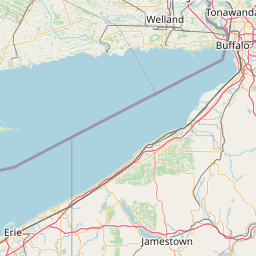
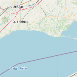
Leaflet | <a href="https://www.openstreetmap.org/copyright">© OpenStreetMap contributors</a>
Item
| Property | Value |
|---|---|
| id | 2078492 |
| downstream_mainstem_id | |
| encompassing_mainstem_basins | |
| featuretype | ['https://www.opengis.net/def/schema/hy_features/hyf/HY_FlowPath', 'https://www.opengis.net/def/schema/hy_features/hyf/HY_WaterBody'] |
| fid | 33926 |
| head_2020huc12 | |
| head_nhdpv1_comid | 904330002 |
| head_nhdpv2_comid | https://geoconnex.us/nhdplusv2/comid/166764152 |
| head_nhdpv2huc12 | https://geoconnex.us/nhdplusv2/huc12/041201040601 |
| head_rf1id | 11370 |
| lengthkm | 19.8 |
| name_at_outlet | Niagara River |
| name_at_outlet_gnis_id | 958547 |
| new_mainstemid | ['https://geoconnex.us/ref/mainstems/2323096'] |
| outlet_2020huc12 | |
| outlet_drainagearea_sqkm | 162.6 |
| outlet_nhdpv1_comid | 15568003 |
| outlet_nhdpv2_comid | https://geoconnex.us/nhdplusv2/comid/15568003 |
| outlet_nhdpv2huc12 | https://geoconnex.us/nhdplusv2/huc12/041201040601 |
| outlet_rf1id | 11371 |
| superseded | True |
| uri | https://geoconnex.us/ref/mainstems/2078492 |
Graph Results
| monitoringLocation | https://sta.geoconnex.dev/collections/USGS/Things/items/'USGS-04216218' |
|---|---|
| siteName | USGS-04216218 |
| datasetDescription | Lake or reservoir elevation above International Great Lakes Datum (IGLD) feet / USGS-04216218-d6a9d1f537434b22b214d39c59ffd8d0 |
| type | Stream |
| url | https://waterdata.usgs.gov/monitoring-location/04216218/#parameterCode=72214 |
| variableMeasured | Lake or reservoir elevation above International Great Lakes Datum (IGLD) |
| variableUnit | ft |
| measurementTechnique | observation |
| temporalCoverage | 2024-08-30T09:15:00Z/2024-09-09T18:00:00Z |
| distributionName | USGS SensorThings API |
| distributionURL | https://labs.waterdata.usgs.gov/sta/v1.1/Datastreams('d6a9d1f537434b22b214d39c59ffd8d0')?$expand=Thing,Observations |
| distributionFormat | application/json |
| wkt | POINT (-78.905 42.9338333333333) |
| monitoringLocation | https://sta.geoconnex.dev/collections/USGS/Things/items/'USGS-04216218' |
|---|---|
| siteName | USGS-04216218 |
| datasetDescription | Lake or reservoir elevation above International Great Lakes Datum (IGLD) feet / USGS-04216218-d6a9d1f537434b22b214d39c59ffd8d0 |
| type | Stream |
| url | https://waterdata.usgs.gov/monitoring-location/04216218/#parameterCode=72214 |
| variableMeasured | Lake or reservoir elevation above International Great Lakes Datum (IGLD) |
| variableUnit | ft |
| measurementTechnique | observation |
| temporalCoverage | 2024-08-30T09:15:00Z/2024-09-09T18:00:00Z |
| distributionName | USGS Instantaneous Values Service |
| distributionURL | https://waterservices.usgs.gov/nwis/iv/?sites=USGS:04216218¶meterCd=72214&format=rdb |
| distributionFormat | text/tab-separated-values |
| wkt | POINT (-78.905 42.9338333333333) |