Mud Creek
Map
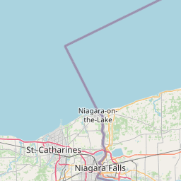
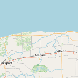
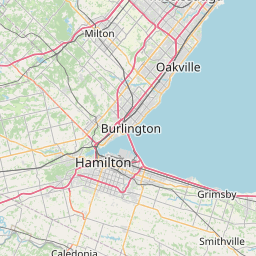
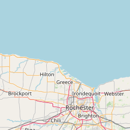
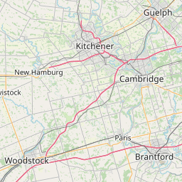
Leaflet | <a href="https://www.openstreetmap.org/copyright">© OpenStreetMap contributors</a>
Item
| Property | Value |
|---|---|
| id | 2078502 |
| downstream_mainstem_id | https://geoconnex.us/ref/mainstems/2078322 |
| encompassing_mainstem_basins | ['https://geoconnex.us/ref/mainstems/2078322'] |
| featuretype | ['https://www.opengis.net/def/schema/hy_features/hyf/HY_FlowPath', 'https://www.opengis.net/def/schema/hy_features/hyf/HY_WaterBody'] |
| fid | 7296 |
| head_2020huc12 | 042701010304 |
| head_nhdpv1_comid | 15567911 |
| head_nhdpv2_comid | https://geoconnex.us/nhdplusv2/comid/15567911 |
| head_nhdpv2huc12 | https://geoconnex.us/nhdplusv2/huc12/041201040304 |
| head_rf1id | 11383 |
| lengthkm | 28.7 |
| name_at_outlet | Mud Creek |
| name_at_outlet_gnis_id | 958008 |
| new_mainstemid | |
| outlet_2020huc12 | 042701010305 |
| outlet_drainagearea_sqkm | 113.2 |
| outlet_nhdpv1_comid | 15567325 |
| outlet_nhdpv2_comid | https://geoconnex.us/nhdplusv2/comid/15567325 |
| outlet_nhdpv2huc12 | https://geoconnex.us/nhdplusv2/huc12/041201040305 |
| outlet_rf1id | 11383 |
| superseded | False |
| uri | https://geoconnex.us/ref/mainstems/2078502 |