Item 2229187
Map
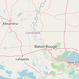
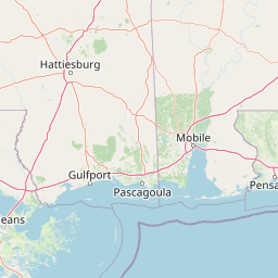
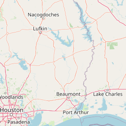
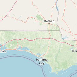
Leaflet | <a href="https://www.openstreetmap.org/copyright">© OpenStreetMap contributors</a>
Item
| Property | Value |
|---|---|
| id | 2229187 |
| downstream_mainstem_id | https://geoconnex.us/ref/mainstems/2229027 |
| encompassing_mainstem_basins | ['https://geoconnex.us/ref/mainstems/2229027'] |
| featuretype | ['https://www.opengis.net/def/schema/hy_features/hyf/HY_FlowPath', 'https://www.opengis.net/def/schema/hy_features/hyf/HY_WaterBody'] |
| fid | 14045 |
| head_2020huc12 | 080903010303 |
| head_nhdpv1_comid | 22369153 |
| head_nhdpv2_comid | https://geoconnex.us/nhdplusv2/comid/22369153 |
| head_nhdpv2huc12 | https://geoconnex.us/nhdplusv2/huc12/080903010303 |
| head_rf1id | 22012 |
| lengthkm | 38.3 |
| name_at_outlet | |
| name_at_outlet_gnis_id | None |
| new_mainstemid | |
| outlet_2020huc12 | 080903010310 |
| outlet_drainagearea_sqkm | 624.5 |
| outlet_nhdpv1_comid | 22370265 |
| outlet_nhdpv2_comid | https://geoconnex.us/nhdplusv2/comid/22370265 |
| outlet_nhdpv2huc12 | https://geoconnex.us/nhdplusv2/huc12/080903010310 |
| outlet_rf1id | 22036 |
| superseded | False |
| uri | https://geoconnex.us/ref/mainstems/2229187 |