First Sand Creek
Map
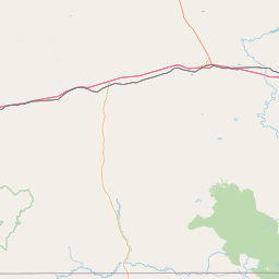
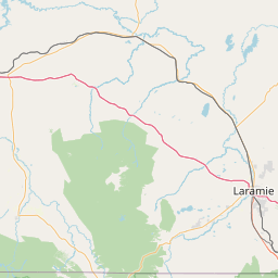
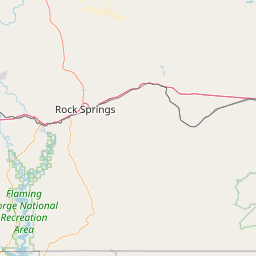
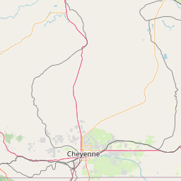
Leaflet | <a href="https://www.openstreetmap.org/copyright">© OpenStreetMap contributors</a>
Item
| Property | Value |
|---|---|
| id | 2231783 |
| downstream_mainstem_id | |
| encompassing_mainstem_basins | |
| featuretype | ['https://www.opengis.net/def/schema/hy_features/hyf/HY_FlowPath', 'https://www.opengis.net/def/schema/hy_features/hyf/HY_WaterBody'] |
| fid | 17709 |
| head_2020huc12 | 101800040401 |
| head_nhdpv1_comid | 15968133 |
| head_nhdpv2_comid | https://geoconnex.us/nhdplusv2/comid/15968133 |
| head_nhdpv2huc12 | https://geoconnex.us/nhdplusv2/huc12/101800040402 |
| head_rf1id | None |
| lengthkm | 26.5 |
| name_at_outlet | First Sand Creek |
| name_at_outlet_gnis_id | 1588490 |
| new_mainstemid | |
| outlet_2020huc12 | 101800040402 |
| outlet_drainagearea_sqkm | 175.4 |
| outlet_nhdpv1_comid | 15967999 |
| outlet_nhdpv2_comid | https://geoconnex.us/nhdplusv2/comid/15967999 |
| outlet_nhdpv2huc12 | https://geoconnex.us/nhdplusv2/huc12/101800040403 |
| outlet_rf1id | None |
| superseded | False |
| uri | https://geoconnex.us/ref/mainstems/2231783 |