Swan Pond Brook
Map
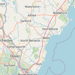
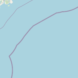


Leaflet | <a href="https://www.openstreetmap.org/copyright">© OpenStreetMap contributors</a>
Item
| Property | Value |
|---|---|
| id | 2266079 |
| downstream_mainstem_id | https://geoconnex.us/ref/mainstems/2265779 |
| encompassing_mainstem_basins | ['https://geoconnex.us/ref/mainstems/2265779'] |
| featuretype | ['https://www.opengis.net/def/schema/hy_features/hyf/HY_FlowPath', 'https://www.opengis.net/def/schema/hy_features/hyf/HY_WaterBody'] |
| fid | 505 |
| head_2020huc12 | 010600021104 |
| head_nhdpv1_comid | 900200032 |
| head_nhdpv2_comid | https://geoconnex.us/nhdplusv2/comid/166196066 |
| head_nhdpv2huc12 | https://geoconnex.us/nhdplusv2/huc12/010600021104 |
| head_rf1id | None |
| lengthkm | 23.8 |
| name_at_outlet | Swan Pond Brook |
| name_at_outlet_gnis_id | 576583 |
| new_mainstemid | |
| outlet_2020huc12 | 010600021104 |
| outlet_drainagearea_sqkm | 80.2 |
| outlet_nhdpv1_comid | 9314839 |
| outlet_nhdpv2_comid | https://geoconnex.us/nhdplusv2/comid/9314839 |
| outlet_nhdpv2huc12 | https://geoconnex.us/nhdplusv2/huc12/010600021104 |
| outlet_rf1id | None |
| superseded | False |
| uri | https://geoconnex.us/ref/mainstems/2266079 |