Mattabesset River
Map
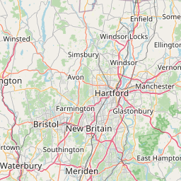
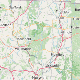
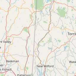
Leaflet | <a href="https://www.openstreetmap.org/copyright">© OpenStreetMap contributors</a>
Item
| Property | Value |
|---|---|
| id | 2278862 |
| downstream_mainstem_id | https://geoconnex.us/ref/mainstems/2277751 |
| encompassing_mainstem_basins | ['https://geoconnex.us/ref/mainstems/2277751'] |
| featuretype | ['https://www.opengis.net/def/schema/hy_features/hyf/HY_FlowPath', 'https://www.opengis.net/def/schema/hy_features/hyf/HY_WaterBody'] |
| fid | 751 |
| head_2020huc12 | 010802050601 |
| head_nhdpv1_comid | 7701368 |
| head_nhdpv2_comid | https://geoconnex.us/nhdplusv2/comid/7701368 |
| head_nhdpv2huc12 | https://geoconnex.us/nhdplusv2/huc12/010802050601 |
| head_rf1id | 1355 |
| lengthkm | 31.5 |
| name_at_outlet | Mattabesset River |
| name_at_outlet_gnis_id | 208768 |
| new_mainstemid | |
| outlet_2020huc12 | 010802050603 |
| outlet_drainagearea_sqkm | 282.1 |
| outlet_nhdpv1_comid | 7704916 |
| outlet_nhdpv2_comid | https://geoconnex.us/nhdplusv2/comid/7704916 |
| outlet_nhdpv2huc12 | https://geoconnex.us/nhdplusv2/huc12/010802050603 |
| outlet_rf1id | 1354 |
| superseded | False |
| uri | https://geoconnex.us/ref/mainstems/2278862 |