Item 2290511
Map


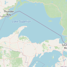
Leaflet | <a href="https://www.openstreetmap.org/copyright">© OpenStreetMap contributors</a>
Item
| Property | Value |
|---|---|
| id | 2290511 |
| downstream_mainstem_id | |
| encompassing_mainstem_basins | |
| featuretype | ['https://www.opengis.net/def/schema/hy_features/hyf/HY_FlowPath', 'https://www.opengis.net/def/schema/hy_features/hyf/HY_WaterBody'] |
| fid | 33814 |
| head_2020huc12 | 090202010806 |
| head_nhdpv1_comid | None |
| head_nhdpv2_comid | https://geoconnex.us/nhdplusv2/comid/14292283 |
| head_nhdpv2huc12 | https://geoconnex.us/nhdplusv2/huc12/090202010806 |
| head_rf1id | 37527 |
| lengthkm | 83.0 |
| name_at_outlet | |
| name_at_outlet_gnis_id | None |
| new_mainstemid | |
| outlet_2020huc12 | 090202011006 |
| outlet_drainagearea_sqkm | 1378.3 |
| outlet_nhdpv1_comid | None |
| outlet_nhdpv2_comid | https://geoconnex.us/nhdplusv2/comid/14299889 |
| outlet_nhdpv2huc12 | https://geoconnex.us/nhdplusv2/huc12/090202011107 |
| outlet_rf1id | 37525 |
| superseded | False |
| uri | https://geoconnex.us/ref/mainstems/2290511 |