Pomperaug River
Map

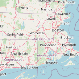


Leaflet | <a href="https://www.openstreetmap.org/copyright">© OpenStreetMap contributors</a>
Item
| Property | Value |
|---|---|
| id | 2299860 |
| downstream_mainstem_id | https://geoconnex.us/ref/mainstems/2299653 |
| encompassing_mainstem_basins | ['https://geoconnex.us/ref/mainstems/2299653'] |
| featuretype | ['https://www.opengis.net/def/schema/hy_features/hyf/HY_FlowPath', 'https://www.opengis.net/def/schema/hy_features/hyf/HY_WaterBody'] |
| fid | 889 |
| head_2020huc12 | 011000050901 |
| head_nhdpv1_comid | 7712782 |
| head_nhdpv2_comid | https://geoconnex.us/nhdplusv2/comid/7712782 |
| head_nhdpv2huc12 | https://geoconnex.us/nhdplusv2/huc12/011000050901 |
| head_rf1id | 1522 |
| lengthkm | 37.6 |
| name_at_outlet | Pomperaug River |
| name_at_outlet_gnis_id | 209898 |
| new_mainstemid | |
| outlet_2020huc12 | 011000050903 |
| outlet_drainagearea_sqkm | 231.3 |
| outlet_nhdpv1_comid | 7718160 |
| outlet_nhdpv2_comid | https://geoconnex.us/nhdplusv2/comid/7718160 |
| outlet_nhdpv2huc12 | https://geoconnex.us/nhdplusv2/huc12/011000050903 |
| outlet_rf1id | 1522 |
| superseded | False |
| uri | https://geoconnex.us/ref/mainstems/2299860 |
Graph Results
| monitoringLocation | https://sta.geoconnex.dev/collections/USGS/Things/items/'USGS-01203600' |
|---|---|
| siteName | USGS-01203600 |
| datasetDescription | Discharge / USGS-01203600-bb94a9aebc7645199068accf1e709a13 |
| type | Stream |
| url | https://waterdata.usgs.gov/monitoring-location/01203600/#parameterCode=00060 |
| variableMeasured | Discharge / USGS-01203600-bb94a9aebc7645199068accf1e709a13 |
| variableUnit | ft^3/s |
| measurementTechnique | observation |
| temporalCoverage | 2024-08-30T09:15:00Z/2024-09-09T17:45:00Z |
| distributionName | USGS Instantaneous Values Service |
| distributionURL | https://waterservices.usgs.gov/nwis/iv/?sites=USGS:01203600¶meterCd=00060&format=rdb |
| distributionFormat | text/tab-separated-values |
| wkt | POINT (-73.17711944444444 41.576302777777784) |
| monitoringLocation | https://sta.geoconnex.dev/collections/USGS/Things/items/'USGS-01203600' |
|---|---|
| siteName | USGS-01203600 |
| datasetDescription | Discharge / USGS-01203600-bb94a9aebc7645199068accf1e709a13 |
| type | Stream |
| url | https://waterdata.usgs.gov/monitoring-location/01203600/#parameterCode=00060 |
| variableMeasured | Discharge / USGS-01203600-bb94a9aebc7645199068accf1e709a13 |
| variableUnit | ft^3/s |
| measurementTechnique | observation |
| temporalCoverage | 2024-08-30T09:15:00Z/2024-09-09T17:45:00Z |
| distributionName | USGS SensorThings API |
| distributionURL | https://labs.waterdata.usgs.gov/sta/v1.1/Datastreams('bb94a9aebc7645199068accf1e709a13')?$expand=Thing,Observations |
| distributionFormat | application/json |
| wkt | POINT (-73.17711944444444 41.576302777777784) |
| monitoringLocation | https://sta.geoconnex.dev/collections/USGS/Things/items/'USGS-01203600' |
|---|---|
| siteName | USGS-01203600 |
| datasetDescription | Gage height, feet / USGS-01203600-77a6ec74fed747f8bb4e72f11eb055b3 |
| type | Stream |
| url | https://waterdata.usgs.gov/monitoring-location/01203600/#parameterCode=00065 |
| variableMeasured | Gage height |
| variableUnit | ft |
| measurementTechnique | observation |
| temporalCoverage | 2024-08-30T09:15:00Z/2024-09-09T17:45:00Z |
| distributionName | USGS SensorThings API |
| distributionURL | https://labs.waterdata.usgs.gov/sta/v1.1/Datastreams('77a6ec74fed747f8bb4e72f11eb055b3')?$expand=Thing,Observations |
| distributionFormat | application/json |
| wkt | POINT (-73.17711944444444 41.576302777777784) |
| monitoringLocation | https://sta.geoconnex.dev/collections/USGS/Things/items/'USGS-01203600' |
|---|---|
| siteName | USGS-01203600 |
| datasetDescription | Gage height, feet / USGS-01203600-77a6ec74fed747f8bb4e72f11eb055b3 |
| type | Stream |
| url | https://waterdata.usgs.gov/monitoring-location/01203600/#parameterCode=00065 |
| variableMeasured | Gage height |
| variableUnit | ft |
| measurementTechnique | observation |
| temporalCoverage | 2024-08-30T09:15:00Z/2024-09-09T17:45:00Z |
| distributionName | USGS Instantaneous Values Service |
| distributionURL | https://waterservices.usgs.gov/nwis/iv/?sites=USGS:01203600¶meterCd=00065&format=rdb |
| distributionFormat | text/tab-separated-values |
| wkt | POINT (-73.17711944444444 41.576302777777784) |
| monitoringLocation | https://sta.geoconnex.dev/collections/USGS/Things/items/'USGS-01204000' |
|---|---|
| siteName | USGS-01204000 |
| datasetDescription | Gage height / USGS-01204000-9924e82396c1405aa51f899f4001fb1f |
| type | Stream |
| url | https://waterdata.usgs.gov/monitoring-location/01204000/#parameterCode=00065 |
| variableMeasured | Gage height / USGS-01204000-9924e82396c1405aa51f899f4001fb1f |
| variableUnit | ft |
| measurementTechnique | observation |
| temporalCoverage | 2024-08-30T09:15:00Z/2024-09-09T18:00:00Z |
| distributionName | USGS Instantaneous Values Service |
| distributionURL | https://waterservices.usgs.gov/nwis/iv/?sites=USGS:01204000¶meterCd=00065&format=rdb |
| distributionFormat | text/tab-separated-values |
| wkt | POINT (-73.2245722222222 41.4819388888889) |
| monitoringLocation | https://sta.geoconnex.dev/collections/USGS/Things/items/'USGS-01204000' |
|---|---|
| siteName | USGS-01204000 |
| datasetDescription | Gage height / USGS-01204000-9924e82396c1405aa51f899f4001fb1f |
| type | Stream |
| url | https://waterdata.usgs.gov/monitoring-location/01204000/#parameterCode=00065 |
| variableMeasured | Gage height / USGS-01204000-9924e82396c1405aa51f899f4001fb1f |
| variableUnit | ft |
| measurementTechnique | observation |
| temporalCoverage | 2024-08-30T09:15:00Z/2024-09-09T18:00:00Z |
| distributionName | USGS SensorThings API |
| distributionURL | https://labs.waterdata.usgs.gov/sta/v1.1/Datastreams('9924e82396c1405aa51f899f4001fb1f')?$expand=Thing,Observations |
| distributionFormat | application/json |
| wkt | POINT (-73.2245722222222 41.4819388888889) |
| monitoringLocation | https://sta.geoconnex.dev/collections/USGS/Things/items/'USGS-01204000' |
|---|---|
| siteName | USGS-01204000 |
| datasetDescription | Discharge / USGS-01204000-fa47f296f5c74f27a599710bd5e473ec |
| type | Stream |
| url | https://waterdata.usgs.gov/monitoring-location/01204000/#parameterCode=00060 |
| variableMeasured | Discharge / USGS-01204000-fa47f296f5c74f27a599710bd5e473ec |
| variableUnit | ft^3/s |
| measurementTechnique | observation |
| temporalCoverage | 2024-08-30T09:15:00Z/2024-09-09T18:00:00Z |
| distributionName | USGS SensorThings API |
| distributionURL | https://labs.waterdata.usgs.gov/sta/v1.1/Datastreams('fa47f296f5c74f27a599710bd5e473ec')?$expand=Thing,Observations |
| distributionFormat | application/json |
| wkt | POINT (-73.2245722222222 41.4819388888889) |
| monitoringLocation | https://sta.geoconnex.dev/collections/USGS/Things/items/'USGS-01204000' |
|---|---|
| siteName | USGS-01204000 |
| datasetDescription | Discharge / USGS-01204000-fa47f296f5c74f27a599710bd5e473ec |
| type | Stream |
| url | https://waterdata.usgs.gov/monitoring-location/01204000/#parameterCode=00060 |
| variableMeasured | Discharge / USGS-01204000-fa47f296f5c74f27a599710bd5e473ec |
| variableUnit | ft^3/s |
| measurementTechnique | observation |
| temporalCoverage | 2024-08-30T09:15:00Z/2024-09-09T18:00:00Z |
| distributionName | USGS Instantaneous Values Service |
| distributionURL | https://waterservices.usgs.gov/nwis/iv/?sites=USGS:01204000¶meterCd=00060&format=rdb |
| distributionFormat | text/tab-separated-values |
| wkt | POINT (-73.2245722222222 41.4819388888889) |