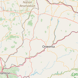
Spruce Swamp Creek
Map
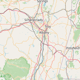
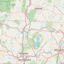
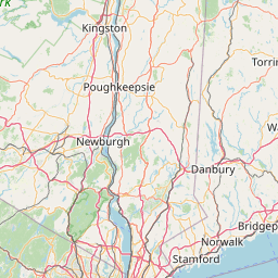
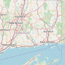
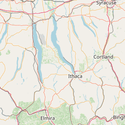
Leaflet | <a href="https://www.openstreetmap.org/copyright">© OpenStreetMap contributors</a>
Item
| Property | Value |
|---|---|
| id | 2300026 |
| downstream_mainstem_id | https://geoconnex.us/ref/mainstems/2299653 |
| encompassing_mainstem_basins | ['https://geoconnex.us/ref/mainstems/2299653'] |
| featuretype | ['https://www.opengis.net/def/schema/hy_features/hyf/HY_FlowPath', 'https://www.opengis.net/def/schema/hy_features/hyf/HY_WaterBody'] |
| fid | 881 |
| head_2020huc12 | 011000050305 |
| head_nhdpv1_comid | 7710560 |
| head_nhdpv2_comid | https://geoconnex.us/nhdplusv2/comid/7710560 |
| head_nhdpv2huc12 | https://geoconnex.us/nhdplusv2/huc12/011000050305 |
| head_rf1id | None |
| lengthkm | 17.9 |
| name_at_outlet | Spruce Swamp Creek |
| name_at_outlet_gnis_id | 211108 |
| new_mainstemid | |
| outlet_2020huc12 | 011000050305 |
| outlet_drainagearea_sqkm | 98.5 |
| outlet_nhdpv1_comid | 7711972 |
| outlet_nhdpv2_comid | https://geoconnex.us/nhdplusv2/comid/7711972 |
| outlet_nhdpv2huc12 | https://geoconnex.us/nhdplusv2/huc12/011000050305 |
| outlet_rf1id | None |
| superseded | False |
| uri | https://geoconnex.us/ref/mainstems/2300026 |
Graph Results
| monitoringLocation | https://sta.geoconnex.dev/collections/USGS/Things/items/'USGS-01199050' |
|---|---|
| siteName | USGS-01199050 |
| datasetDescription | Gage height / USGS-01199050-b8672ac5487643b18b3049a7a4cd1908 |
| type | Stream |
| url | https://waterdata.usgs.gov/monitoring-location/01199050/#parameterCode=00065 |
| variableMeasured | Gage height / USGS-01199050-b8672ac5487643b18b3049a7a4cd1908 |
| variableUnit | ft |
| measurementTechnique | observation |
| temporalCoverage | 2024-08-30T09:15:00Z/2024-09-09T18:00:00Z |
| distributionName | USGS Instantaneous Values Service |
| distributionURL | https://waterservices.usgs.gov/nwis/iv/?sites=USGS:01199050¶meterCd=00065&format=rdb |
| distributionFormat | text/tab-separated-values |
| wkt | POINT (-73.3909532097261 41.9423154799212) |
| monitoringLocation | https://sta.geoconnex.dev/collections/USGS/Things/items/'USGS-01199050' |
|---|---|
| siteName | USGS-01199050 |
| datasetDescription | Gage height / USGS-01199050-b8672ac5487643b18b3049a7a4cd1908 |
| type | Stream |
| url | https://waterdata.usgs.gov/monitoring-location/01199050/#parameterCode=00065 |
| variableMeasured | Gage height / USGS-01199050-b8672ac5487643b18b3049a7a4cd1908 |
| variableUnit | ft |
| measurementTechnique | observation |
| temporalCoverage | 2024-08-30T09:15:00Z/2024-09-09T18:00:00Z |
| distributionName | USGS SensorThings API |
| distributionURL | https://labs.waterdata.usgs.gov/sta/v1.1/Datastreams('b8672ac5487643b18b3049a7a4cd1908')?$expand=Thing,Observations |
| distributionFormat | application/json |
| wkt | POINT (-73.3909532097261 41.9423154799212) |
| monitoringLocation | https://sta.geoconnex.dev/collections/USGS/Things/items/'USGS-01199050' |
|---|---|
| siteName | USGS-01199050 |
| datasetDescription | Discharge, cubic feet per second / USGS-01199050-7eebe51ab1b14987b8ef9e3b92e141c5 |
| type | Stream |
| url | https://waterdata.usgs.gov/monitoring-location/01199050/#parameterCode=00060 |
| variableMeasured | Discharge |
| variableUnit | ft^3/s |
| measurementTechnique | observation |
| temporalCoverage | 2024-08-30T09:15:00Z/2024-09-09T18:00:00Z |
| distributionName | USGS SensorThings API |
| distributionURL | https://labs.waterdata.usgs.gov/sta/v1.1/Datastreams('7eebe51ab1b14987b8ef9e3b92e141c5')?$expand=Thing,Observations |
| distributionFormat | application/json |
| wkt | POINT (-73.3909532097261 41.9423154799212) |
| monitoringLocation | https://sta.geoconnex.dev/collections/USGS/Things/items/'USGS-01199050' |
|---|---|
| siteName | USGS-01199050 |
| datasetDescription | Discharge, cubic feet per second / USGS-01199050-7eebe51ab1b14987b8ef9e3b92e141c5 |
| type | Stream |
| url | https://waterdata.usgs.gov/monitoring-location/01199050/#parameterCode=00060 |
| variableMeasured | Discharge |
| variableUnit | ft^3/s |
| measurementTechnique | observation |
| temporalCoverage | 2024-08-30T09:15:00Z/2024-09-09T18:00:00Z |
| distributionName | USGS Instantaneous Values Service |
| distributionURL | https://waterservices.usgs.gov/nwis/iv/?sites=USGS:01199050¶meterCd=00060&format=rdb |
| distributionFormat | text/tab-separated-values |
| wkt | POINT (-73.3909532097261 41.9423154799212) |