South Fork Chehalis River
Map
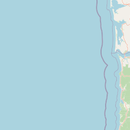


Leaflet | <a href="https://www.openstreetmap.org/copyright">© OpenStreetMap contributors</a>
Item
| Property | Value |
|---|---|
| id | 2316572 |
| downstream_mainstem_id | https://geoconnex.us/ref/mainstems/2316435 |
| encompassing_mainstem_basins | ['https://geoconnex.us/ref/mainstems/2316435'] |
| featuretype | ['https://www.opengis.net/def/schema/hy_features/hyf/HY_FlowPath', 'https://www.opengis.net/def/schema/hy_features/hyf/HY_WaterBody'] |
| fid | 31345 |
| head_2020huc12 | 171001030107 |
| head_nhdpv1_comid | 23850627 |
| head_nhdpv2_comid | https://geoconnex.us/nhdplusv2/comid/23850627 |
| head_nhdpv2huc12 | https://geoconnex.us/nhdplusv2/huc12/171001030107 |
| head_rf1id | 54325 |
| lengthkm | 49.1 |
| name_at_outlet | South Fork Chehalis River |
| name_at_outlet_gnis_id | 1513210 |
| new_mainstemid | |
| outlet_2020huc12 | 171001030107 |
| outlet_drainagearea_sqkm | 324.9 |
| outlet_nhdpv1_comid | 23850545 |
| outlet_nhdpv2_comid | https://geoconnex.us/nhdplusv2/comid/23850545 |
| outlet_nhdpv2huc12 | https://geoconnex.us/nhdplusv2/huc12/171001030107 |
| outlet_rf1id | 54320 |
| superseded | False |
| uri | https://geoconnex.us/ref/mainstems/2316572 |
Graph Results
| monitoringLocation | https://sta.geoconnex.dev/collections/USGS/Things/items/'USGS-12020800' |
|---|---|
| siteName | USGS-12020800 |
| datasetDescription | Precipitation, total, inches / USGS-12020800-0beffac4dc2d4724a25f479db10b81c9 |
| type | Stream |
| url | https://waterdata.usgs.gov/monitoring-location/12020800/#parameterCode=00045 |
| variableMeasured | Precipitation |
| variableUnit | in |
| measurementTechnique | observation |
| temporalCoverage | 2024-08-30T09:15:00Z/2024-09-09T18:15:00Z |
| distributionName | USGS Instantaneous Values Service |
| distributionURL | https://waterservices.usgs.gov/nwis/iv/?sites=USGS:12020800¶meterCd=00045&format=rdb |
| distributionFormat | text/tab-separated-values |
| wkt | POINT (-123.083737624593 46.4448281520753) |
| monitoringLocation | https://sta.geoconnex.dev/collections/USGS/Things/items/'USGS-12020800' |
|---|---|
| siteName | USGS-12020800 |
| datasetDescription | Precipitation, total, inches / USGS-12020800-0beffac4dc2d4724a25f479db10b81c9 |
| type | Stream |
| url | https://waterdata.usgs.gov/monitoring-location/12020800/#parameterCode=00045 |
| variableMeasured | Precipitation |
| variableUnit | in |
| measurementTechnique | observation |
| temporalCoverage | 2024-08-30T09:15:00Z/2024-09-09T18:15:00Z |
| distributionName | USGS SensorThings API |
| distributionURL | https://labs.waterdata.usgs.gov/sta/v1.1/Datastreams('0beffac4dc2d4724a25f479db10b81c9')?$expand=Thing,Observations |
| distributionFormat | application/json |
| wkt | POINT (-123.083737624593 46.4448281520753) |