Rock Creek
Map
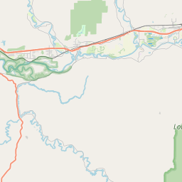
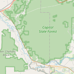
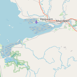
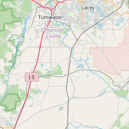
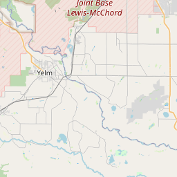
Leaflet | <a href="https://www.openstreetmap.org/copyright">© OpenStreetMap contributors</a>
Item
| Property | Value |
|---|---|
| id | 2316867 |
| downstream_mainstem_id | https://geoconnex.us/ref/mainstems/2316435 |
| encompassing_mainstem_basins | ['https://geoconnex.us/ref/mainstems/2316435'] |
| featuretype | ['https://www.opengis.net/def/schema/hy_features/hyf/HY_FlowPath', 'https://www.opengis.net/def/schema/hy_features/hyf/HY_WaterBody'] |
| fid | 31347 |
| head_2020huc12 | 171001030507 |
| head_nhdpv1_comid | 23850197 |
| head_nhdpv2_comid | https://geoconnex.us/nhdplusv2/comid/23850197 |
| head_nhdpv2huc12 | https://geoconnex.us/nhdplusv2/huc12/171001030507 |
| head_rf1id | 54290 |
| lengthkm | 18.5 |
| name_at_outlet | Rock Creek |
| name_at_outlet_gnis_id | 1507849 |
| new_mainstemid | |
| outlet_2020huc12 | 171001030507 |
| outlet_drainagearea_sqkm | 68.6 |
| outlet_nhdpv1_comid | 23850187 |
| outlet_nhdpv2_comid | https://geoconnex.us/nhdplusv2/comid/23850187 |
| outlet_nhdpv2huc12 | https://geoconnex.us/nhdplusv2/huc12/171001030507 |
| outlet_rf1id | 54289 |
| superseded | False |
| uri | https://geoconnex.us/ref/mainstems/2316867 |