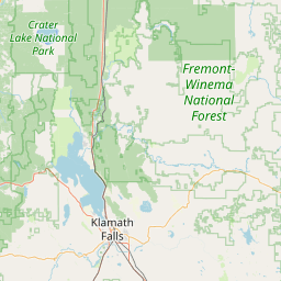
Upper Rock Creek
Map
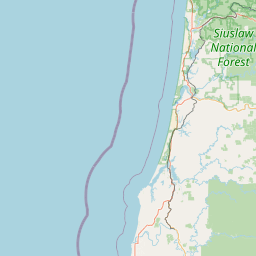
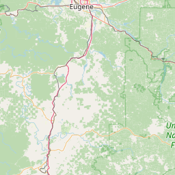

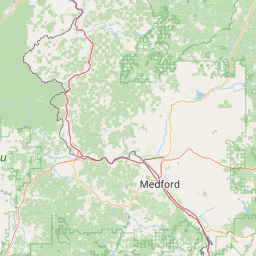

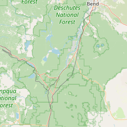


Leaflet | <a href="https://www.openstreetmap.org/copyright">© OpenStreetMap contributors</a>
Item
| Property | Value |
|---|---|
| id | 2327343 |
| downstream_mainstem_id | https://geoconnex.us/ref/mainstems/2327239 |
| encompassing_mainstem_basins | ['https://geoconnex.us/ref/mainstems/2327239', 'https://geoconnex.us/ref/mainstems/2327185'] |
| featuretype | ['https://www.opengis.net/def/schema/hy_features/hyf/HY_FlowPath', 'https://www.opengis.net/def/schema/hy_features/hyf/HY_WaterBody'] |
| fid | 31551 |
| head_2020huc12 | 171003050103 |
| head_nhdpv1_comid | 23914877 |
| head_nhdpv2_comid | https://geoconnex.us/nhdplusv2/comid/23914877 |
| head_nhdpv2huc12 | https://geoconnex.us/nhdplusv2/huc12/171003050103 |
| head_rf1id | 53645 |
| lengthkm | 18.5 |
| name_at_outlet | Upper Rock Creek |
| name_at_outlet_gnis_id | 1148593 |
| new_mainstemid | |
| outlet_2020huc12 | 171003050103 |
| outlet_drainagearea_sqkm | 74.6 |
| outlet_nhdpv1_comid | 23914855 |
| outlet_nhdpv2_comid | https://geoconnex.us/nhdplusv2/comid/23914855 |
| outlet_nhdpv2huc12 | https://geoconnex.us/nhdplusv2/huc12/171003050103 |
| outlet_rf1id | 53643 |
| superseded | False |
| uri | https://geoconnex.us/ref/mainstems/2327343 |