Big Butte Creek
Map
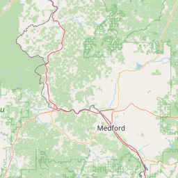
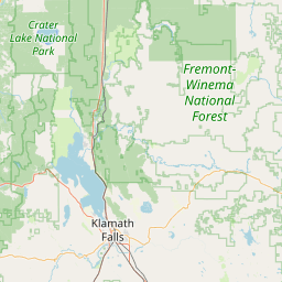


Leaflet | <a href="https://www.openstreetmap.org/copyright">© OpenStreetMap contributors</a>
Item
| Property | Value |
|---|---|
| id | 2329007 |
| downstream_mainstem_id | https://geoconnex.us/ref/mainstems/2328486 |
| encompassing_mainstem_basins | ['https://geoconnex.us/ref/mainstems/2328486'] |
| featuretype | ['https://www.opengis.net/def/schema/hy_features/hyf/HY_FlowPath', 'https://www.opengis.net/def/schema/hy_features/hyf/HY_WaterBody'] |
| fid | 31572 |
| head_2020huc12 | 171003070401 |
| head_nhdpv1_comid | 23923388 |
| head_nhdpv2_comid | https://geoconnex.us/nhdplusv2/comid/23923388 |
| head_nhdpv2huc12 | https://geoconnex.us/nhdplusv2/huc12/171003070401 |
| head_rf1id | 53786 |
| lengthkm | 47.3 |
| name_at_outlet | Big Butte Creek |
| name_at_outlet_gnis_id | 1137984 |
| new_mainstemid | |
| outlet_2020huc12 | 171003070408 |
| outlet_drainagearea_sqkm | 640.4 |
| outlet_nhdpv1_comid | 23923284 |
| outlet_nhdpv2_comid | https://geoconnex.us/nhdplusv2/comid/23923284 |
| outlet_nhdpv2huc12 | https://geoconnex.us/nhdplusv2/huc12/171003070408 |
| outlet_rf1id | 53772 |
| superseded | False |
| uri | https://geoconnex.us/ref/mainstems/2329007 |
Graph Results
| monitoringLocation | https://sta.geoconnex.dev/collections/USGS/Things/items/'USGS-14337500' |
|---|---|
| siteName | USGS-14337500 |
| datasetDescription | Discharge / USGS-14337500-b43b86a0f4d54f308c3bf120b5d8eb17 |
| type | Stream |
| url | https://waterdata.usgs.gov/monitoring-location/14337500/#parameterCode=00060 |
| variableMeasured | Discharge / USGS-14337500-b43b86a0f4d54f308c3bf120b5d8eb17 |
| variableUnit | ft^3/s |
| measurementTechnique | observation |
| temporalCoverage | 2024-08-30T09:15:00Z/2024-09-09T18:50:00Z |
| distributionName | USGS SensorThings API |
| distributionURL | https://labs.waterdata.usgs.gov/sta/v1.1/Datastreams('b43b86a0f4d54f308c3bf120b5d8eb17')?$expand=Thing,Observations |
| distributionFormat | application/json |
| wkt | POINT (-122.69142881941 42.6512371979792) |
| monitoringLocation | https://sta.geoconnex.dev/collections/USGS/Things/items/'USGS-14337500' |
|---|---|
| siteName | USGS-14337500 |
| datasetDescription | Discharge / USGS-14337500-b43b86a0f4d54f308c3bf120b5d8eb17 |
| type | Stream |
| url | https://waterdata.usgs.gov/monitoring-location/14337500/#parameterCode=00060 |
| variableMeasured | Discharge / USGS-14337500-b43b86a0f4d54f308c3bf120b5d8eb17 |
| variableUnit | ft^3/s |
| measurementTechnique | observation |
| temporalCoverage | 2024-08-30T09:15:00Z/2024-09-09T18:50:00Z |
| distributionName | USGS Instantaneous Values Service |
| distributionURL | https://waterservices.usgs.gov/nwis/iv/?sites=USGS:14337500¶meterCd=00060&format=rdb |
| distributionFormat | text/tab-separated-values |
| wkt | POINT (-122.69142881941 42.6512371979792) |
| monitoringLocation | https://sta.geoconnex.dev/collections/USGS/Things/items/'USGS-14337500' |
|---|---|
| siteName | USGS-14337500 |
| datasetDescription | Gage height / USGS-14337500-d9df86faaa2646f6a58352ff22d6b2c2 |
| type | Stream |
| url | https://waterdata.usgs.gov/monitoring-location/14337500/#parameterCode=00065 |
| variableMeasured | Gage height / USGS-14337500-d9df86faaa2646f6a58352ff22d6b2c2 |
| variableUnit | ft |
| measurementTechnique | observation |
| temporalCoverage | 2024-08-30T09:15:00Z/2024-09-09T19:00:00Z |
| distributionName | USGS Instantaneous Values Service |
| distributionURL | https://waterservices.usgs.gov/nwis/iv/?sites=USGS:14337500¶meterCd=00065&format=rdb |
| distributionFormat | text/tab-separated-values |
| wkt | POINT (-122.69142881941 42.6512371979792) |
| monitoringLocation | https://sta.geoconnex.dev/collections/USGS/Things/items/'USGS-14337500' |
|---|---|
| siteName | USGS-14337500 |
| datasetDescription | Gage height / USGS-14337500-d9df86faaa2646f6a58352ff22d6b2c2 |
| type | Stream |
| url | https://waterdata.usgs.gov/monitoring-location/14337500/#parameterCode=00065 |
| variableMeasured | Gage height / USGS-14337500-d9df86faaa2646f6a58352ff22d6b2c2 |
| variableUnit | ft |
| measurementTechnique | observation |
| temporalCoverage | 2024-08-30T09:15:00Z/2024-09-09T19:00:00Z |
| distributionName | USGS SensorThings API |
| distributionURL | https://labs.waterdata.usgs.gov/sta/v1.1/Datastreams('d9df86faaa2646f6a58352ff22d6b2c2')?$expand=Thing,Observations |
| distributionFormat | application/json |
| wkt | POINT (-122.69142881941 42.6512371979792) |
| monitoringLocation | https://sta.geoconnex.dev/collections/USGS/Things/items/'USGS-14337500' |
|---|---|
| siteName | USGS-14337500 |
| datasetDescription | Temperature, water, degrees Celsius / USGS-14337500-dfccbe828e194dd1bc9503dd89d18a61 |
| type | Stream |
| url | https://waterdata.usgs.gov/monitoring-location/14337500/#parameterCode=00010 |
| variableMeasured | Temperature |
| variableUnit | degC |
| measurementTechnique | observation |
| temporalCoverage | 2024-08-30T09:15:00Z/2024-09-09T19:00:00Z |
| distributionName | USGS Instantaneous Values Service |
| distributionURL | https://waterservices.usgs.gov/nwis/iv/?sites=USGS:14337500¶meterCd=00010&format=rdb |
| distributionFormat | text/tab-separated-values |
| wkt | POINT (-122.69142881941 42.6512371979792) |
| monitoringLocation | https://sta.geoconnex.dev/collections/USGS/Things/items/'USGS-14337500' |
|---|---|
| siteName | USGS-14337500 |
| datasetDescription | Temperature, water, degrees Celsius / USGS-14337500-dfccbe828e194dd1bc9503dd89d18a61 |
| type | Stream |
| url | https://waterdata.usgs.gov/monitoring-location/14337500/#parameterCode=00010 |
| variableMeasured | Temperature |
| variableUnit | degC |
| measurementTechnique | observation |
| temporalCoverage | 2024-08-30T09:15:00Z/2024-09-09T19:00:00Z |
| distributionName | USGS SensorThings API |
| distributionURL | https://labs.waterdata.usgs.gov/sta/v1.1/Datastreams('dfccbe828e194dd1bc9503dd89d18a61')?$expand=Thing,Observations |
| distributionFormat | application/json |
| wkt | POINT (-122.69142881941 42.6512371979792) |