Little Applegate River
Map
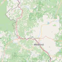
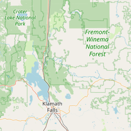

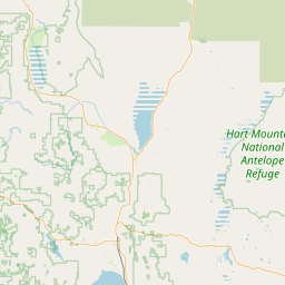

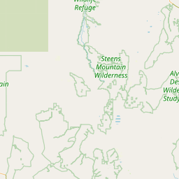
Leaflet | <a href="https://www.openstreetmap.org/copyright">© OpenStreetMap contributors</a>
Item
| Property | Value |
|---|---|
| id | 2329021 |
| downstream_mainstem_id | https://geoconnex.us/ref/mainstems/2328745 |
| encompassing_mainstem_basins | ['https://geoconnex.us/ref/mainstems/2328745', 'https://geoconnex.us/ref/mainstems/2328486'] |
| featuretype | ['https://www.opengis.net/def/schema/hy_features/hyf/HY_FlowPath', 'https://www.opengis.net/def/schema/hy_features/hyf/HY_WaterBody'] |
| fid | 31617 |
| head_2020huc12 | 171003090301 |
| head_nhdpv1_comid | 23936263 |
| head_nhdpv2_comid | https://geoconnex.us/nhdplusv2/comid/23936263 |
| head_nhdpv2huc12 | https://geoconnex.us/nhdplusv2/huc12/171003090301 |
| head_rf1id | 54032 |
| lengthkm | 33.6 |
| name_at_outlet | Little Applegate River |
| name_at_outlet_gnis_id | 1145070 |
| new_mainstemid | |
| outlet_2020huc12 | 171003090304 |
| outlet_drainagearea_sqkm | 292.5 |
| outlet_nhdpv1_comid | 23936193 |
| outlet_nhdpv2_comid | https://geoconnex.us/nhdplusv2/comid/23936193 |
| outlet_nhdpv2huc12 | https://geoconnex.us/nhdplusv2/huc12/171003090304 |
| outlet_rf1id | 54026 |
| superseded | False |
| uri | https://geoconnex.us/ref/mainstems/2329021 |
Graph Results
| monitoringLocation | https://sta.geoconnex.dev/collections/USGS/Things/items/'USGS-14365400' |
|---|---|
| siteName | USGS-14365400 |
| datasetDescription | Gage height / USGS-14365400-9d8d28ae2c11438dbec312106a8078f7 |
| type | Stream |
| url | https://waterdata.usgs.gov/monitoring-location/14365400/#parameterCode=00065 |
| variableMeasured | Gage height / USGS-14365400-9d8d28ae2c11438dbec312106a8078f7 |
| variableUnit | ft |
| measurementTechnique | observation |
| temporalCoverage | 2024-08-30T09:15:00Z/2024-09-09T19:00:00Z |
| distributionName | USGS Instantaneous Values Service |
| distributionURL | https://waterservices.usgs.gov/nwis/iv/?sites=USGS:14365400¶meterCd=00065&format=rdb |
| distributionFormat | text/tab-separated-values |
| wkt | POINT (-123.003097377524 42.1781813360046) |
| monitoringLocation | https://sta.geoconnex.dev/collections/USGS/Things/items/'USGS-14365400' |
|---|---|
| siteName | USGS-14365400 |
| datasetDescription | Gage height / USGS-14365400-9d8d28ae2c11438dbec312106a8078f7 |
| type | Stream |
| url | https://waterdata.usgs.gov/monitoring-location/14365400/#parameterCode=00065 |
| variableMeasured | Gage height / USGS-14365400-9d8d28ae2c11438dbec312106a8078f7 |
| variableUnit | ft |
| measurementTechnique | observation |
| temporalCoverage | 2024-08-30T09:15:00Z/2024-09-09T19:00:00Z |
| distributionName | USGS SensorThings API |
| distributionURL | https://labs.waterdata.usgs.gov/sta/v1.1/Datastreams('9d8d28ae2c11438dbec312106a8078f7')?$expand=Thing,Observations |
| distributionFormat | application/json |
| wkt | POINT (-123.003097377524 42.1781813360046) |