Tinker Creek
Map
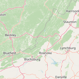
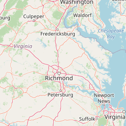


Leaflet | <a href="https://www.openstreetmap.org/copyright">© OpenStreetMap contributors</a>
Item
| Property | Value |
|---|---|
| id | 2366851 |
| downstream_mainstem_id | https://geoconnex.us/ref/mainstems/2365428 |
| encompassing_mainstem_basins | ['https://geoconnex.us/ref/mainstems/2365428'] |
| featuretype | ['https://www.opengis.net/def/schema/hy_features/hyf/HY_FlowPath', 'https://www.opengis.net/def/schema/hy_features/hyf/HY_WaterBody'] |
| fid | 2435 |
| head_2020huc12 | 030101010401 |
| head_nhdpv1_comid | 8623363 |
| head_nhdpv2_comid | https://geoconnex.us/nhdplusv2/comid/8623363 |
| head_nhdpv2huc12 | https://geoconnex.us/nhdplusv2/huc12/030101010401 |
| head_rf1id | 4294 |
| lengthkm | 31.6 |
| name_at_outlet | Tinker Creek |
| name_at_outlet_gnis_id | 1487927 |
| new_mainstemid | |
| outlet_2020huc12 | 030101010403 |
| outlet_drainagearea_sqkm | 289.6 |
| outlet_nhdpv1_comid | 8624983 |
| outlet_nhdpv2_comid | https://geoconnex.us/nhdplusv2/comid/8624983 |
| outlet_nhdpv2huc12 | https://geoconnex.us/nhdplusv2/huc12/030101010403 |
| outlet_rf1id | 4294 |
| superseded | False |
| uri | https://geoconnex.us/ref/mainstems/2366851 |
Graph Results
| monitoringLocation | https://sta.geoconnex.dev/collections/USGS/Things/items/'USGS-0205551614' |
|---|---|
| siteName | USGS-0205551614 |
| datasetDescription | Turbidity, FNU / USGS-0205551614-2c7e191d96124a50b1a985c8d567b95c |
| type | Stream |
| url | https://waterdata.usgs.gov/monitoring-location/0205551614/#parameterCode=63680 |
| variableMeasured | Turbidity |
| variableUnit | _FNU |
| measurementTechnique | observation |
| temporalCoverage | 2024-08-30T09:15:00Z/2024-09-09T17:45:00Z |
| distributionName | USGS Instantaneous Values Service |
| distributionURL | https://waterservices.usgs.gov/nwis/iv/?sites=USGS:0205551614¶meterCd=63680&format=rdb |
| distributionFormat | text/tab-separated-values |
| wkt | POINT (-79.9093611111111 37.2778888888889) |
| monitoringLocation | https://sta.geoconnex.dev/collections/USGS/Things/items/'USGS-0205551614' |
|---|---|
| siteName | USGS-0205551614 |
| datasetDescription | Turbidity, FNU / USGS-0205551614-2c7e191d96124a50b1a985c8d567b95c |
| type | Stream |
| url | https://waterdata.usgs.gov/monitoring-location/0205551614/#parameterCode=63680 |
| variableMeasured | Turbidity |
| variableUnit | _FNU |
| measurementTechnique | observation |
| temporalCoverage | 2024-08-30T09:15:00Z/2024-09-09T17:45:00Z |
| distributionName | USGS SensorThings API |
| distributionURL | https://labs.waterdata.usgs.gov/sta/v1.1/Datastreams('2c7e191d96124a50b1a985c8d567b95c')?$expand=Thing,Observations |
| distributionFormat | application/json |
| wkt | POINT (-79.9093611111111 37.2778888888889) |
| monitoringLocation | https://sta.geoconnex.dev/collections/USGS/Things/items/'USGS-0205551614' |
|---|---|
| siteName | USGS-0205551614 |
| datasetDescription | Dissolved oxygen / USGS-0205551614-4185da72039f4cb4b968c455326a4695 |
| type | Stream |
| url | https://waterdata.usgs.gov/monitoring-location/0205551614/#parameterCode=00300 |
| variableMeasured | Dissolved oxygen / USGS-0205551614-4185da72039f4cb4b968c455326a4695 |
| variableUnit | mg/l |
| measurementTechnique | observation |
| temporalCoverage | 2024-08-30T09:15:00Z/2024-09-09T17:45:00Z |
| distributionName | USGS Instantaneous Values Service |
| distributionURL | https://waterservices.usgs.gov/nwis/iv/?sites=USGS:0205551614¶meterCd=00300&format=rdb |
| distributionFormat | text/tab-separated-values |
| wkt | POINT (-79.9093611111111 37.2778888888889) |
| monitoringLocation | https://sta.geoconnex.dev/collections/USGS/Things/items/'USGS-0205551614' |
|---|---|
| siteName | USGS-0205551614 |
| datasetDescription | Dissolved oxygen / USGS-0205551614-4185da72039f4cb4b968c455326a4695 |
| type | Stream |
| url | https://waterdata.usgs.gov/monitoring-location/0205551614/#parameterCode=00300 |
| variableMeasured | Dissolved oxygen / USGS-0205551614-4185da72039f4cb4b968c455326a4695 |
| variableUnit | mg/l |
| measurementTechnique | observation |
| temporalCoverage | 2024-08-30T09:15:00Z/2024-09-09T17:45:00Z |
| distributionName | USGS SensorThings API |
| distributionURL | https://labs.waterdata.usgs.gov/sta/v1.1/Datastreams('4185da72039f4cb4b968c455326a4695')?$expand=Thing,Observations |
| distributionFormat | application/json |
| wkt | POINT (-79.9093611111111 37.2778888888889) |
| monitoringLocation | https://sta.geoconnex.dev/collections/USGS/Things/items/'USGS-0205551614' |
|---|---|
| siteName | USGS-0205551614 |
| datasetDescription | Specific cond at 25C / USGS-0205551614-3b9f531f7ac4421c99f1549635064521 |
| type | Stream |
| url | https://waterdata.usgs.gov/monitoring-location/0205551614/#parameterCode=00095 |
| variableMeasured | Specific cond at 25C / USGS-0205551614-3b9f531f7ac4421c99f1549635064521 |
| variableUnit | uS/cm |
| measurementTechnique | observation |
| temporalCoverage | 2024-08-30T09:15:00Z/2024-09-09T17:45:00Z |
| distributionName | USGS Instantaneous Values Service |
| distributionURL | https://waterservices.usgs.gov/nwis/iv/?sites=USGS:0205551614¶meterCd=00095&format=rdb |
| distributionFormat | text/tab-separated-values |
| wkt | POINT (-79.9093611111111 37.2778888888889) |
| monitoringLocation | https://sta.geoconnex.dev/collections/USGS/Things/items/'USGS-0205551614' |
|---|---|
| siteName | USGS-0205551614 |
| datasetDescription | Specific cond at 25C / USGS-0205551614-3b9f531f7ac4421c99f1549635064521 |
| type | Stream |
| url | https://waterdata.usgs.gov/monitoring-location/0205551614/#parameterCode=00095 |
| variableMeasured | Specific cond at 25C / USGS-0205551614-3b9f531f7ac4421c99f1549635064521 |
| variableUnit | uS/cm |
| measurementTechnique | observation |
| temporalCoverage | 2024-08-30T09:15:00Z/2024-09-09T17:45:00Z |
| distributionName | USGS SensorThings API |
| distributionURL | https://labs.waterdata.usgs.gov/sta/v1.1/Datastreams('3b9f531f7ac4421c99f1549635064521')?$expand=Thing,Observations |
| distributionFormat | application/json |
| wkt | POINT (-79.9093611111111 37.2778888888889) |
| monitoringLocation | https://sta.geoconnex.dev/collections/USGS/Things/items/'USGS-0205551614' |
|---|---|
| siteName | USGS-0205551614 |
| datasetDescription | Temperature, water, degrees Celsius / USGS-0205551614-17d12c44c4414b939e01b095541370e9 |
| type | Stream |
| url | https://waterdata.usgs.gov/monitoring-location/0205551614/#parameterCode=00010 |
| variableMeasured | Temperature |
| variableUnit | degC |
| measurementTechnique | observation |
| temporalCoverage | 2024-08-30T09:15:00Z/2024-09-09T17:45:00Z |
| distributionName | USGS SensorThings API |
| distributionURL | https://labs.waterdata.usgs.gov/sta/v1.1/Datastreams('17d12c44c4414b939e01b095541370e9')?$expand=Thing,Observations |
| distributionFormat | application/json |
| wkt | POINT (-79.9093611111111 37.2778888888889) |
| monitoringLocation | https://sta.geoconnex.dev/collections/USGS/Things/items/'USGS-0205551614' |
|---|---|
| siteName | USGS-0205551614 |
| datasetDescription | Temperature, water, degrees Celsius / USGS-0205551614-17d12c44c4414b939e01b095541370e9 |
| type | Stream |
| url | https://waterdata.usgs.gov/monitoring-location/0205551614/#parameterCode=00010 |
| variableMeasured | Temperature |
| variableUnit | degC |
| measurementTechnique | observation |
| temporalCoverage | 2024-08-30T09:15:00Z/2024-09-09T17:45:00Z |
| distributionName | USGS Instantaneous Values Service |
| distributionURL | https://waterservices.usgs.gov/nwis/iv/?sites=USGS:0205551614¶meterCd=00010&format=rdb |
| distributionFormat | text/tab-separated-values |
| wkt | POINT (-79.9093611111111 37.2778888888889) |
| monitoringLocation | https://sta.geoconnex.dev/collections/USGS/Things/items/'USGS-0205551614' |
|---|---|
| siteName | USGS-0205551614 |
| datasetDescription | Discharge / USGS-0205551614-b13ad38bd27f42cfaf57991c87e296a3 |
| type | Stream |
| url | https://waterdata.usgs.gov/monitoring-location/0205551614/#parameterCode=00060 |
| variableMeasured | Discharge / USGS-0205551614-b13ad38bd27f42cfaf57991c87e296a3 |
| variableUnit | ft^3/s |
| measurementTechnique | observation |
| temporalCoverage | 2024-08-30T09:15:00Z/2024-09-09T17:45:00Z |
| distributionName | USGS Instantaneous Values Service |
| distributionURL | https://waterservices.usgs.gov/nwis/iv/?sites=USGS:0205551614¶meterCd=00060&format=rdb |
| distributionFormat | text/tab-separated-values |
| wkt | POINT (-79.9093611111111 37.2778888888889) |
| monitoringLocation | https://sta.geoconnex.dev/collections/USGS/Things/items/'USGS-0205551614' |
|---|---|
| siteName | USGS-0205551614 |
| datasetDescription | Discharge / USGS-0205551614-b13ad38bd27f42cfaf57991c87e296a3 |
| type | Stream |
| url | https://waterdata.usgs.gov/monitoring-location/0205551614/#parameterCode=00060 |
| variableMeasured | Discharge / USGS-0205551614-b13ad38bd27f42cfaf57991c87e296a3 |
| variableUnit | ft^3/s |
| measurementTechnique | observation |
| temporalCoverage | 2024-08-30T09:15:00Z/2024-09-09T17:45:00Z |
| distributionName | USGS SensorThings API |
| distributionURL | https://labs.waterdata.usgs.gov/sta/v1.1/Datastreams('b13ad38bd27f42cfaf57991c87e296a3')?$expand=Thing,Observations |
| distributionFormat | application/json |
| wkt | POINT (-79.9093611111111 37.2778888888889) |
| monitoringLocation | https://sta.geoconnex.dev/collections/USGS/Things/items/'USGS-0205551614' |
|---|---|
| siteName | USGS-0205551614 |
| datasetDescription | pH / USGS-0205551614-d1cab7547b734f60aeb141729cc25347 |
| type | Stream |
| url | https://waterdata.usgs.gov/monitoring-location/0205551614/#parameterCode=00400 |
| variableMeasured | pH / USGS-0205551614-d1cab7547b734f60aeb141729cc25347 |
| variableUnit | pH Units |
| measurementTechnique | observation |
| temporalCoverage | 2024-08-30T09:15:00Z/2024-09-09T17:45:00Z |
| distributionName | USGS SensorThings API |
| distributionURL | https://labs.waterdata.usgs.gov/sta/v1.1/Datastreams('d1cab7547b734f60aeb141729cc25347')?$expand=Thing,Observations |
| distributionFormat | application/json |
| wkt | POINT (-79.9093611111111 37.2778888888889) |
| monitoringLocation | https://sta.geoconnex.dev/collections/USGS/Things/items/'USGS-0205551614' |
|---|---|
| siteName | USGS-0205551614 |
| datasetDescription | pH / USGS-0205551614-d1cab7547b734f60aeb141729cc25347 |
| type | Stream |
| url | https://waterdata.usgs.gov/monitoring-location/0205551614/#parameterCode=00400 |
| variableMeasured | pH / USGS-0205551614-d1cab7547b734f60aeb141729cc25347 |
| variableUnit | pH Units |
| measurementTechnique | observation |
| temporalCoverage | 2024-08-30T09:15:00Z/2024-09-09T17:45:00Z |
| distributionName | USGS Instantaneous Values Service |
| distributionURL | https://waterservices.usgs.gov/nwis/iv/?sites=USGS:0205551614¶meterCd=00400&format=rdb |
| distributionFormat | text/tab-separated-values |
| wkt | POINT (-79.9093611111111 37.2778888888889) |
| monitoringLocation | https://sta.geoconnex.dev/collections/USGS/Things/items/'USGS-0205551614' |
|---|---|
| siteName | USGS-0205551614 |
| datasetDescription | Gage height, feet / USGS-0205551614-3fbb446bde5545d799abbc9f5ef43fd1 |
| type | Stream |
| url | https://waterdata.usgs.gov/monitoring-location/0205551614/#parameterCode=00065 |
| variableMeasured | Gage height |
| variableUnit | ft |
| measurementTechnique | observation |
| temporalCoverage | 2024-08-30T09:15:00Z/2024-09-09T17:45:00Z |
| distributionName | USGS SensorThings API |
| distributionURL | https://labs.waterdata.usgs.gov/sta/v1.1/Datastreams('3fbb446bde5545d799abbc9f5ef43fd1')?$expand=Thing,Observations |
| distributionFormat | application/json |
| wkt | POINT (-79.9093611111111 37.2778888888889) |
| monitoringLocation | https://sta.geoconnex.dev/collections/USGS/Things/items/'USGS-0205551614' |
|---|---|
| siteName | USGS-0205551614 |
| datasetDescription | Gage height, feet / USGS-0205551614-3fbb446bde5545d799abbc9f5ef43fd1 |
| type | Stream |
| url | https://waterdata.usgs.gov/monitoring-location/0205551614/#parameterCode=00065 |
| variableMeasured | Gage height |
| variableUnit | ft |
| measurementTechnique | observation |
| temporalCoverage | 2024-08-30T09:15:00Z/2024-09-09T17:45:00Z |
| distributionName | USGS Instantaneous Values Service |
| distributionURL | https://waterservices.usgs.gov/nwis/iv/?sites=USGS:0205551614¶meterCd=00065&format=rdb |
| distributionFormat | text/tab-separated-values |
| wkt | POINT (-79.9093611111111 37.2778888888889) |