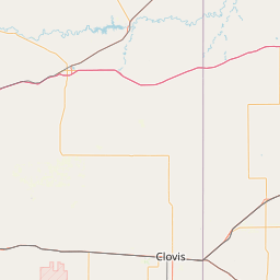
North Groesbeck Creek
Map
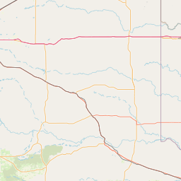
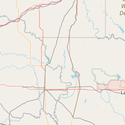
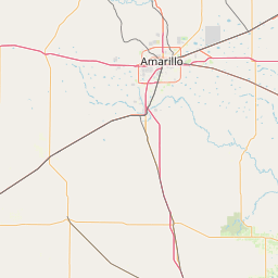
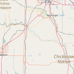
Leaflet | <a href="https://www.openstreetmap.org/copyright">© OpenStreetMap contributors</a>
Item
| Property | Value |
|---|---|
| id | 239124 |
| downstream_mainstem_id | https://geoconnex.us/ref/mainstems/236727 |
| encompassing_mainstem_basins | ['https://geoconnex.us/ref/mainstems/236727', 'https://geoconnex.us/ref/mainstems/225074'] |
| featuretype | ['https://www.opengis.net/def/schema/hy_features/hyf/HY_FlowPath', 'https://www.opengis.net/def/schema/hy_features/hyf/HY_WaterBody'] |
| fid | 21854 |
| head_2020huc12 | 111301010101 |
| head_nhdpv1_comid | 13739007 |
| head_nhdpv2_comid | https://geoconnex.us/nhdplusv2/comid/13739007 |
| head_nhdpv2huc12 | https://geoconnex.us/nhdplusv2/huc12/111301010101 |
| head_rf1id | 36181 |
| lengthkm | 63.6 |
| name_at_outlet | North Groesbeck Creek |
| name_at_outlet_gnis_id | 1364075 |
| new_mainstemid | |
| outlet_2020huc12 | 111301010104 |
| outlet_drainagearea_sqkm | 440.7 |
| outlet_nhdpv1_comid | 13739993 |
| outlet_nhdpv2_comid | https://geoconnex.us/nhdplusv2/comid/13739993 |
| outlet_nhdpv2huc12 | https://geoconnex.us/nhdplusv2/huc12/111301010104 |
| outlet_rf1id | 36181 |
| superseded | False |
| uri | https://geoconnex.us/ref/mainstems/239124 |