Crabtree Creek
Map
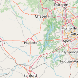
Leaflet | <a href="https://www.openstreetmap.org/copyright">© OpenStreetMap contributors</a>
Item
| Property | Value |
|---|---|
| id | 2398578 |
| downstream_mainstem_id | https://geoconnex.us/ref/mainstems/2398012 |
| encompassing_mainstem_basins | ['https://geoconnex.us/ref/mainstems/2398012'] |
| featuretype | ['https://www.opengis.net/def/schema/hy_features/hyf/HY_FlowPath', 'https://www.opengis.net/def/schema/hy_features/hyf/HY_WaterBody'] |
| fid | 2764 |
| head_2020huc12 | 030202010801 |
| head_nhdpv1_comid | 8783987 |
| head_nhdpv2_comid | https://geoconnex.us/nhdplusv2/comid/8783987 |
| head_nhdpv2huc12 | https://geoconnex.us/nhdplusv2/huc12/030202010801 |
| head_rf1id | 4783 |
| lengthkm | 46.3 |
| name_at_outlet | Crabtree Creek |
| name_at_outlet_gnis_id | 983696 |
| new_mainstemid | |
| outlet_2020huc12 | 030202010804 |
| outlet_drainagearea_sqkm | 376.2 |
| outlet_nhdpv1_comid | 8783935 |
| outlet_nhdpv2_comid | https://geoconnex.us/nhdplusv2/comid/8783935 |
| outlet_nhdpv2huc12 | https://geoconnex.us/nhdplusv2/huc12/030202010804 |
| outlet_rf1id | 4783 |
| superseded | False |
| uri | https://geoconnex.us/ref/mainstems/2398578 |
Graph Results
| monitoringLocation | https://sta.geoconnex.dev/collections/USGS/Things/items/'USGS-02087275' |
|---|---|
| siteName | USGS-02087275 |
| datasetDescription | Gage height / USGS-02087275-ff3b73185ae4482791a00b3fafedf4fc |
| type | Stream |
| url | https://waterdata.usgs.gov/monitoring-location/02087275/#parameterCode=00065 |
| variableMeasured | Gage height / USGS-02087275-ff3b73185ae4482791a00b3fafedf4fc |
| variableUnit | ft |
| measurementTechnique | observation |
| temporalCoverage | 2024-08-30T09:05:00Z/2024-09-09T18:40:00Z |
| distributionName | USGS Instantaneous Values Service |
| distributionURL | https://waterservices.usgs.gov/nwis/iv/?sites=USGS:02087275¶meterCd=00065&format=rdb |
| distributionFormat | text/tab-separated-values |
| wkt | POINT (-78.6741666666667 35.8380555555556) |
| monitoringLocation | https://sta.geoconnex.dev/collections/USGS/Things/items/'USGS-02087275' |
|---|---|
| siteName | USGS-02087275 |
| datasetDescription | Gage height / USGS-02087275-ff3b73185ae4482791a00b3fafedf4fc |
| type | Stream |
| url | https://waterdata.usgs.gov/monitoring-location/02087275/#parameterCode=00065 |
| variableMeasured | Gage height / USGS-02087275-ff3b73185ae4482791a00b3fafedf4fc |
| variableUnit | ft |
| measurementTechnique | observation |
| temporalCoverage | 2024-08-30T09:05:00Z/2024-09-09T18:40:00Z |
| distributionName | USGS SensorThings API |
| distributionURL | https://labs.waterdata.usgs.gov/sta/v1.1/Datastreams('ff3b73185ae4482791a00b3fafedf4fc')?$expand=Thing,Observations |
| distributionFormat | application/json |
| wkt | POINT (-78.6741666666667 35.8380555555556) |
| monitoringLocation | https://sta.geoconnex.dev/collections/USGS/Things/items/'USGS-02087275' |
|---|---|
| siteName | USGS-02087275 |
| datasetDescription | Discharge / USGS-02087275-62a2ff32850e4dcbbc2ea668a8d13e34 |
| type | Stream |
| url | https://waterdata.usgs.gov/monitoring-location/02087275/#parameterCode=00060 |
| variableMeasured | Discharge / USGS-02087275-62a2ff32850e4dcbbc2ea668a8d13e34 |
| variableUnit | ft^3/s |
| measurementTechnique | observation |
| temporalCoverage | 2024-08-30T09:05:00Z/2024-09-09T18:40:00Z |
| distributionName | USGS Instantaneous Values Service |
| distributionURL | https://waterservices.usgs.gov/nwis/iv/?sites=USGS:02087275¶meterCd=00060&format=rdb |
| distributionFormat | text/tab-separated-values |
| wkt | POINT (-78.6741666666667 35.8380555555556) |
| monitoringLocation | https://sta.geoconnex.dev/collections/USGS/Things/items/'USGS-02087275' |
|---|---|
| siteName | USGS-02087275 |
| datasetDescription | Discharge / USGS-02087275-62a2ff32850e4dcbbc2ea668a8d13e34 |
| type | Stream |
| url | https://waterdata.usgs.gov/monitoring-location/02087275/#parameterCode=00060 |
| variableMeasured | Discharge / USGS-02087275-62a2ff32850e4dcbbc2ea668a8d13e34 |
| variableUnit | ft^3/s |
| measurementTechnique | observation |
| temporalCoverage | 2024-08-30T09:05:00Z/2024-09-09T18:40:00Z |
| distributionName | USGS SensorThings API |
| distributionURL | https://labs.waterdata.usgs.gov/sta/v1.1/Datastreams('62a2ff32850e4dcbbc2ea668a8d13e34')?$expand=Thing,Observations |
| distributionFormat | application/json |
| wkt | POINT (-78.6741666666667 35.8380555555556) |
| monitoringLocation | https://sta.geoconnex.dev/collections/USGS/Things/items/'USGS-02087275' |
|---|---|
| siteName | USGS-02087275 |
| datasetDescription | Stream water level elevation above NAVD 1988, in feet / USGS-02087275-5779694a2fd340d0b002a102d6e3c42c |
| type | Stream |
| url | https://waterdata.usgs.gov/monitoring-location/02087275/#parameterCode=63160 |
| variableMeasured | Stream water level elevation above NAVD 1988 |
| variableUnit | ft |
| measurementTechnique | observation |
| temporalCoverage | 2024-08-30T09:05:00Z/2024-09-09T18:35:00Z |
| distributionName | USGS Instantaneous Values Service |
| distributionURL | https://waterservices.usgs.gov/nwis/iv/?sites=USGS:02087275¶meterCd=63160&format=rdb |
| distributionFormat | text/tab-separated-values |
| wkt | POINT (-78.6741666666667 35.8380555555556) |
| monitoringLocation | https://sta.geoconnex.dev/collections/USGS/Things/items/'USGS-02087275' |
|---|---|
| siteName | USGS-02087275 |
| datasetDescription | Stream water level elevation above NAVD 1988, in feet / USGS-02087275-5779694a2fd340d0b002a102d6e3c42c |
| type | Stream |
| url | https://waterdata.usgs.gov/monitoring-location/02087275/#parameterCode=63160 |
| variableMeasured | Stream water level elevation above NAVD 1988 |
| variableUnit | ft |
| measurementTechnique | observation |
| temporalCoverage | 2024-08-30T09:05:00Z/2024-09-09T18:35:00Z |
| distributionName | USGS SensorThings API |
| distributionURL | https://labs.waterdata.usgs.gov/sta/v1.1/Datastreams('5779694a2fd340d0b002a102d6e3c42c')?$expand=Thing,Observations |
| distributionFormat | application/json |
| wkt | POINT (-78.6741666666667 35.8380555555556) |
| monitoringLocation | https://sta.geoconnex.dev/collections/USGS/Things/items/'USGS-02087275' |
|---|---|
| siteName | USGS-02087275 |
| datasetDescription | None / USGS-02087275-7be2cc81429d4026979287684d37b6f3 |
| type | Stream |
| url | https://waterdata.usgs.gov/monitoring-location/02087275/#parameterCode=00045 |
| variableMeasured | None / USGS-02087275-7be2cc81429d4026979287684d37b6f3 |
| variableUnit | in |
| measurementTechnique | observation |
| temporalCoverage | 2024-08-30T09:05:00Z/2024-09-09T18:40:00Z |
| distributionName | USGS Instantaneous Values Service |
| distributionURL | https://waterservices.usgs.gov/nwis/iv/?sites=USGS:02087275¶meterCd=00045&format=rdb |
| distributionFormat | text/tab-separated-values |
| wkt | POINT (-78.6741666666667 35.8380555555556) |
| monitoringLocation | https://sta.geoconnex.dev/collections/USGS/Things/items/'USGS-02087275' |
|---|---|
| siteName | USGS-02087275 |
| datasetDescription | None / USGS-02087275-7be2cc81429d4026979287684d37b6f3 |
| type | Stream |
| url | https://waterdata.usgs.gov/monitoring-location/02087275/#parameterCode=00045 |
| variableMeasured | None / USGS-02087275-7be2cc81429d4026979287684d37b6f3 |
| variableUnit | in |
| measurementTechnique | observation |
| temporalCoverage | 2024-08-30T09:05:00Z/2024-09-09T18:40:00Z |
| distributionName | USGS SensorThings API |
| distributionURL | https://labs.waterdata.usgs.gov/sta/v1.1/Datastreams('7be2cc81429d4026979287684d37b6f3')?$expand=Thing,Observations |
| distributionFormat | application/json |
| wkt | POINT (-78.6741666666667 35.8380555555556) |
| monitoringLocation | https://sta.geoconnex.dev/collections/USGS/Things/items/'USGS-02087322' |
|---|---|
| siteName | USGS-02087322 |
| datasetDescription | None / USGS-02087322-5bc896bf651141659c10487bafa46571 |
| type | Stream |
| url | https://waterdata.usgs.gov/monitoring-location/02087322/#parameterCode=00045 |
| variableMeasured | None / USGS-02087322-5bc896bf651141659c10487bafa46571 |
| variableUnit | in |
| measurementTechnique | observation |
| temporalCoverage | 2024-08-30T09:05:00Z/2024-09-09T18:40:00Z |
| distributionName | USGS Instantaneous Values Service |
| distributionURL | https://waterservices.usgs.gov/nwis/iv/?sites=USGS:02087322¶meterCd=00045&format=rdb |
| distributionFormat | text/tab-separated-values |
| wkt | POINT (-78.6261111111111 35.8158333333333) |
| monitoringLocation | https://sta.geoconnex.dev/collections/USGS/Things/items/'USGS-02087322' |
|---|---|
| siteName | USGS-02087322 |
| datasetDescription | None / USGS-02087322-5bc896bf651141659c10487bafa46571 |
| type | Stream |
| url | https://waterdata.usgs.gov/monitoring-location/02087322/#parameterCode=00045 |
| variableMeasured | None / USGS-02087322-5bc896bf651141659c10487bafa46571 |
| variableUnit | in |
| measurementTechnique | observation |
| temporalCoverage | 2024-08-30T09:05:00Z/2024-09-09T18:40:00Z |
| distributionName | USGS SensorThings API |
| distributionURL | https://labs.waterdata.usgs.gov/sta/v1.1/Datastreams('5bc896bf651141659c10487bafa46571')?$expand=Thing,Observations |
| distributionFormat | application/json |
| wkt | POINT (-78.6261111111111 35.8158333333333) |
| monitoringLocation | https://sta.geoconnex.dev/collections/USGS/Things/items/'USGS-02087322' |
|---|---|
| siteName | USGS-02087322 |
| datasetDescription | Gage height / USGS-02087322-b118382eccac48cab4f5bdecd773512e |
| type | Stream |
| url | https://waterdata.usgs.gov/monitoring-location/02087322/#parameterCode=00065 |
| variableMeasured | Gage height / USGS-02087322-b118382eccac48cab4f5bdecd773512e |
| variableUnit | ft |
| measurementTechnique | observation |
| temporalCoverage | 2024-08-30T09:05:00Z/2024-09-09T18:40:00Z |
| distributionName | USGS Instantaneous Values Service |
| distributionURL | https://waterservices.usgs.gov/nwis/iv/?sites=USGS:02087322¶meterCd=00065&format=rdb |
| distributionFormat | text/tab-separated-values |
| wkt | POINT (-78.6261111111111 35.8158333333333) |
| monitoringLocation | https://sta.geoconnex.dev/collections/USGS/Things/items/'USGS-02087322' |
|---|---|
| siteName | USGS-02087322 |
| datasetDescription | Gage height / USGS-02087322-b118382eccac48cab4f5bdecd773512e |
| type | Stream |
| url | https://waterdata.usgs.gov/monitoring-location/02087322/#parameterCode=00065 |
| variableMeasured | Gage height / USGS-02087322-b118382eccac48cab4f5bdecd773512e |
| variableUnit | ft |
| measurementTechnique | observation |
| temporalCoverage | 2024-08-30T09:05:00Z/2024-09-09T18:40:00Z |
| distributionName | USGS SensorThings API |
| distributionURL | https://labs.waterdata.usgs.gov/sta/v1.1/Datastreams('b118382eccac48cab4f5bdecd773512e')?$expand=Thing,Observations |
| distributionFormat | application/json |
| wkt | POINT (-78.6261111111111 35.8158333333333) |
| monitoringLocation | https://sta.geoconnex.dev/collections/USGS/Things/items/'USGS-02087322' |
|---|---|
| siteName | USGS-02087322 |
| datasetDescription | Stream water level elevation above NAVD 1988, in feet / USGS-02087322-e73b46debb9340659d083295c10958ad |
| type | Stream |
| url | https://waterdata.usgs.gov/monitoring-location/02087322/#parameterCode=63160 |
| variableMeasured | Stream water level elevation above NAVD 1988 |
| variableUnit | ft |
| measurementTechnique | observation |
| temporalCoverage | 2024-08-30T09:05:00Z/2024-09-09T18:40:00Z |
| distributionName | USGS Instantaneous Values Service |
| distributionURL | https://waterservices.usgs.gov/nwis/iv/?sites=USGS:02087322¶meterCd=63160&format=rdb |
| distributionFormat | text/tab-separated-values |
| wkt | POINT (-78.6261111111111 35.8158333333333) |
| monitoringLocation | https://sta.geoconnex.dev/collections/USGS/Things/items/'USGS-02087322' |
|---|---|
| siteName | USGS-02087322 |
| datasetDescription | Stream water level elevation above NAVD 1988, in feet / USGS-02087322-e73b46debb9340659d083295c10958ad |
| type | Stream |
| url | https://waterdata.usgs.gov/monitoring-location/02087322/#parameterCode=63160 |
| variableMeasured | Stream water level elevation above NAVD 1988 |
| variableUnit | ft |
| measurementTechnique | observation |
| temporalCoverage | 2024-08-30T09:05:00Z/2024-09-09T18:40:00Z |
| distributionName | USGS SensorThings API |
| distributionURL | https://labs.waterdata.usgs.gov/sta/v1.1/Datastreams('e73b46debb9340659d083295c10958ad')?$expand=Thing,Observations |
| distributionFormat | application/json |
| wkt | POINT (-78.6261111111111 35.8158333333333) |
| monitoringLocation | https://sta.geoconnex.dev/collections/USGS/Things/items/'USGS-0208726005' |
|---|---|
| siteName | USGS-0208726005 |
| datasetDescription | Discharge / USGS-0208726005-19c080ada36c4824b9169cc75acf5840 |
| type | Stream |
| url | https://waterdata.usgs.gov/monitoring-location/0208726005/#parameterCode=00060 |
| variableMeasured | Discharge / USGS-0208726005-19c080ada36c4824b9169cc75acf5840 |
| variableUnit | ft^3/s |
| measurementTechnique | observation |
| temporalCoverage | 2024-08-30T09:05:00Z/2024-09-09T18:40:00Z |
| distributionName | USGS Instantaneous Values Service |
| distributionURL | https://waterservices.usgs.gov/nwis/iv/?sites=USGS:0208726005¶meterCd=00060&format=rdb |
| distributionFormat | text/tab-separated-values |
| wkt | POINT (-78.7244444444444 35.8452777777778) |
| monitoringLocation | https://sta.geoconnex.dev/collections/USGS/Things/items/'USGS-0208726005' |
|---|---|
| siteName | USGS-0208726005 |
| datasetDescription | Discharge / USGS-0208726005-19c080ada36c4824b9169cc75acf5840 |
| type | Stream |
| url | https://waterdata.usgs.gov/monitoring-location/0208726005/#parameterCode=00060 |
| variableMeasured | Discharge / USGS-0208726005-19c080ada36c4824b9169cc75acf5840 |
| variableUnit | ft^3/s |
| measurementTechnique | observation |
| temporalCoverage | 2024-08-30T09:05:00Z/2024-09-09T18:40:00Z |
| distributionName | USGS SensorThings API |
| distributionURL | https://labs.waterdata.usgs.gov/sta/v1.1/Datastreams('19c080ada36c4824b9169cc75acf5840')?$expand=Thing,Observations |
| distributionFormat | application/json |
| wkt | POINT (-78.7244444444444 35.8452777777778) |
| monitoringLocation | https://sta.geoconnex.dev/collections/USGS/Things/items/'USGS-0208726005' |
|---|---|
| siteName | USGS-0208726005 |
| datasetDescription | Stream water level elevation above NAVD 1988, in feet / USGS-0208726005-a70d97d07158415fb92a079a62352f31 |
| type | Stream |
| url | https://waterdata.usgs.gov/monitoring-location/0208726005/#parameterCode=63160 |
| variableMeasured | Stream water level elevation above NAVD 1988 |
| variableUnit | ft |
| measurementTechnique | observation |
| temporalCoverage | 2024-08-30T09:05:00Z/2024-09-09T18:35:00Z |
| distributionName | USGS Instantaneous Values Service |
| distributionURL | https://waterservices.usgs.gov/nwis/iv/?sites=USGS:0208726005¶meterCd=63160&format=rdb |
| distributionFormat | text/tab-separated-values |
| wkt | POINT (-78.7244444444444 35.8452777777778) |
| monitoringLocation | https://sta.geoconnex.dev/collections/USGS/Things/items/'USGS-0208726005' |
|---|---|
| siteName | USGS-0208726005 |
| datasetDescription | Stream water level elevation above NAVD 1988, in feet / USGS-0208726005-a70d97d07158415fb92a079a62352f31 |
| type | Stream |
| url | https://waterdata.usgs.gov/monitoring-location/0208726005/#parameterCode=63160 |
| variableMeasured | Stream water level elevation above NAVD 1988 |
| variableUnit | ft |
| measurementTechnique | observation |
| temporalCoverage | 2024-08-30T09:05:00Z/2024-09-09T18:35:00Z |
| distributionName | USGS SensorThings API |
| distributionURL | https://labs.waterdata.usgs.gov/sta/v1.1/Datastreams('a70d97d07158415fb92a079a62352f31')?$expand=Thing,Observations |
| distributionFormat | application/json |
| wkt | POINT (-78.7244444444444 35.8452777777778) |
| monitoringLocation | https://sta.geoconnex.dev/collections/USGS/Things/items/'USGS-0208726005' |
|---|---|
| siteName | USGS-0208726005 |
| datasetDescription | Gage height / USGS-0208726005-d375797d19eb470d82a0f6d121e7c862 |
| type | Stream |
| url | https://waterdata.usgs.gov/monitoring-location/0208726005/#parameterCode=00065 |
| variableMeasured | Gage height / USGS-0208726005-d375797d19eb470d82a0f6d121e7c862 |
| variableUnit | ft |
| measurementTechnique | observation |
| temporalCoverage | 2024-08-30T09:05:00Z/2024-09-09T18:40:00Z |
| distributionName | USGS Instantaneous Values Service |
| distributionURL | https://waterservices.usgs.gov/nwis/iv/?sites=USGS:0208726005¶meterCd=00065&format=rdb |
| distributionFormat | text/tab-separated-values |
| wkt | POINT (-78.7244444444444 35.8452777777778) |
| monitoringLocation | https://sta.geoconnex.dev/collections/USGS/Things/items/'USGS-0208726005' |
|---|---|
| siteName | USGS-0208726005 |
| datasetDescription | Gage height / USGS-0208726005-d375797d19eb470d82a0f6d121e7c862 |
| type | Stream |
| url | https://waterdata.usgs.gov/monitoring-location/0208726005/#parameterCode=00065 |
| variableMeasured | Gage height / USGS-0208726005-d375797d19eb470d82a0f6d121e7c862 |
| variableUnit | ft |
| measurementTechnique | observation |
| temporalCoverage | 2024-08-30T09:05:00Z/2024-09-09T18:40:00Z |
| distributionName | USGS SensorThings API |
| distributionURL | https://labs.waterdata.usgs.gov/sta/v1.1/Datastreams('d375797d19eb470d82a0f6d121e7c862')?$expand=Thing,Observations |
| distributionFormat | application/json |
| wkt | POINT (-78.7244444444444 35.8452777777778) |