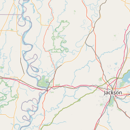
Jim Bayou
Map
Leaflet | <a href="https://www.openstreetmap.org/copyright">© OpenStreetMap contributors</a>
Item
| Property | Value |
|---|---|
| id | 240638 |
| downstream_mainstem_id | https://geoconnex.us/ref/mainstems/233505 |
| encompassing_mainstem_basins | ['https://geoconnex.us/ref/mainstems/233505', 'https://geoconnex.us/ref/mainstems/228773', 'https://geoconnex.us/ref/mainstems/225074'] |
| featuretype | ['https://www.opengis.net/def/schema/hy_features/hyf/HY_FlowPath', 'https://www.opengis.net/def/schema/hy_features/hyf/HY_WaterBody'] |
| fid | 22534 |
| head_2020huc12 | 111403060306 |
| head_nhdpv1_comid | 1016019 |
| head_nhdpv2_comid | https://geoconnex.us/nhdplusv2/comid/1016019 |
| head_nhdpv2huc12 | https://geoconnex.us/nhdplusv2/huc12/111403060306 |
| head_rf1id | 36855 |
| lengthkm | 42.4 |
| name_at_outlet | Jim Bayou |
| name_at_outlet_gnis_id | 1372166 |
| new_mainstemid | |
| outlet_2020huc12 | 111403060307 |
| outlet_drainagearea_sqkm | 235.7 |
| outlet_nhdpv1_comid | 1017535 |
| outlet_nhdpv2_comid | https://geoconnex.us/nhdplusv2/comid/1017535 |
| outlet_nhdpv2huc12 | https://geoconnex.us/nhdplusv2/huc12/111403060307 |
| outlet_rf1id | 36855 |
| superseded | False |
| uri | https://geoconnex.us/ref/mainstems/240638 |