Beaver Creek
Map
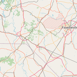
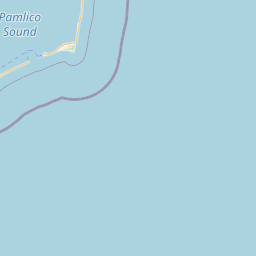
Leaflet | <a href="https://www.openstreetmap.org/copyright">© OpenStreetMap contributors</a>
Item
| Property | Value |
|---|---|
| id | 2409576 |
| downstream_mainstem_id | https://geoconnex.us/ref/mainstems/2409127 |
| encompassing_mainstem_basins | ['https://geoconnex.us/ref/mainstems/2409127', 'https://geoconnex.us/ref/mainstems/2408441', 'https://geoconnex.us/ref/mainstems/2407369'] |
| featuretype | ['https://www.opengis.net/def/schema/hy_features/hyf/HY_FlowPath', 'https://www.opengis.net/def/schema/hy_features/hyf/HY_WaterBody'] |
| fid | 2898 |
| head_2020huc12 | 030300040609 |
| head_nhdpv1_comid | 8846413 |
| head_nhdpv2_comid | https://geoconnex.us/nhdplusv2/comid/8846413 |
| head_nhdpv2huc12 | https://geoconnex.us/nhdplusv2/huc12/030300040609 |
| head_rf1id | 4952 |
| lengthkm | 19.6 |
| name_at_outlet | Beaver Creek |
| name_at_outlet_gnis_id | 1025123 |
| new_mainstemid | |
| outlet_2020huc12 | 030300040609 |
| outlet_drainagearea_sqkm | 92.1 |
| outlet_nhdpv1_comid | 8851679 |
| outlet_nhdpv2_comid | https://geoconnex.us/nhdplusv2/comid/8851679 |
| outlet_nhdpv2huc12 | https://geoconnex.us/nhdplusv2/huc12/030300040609 |
| outlet_rf1id | 4951 |
| superseded | False |
| uri | https://geoconnex.us/ref/mainstems/2409576 |
Graph Results
| monitoringLocation | https://sta.geoconnex.dev/collections/USGS/Things/items/'USGS-0210433975' |
|---|---|
| siteName | USGS-0210433975 |
| datasetDescription | Gage height / USGS-0210433975-c55d72e5d5aa4938a334b01e4cfaa5cb |
| type | Stream |
| url | https://waterdata.usgs.gov/monitoring-location/0210433975/#parameterCode=00065 |
| variableMeasured | Gage height / USGS-0210433975-c55d72e5d5aa4938a334b01e4cfaa5cb |
| variableUnit | ft |
| measurementTechnique | observation |
| temporalCoverage | 2024-08-30T09:15:00Z/2024-09-09T18:30:00Z |
| distributionName | USGS Instantaneous Values Service |
| distributionURL | https://waterservices.usgs.gov/nwis/iv/?sites=USGS:0210433975¶meterCd=00065&format=rdb |
| distributionFormat | text/tab-separated-values |
| wkt | POINT (-78.97503888888889 35.1122) |
| monitoringLocation | https://sta.geoconnex.dev/collections/USGS/Things/items/'USGS-0210433975' |
|---|---|
| siteName | USGS-0210433975 |
| datasetDescription | Gage height / USGS-0210433975-c55d72e5d5aa4938a334b01e4cfaa5cb |
| type | Stream |
| url | https://waterdata.usgs.gov/monitoring-location/0210433975/#parameterCode=00065 |
| variableMeasured | Gage height / USGS-0210433975-c55d72e5d5aa4938a334b01e4cfaa5cb |
| variableUnit | ft |
| measurementTechnique | observation |
| temporalCoverage | 2024-08-30T09:15:00Z/2024-09-09T18:30:00Z |
| distributionName | USGS SensorThings API |
| distributionURL | https://labs.waterdata.usgs.gov/sta/v1.1/Datastreams('c55d72e5d5aa4938a334b01e4cfaa5cb')?$expand=Thing,Observations |
| distributionFormat | application/json |
| wkt | POINT (-78.97503888888889 35.1122) |
| monitoringLocation | https://sta.geoconnex.dev/collections/USGS/Things/items/'USGS-0210433959' |
|---|---|
| siteName | USGS-0210433959 |
| datasetDescription | Gage height / USGS-0210433959-a843a61c77414d5d94a555cffce5f70e |
| type | Stream |
| url | https://waterdata.usgs.gov/monitoring-location/0210433959/#parameterCode=00065 |
| variableMeasured | Gage height / USGS-0210433959-a843a61c77414d5d94a555cffce5f70e |
| variableUnit | ft |
| measurementTechnique | observation |
| temporalCoverage | 2024-08-30T09:15:00Z/2024-09-09T18:00:00Z |
| distributionName | USGS SensorThings API |
| distributionURL | https://labs.waterdata.usgs.gov/sta/v1.1/Datastreams('a843a61c77414d5d94a555cffce5f70e')?$expand=Thing,Observations |
| distributionFormat | application/json |
| wkt | POINT (-78.97483055555556 35.12713055555555) |
| monitoringLocation | https://sta.geoconnex.dev/collections/USGS/Things/items/'USGS-0210433959' |
|---|---|
| siteName | USGS-0210433959 |
| datasetDescription | Gage height / USGS-0210433959-a843a61c77414d5d94a555cffce5f70e |
| type | Stream |
| url | https://waterdata.usgs.gov/monitoring-location/0210433959/#parameterCode=00065 |
| variableMeasured | Gage height / USGS-0210433959-a843a61c77414d5d94a555cffce5f70e |
| variableUnit | ft |
| measurementTechnique | observation |
| temporalCoverage | 2024-08-30T09:15:00Z/2024-09-09T18:00:00Z |
| distributionName | USGS Instantaneous Values Service |
| distributionURL | https://waterservices.usgs.gov/nwis/iv/?sites=USGS:0210433959¶meterCd=00065&format=rdb |
| distributionFormat | text/tab-separated-values |
| wkt | POINT (-78.97483055555556 35.12713055555555) |