Tick Creek
Map
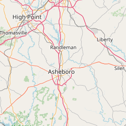
Leaflet | <a href="https://www.openstreetmap.org/copyright">© OpenStreetMap contributors</a>
Item
| Property | Value |
|---|---|
| id | 2410631 |
| downstream_mainstem_id | https://geoconnex.us/ref/mainstems/2408362 |
| encompassing_mainstem_basins | ['https://geoconnex.us/ref/mainstems/2408362', 'https://geoconnex.us/ref/mainstems/2407619', 'https://geoconnex.us/ref/mainstems/2407369'] |
| featuretype | ['https://www.opengis.net/def/schema/hy_features/hyf/HY_FlowPath', 'https://www.opengis.net/def/schema/hy_features/hyf/HY_WaterBody'] |
| fid | 2870 |
| head_2020huc12 | |
| head_nhdpv1_comid | 8870454 |
| head_nhdpv2_comid | https://geoconnex.us/nhdplusv2/comid/8870454 |
| head_nhdpv2huc12 | |
| head_rf1id | 4888 |
| lengthkm | 19.7 |
| name_at_outlet | Tick Creek |
| name_at_outlet_gnis_id | 996098 |
| new_mainstemid | |
| outlet_2020huc12 | |
| outlet_drainagearea_sqkm | 54.6 |
| outlet_nhdpv1_comid | 8870426 |
| outlet_nhdpv2_comid | https://geoconnex.us/nhdplusv2/comid/8870426 |
| outlet_nhdpv2huc12 | |
| outlet_rf1id | 4888 |
| superseded | False |
| uri | https://geoconnex.us/ref/mainstems/2410631 |
Graph Results
| monitoringLocation | https://sta.geoconnex.dev/collections/USGS/Things/items/'USGS-02101800' |
|---|---|
| siteName | USGS-02101800 |
| datasetDescription | Discharge / USGS-02101800-18c81894737c449497136f773aaeb124 |
| type | Stream |
| url | https://waterdata.usgs.gov/monitoring-location/02101800/#parameterCode=00060 |
| variableMeasured | Discharge / USGS-02101800-18c81894737c449497136f773aaeb124 |
| variableUnit | ft^3/s |
| measurementTechnique | observation |
| temporalCoverage | 2024-08-30T09:15:00Z/2024-09-09T17:45:00Z |
| distributionName | USGS Instantaneous Values Service |
| distributionURL | https://waterservices.usgs.gov/nwis/iv/?sites=USGS:02101800¶meterCd=00060&format=rdb |
| distributionFormat | text/tab-separated-values |
| wkt | POINT (-79.4016666666667 35.6597222222222) |
| monitoringLocation | https://sta.geoconnex.dev/collections/USGS/Things/items/'USGS-02101800' |
|---|---|
| siteName | USGS-02101800 |
| datasetDescription | Discharge / USGS-02101800-18c81894737c449497136f773aaeb124 |
| type | Stream |
| url | https://waterdata.usgs.gov/monitoring-location/02101800/#parameterCode=00060 |
| variableMeasured | Discharge / USGS-02101800-18c81894737c449497136f773aaeb124 |
| variableUnit | ft^3/s |
| measurementTechnique | observation |
| temporalCoverage | 2024-08-30T09:15:00Z/2024-09-09T17:45:00Z |
| distributionName | USGS SensorThings API |
| distributionURL | https://labs.waterdata.usgs.gov/sta/v1.1/Datastreams('18c81894737c449497136f773aaeb124')?$expand=Thing,Observations |
| distributionFormat | application/json |
| wkt | POINT (-79.4016666666667 35.6597222222222) |
| monitoringLocation | https://sta.geoconnex.dev/collections/USGS/Things/items/'USGS-02101800' |
|---|---|
| siteName | USGS-02101800 |
| datasetDescription | Gage height, feet / USGS-02101800-5bc97900bc7948f28df93b367c9b0f43 |
| type | Stream |
| url | https://waterdata.usgs.gov/monitoring-location/02101800/#parameterCode=00065 |
| variableMeasured | Gage height |
| variableUnit | ft |
| measurementTechnique | observation |
| temporalCoverage | 2024-08-30T09:15:00Z/2024-09-09T17:45:00Z |
| distributionName | USGS SensorThings API |
| distributionURL | https://labs.waterdata.usgs.gov/sta/v1.1/Datastreams('5bc97900bc7948f28df93b367c9b0f43')?$expand=Thing,Observations |
| distributionFormat | application/json |
| wkt | POINT (-79.4016666666667 35.6597222222222) |
| monitoringLocation | https://sta.geoconnex.dev/collections/USGS/Things/items/'USGS-02101800' |
|---|---|
| siteName | USGS-02101800 |
| datasetDescription | Gage height, feet / USGS-02101800-5bc97900bc7948f28df93b367c9b0f43 |
| type | Stream |
| url | https://waterdata.usgs.gov/monitoring-location/02101800/#parameterCode=00065 |
| variableMeasured | Gage height |
| variableUnit | ft |
| measurementTechnique | observation |
| temporalCoverage | 2024-08-30T09:15:00Z/2024-09-09T17:45:00Z |
| distributionName | USGS Instantaneous Values Service |
| distributionURL | https://waterservices.usgs.gov/nwis/iv/?sites=USGS:02101800¶meterCd=00065&format=rdb |
| distributionFormat | text/tab-separated-values |
| wkt | POINT (-79.4016666666667 35.6597222222222) |