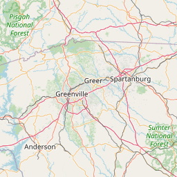
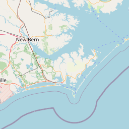
Twentyfive Mile Creek
Map


Leaflet | <a href="https://www.openstreetmap.org/copyright">© OpenStreetMap contributors</a>
Item
| Property | Value |
|---|---|
| id | 2427937 |
| downstream_mainstem_id | https://geoconnex.us/ref/mainstems/2427259 |
| encompassing_mainstem_basins | ['https://geoconnex.us/ref/mainstems/2427259', 'https://geoconnex.us/ref/mainstems/2427150'] |
| featuretype | ['https://www.opengis.net/def/schema/hy_features/hyf/HY_FlowPath', 'https://www.opengis.net/def/schema/hy_features/hyf/HY_WaterBody'] |
| fid | 3347 |
| head_2020huc12 | 030501040205 |
| head_nhdpv1_comid | 9715979 |
| head_nhdpv2_comid | https://geoconnex.us/nhdplusv2/comid/9715979 |
| head_nhdpv2huc12 | https://geoconnex.us/nhdplusv2/huc12/030501040205 |
| head_rf1id | 5583 |
| lengthkm | 44.1 |
| name_at_outlet | Twentyfive Mile Creek |
| name_at_outlet_gnis_id | 1251239 |
| new_mainstemid | |
| outlet_2020huc12 | 030501040207 |
| outlet_drainagearea_sqkm | 322.7 |
| outlet_nhdpv1_comid | 9718573 |
| outlet_nhdpv2_comid | https://geoconnex.us/nhdplusv2/comid/9718573 |
| outlet_nhdpv2huc12 | https://geoconnex.us/nhdplusv2/huc12/030501040207 |
| outlet_rf1id | 5574 |
| superseded | False |
| uri | https://geoconnex.us/ref/mainstems/2427937 |