North Fork Catawba River
Map


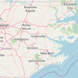

Leaflet | <a href="https://www.openstreetmap.org/copyright">© OpenStreetMap contributors</a>
Item
| Property | Value |
|---|---|
| id | 2428530 |
| downstream_mainstem_id | https://geoconnex.us/ref/mainstems/2427259 |
| encompassing_mainstem_basins | ['https://geoconnex.us/ref/mainstems/2427259', 'https://geoconnex.us/ref/mainstems/2427150'] |
| featuretype | ['https://www.opengis.net/def/schema/hy_features/hyf/HY_FlowPath', 'https://www.opengis.net/def/schema/hy_features/hyf/HY_WaterBody'] |
| fid | 3278 |
| head_2020huc12 | 030501010202 |
| head_nhdpv1_comid | 9751732 |
| head_nhdpv2_comid | https://geoconnex.us/nhdplusv2/comid/9751732 |
| head_nhdpv2huc12 | https://geoconnex.us/nhdplusv2/huc12/030501010202 |
| head_rf1id | 10091 |
| lengthkm | 35.4 |
| name_at_outlet | North Fork Catawba River |
| name_at_outlet_gnis_id | 1024192 |
| new_mainstemid | |
| outlet_2020huc12 | 030501010202 |
| outlet_drainagearea_sqkm | 220.9 |
| outlet_nhdpv1_comid | 9754218 |
| outlet_nhdpv2_comid | https://geoconnex.us/nhdplusv2/comid/9754218 |
| outlet_nhdpv2huc12 | https://geoconnex.us/nhdplusv2/huc12/030501010202 |
| outlet_rf1id | 10096 |
| superseded | False |
| uri | https://geoconnex.us/ref/mainstems/2428530 |