Wilson Creek
Map
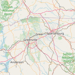
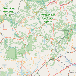
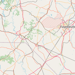
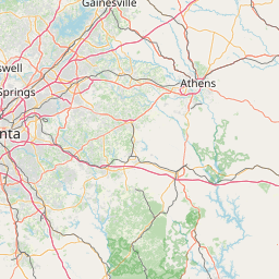
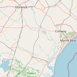

Leaflet | <a href="https://www.openstreetmap.org/copyright">© OpenStreetMap contributors</a>
Item
| Property | Value |
|---|---|
| id | 2429055 |
| downstream_mainstem_id | https://geoconnex.us/ref/mainstems/2428913 |
| encompassing_mainstem_basins | ['https://geoconnex.us/ref/mainstems/2428913', 'https://geoconnex.us/ref/mainstems/2427572', 'https://geoconnex.us/ref/mainstems/2427150'] |
| featuretype | ['https://www.opengis.net/def/schema/hy_features/hyf/HY_FlowPath', 'https://www.opengis.net/def/schema/hy_features/hyf/HY_WaterBody'] |
| fid | 3453 |
| head_2020huc12 | 030501090701 |
| head_nhdpv1_comid | 9870976 |
| head_nhdpv2_comid | https://geoconnex.us/nhdplusv2/comid/9870976 |
| head_nhdpv2huc12 | https://geoconnex.us/nhdplusv2/huc12/030501090701 |
| head_rf1id | 5818 |
| lengthkm | 40.6 |
| name_at_outlet | Wilson Creek |
| name_at_outlet_gnis_id | 1230510 |
| new_mainstemid | |
| outlet_2020huc12 | 030501090702 |
| outlet_drainagearea_sqkm | 200.8 |
| outlet_nhdpv1_comid | 9869424 |
| outlet_nhdpv2_comid | https://geoconnex.us/nhdplusv2/comid/9869424 |
| outlet_nhdpv2huc12 | https://geoconnex.us/nhdplusv2/huc12/030501090702 |
| outlet_rf1id | 5818 |
| superseded | False |
| uri | https://geoconnex.us/ref/mainstems/2429055 |
Graph Results
| monitoringLocation | https://sta.geoconnex.dev/collections/USGS/Things/items/'USGS-021668000' |
|---|---|
| siteName | USGS-021668000 |
| datasetDescription | Stream water level elevation above NAVD 1988, in feet / USGS-021668000-19ac3687fa9c4290a10247b9c72c1838 |
| type | Stream |
| url | https://waterdata.usgs.gov/monitoring-location/021668000/#parameterCode=63160 |
| variableMeasured | Stream water level elevation above NAVD 1988 |
| variableUnit | ft |
| measurementTechnique | observation |
| temporalCoverage | 2024-08-30T09:15:00Z/2024-09-09T17:45:00Z |
| distributionName | USGS SensorThings API |
| distributionURL | https://labs.waterdata.usgs.gov/sta/v1.1/Datastreams('19ac3687fa9c4290a10247b9c72c1838')?$expand=Thing,Observations |
| distributionFormat | application/json |
| wkt | POINT (-82.0462777777778 34.2016944444444) |
| monitoringLocation | https://sta.geoconnex.dev/collections/USGS/Things/items/'USGS-021668000' |
|---|---|
| siteName | USGS-021668000 |
| datasetDescription | Stream water level elevation above NAVD 1988, in feet / USGS-021668000-19ac3687fa9c4290a10247b9c72c1838 |
| type | Stream |
| url | https://waterdata.usgs.gov/monitoring-location/021668000/#parameterCode=63160 |
| variableMeasured | Stream water level elevation above NAVD 1988 |
| variableUnit | ft |
| measurementTechnique | observation |
| temporalCoverage | 2024-08-30T09:15:00Z/2024-09-09T17:45:00Z |
| distributionName | USGS Instantaneous Values Service |
| distributionURL | https://waterservices.usgs.gov/nwis/iv/?sites=USGS:021668000¶meterCd=63160&format=rdb |
| distributionFormat | text/tab-separated-values |
| wkt | POINT (-82.0462777777778 34.2016944444444) |
| monitoringLocation | https://sta.geoconnex.dev/collections/USGS/Things/items/'USGS-021668000' |
|---|---|
| siteName | USGS-021668000 |
| datasetDescription | Gage height, feet / USGS-021668000-20d981489f784b309ba63526fc947c05 |
| type | Stream |
| url | https://waterdata.usgs.gov/monitoring-location/021668000/#parameterCode=00065 |
| variableMeasured | Gage height |
| variableUnit | ft |
| measurementTechnique | observation |
| temporalCoverage | 2024-08-30T09:15:00Z/2024-09-09T17:45:00Z |
| distributionName | USGS SensorThings API |
| distributionURL | https://labs.waterdata.usgs.gov/sta/v1.1/Datastreams('20d981489f784b309ba63526fc947c05')?$expand=Thing,Observations |
| distributionFormat | application/json |
| wkt | POINT (-82.0462777777778 34.2016944444444) |
| monitoringLocation | https://sta.geoconnex.dev/collections/USGS/Things/items/'USGS-021668000' |
|---|---|
| siteName | USGS-021668000 |
| datasetDescription | Gage height, feet / USGS-021668000-20d981489f784b309ba63526fc947c05 |
| type | Stream |
| url | https://waterdata.usgs.gov/monitoring-location/021668000/#parameterCode=00065 |
| variableMeasured | Gage height |
| variableUnit | ft |
| measurementTechnique | observation |
| temporalCoverage | 2024-08-30T09:15:00Z/2024-09-09T17:45:00Z |
| distributionName | USGS Instantaneous Values Service |
| distributionURL | https://waterservices.usgs.gov/nwis/iv/?sites=USGS:021668000¶meterCd=00065&format=rdb |
| distributionFormat | text/tab-separated-values |
| wkt | POINT (-82.0462777777778 34.2016944444444) |