Middle Saluda River
Map
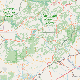
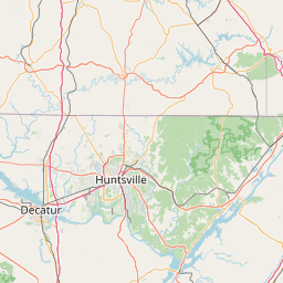
Leaflet | <a href="https://www.openstreetmap.org/copyright">© OpenStreetMap contributors</a>
Item
| Property | Value |
|---|---|
| id | 2429058 |
| downstream_mainstem_id | https://geoconnex.us/ref/mainstems/2427572 |
| encompassing_mainstem_basins | ['https://geoconnex.us/ref/mainstems/2427572', 'https://geoconnex.us/ref/mainstems/2427150'] |
| featuretype | ['https://www.opengis.net/def/schema/hy_features/hyf/HY_FlowPath', 'https://www.opengis.net/def/schema/hy_features/hyf/HY_WaterBody'] |
| fid | 3446 |
| head_2020huc12 | 030501090202 |
| head_nhdpv1_comid | 9865672 |
| head_nhdpv2_comid | https://geoconnex.us/nhdplusv2/comid/9865672 |
| head_nhdpv2huc12 | https://geoconnex.us/nhdplusv2/huc12/030501090202 |
| head_rf1id | 5808 |
| lengthkm | 30.2 |
| name_at_outlet | Middle Saluda River |
| name_at_outlet_gnis_id | 1246632 |
| new_mainstemid | |
| outlet_2020huc12 | 030501091403 |
| outlet_drainagearea_sqkm | 127.2 |
| outlet_nhdpv1_comid | 9866104 |
| outlet_nhdpv2_comid | https://geoconnex.us/nhdplusv2/comid/9866104 |
| outlet_nhdpv2huc12 | https://geoconnex.us/nhdplusv2/huc12/030501091403 |
| outlet_rf1id | 5808 |
| superseded | False |
| uri | https://geoconnex.us/ref/mainstems/2429058 |
Graph Results
| monitoringLocation | https://sta.geoconnex.dev/collections/USGS/Things/items/'USGS-02162350' |
|---|---|
| siteName | USGS-02162350 |
| datasetDescription | Discharge / USGS-02162350-c8034aace58b4d3f829a9d204179148f |
| type | Stream |
| url | https://waterdata.usgs.gov/monitoring-location/02162350/#parameterCode=00060 |
| variableMeasured | Discharge / USGS-02162350-c8034aace58b4d3f829a9d204179148f |
| variableUnit | ft^3/s |
| measurementTechnique | observation |
| temporalCoverage | 2024-08-30T09:15:00Z/2024-09-09T17:45:00Z |
| distributionName | USGS Instantaneous Values Service |
| distributionURL | https://waterservices.usgs.gov/nwis/iv/?sites=USGS:02162350¶meterCd=00060&format=rdb |
| distributionFormat | text/tab-separated-values |
| wkt | POINT (-82.5376230196213 35.1201172327169) |
| monitoringLocation | https://sta.geoconnex.dev/collections/USGS/Things/items/'USGS-02162350' |
|---|---|
| siteName | USGS-02162350 |
| datasetDescription | Discharge / USGS-02162350-c8034aace58b4d3f829a9d204179148f |
| type | Stream |
| url | https://waterdata.usgs.gov/monitoring-location/02162350/#parameterCode=00060 |
| variableMeasured | Discharge / USGS-02162350-c8034aace58b4d3f829a9d204179148f |
| variableUnit | ft^3/s |
| measurementTechnique | observation |
| temporalCoverage | 2024-08-30T09:15:00Z/2024-09-09T17:45:00Z |
| distributionName | USGS SensorThings API |
| distributionURL | https://labs.waterdata.usgs.gov/sta/v1.1/Datastreams('c8034aace58b4d3f829a9d204179148f')?$expand=Thing,Observations |
| distributionFormat | application/json |
| wkt | POINT (-82.5376230196213 35.1201172327169) |
| monitoringLocation | https://sta.geoconnex.dev/collections/USGS/Things/items/'USGS-02162350' |
|---|---|
| siteName | USGS-02162350 |
| datasetDescription | Gage height, feet / USGS-02162350-fcd18118e60b49b79c58aea3d2f96a48 |
| type | Stream |
| url | https://waterdata.usgs.gov/monitoring-location/02162350/#parameterCode=00065 |
| variableMeasured | Gage height |
| variableUnit | ft |
| measurementTechnique | observation |
| temporalCoverage | 2024-08-30T09:15:00Z/2024-09-09T17:45:00Z |
| distributionName | USGS Instantaneous Values Service |
| distributionURL | https://waterservices.usgs.gov/nwis/iv/?sites=USGS:02162350¶meterCd=00065&format=rdb |
| distributionFormat | text/tab-separated-values |
| wkt | POINT (-82.5376230196213 35.1201172327169) |
| monitoringLocation | https://sta.geoconnex.dev/collections/USGS/Things/items/'USGS-02162350' |
|---|---|
| siteName | USGS-02162350 |
| datasetDescription | Gage height, feet / USGS-02162350-fcd18118e60b49b79c58aea3d2f96a48 |
| type | Stream |
| url | https://waterdata.usgs.gov/monitoring-location/02162350/#parameterCode=00065 |
| variableMeasured | Gage height |
| variableUnit | ft |
| measurementTechnique | observation |
| temporalCoverage | 2024-08-30T09:15:00Z/2024-09-09T17:45:00Z |
| distributionName | USGS SensorThings API |
| distributionURL | https://labs.waterdata.usgs.gov/sta/v1.1/Datastreams('fcd18118e60b49b79c58aea3d2f96a48')?$expand=Thing,Observations |
| distributionFormat | application/json |
| wkt | POINT (-82.5376230196213 35.1201172327169) |
| monitoringLocation | https://sta.geoconnex.dev/collections/USGS/Things/items/'USGS-02162350' |
|---|---|
| siteName | USGS-02162350 |
| datasetDescription | Stream water level elevation above NAVD 1988, in feet / USGS-02162350-6ac2568b54ea46deb3d0b09c62ab253b |
| type | Stream |
| url | https://waterdata.usgs.gov/monitoring-location/02162350/#parameterCode=63160 |
| variableMeasured | Stream water level elevation above NAVD 1988 |
| variableUnit | ft |
| measurementTechnique | observation |
| temporalCoverage | 2024-08-30T09:15:00Z/2024-09-09T17:45:00Z |
| distributionName | USGS Instantaneous Values Service |
| distributionURL | https://waterservices.usgs.gov/nwis/iv/?sites=USGS:02162350¶meterCd=63160&format=rdb |
| distributionFormat | text/tab-separated-values |
| wkt | POINT (-82.5376230196213 35.1201172327169) |
| monitoringLocation | https://sta.geoconnex.dev/collections/USGS/Things/items/'USGS-02162350' |
|---|---|
| siteName | USGS-02162350 |
| datasetDescription | Stream water level elevation above NAVD 1988, in feet / USGS-02162350-6ac2568b54ea46deb3d0b09c62ab253b |
| type | Stream |
| url | https://waterdata.usgs.gov/monitoring-location/02162350/#parameterCode=63160 |
| variableMeasured | Stream water level elevation above NAVD 1988 |
| variableUnit | ft |
| measurementTechnique | observation |
| temporalCoverage | 2024-08-30T09:15:00Z/2024-09-09T17:45:00Z |
| distributionName | USGS SensorThings API |
| distributionURL | https://labs.waterdata.usgs.gov/sta/v1.1/Datastreams('6ac2568b54ea46deb3d0b09c62ab253b')?$expand=Thing,Observations |
| distributionFormat | application/json |
| wkt | POINT (-82.5376230196213 35.1201172327169) |