Item 2589461
Map
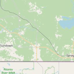
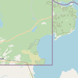

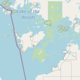
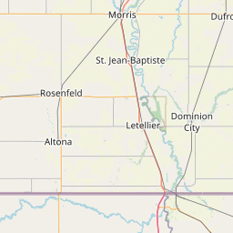
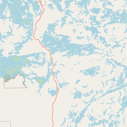
Leaflet | <a href="https://www.openstreetmap.org/copyright">© OpenStreetMap contributors</a>
Item
| Property | Value |
|---|---|
| id | 2589461 |
| downstream_mainstem_id | https://geoconnex.us/ref/mainstems/2589302 |
| encompassing_mainstem_basins | ['https://geoconnex.us/ref/mainstems/2589302', 'https://geoconnex.us/ref/mainstems/2589157'] |
| featuretype | ['https://www.opengis.net/def/schema/hy_features/hyf/HY_FlowPath', 'https://www.opengis.net/def/schema/hy_features/hyf/HY_WaterBody'] |
| fid | 14309 |
| head_2020huc12 | 090203140406 |
| head_nhdpv1_comid | 7086083 |
| head_nhdpv2_comid | https://geoconnex.us/nhdplusv2/comid/7086083 |
| head_nhdpv2huc12 | |
| head_rf1id | None |
| lengthkm | 6.6 |
| name_at_outlet | |
| name_at_outlet_gnis_id | None |
| new_mainstemid | |
| outlet_2020huc12 | 090203140406 |
| outlet_drainagearea_sqkm | 500.9 |
| outlet_nhdpv1_comid | 7087369 |
| outlet_nhdpv2_comid | https://geoconnex.us/nhdplusv2/comid/7087369 |
| outlet_nhdpv2huc12 | |
| outlet_rf1id | None |
| superseded | False |
| uri | https://geoconnex.us/ref/mainstems/2589461 |
Graph Results
| monitoringLocation | https://sta.geoconnex.dev/collections/USGS/Things/items/'USGS-05106000' |
|---|---|
| siteName | USGS-05106000 |
| datasetDescription | Gage height / USGS-05106000-e9abcf795f374d60b2e7c7b0bb70656e |
| type | Stream |
| url | https://waterdata.usgs.gov/monitoring-location/05106000/#parameterCode=00065 |
| variableMeasured | Gage height / USGS-05106000-e9abcf795f374d60b2e7c7b0bb70656e |
| variableUnit | ft |
| measurementTechnique | observation |
| temporalCoverage | 2024-08-30T09:15:00Z/2024-09-09T18:30:00Z |
| distributionName | USGS Instantaneous Values Service |
| distributionURL | https://waterservices.usgs.gov/nwis/iv/?sites=USGS:05106000¶meterCd=00065&format=rdb |
| distributionFormat | text/tab-separated-values |
| wkt | POINT (-95.6621992350753 48.9924885875228) |
| monitoringLocation | https://sta.geoconnex.dev/collections/USGS/Things/items/'USGS-05106000' |
|---|---|
| siteName | USGS-05106000 |
| datasetDescription | Gage height / USGS-05106000-e9abcf795f374d60b2e7c7b0bb70656e |
| type | Stream |
| url | https://waterdata.usgs.gov/monitoring-location/05106000/#parameterCode=00065 |
| variableMeasured | Gage height / USGS-05106000-e9abcf795f374d60b2e7c7b0bb70656e |
| variableUnit | ft |
| measurementTechnique | observation |
| temporalCoverage | 2024-08-30T09:15:00Z/2024-09-09T18:30:00Z |
| distributionName | USGS SensorThings API |
| distributionURL | https://labs.waterdata.usgs.gov/sta/v1.1/Datastreams('e9abcf795f374d60b2e7c7b0bb70656e')?$expand=Thing,Observations |
| distributionFormat | application/json |
| wkt | POINT (-95.6621992350753 48.9924885875228) |
| monitoringLocation | https://sta.geoconnex.dev/collections/USGS/Things/items/'USGS-05106000' |
|---|---|
| siteName | USGS-05106000 |
| datasetDescription | Discharge / USGS-05106000-6ee128b67fa94dd392bb47c221afd57f |
| type | Stream |
| url | https://waterdata.usgs.gov/monitoring-location/05106000/#parameterCode=00060 |
| variableMeasured | Discharge / USGS-05106000-6ee128b67fa94dd392bb47c221afd57f |
| variableUnit | ft^3/s |
| measurementTechnique | observation |
| temporalCoverage | 2024-08-30T09:15:00Z/2024-09-09T18:30:00Z |
| distributionName | USGS Instantaneous Values Service |
| distributionURL | https://waterservices.usgs.gov/nwis/iv/?sites=USGS:05106000¶meterCd=00060&format=rdb |
| distributionFormat | text/tab-separated-values |
| wkt | POINT (-95.6621992350753 48.9924885875228) |
| monitoringLocation | https://sta.geoconnex.dev/collections/USGS/Things/items/'USGS-05106000' |
|---|---|
| siteName | USGS-05106000 |
| datasetDescription | Discharge / USGS-05106000-6ee128b67fa94dd392bb47c221afd57f |
| type | Stream |
| url | https://waterdata.usgs.gov/monitoring-location/05106000/#parameterCode=00060 |
| variableMeasured | Discharge / USGS-05106000-6ee128b67fa94dd392bb47c221afd57f |
| variableUnit | ft^3/s |
| measurementTechnique | observation |
| temporalCoverage | 2024-08-30T09:15:00Z/2024-09-09T18:30:00Z |
| distributionName | USGS SensorThings API |
| distributionURL | https://labs.waterdata.usgs.gov/sta/v1.1/Datastreams('6ee128b67fa94dd392bb47c221afd57f')?$expand=Thing,Observations |
| distributionFormat | application/json |
| wkt | POINT (-95.6621992350753 48.9924885875228) |
| monitoringLocation | https://sta.geoconnex.dev/collections/USGS/Things/items/'USGS-05106000' |
|---|---|
| siteName | USGS-05106000 |
| datasetDescription | Stream water level elevation above NAVD 1988, in feet / USGS-05106000-8483001108f14dd28318675120116142 |
| type | Stream |
| url | https://waterdata.usgs.gov/monitoring-location/05106000/#parameterCode=63160 |
| variableMeasured | Stream water level elevation above NAVD 1988 |
| variableUnit | ft |
| measurementTechnique | observation |
| temporalCoverage | 2024-08-30T09:15:00Z/2024-09-09T18:30:00Z |
| distributionName | USGS SensorThings API |
| distributionURL | https://labs.waterdata.usgs.gov/sta/v1.1/Datastreams('8483001108f14dd28318675120116142')?$expand=Thing,Observations |
| distributionFormat | application/json |
| wkt | POINT (-95.6621992350753 48.9924885875228) |
| monitoringLocation | https://sta.geoconnex.dev/collections/USGS/Things/items/'USGS-05106000' |
|---|---|
| siteName | USGS-05106000 |
| datasetDescription | Stream water level elevation above NAVD 1988, in feet / USGS-05106000-8483001108f14dd28318675120116142 |
| type | Stream |
| url | https://waterdata.usgs.gov/monitoring-location/05106000/#parameterCode=63160 |
| variableMeasured | Stream water level elevation above NAVD 1988 |
| variableUnit | ft |
| measurementTechnique | observation |
| temporalCoverage | 2024-08-30T09:15:00Z/2024-09-09T18:30:00Z |
| distributionName | USGS Instantaneous Values Service |
| distributionURL | https://waterservices.usgs.gov/nwis/iv/?sites=USGS:05106000¶meterCd=63160&format=rdb |
| distributionFormat | text/tab-separated-values |
| wkt | POINT (-95.6621992350753 48.9924885875228) |