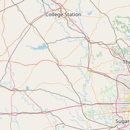
Spring Creek
Map
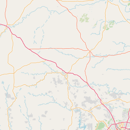
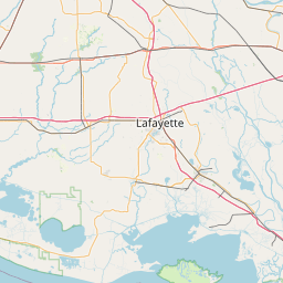
Leaflet | <a href="https://www.openstreetmap.org/copyright">© OpenStreetMap contributors</a>
Item
| Property | Value |
|---|---|
| id | 2600538 |
| downstream_mainstem_id | https://geoconnex.us/ref/mainstems/2600466 |
| encompassing_mainstem_basins | ['https://geoconnex.us/ref/mainstems/2600466', 'https://geoconnex.us/ref/mainstems/2600464'] |
| featuretype | ['https://www.opengis.net/def/schema/hy_features/hyf/HY_FlowPath', 'https://www.opengis.net/def/schema/hy_features/hyf/HY_WaterBody'] |
| fid | 23129 |
| head_2020huc12 | 120401020201 |
| head_nhdpv1_comid | 1508335 |
| head_nhdpv2_comid | https://geoconnex.us/nhdplusv2/comid/1508335 |
| head_nhdpv2huc12 | https://geoconnex.us/nhdplusv2/huc12/120401020201 |
| head_rf1id | 38456 |
| lengthkm | 111.5 |
| name_at_outlet | Spring Creek |
| name_at_outlet_gnis_id | 1347715 |
| new_mainstemid | |
| outlet_2020huc12 | 120401020213 |
| outlet_drainagearea_sqkm | 1960.3 |
| outlet_nhdpv1_comid | 1508325 |
| outlet_nhdpv2_comid | https://geoconnex.us/nhdplusv2/comid/1508325 |
| outlet_nhdpv2huc12 | https://geoconnex.us/nhdplusv2/huc12/120401020213 |
| outlet_rf1id | 38448 |
| superseded | False |
| uri | https://geoconnex.us/ref/mainstems/2600538 |
Graph Results
| monitoringLocation | https://sta.geoconnex.dev/collections/USGS/Things/items/'USGS-08068310' |
|---|---|
| siteName | USGS-08068310 |
| datasetDescription | Gage height / USGS-08068310-7cfcf85bf9eb419aa91591a752bcfdf5 |
| type | Stream |
| url | https://waterdata.usgs.gov/monitoring-location/08068310/#parameterCode=00065 |
| variableMeasured | Gage height / USGS-08068310-7cfcf85bf9eb419aa91591a752bcfdf5 |
| variableUnit | ft |
| measurementTechnique | observation |
| temporalCoverage | 2024-08-30T09:15:00Z/2024-09-09T18:15:00Z |
| distributionName | USGS Instantaneous Values Service |
| distributionURL | https://waterservices.usgs.gov/nwis/iv/?sites=USGS:08068310¶meterCd=00065&format=rdb |
| distributionFormat | text/tab-separated-values |
| wkt | POINT (-95.5416388888889 30.1703611111111) |
| monitoringLocation | https://sta.geoconnex.dev/collections/USGS/Things/items/'USGS-08068310' |
|---|---|
| siteName | USGS-08068310 |
| datasetDescription | Gage height / USGS-08068310-7cfcf85bf9eb419aa91591a752bcfdf5 |
| type | Stream |
| url | https://waterdata.usgs.gov/monitoring-location/08068310/#parameterCode=00065 |
| variableMeasured | Gage height / USGS-08068310-7cfcf85bf9eb419aa91591a752bcfdf5 |
| variableUnit | ft |
| measurementTechnique | observation |
| temporalCoverage | 2024-08-30T09:15:00Z/2024-09-09T18:15:00Z |
| distributionName | USGS SensorThings API |
| distributionURL | https://labs.waterdata.usgs.gov/sta/v1.1/Datastreams('7cfcf85bf9eb419aa91591a752bcfdf5')?$expand=Thing,Observations |
| distributionFormat | application/json |
| wkt | POINT (-95.5416388888889 30.1703611111111) |
| monitoringLocation | https://sta.geoconnex.dev/collections/USGS/Things/items/'USGS-08068310' |
|---|---|
| siteName | USGS-08068310 |
| datasetDescription | Discharge / USGS-08068310-ac5ea4f10eeb43e6a1b44523bb2daed8 |
| type | Stream |
| url | https://waterdata.usgs.gov/monitoring-location/08068310/#parameterCode=00060 |
| variableMeasured | Discharge / USGS-08068310-ac5ea4f10eeb43e6a1b44523bb2daed8 |
| variableUnit | ft^3/s |
| measurementTechnique | observation |
| temporalCoverage | 2024-08-30T09:15:00Z/2024-09-09T18:15:00Z |
| distributionName | USGS SensorThings API |
| distributionURL | https://labs.waterdata.usgs.gov/sta/v1.1/Datastreams('ac5ea4f10eeb43e6a1b44523bb2daed8')?$expand=Thing,Observations |
| distributionFormat | application/json |
| wkt | POINT (-95.5416388888889 30.1703611111111) |
| monitoringLocation | https://sta.geoconnex.dev/collections/USGS/Things/items/'USGS-08068310' |
|---|---|
| siteName | USGS-08068310 |
| datasetDescription | Discharge / USGS-08068310-ac5ea4f10eeb43e6a1b44523bb2daed8 |
| type | Stream |
| url | https://waterdata.usgs.gov/monitoring-location/08068310/#parameterCode=00060 |
| variableMeasured | Discharge / USGS-08068310-ac5ea4f10eeb43e6a1b44523bb2daed8 |
| variableUnit | ft^3/s |
| measurementTechnique | observation |
| temporalCoverage | 2024-08-30T09:15:00Z/2024-09-09T18:15:00Z |
| distributionName | USGS Instantaneous Values Service |
| distributionURL | https://waterservices.usgs.gov/nwis/iv/?sites=USGS:08068310¶meterCd=00060&format=rdb |
| distributionFormat | text/tab-separated-values |
| wkt | POINT (-95.5416388888889 30.1703611111111) |
| monitoringLocation | https://sta.geoconnex.dev/collections/USGS/Things/items/'USGS-08068500' |
|---|---|
| siteName | USGS-08068500 |
| datasetDescription | Temperature water / USGS-08068500-5408191ee3714104aa2162e902810881 |
| type | Stream |
| url | https://waterdata.usgs.gov/monitoring-location/08068500/#parameterCode=00010 |
| variableMeasured | Temperature |
| variableUnit | degC |
| measurementTechnique | observation |
| temporalCoverage | 2024-08-30T09:15:00Z/2024-09-09T18:45:00Z |
| distributionName | USGS Instantaneous Values Service |
| distributionURL | https://waterservices.usgs.gov/nwis/iv/?sites=USGS:08068500¶meterCd=00010&format=rdb |
| distributionFormat | text/tab-separated-values |
| wkt | POINT (-95.4363274542881 30.1104951653714) |
| monitoringLocation | https://sta.geoconnex.dev/collections/USGS/Things/items/'USGS-08068500' |
|---|---|
| siteName | USGS-08068500 |
| datasetDescription | Temperature water / USGS-08068500-5408191ee3714104aa2162e902810881 |
| type | Stream |
| url | https://waterdata.usgs.gov/monitoring-location/08068500/#parameterCode=00010 |
| variableMeasured | Temperature |
| variableUnit | degC |
| measurementTechnique | observation |
| temporalCoverage | 2024-08-30T09:15:00Z/2024-09-09T18:45:00Z |
| distributionName | USGS SensorThings API |
| distributionURL | https://labs.waterdata.usgs.gov/sta/v1.1/Datastreams('5408191ee3714104aa2162e902810881')?$expand=Thing,Observations |
| distributionFormat | application/json |
| wkt | POINT (-95.4363274542881 30.1104951653714) |
| monitoringLocation | https://sta.geoconnex.dev/collections/USGS/Things/items/'USGS-08068500' |
|---|---|
| siteName | USGS-08068500 |
| datasetDescription | Gage height / USGS-08068500-3f4c833f1c0f40749aa9671f9a678e0b |
| type | Stream |
| url | https://waterdata.usgs.gov/monitoring-location/08068500/#parameterCode=00065 |
| variableMeasured | Gage height / USGS-08068500-3f4c833f1c0f40749aa9671f9a678e0b |
| variableUnit | ft |
| measurementTechnique | observation |
| temporalCoverage | 2024-08-30T09:15:00Z/2024-09-09T18:45:00Z |
| distributionName | USGS Instantaneous Values Service |
| distributionURL | https://waterservices.usgs.gov/nwis/iv/?sites=USGS:08068500¶meterCd=00065&format=rdb |
| distributionFormat | text/tab-separated-values |
| wkt | POINT (-95.4363274542881 30.1104951653714) |
| monitoringLocation | https://sta.geoconnex.dev/collections/USGS/Things/items/'USGS-08068500' |
|---|---|
| siteName | USGS-08068500 |
| datasetDescription | Gage height / USGS-08068500-3f4c833f1c0f40749aa9671f9a678e0b |
| type | Stream |
| url | https://waterdata.usgs.gov/monitoring-location/08068500/#parameterCode=00065 |
| variableMeasured | Gage height / USGS-08068500-3f4c833f1c0f40749aa9671f9a678e0b |
| variableUnit | ft |
| measurementTechnique | observation |
| temporalCoverage | 2024-08-30T09:15:00Z/2024-09-09T18:45:00Z |
| distributionName | USGS SensorThings API |
| distributionURL | https://labs.waterdata.usgs.gov/sta/v1.1/Datastreams('3f4c833f1c0f40749aa9671f9a678e0b')?$expand=Thing,Observations |
| distributionFormat | application/json |
| wkt | POINT (-95.4363274542881 30.1104951653714) |
| monitoringLocation | https://sta.geoconnex.dev/collections/USGS/Things/items/'USGS-08068500' |
|---|---|
| siteName | USGS-08068500 |
| datasetDescription | pH water unfiltered field standard units / USGS-08068500-4f9a74fa61034f5c9d1ca9653ece732b |
| type | Stream |
| url | https://waterdata.usgs.gov/monitoring-location/08068500/#parameterCode=00400 |
| variableMeasured | pH |
| variableUnit | pH Units |
| measurementTechnique | observation |
| temporalCoverage | 2024-08-30T09:15:00Z/2024-09-09T18:45:00Z |
| distributionName | USGS Instantaneous Values Service |
| distributionURL | https://waterservices.usgs.gov/nwis/iv/?sites=USGS:08068500¶meterCd=00400&format=rdb |
| distributionFormat | text/tab-separated-values |
| wkt | POINT (-95.4363274542881 30.1104951653714) |
| monitoringLocation | https://sta.geoconnex.dev/collections/USGS/Things/items/'USGS-08068500' |
|---|---|
| siteName | USGS-08068500 |
| datasetDescription | pH water unfiltered field standard units / USGS-08068500-4f9a74fa61034f5c9d1ca9653ece732b |
| type | Stream |
| url | https://waterdata.usgs.gov/monitoring-location/08068500/#parameterCode=00400 |
| variableMeasured | pH |
| variableUnit | pH Units |
| measurementTechnique | observation |
| temporalCoverage | 2024-08-30T09:15:00Z/2024-09-09T18:45:00Z |
| distributionName | USGS SensorThings API |
| distributionURL | https://labs.waterdata.usgs.gov/sta/v1.1/Datastreams('4f9a74fa61034f5c9d1ca9653ece732b')?$expand=Thing,Observations |
| distributionFormat | application/json |
| wkt | POINT (-95.4363274542881 30.1104951653714) |
| monitoringLocation | https://sta.geoconnex.dev/collections/USGS/Things/items/'USGS-08068500' |
|---|---|
| siteName | USGS-08068500 |
| datasetDescription | Specific cond at 25C / USGS-08068500-70ceb8dbbe0c40dc9af39d0799d5bdee |
| type | Stream |
| url | https://waterdata.usgs.gov/monitoring-location/08068500/#parameterCode=00095 |
| variableMeasured | Specific cond at 25C / USGS-08068500-70ceb8dbbe0c40dc9af39d0799d5bdee |
| variableUnit | uS/cm |
| measurementTechnique | observation |
| temporalCoverage | 2024-08-30T09:15:00Z/2024-09-09T18:45:00Z |
| distributionName | USGS Instantaneous Values Service |
| distributionURL | https://waterservices.usgs.gov/nwis/iv/?sites=USGS:08068500¶meterCd=00095&format=rdb |
| distributionFormat | text/tab-separated-values |
| wkt | POINT (-95.4363274542881 30.1104951653714) |
| monitoringLocation | https://sta.geoconnex.dev/collections/USGS/Things/items/'USGS-08068500' |
|---|---|
| siteName | USGS-08068500 |
| datasetDescription | Specific cond at 25C / USGS-08068500-70ceb8dbbe0c40dc9af39d0799d5bdee |
| type | Stream |
| url | https://waterdata.usgs.gov/monitoring-location/08068500/#parameterCode=00095 |
| variableMeasured | Specific cond at 25C / USGS-08068500-70ceb8dbbe0c40dc9af39d0799d5bdee |
| variableUnit | uS/cm |
| measurementTechnique | observation |
| temporalCoverage | 2024-08-30T09:15:00Z/2024-09-09T18:45:00Z |
| distributionName | USGS SensorThings API |
| distributionURL | https://labs.waterdata.usgs.gov/sta/v1.1/Datastreams('70ceb8dbbe0c40dc9af39d0799d5bdee')?$expand=Thing,Observations |
| distributionFormat | application/json |
| wkt | POINT (-95.4363274542881 30.1104951653714) |
| monitoringLocation | https://sta.geoconnex.dev/collections/USGS/Things/items/'USGS-08068500' |
|---|---|
| siteName | USGS-08068500 |
| datasetDescription | Discharge / USGS-08068500-78a17dce59444e52b55dcd897ad2c314 |
| type | Stream |
| url | https://waterdata.usgs.gov/monitoring-location/08068500/#parameterCode=00060 |
| variableMeasured | Discharge / USGS-08068500-78a17dce59444e52b55dcd897ad2c314 |
| variableUnit | ft^3/s |
| measurementTechnique | observation |
| temporalCoverage | 2024-08-30T09:15:00Z/2024-09-09T18:45:00Z |
| distributionName | USGS SensorThings API |
| distributionURL | https://labs.waterdata.usgs.gov/sta/v1.1/Datastreams('78a17dce59444e52b55dcd897ad2c314')?$expand=Thing,Observations |
| distributionFormat | application/json |
| wkt | POINT (-95.4363274542881 30.1104951653714) |
| monitoringLocation | https://sta.geoconnex.dev/collections/USGS/Things/items/'USGS-08068500' |
|---|---|
| siteName | USGS-08068500 |
| datasetDescription | Discharge / USGS-08068500-78a17dce59444e52b55dcd897ad2c314 |
| type | Stream |
| url | https://waterdata.usgs.gov/monitoring-location/08068500/#parameterCode=00060 |
| variableMeasured | Discharge / USGS-08068500-78a17dce59444e52b55dcd897ad2c314 |
| variableUnit | ft^3/s |
| measurementTechnique | observation |
| temporalCoverage | 2024-08-30T09:15:00Z/2024-09-09T18:45:00Z |
| distributionName | USGS Instantaneous Values Service |
| distributionURL | https://waterservices.usgs.gov/nwis/iv/?sites=USGS:08068500¶meterCd=00060&format=rdb |
| distributionFormat | text/tab-separated-values |
| wkt | POINT (-95.4363274542881 30.1104951653714) |
| monitoringLocation | https://sta.geoconnex.dev/collections/USGS/Things/items/'USGS-08068500' |
|---|---|
| siteName | USGS-08068500 |
| datasetDescription | Turbidity FNU / USGS-08068500-a86504b1338e4d1d8e99a111c27fcc35 |
| type | Stream |
| url | https://waterdata.usgs.gov/monitoring-location/08068500/#parameterCode=63680 |
| variableMeasured | Turbidity |
| variableUnit | _FNU |
| measurementTechnique | observation |
| temporalCoverage | 2024-08-30T09:15:00Z/2024-09-09T18:45:00Z |
| distributionName | USGS Instantaneous Values Service |
| distributionURL | https://waterservices.usgs.gov/nwis/iv/?sites=USGS:08068500¶meterCd=63680&format=rdb |
| distributionFormat | text/tab-separated-values |
| wkt | POINT (-95.4363274542881 30.1104951653714) |
| monitoringLocation | https://sta.geoconnex.dev/collections/USGS/Things/items/'USGS-08068500' |
|---|---|
| siteName | USGS-08068500 |
| datasetDescription | Turbidity FNU / USGS-08068500-a86504b1338e4d1d8e99a111c27fcc35 |
| type | Stream |
| url | https://waterdata.usgs.gov/monitoring-location/08068500/#parameterCode=63680 |
| variableMeasured | Turbidity |
| variableUnit | _FNU |
| measurementTechnique | observation |
| temporalCoverage | 2024-08-30T09:15:00Z/2024-09-09T18:45:00Z |
| distributionName | USGS SensorThings API |
| distributionURL | https://labs.waterdata.usgs.gov/sta/v1.1/Datastreams('a86504b1338e4d1d8e99a111c27fcc35')?$expand=Thing,Observations |
| distributionFormat | application/json |
| wkt | POINT (-95.4363274542881 30.1104951653714) |
| monitoringLocation | https://sta.geoconnex.dev/collections/USGS/Things/items/'USGS-08068500' |
|---|---|
| siteName | USGS-08068500 |
| datasetDescription | Dissolved oxygen / USGS-08068500-f6d9e3426d624f7e8903869bc9d3302a |
| type | Stream |
| url | https://waterdata.usgs.gov/monitoring-location/08068500/#parameterCode=00300 |
| variableMeasured | Dissolved oxygen / USGS-08068500-f6d9e3426d624f7e8903869bc9d3302a |
| variableUnit | mg/l |
| measurementTechnique | observation |
| temporalCoverage | 2024-08-30T09:15:00Z/2024-09-09T18:45:00Z |
| distributionName | USGS Instantaneous Values Service |
| distributionURL | https://waterservices.usgs.gov/nwis/iv/?sites=USGS:08068500¶meterCd=00300&format=rdb |
| distributionFormat | text/tab-separated-values |
| wkt | POINT (-95.4363274542881 30.1104951653714) |
| monitoringLocation | https://sta.geoconnex.dev/collections/USGS/Things/items/'USGS-08068500' |
|---|---|
| siteName | USGS-08068500 |
| datasetDescription | Dissolved oxygen / USGS-08068500-f6d9e3426d624f7e8903869bc9d3302a |
| type | Stream |
| url | https://waterdata.usgs.gov/monitoring-location/08068500/#parameterCode=00300 |
| variableMeasured | Dissolved oxygen / USGS-08068500-f6d9e3426d624f7e8903869bc9d3302a |
| variableUnit | mg/l |
| measurementTechnique | observation |
| temporalCoverage | 2024-08-30T09:15:00Z/2024-09-09T18:45:00Z |
| distributionName | USGS SensorThings API |
| distributionURL | https://labs.waterdata.usgs.gov/sta/v1.1/Datastreams('f6d9e3426d624f7e8903869bc9d3302a')?$expand=Thing,Observations |
| distributionFormat | application/json |
| wkt | POINT (-95.4363274542881 30.1104951653714) |
| monitoringLocation | https://sta.geoconnex.dev/collections/USGS/Things/items/'USGS-08068275' |
|---|---|
| siteName | USGS-08068275 |
| datasetDescription | Discharge / USGS-08068275-7c47668f8a4649a593fc62879cd655c4 |
| type | Stream |
| url | https://waterdata.usgs.gov/monitoring-location/08068275/#parameterCode=00060 |
| variableMeasured | Discharge / USGS-08068275-7c47668f8a4649a593fc62879cd655c4 |
| variableUnit | ft^3/s |
| measurementTechnique | observation |
| temporalCoverage | 2024-08-30T09:15:00Z/2024-09-09T18:00:00Z |
| distributionName | USGS SensorThings API |
| distributionURL | https://labs.waterdata.usgs.gov/sta/v1.1/Datastreams('7c47668f8a4649a593fc62879cd655c4')?$expand=Thing,Observations |
| distributionFormat | application/json |
| wkt | POINT (-95.646055898808 30.1199389943233) |
| monitoringLocation | https://sta.geoconnex.dev/collections/USGS/Things/items/'USGS-08068275' |
|---|---|
| siteName | USGS-08068275 |
| datasetDescription | Discharge / USGS-08068275-7c47668f8a4649a593fc62879cd655c4 |
| type | Stream |
| url | https://waterdata.usgs.gov/monitoring-location/08068275/#parameterCode=00060 |
| variableMeasured | Discharge / USGS-08068275-7c47668f8a4649a593fc62879cd655c4 |
| variableUnit | ft^3/s |
| measurementTechnique | observation |
| temporalCoverage | 2024-08-30T09:15:00Z/2024-09-09T18:00:00Z |
| distributionName | USGS Instantaneous Values Service |
| distributionURL | https://waterservices.usgs.gov/nwis/iv/?sites=USGS:08068275¶meterCd=00060&format=rdb |
| distributionFormat | text/tab-separated-values |
| wkt | POINT (-95.646055898808 30.1199389943233) |
| monitoringLocation | https://sta.geoconnex.dev/collections/USGS/Things/items/'USGS-08068275' |
|---|---|
| siteName | USGS-08068275 |
| datasetDescription | Gage height / USGS-08068275-81d5fd027167428985848108189c5c10 |
| type | Stream |
| url | https://waterdata.usgs.gov/monitoring-location/08068275/#parameterCode=00065 |
| variableMeasured | Gage height / USGS-08068275-81d5fd027167428985848108189c5c10 |
| variableUnit | ft |
| measurementTechnique | observation |
| temporalCoverage | 2024-08-30T09:15:00Z/2024-09-09T18:00:00Z |
| distributionName | USGS Instantaneous Values Service |
| distributionURL | https://waterservices.usgs.gov/nwis/iv/?sites=USGS:08068275¶meterCd=00065&format=rdb |
| distributionFormat | text/tab-separated-values |
| wkt | POINT (-95.646055898808 30.1199389943233) |
| monitoringLocation | https://sta.geoconnex.dev/collections/USGS/Things/items/'USGS-08068275' |
|---|---|
| siteName | USGS-08068275 |
| datasetDescription | Gage height / USGS-08068275-81d5fd027167428985848108189c5c10 |
| type | Stream |
| url | https://waterdata.usgs.gov/monitoring-location/08068275/#parameterCode=00065 |
| variableMeasured | Gage height / USGS-08068275-81d5fd027167428985848108189c5c10 |
| variableUnit | ft |
| measurementTechnique | observation |
| temporalCoverage | 2024-08-30T09:15:00Z/2024-09-09T18:00:00Z |
| distributionName | USGS SensorThings API |
| distributionURL | https://labs.waterdata.usgs.gov/sta/v1.1/Datastreams('81d5fd027167428985848108189c5c10')?$expand=Thing,Observations |
| distributionFormat | application/json |
| wkt | POINT (-95.646055898808 30.1199389943233) |