Mulberry Creek
Map
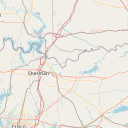
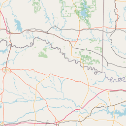
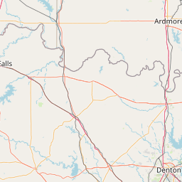
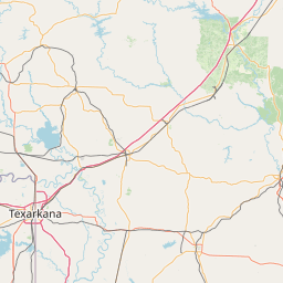
Leaflet | <a href="https://www.openstreetmap.org/copyright">© OpenStreetMap contributors</a>
Item
| Property | Value |
|---|---|
| id | 260060 |
| downstream_mainstem_id | https://geoconnex.us/ref/mainstems/245630 |
| encompassing_mainstem_basins | ['https://geoconnex.us/ref/mainstems/245630', 'https://geoconnex.us/ref/mainstems/240654', 'https://geoconnex.us/ref/mainstems/227521', 'https://geoconnex.us/ref/mainstems/225074'] |
| featuretype | ['https://www.opengis.net/def/schema/hy_features/hyf/HY_FlowPath', 'https://www.opengis.net/def/schema/hy_features/hyf/HY_WaterBody'] |
| fid | 22480 |
| head_2020huc12 | |
| head_nhdpv1_comid | 1126207 |
| head_nhdpv2_comid | https://geoconnex.us/nhdplusv2/comid/1126207 |
| head_nhdpv2huc12 | |
| head_rf1id | None |
| lengthkm | 22.2 |
| name_at_outlet | Mulberry Creek |
| name_at_outlet_gnis_id | 1363448 |
| new_mainstemid | |
| outlet_2020huc12 | |
| outlet_drainagearea_sqkm | 66.2 |
| outlet_nhdpv1_comid | 1126371 |
| outlet_nhdpv2_comid | https://geoconnex.us/nhdplusv2/comid/1126371 |
| outlet_nhdpv2huc12 | |
| outlet_rf1id | None |
| superseded | False |
| uri | https://geoconnex.us/ref/mainstems/260060 |