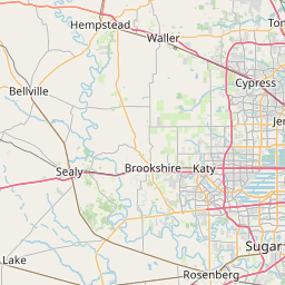
Halls Bayou
Map
Leaflet | <a href="https://www.openstreetmap.org/copyright">© OpenStreetMap contributors</a>
Item
| Property | Value |
|---|---|
| id | 2600768 |
| downstream_mainstem_id | https://geoconnex.us/ref/mainstems/2600592 |
| encompassing_mainstem_basins | ['https://geoconnex.us/ref/mainstems/2600592', 'https://geoconnex.us/ref/mainstems/2600464'] |
| featuretype | ['https://www.opengis.net/def/schema/hy_features/hyf/HY_FlowPath', 'https://www.opengis.net/def/schema/hy_features/hyf/HY_WaterBody'] |
| fid | 23161 |
| head_2020huc12 | 120401040604 |
| head_nhdpv1_comid | 1438513 |
| head_nhdpv2_comid | https://geoconnex.us/nhdplusv2/comid/1438513 |
| head_nhdpv2huc12 | https://geoconnex.us/nhdplusv2/huc12/120401040604 |
| head_rf1id | None |
| lengthkm | 27.6 |
| name_at_outlet | Halls Bayou |
| name_at_outlet_gnis_id | 1373983 |
| new_mainstemid | |
| outlet_2020huc12 | 120401040604 |
| outlet_drainagearea_sqkm | 134.5 |
| outlet_nhdpv1_comid | 1440231 |
| outlet_nhdpv2_comid | https://geoconnex.us/nhdplusv2/comid/1440231 |
| outlet_nhdpv2huc12 | https://geoconnex.us/nhdplusv2/huc12/120401040604 |
| outlet_rf1id | None |
| superseded | False |
| uri | https://geoconnex.us/ref/mainstems/2600768 |
Graph Results
| monitoringLocation | https://sta.geoconnex.dev/collections/USGS/Things/items/'USGS-08076500' |
|---|---|
| siteName | USGS-08076500 |
| datasetDescription | Gage height / USGS-08076500-59a42d5371cf4693b7bafcb76f4980a5 |
| type | Stream |
| url | https://waterdata.usgs.gov/monitoring-location/08076500/#parameterCode=00065 |
| variableMeasured | Gage height / USGS-08076500-59a42d5371cf4693b7bafcb76f4980a5 |
| variableUnit | ft |
| measurementTechnique | observation |
| temporalCoverage | 2024-08-30T09:15:00Z/2024-09-09T18:15:00Z |
| distributionName | USGS Instantaneous Values Service |
| distributionURL | https://waterservices.usgs.gov/nwis/iv/?sites=USGS:08076500¶meterCd=00065&format=rdb |
| distributionFormat | text/tab-separated-values |
| wkt | POINT (-95.3349364503016 29.8618914342345) |
| monitoringLocation | https://sta.geoconnex.dev/collections/USGS/Things/items/'USGS-08076500' |
|---|---|
| siteName | USGS-08076500 |
| datasetDescription | Gage height / USGS-08076500-59a42d5371cf4693b7bafcb76f4980a5 |
| type | Stream |
| url | https://waterdata.usgs.gov/monitoring-location/08076500/#parameterCode=00065 |
| variableMeasured | Gage height / USGS-08076500-59a42d5371cf4693b7bafcb76f4980a5 |
| variableUnit | ft |
| measurementTechnique | observation |
| temporalCoverage | 2024-08-30T09:15:00Z/2024-09-09T18:15:00Z |
| distributionName | USGS SensorThings API |
| distributionURL | https://labs.waterdata.usgs.gov/sta/v1.1/Datastreams('59a42d5371cf4693b7bafcb76f4980a5')?$expand=Thing,Observations |
| distributionFormat | application/json |
| wkt | POINT (-95.3349364503016 29.8618914342345) |
| monitoringLocation | https://sta.geoconnex.dev/collections/USGS/Things/items/'USGS-08076500' |
|---|---|
| siteName | USGS-08076500 |
| datasetDescription | Discharge / USGS-08076500-68321adf94194f3ca08b88c9bc5e2dd5 |
| type | Stream |
| url | https://waterdata.usgs.gov/monitoring-location/08076500/#parameterCode=00060 |
| variableMeasured | Discharge / USGS-08076500-68321adf94194f3ca08b88c9bc5e2dd5 |
| variableUnit | ft^3/s |
| measurementTechnique | observation |
| temporalCoverage | 2024-08-30T09:15:00Z/2024-09-09T18:15:00Z |
| distributionName | USGS SensorThings API |
| distributionURL | https://labs.waterdata.usgs.gov/sta/v1.1/Datastreams('68321adf94194f3ca08b88c9bc5e2dd5')?$expand=Thing,Observations |
| distributionFormat | application/json |
| wkt | POINT (-95.3349364503016 29.8618914342345) |
| monitoringLocation | https://sta.geoconnex.dev/collections/USGS/Things/items/'USGS-08076500' |
|---|---|
| siteName | USGS-08076500 |
| datasetDescription | Discharge / USGS-08076500-68321adf94194f3ca08b88c9bc5e2dd5 |
| type | Stream |
| url | https://waterdata.usgs.gov/monitoring-location/08076500/#parameterCode=00060 |
| variableMeasured | Discharge / USGS-08076500-68321adf94194f3ca08b88c9bc5e2dd5 |
| variableUnit | ft^3/s |
| measurementTechnique | observation |
| temporalCoverage | 2024-08-30T09:15:00Z/2024-09-09T18:15:00Z |
| distributionName | USGS Instantaneous Values Service |
| distributionURL | https://waterservices.usgs.gov/nwis/iv/?sites=USGS:08076500¶meterCd=00060&format=rdb |
| distributionFormat | text/tab-separated-values |
| wkt | POINT (-95.3349364503016 29.8618914342345) |