South Fork Sabine River
Map


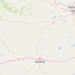


Leaflet | <a href="https://www.openstreetmap.org/copyright">© OpenStreetMap contributors</a>
Item
| Property | Value |
|---|---|
| id | 2603559 |
| downstream_mainstem_id | https://geoconnex.us/ref/mainstems/2602415 |
| encompassing_mainstem_basins | ['https://geoconnex.us/ref/mainstems/2602415', 'https://geoconnex.us/ref/mainstems/2602412'] |
| featuretype | ['https://www.opengis.net/def/schema/hy_features/hyf/HY_FlowPath', 'https://www.opengis.net/def/schema/hy_features/hyf/HY_WaterBody'] |
| fid | 22567 |
| head_2020huc12 | 120100010301 |
| head_nhdpv1_comid | 5253915 |
| head_nhdpv2_comid | https://geoconnex.us/nhdplusv2/comid/5253915 |
| head_nhdpv2huc12 | https://geoconnex.us/nhdplusv2/huc12/120100010301 |
| head_rf1id | 39992 |
| lengthkm | 71.2 |
| name_at_outlet | South Fork Sabine River |
| name_at_outlet_gnis_id | 1376206 |
| new_mainstemid | |
| outlet_2020huc12 | 120100010405 |
| outlet_drainagearea_sqkm | 585.9 |
| outlet_nhdpv1_comid | 5256773 |
| outlet_nhdpv2_comid | https://geoconnex.us/nhdplusv2/comid/5256773 |
| outlet_nhdpv2huc12 | https://geoconnex.us/nhdplusv2/huc12/120100010405 |
| outlet_rf1id | 39997 |
| superseded | False |
| uri | https://geoconnex.us/ref/mainstems/2603559 |
Graph Results
| monitoringLocation | https://sta.geoconnex.dev/collections/USGS/Things/items/'USGS-08017300' |
|---|---|
| siteName | USGS-08017300 |
| datasetDescription | Discharge cubic feet per second / USGS-08017300-4094c6ded17946d79f867cc981074fc1 |
| type | Stream |
| url | https://waterdata.usgs.gov/monitoring-location/08017300/#parameterCode=00060 |
| variableMeasured | Discharge |
| variableUnit | ft^3/s |
| measurementTechnique | observation |
| temporalCoverage | 2024-08-30T09:15:00Z/2024-09-09T18:45:00Z |
| distributionName | USGS Instantaneous Values Service |
| distributionURL | https://waterservices.usgs.gov/nwis/iv/?sites=USGS:08017300¶meterCd=00060&format=rdb |
| distributionFormat | text/tab-separated-values |
| wkt | POINT (-96.2533118054683 32.897900845515) |
| monitoringLocation | https://sta.geoconnex.dev/collections/USGS/Things/items/'USGS-08017300' |
|---|---|
| siteName | USGS-08017300 |
| datasetDescription | Discharge cubic feet per second / USGS-08017300-4094c6ded17946d79f867cc981074fc1 |
| type | Stream |
| url | https://waterdata.usgs.gov/monitoring-location/08017300/#parameterCode=00060 |
| variableMeasured | Discharge |
| variableUnit | ft^3/s |
| measurementTechnique | observation |
| temporalCoverage | 2024-08-30T09:15:00Z/2024-09-09T18:45:00Z |
| distributionName | USGS SensorThings API |
| distributionURL | https://labs.waterdata.usgs.gov/sta/v1.1/Datastreams('4094c6ded17946d79f867cc981074fc1')?$expand=Thing,Observations |
| distributionFormat | application/json |
| wkt | POINT (-96.2533118054683 32.897900845515) |
| monitoringLocation | https://sta.geoconnex.dev/collections/USGS/Things/items/'USGS-08017300' |
|---|---|
| siteName | USGS-08017300 |
| datasetDescription | Gage height / USGS-08017300-92241676112f4be294c795bccc65979b |
| type | Stream |
| url | https://waterdata.usgs.gov/monitoring-location/08017300/#parameterCode=00065 |
| variableMeasured | Gage height / USGS-08017300-92241676112f4be294c795bccc65979b |
| variableUnit | ft |
| measurementTechnique | observation |
| temporalCoverage | 2024-08-30T09:15:00Z/2024-09-09T18:45:00Z |
| distributionName | USGS Instantaneous Values Service |
| distributionURL | https://waterservices.usgs.gov/nwis/iv/?sites=USGS:08017300¶meterCd=00065&format=rdb |
| distributionFormat | text/tab-separated-values |
| wkt | POINT (-96.2533118054683 32.897900845515) |
| monitoringLocation | https://sta.geoconnex.dev/collections/USGS/Things/items/'USGS-08017300' |
|---|---|
| siteName | USGS-08017300 |
| datasetDescription | Gage height / USGS-08017300-92241676112f4be294c795bccc65979b |
| type | Stream |
| url | https://waterdata.usgs.gov/monitoring-location/08017300/#parameterCode=00065 |
| variableMeasured | Gage height / USGS-08017300-92241676112f4be294c795bccc65979b |
| variableUnit | ft |
| measurementTechnique | observation |
| temporalCoverage | 2024-08-30T09:15:00Z/2024-09-09T18:45:00Z |
| distributionName | USGS SensorThings API |
| distributionURL | https://labs.waterdata.usgs.gov/sta/v1.1/Datastreams('92241676112f4be294c795bccc65979b')?$expand=Thing,Observations |
| distributionFormat | application/json |
| wkt | POINT (-96.2533118054683 32.897900845515) |