Little Missouri River
Map


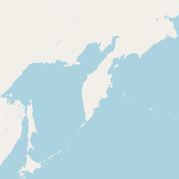

Leaflet | <a href="https://www.openstreetmap.org/copyright">© OpenStreetMap contributors</a>
Item
| Property | Value |
|---|---|
| id | 321084 |
| downstream_mainstem_id | https://geoconnex.us/ref/mainstems/312532 |
| encompassing_mainstem_basins | ['https://geoconnex.us/ref/mainstems/312532', 'https://geoconnex.us/ref/mainstems/312091'] |
| featuretype | ['https://www.opengis.net/def/schema/hy_features/hyf/HY_FlowPath', 'https://www.opengis.net/def/schema/hy_features/hyf/HY_WaterBody'] |
| fid | 16376 |
| head_2020huc12 | 101102010201 |
| head_nhdpv1_comid | 9797766 |
| head_nhdpv2_comid | https://geoconnex.us/nhdplusv2/comid/9797766 |
| head_nhdpv2huc12 | https://geoconnex.us/nhdplusv2/huc12/101102010101 |
| head_rf1id | 33515 |
| lengthkm | 1056.2 |
| name_at_outlet | Little Missouri River |
| name_at_outlet_gnis_id | 1034981 |
| new_mainstemid | |
| outlet_2020huc12 | 101102050609 |
| outlet_drainagearea_sqkm | 24621.2 |
| outlet_nhdpv1_comid | 21540574 |
| outlet_nhdpv2_comid | https://geoconnex.us/nhdplusv2/comid/21540574 |
| outlet_nhdpv2huc12 | https://geoconnex.us/nhdplusv2/huc12/101102050609 |
| outlet_rf1id | 33793 |
| superseded | False |
| uri | https://geoconnex.us/ref/mainstems/321084 |
Graph Results
| monitoringLocation | https://geoconnex.us/iow/wqp/21NDHDWQ-553062 |
|---|---|
| siteName | 21NDHDWQ-553062 |
| datasetDescription | pH at 21NDHDWQ-553062 |
| type | River/Stream |
| url | https://www.waterqualitydata.us/provider/STORET/21NDHDWQ/21NDHDWQ-553062/ |
| variableMeasured | pH |
| variableUnit | None |
| measurementTechnique | observation |
| temporalCoverage | 1999-01-01T00:00:00Z/1999-12-31T00:00:00Z |
| distributionName | Water Quality Portal |
| distributionURL | https://www.waterqualitydata.us/data/Result/search?siteid=21NDHDWQ-553062&CharacteristicName=pH&mimeType=csv |
| distributionFormat | text/comma-separated-values |
| wkt | POINT (-103.79294 46.55606) |
| monitoringLocation | https://geoconnex.us/iow/wqp/21NDHDWQ-553062 |
|---|---|
| siteName | 21NDHDWQ-553062 |
| datasetDescription | Dissolved oxygen (DO) at 21NDHDWQ-553062 |
| type | River/Stream |
| url | https://www.waterqualitydata.us/provider/STORET/21NDHDWQ/21NDHDWQ-553062/ |
| variableMeasured | Dissolved oxygen (DO) |
| variableUnit | mg/L |
| measurementTechnique | observation |
| temporalCoverage | 1998-01-01T00:00:00Z/1999-12-31T00:00:00Z |
| distributionName | Water Quality Portal |
| distributionURL | https://www.waterqualitydata.us/data/Result/search?siteid=21NDHDWQ-553062&CharacteristicName=Dissolved oxygen (DO)&mimeType=csv |
| distributionFormat | text/comma-separated-values |
| wkt | POINT (-103.79294 46.55606) |
| monitoringLocation | https://geoconnex.us/iow/wqp/21NDHDWQ-553062 |
|---|---|
| siteName | 21NDHDWQ-553062 |
| datasetDescription | Temperature, water at 21NDHDWQ-553062 |
| type | River/Stream |
| url | https://www.waterqualitydata.us/provider/STORET/21NDHDWQ/21NDHDWQ-553062/ |
| variableMeasured | Temperature, water |
| variableUnit | deg C |
| measurementTechnique | observation |
| temporalCoverage | 1998-01-01T00:00:00Z/1999-12-31T00:00:00Z |
| distributionName | Water Quality Portal |
| distributionURL | https://www.waterqualitydata.us/data/Result/search?siteid=21NDHDWQ-553062&CharacteristicName=Temperature, water&mimeType=csv |
| distributionFormat | text/comma-separated-values |
| wkt | POINT (-103.79294 46.55606) |
| monitoringLocation | https://geoconnex.us/iow/wqp/21NDHDWQ-553062 |
|---|---|
| siteName | 21NDHDWQ-553062 |
| datasetDescription | Specific conductance at 21NDHDWQ-553062 |
| type | River/Stream |
| url | https://www.waterqualitydata.us/provider/STORET/21NDHDWQ/21NDHDWQ-553062/ |
| variableMeasured | Specific conductance |
| variableUnit | umho/cm |
| measurementTechnique | observation |
| temporalCoverage | 1998-01-01T00:00:00Z/1999-12-31T00:00:00Z |
| distributionName | Water Quality Portal |
| distributionURL | https://www.waterqualitydata.us/data/Result/search?siteid=21NDHDWQ-553062&CharacteristicName=Specific conductance&mimeType=csv |
| distributionFormat | text/comma-separated-values |
| wkt | POINT (-103.79294 46.55606) |
| monitoringLocation | https://geoconnex.us/iow/wqp/USGS-452823104015301 |
|---|---|
| siteName | USGS-452823104015301 |
| datasetDescription | Sulfate at USGS-452823104015301 |
| type | Well |
| url | https://www.waterqualitydata.us/provider/NWIS/USGS-SD/USGS-452823104015301/ |
| variableMeasured | Sulfate |
| variableUnit | milligrams per liter |
| measurementTechnique | observation |
| temporalCoverage | 1970-01-01T00:00:00Z/1970-12-31T00:00:00Z |
| distributionName | Water Quality Portal |
| distributionURL | https://www.waterqualitydata.us/data/Result/search?siteid=USGS-452823104015301&CharacteristicName=Sulfate&mimeType=csv |
| distributionFormat | text/comma-separated-values |
| wkt | POINT (-104.0318805 45.47304925) |
| monitoringLocation | https://geoconnex.us/iow/wqp/USGS-452823104015301 |
|---|---|
| siteName | USGS-452823104015301 |
| datasetDescription | Sodium at USGS-452823104015301 |
| type | Well |
| url | https://www.waterqualitydata.us/provider/NWIS/USGS-SD/USGS-452823104015301/ |
| variableMeasured | Sodium |
| variableUnit | milligrams per liter |
| measurementTechnique | observation |
| temporalCoverage | 1970-01-01T00:00:00Z/1970-12-31T00:00:00Z |
| distributionName | Water Quality Portal |
| distributionURL | https://www.waterqualitydata.us/data/Result/search?siteid=USGS-452823104015301&CharacteristicName=Sodium&mimeType=csv |
| distributionFormat | text/comma-separated-values |
| wkt | POINT (-104.0318805 45.47304925) |
| monitoringLocation | https://geoconnex.us/iow/wqp/USGS-452823104015301 |
|---|---|
| siteName | USGS-452823104015301 |
| datasetDescription | Magnesium at USGS-452823104015301 |
| type | Well |
| url | https://www.waterqualitydata.us/provider/NWIS/USGS-SD/USGS-452823104015301/ |
| variableMeasured | Magnesium |
| variableUnit | percent |
| measurementTechnique | observation |
| temporalCoverage | 1970-01-01T00:00:00Z/1970-12-31T00:00:00Z |
| distributionName | Water Quality Portal |
| distributionURL | https://www.waterqualitydata.us/data/Result/search?siteid=USGS-452823104015301&CharacteristicName=Magnesium&mimeType=csv |
| distributionFormat | text/comma-separated-values |
| wkt | POINT (-104.0318805 45.47304925) |
| monitoringLocation | https://geoconnex.us/iow/wqp/USGS-452823104015301 |
|---|---|
| siteName | USGS-452823104015301 |
| datasetDescription | Fluoride at USGS-452823104015301 |
| type | Well |
| url | https://www.waterqualitydata.us/provider/NWIS/USGS-SD/USGS-452823104015301/ |
| variableMeasured | Fluoride |
| variableUnit | milligrams per liter |
| measurementTechnique | observation |
| temporalCoverage | 1970-01-01T00:00:00Z/1970-12-31T00:00:00Z |
| distributionName | Water Quality Portal |
| distributionURL | https://www.waterqualitydata.us/data/Result/search?siteid=USGS-452823104015301&CharacteristicName=Fluoride&mimeType=csv |
| distributionFormat | text/comma-separated-values |
| wkt | POINT (-104.0318805 45.47304925) |
| monitoringLocation | https://geoconnex.us/iow/wqp/USGS-452823104015301 |
|---|---|
| siteName | USGS-452823104015301 |
| datasetDescription | Chloride at USGS-452823104015301 |
| type | Well |
| url | https://www.waterqualitydata.us/provider/NWIS/USGS-SD/USGS-452823104015301/ |
| variableMeasured | Chloride |
| variableUnit | milligrams per liter |
| measurementTechnique | observation |
| temporalCoverage | 1970-01-01T00:00:00Z/1970-12-31T00:00:00Z |
| distributionName | Water Quality Portal |
| distributionURL | https://www.waterqualitydata.us/data/Result/search?siteid=USGS-452823104015301&CharacteristicName=Chloride&mimeType=csv |
| distributionFormat | text/comma-separated-values |
| wkt | POINT (-104.0318805 45.47304925) |
| monitoringLocation | https://geoconnex.us/iow/wqp/USGS-452823104015301 |
|---|---|
| siteName | USGS-452823104015301 |
| datasetDescription | Alkalinity at USGS-452823104015301 |
| type | Well |
| url | https://www.waterqualitydata.us/provider/NWIS/USGS-SD/USGS-452823104015301/ |
| variableMeasured | Alkalinity |
| variableUnit | milligrams per liter as calcium carbonate |
| measurementTechnique | observation |
| temporalCoverage | 1970-01-01T00:00:00Z/1970-12-31T00:00:00Z |
| distributionName | Water Quality Portal |
| distributionURL | https://www.waterqualitydata.us/data/Result/search?siteid=USGS-452823104015301&CharacteristicName=Alkalinity&mimeType=csv |
| distributionFormat | text/comma-separated-values |
| wkt | POINT (-104.0318805 45.47304925) |
| monitoringLocation | https://geoconnex.us/iow/wqp/USGS-452823104015301 |
|---|---|
| siteName | USGS-452823104015301 |
| datasetDescription | Carbon dioxide at USGS-452823104015301 |
| type | Well |
| url | https://www.waterqualitydata.us/provider/NWIS/USGS-SD/USGS-452823104015301/ |
| variableMeasured | Carbon dioxide |
| variableUnit | milligrams per liter |
| measurementTechnique | observation |
| temporalCoverage | 1970-01-01T00:00:00Z/1970-12-31T00:00:00Z |
| distributionName | Water Quality Portal |
| distributionURL | https://www.waterqualitydata.us/data/Result/search?siteid=USGS-452823104015301&CharacteristicName=Carbon dioxide&mimeType=csv |
| distributionFormat | text/comma-separated-values |
| wkt | POINT (-104.0318805 45.47304925) |
| monitoringLocation | https://geoconnex.us/iow/wqp/USGS-452823104015301 |
|---|---|
| siteName | USGS-452823104015301 |
| datasetDescription | Boron at USGS-452823104015301 |
| type | Well |
| url | https://www.waterqualitydata.us/provider/NWIS/USGS-SD/USGS-452823104015301/ |
| variableMeasured | Boron |
| variableUnit | Unknown |
| measurementTechnique | observation |
| temporalCoverage | 1970-01-01T00:00:00Z/1970-12-31T00:00:00Z |
| distributionName | Water Quality Portal |
| distributionURL | https://www.waterqualitydata.us/data/Result/search?siteid=USGS-452823104015301&CharacteristicName=Boron&mimeType=csv |
| distributionFormat | text/comma-separated-values |
| wkt | POINT (-104.0318805 45.47304925) |
| monitoringLocation | https://geoconnex.us/iow/wqp/USGS-452823104015301 |
|---|---|
| siteName | USGS-452823104015301 |
| datasetDescription | Total dissolved solids at USGS-452823104015301 |
| type | Well |
| url | https://www.waterqualitydata.us/provider/NWIS/USGS-SD/USGS-452823104015301/ |
| variableMeasured | Total dissolved solids |
| variableUnit | milligrams per liter |
| measurementTechnique | observation |
| temporalCoverage | 1970-01-01T00:00:00Z/1970-12-31T00:00:00Z |
| distributionName | Water Quality Portal |
| distributionURL | https://www.waterqualitydata.us/data/Result/search?siteid=USGS-452823104015301&CharacteristicName=Total dissolved solids&mimeType=csv |
| distributionFormat | text/comma-separated-values |
| wkt | POINT (-104.0318805 45.47304925) |
| monitoringLocation | https://geoconnex.us/iow/wqp/USGS-452823104015301 |
|---|---|
| siteName | USGS-452823104015301 |
| datasetDescription | Potassium at USGS-452823104015301 |
| type | Well |
| url | https://www.waterqualitydata.us/provider/NWIS/USGS-SD/USGS-452823104015301/ |
| variableMeasured | Potassium |
| variableUnit | milligrams per liter |
| measurementTechnique | observation |
| temporalCoverage | 1970-01-01T00:00:00Z/1970-12-31T00:00:00Z |
| distributionName | Water Quality Portal |
| distributionURL | https://www.waterqualitydata.us/data/Result/search?siteid=USGS-452823104015301&CharacteristicName=Potassium&mimeType=csv |
| distributionFormat | text/comma-separated-values |
| wkt | POINT (-104.0318805 45.47304925) |
| monitoringLocation | https://geoconnex.us/iow/wqp/USGS-452823104015301 |
|---|---|
| siteName | USGS-452823104015301 |
| datasetDescription | Hardness, Ca, Mg at USGS-452823104015301 |
| type | Well |
| url | https://www.waterqualitydata.us/provider/NWIS/USGS-SD/USGS-452823104015301/ |
| variableMeasured | Hardness, Ca, Mg |
| variableUnit | milligrams per liter as calcium carbonate |
| measurementTechnique | observation |
| temporalCoverage | 1970-01-01T00:00:00Z/1970-12-31T00:00:00Z |
| distributionName | Water Quality Portal |
| distributionURL | https://www.waterqualitydata.us/data/Result/search?siteid=USGS-452823104015301&CharacteristicName=Hardness, Ca, Mg&mimeType=csv |
| distributionFormat | text/comma-separated-values |
| wkt | POINT (-104.0318805 45.47304925) |
| monitoringLocation | https://geoconnex.us/iow/wqp/USGS-452823104015301 |
|---|---|
| siteName | USGS-452823104015301 |
| datasetDescription | Sodium, percent total cations at USGS-452823104015301 |
| type | Well |
| url | https://www.waterqualitydata.us/provider/NWIS/USGS-SD/USGS-452823104015301/ |
| variableMeasured | Sodium, percent total cations |
| variableUnit | percent |
| measurementTechnique | observation |
| temporalCoverage | 1970-01-01T00:00:00Z/1970-12-31T00:00:00Z |
| distributionName | Water Quality Portal |
| distributionURL | https://www.waterqualitydata.us/data/Result/search?siteid=USGS-452823104015301&CharacteristicName=Sodium, percent total cations&mimeType=csv |
| distributionFormat | text/comma-separated-values |
| wkt | POINT (-104.0318805 45.47304925) |
| monitoringLocation | https://geoconnex.us/iow/wqp/USGS-452823104015301 |
|---|---|
| siteName | USGS-452823104015301 |
| datasetDescription | pH at USGS-452823104015301 |
| type | Well |
| url | https://www.waterqualitydata.us/provider/NWIS/USGS-SD/USGS-452823104015301/ |
| variableMeasured | pH |
| variableUnit | Unknown |
| measurementTechnique | observation |
| temporalCoverage | 1970-01-01T00:00:00Z/1970-12-31T00:00:00Z |
| distributionName | Water Quality Portal |
| distributionURL | https://www.waterqualitydata.us/data/Result/search?siteid=USGS-452823104015301&CharacteristicName=pH&mimeType=csv |
| distributionFormat | text/comma-separated-values |
| wkt | POINT (-104.0318805 45.47304925) |
| monitoringLocation | https://geoconnex.us/iow/wqp/USGS-452823104015301 |
|---|---|
| siteName | USGS-452823104015301 |
| datasetDescription | Calcium at USGS-452823104015301 |
| type | Well |
| url | https://www.waterqualitydata.us/provider/NWIS/USGS-SD/USGS-452823104015301/ |
| variableMeasured | Calcium |
| variableUnit | milligrams per liter |
| measurementTechnique | observation |
| temporalCoverage | 1970-01-01T00:00:00Z/1970-12-31T00:00:00Z |
| distributionName | Water Quality Portal |
| distributionURL | https://www.waterqualitydata.us/data/Result/search?siteid=USGS-452823104015301&CharacteristicName=Calcium&mimeType=csv |
| distributionFormat | text/comma-separated-values |
| wkt | POINT (-104.0318805 45.47304925) |
| monitoringLocation | https://geoconnex.us/iow/wqp/USGS-452823104015301 |
|---|---|
| siteName | USGS-452823104015301 |
| datasetDescription | Nitrate at USGS-452823104015301 |
| type | Well |
| url | https://www.waterqualitydata.us/provider/NWIS/USGS-SD/USGS-452823104015301/ |
| variableMeasured | Nitrate |
| variableUnit | milligrams per liter as nitrogen |
| measurementTechnique | observation |
| temporalCoverage | 1970-01-01T00:00:00Z/1970-12-31T00:00:00Z |
| distributionName | Water Quality Portal |
| distributionURL | https://www.waterqualitydata.us/data/Result/search?siteid=USGS-452823104015301&CharacteristicName=Nitrate&mimeType=csv |
| distributionFormat | text/comma-separated-values |
| wkt | POINT (-104.0318805 45.47304925) |
| monitoringLocation | https://geoconnex.us/iow/wqp/USGS-452823104015301 |
|---|---|
| siteName | USGS-452823104015301 |
| datasetDescription | Iron at USGS-452823104015301 |
| type | Well |
| url | https://www.waterqualitydata.us/provider/NWIS/USGS-SD/USGS-452823104015301/ |
| variableMeasured | Iron |
| variableUnit | percent |
| measurementTechnique | observation |
| temporalCoverage | 1970-01-01T00:00:00Z/1970-12-31T00:00:00Z |
| distributionName | Water Quality Portal |
| distributionURL | https://www.waterqualitydata.us/data/Result/search?siteid=USGS-452823104015301&CharacteristicName=Iron&mimeType=csv |
| distributionFormat | text/comma-separated-values |
| wkt | POINT (-104.0318805 45.47304925) |
| monitoringLocation | https://geoconnex.us/iow/wqp/USGS-473554102473901 |
|---|---|
| siteName | USGS-473554102473901 |
| datasetDescription | Sodium at USGS-473554102473901 |
| type | Well |
| url | https://www.waterqualitydata.us/provider/NWIS/USGS-ND/USGS-473554102473901/ |
| variableMeasured | Sodium |
| variableUnit | mg/l |
| measurementTechnique | observation |
| temporalCoverage | 1971-01-01T00:00:00Z/1971-12-31T00:00:00Z |
| distributionName | Water Quality Portal |
| distributionURL | https://www.waterqualitydata.us/data/Result/search?siteid=USGS-473554102473901&CharacteristicName=Sodium&mimeType=csv |
| distributionFormat | text/comma-separated-values |
| wkt | POINT (-102.794634 47.5983468) |
| monitoringLocation | https://geoconnex.us/iow/wqp/USGS-473554102473901 |
|---|---|
| siteName | USGS-473554102473901 |
| datasetDescription | Calcium at USGS-473554102473901 |
| type | Well |
| url | https://www.waterqualitydata.us/provider/NWIS/USGS-ND/USGS-473554102473901/ |
| variableMeasured | Calcium |
| variableUnit | mg/L |
| measurementTechnique | observation |
| temporalCoverage | 1971-01-01T00:00:00Z/1971-12-31T00:00:00Z |
| distributionName | Water Quality Portal |
| distributionURL | https://www.waterqualitydata.us/data/Result/search?siteid=USGS-473554102473901&CharacteristicName=Calcium&mimeType=csv |
| distributionFormat | text/comma-separated-values |
| wkt | POINT (-102.794634 47.5983468) |
| monitoringLocation | https://geoconnex.us/iow/wqp/USGS-473554102473901 |
|---|---|
| siteName | USGS-473554102473901 |
| datasetDescription | Nitrate at USGS-473554102473901 |
| type | Well |
| url | https://www.waterqualitydata.us/provider/NWIS/USGS-ND/USGS-473554102473901/ |
| variableMeasured | Nitrate |
| variableUnit | mg/l as N |
| measurementTechnique | observation |
| temporalCoverage | 1971-01-01T00:00:00Z/1971-12-31T00:00:00Z |
| distributionName | Water Quality Portal |
| distributionURL | https://www.waterqualitydata.us/data/Result/search?siteid=USGS-473554102473901&CharacteristicName=Nitrate&mimeType=csv |
| distributionFormat | text/comma-separated-values |
| wkt | POINT (-102.794634 47.5983468) |
| monitoringLocation | https://geoconnex.us/iow/wqp/USGS-473554102473901 |
|---|---|
| siteName | USGS-473554102473901 |
| datasetDescription | Boron at USGS-473554102473901 |
| type | Well |
| url | https://www.waterqualitydata.us/provider/NWIS/USGS-ND/USGS-473554102473901/ |
| variableMeasured | Boron |
| variableUnit | Unknown |
| measurementTechnique | observation |
| temporalCoverage | 1971-01-01T00:00:00Z/1971-12-31T00:00:00Z |
| distributionName | Water Quality Portal |
| distributionURL | https://www.waterqualitydata.us/data/Result/search?siteid=USGS-473554102473901&CharacteristicName=Boron&mimeType=csv |
| distributionFormat | text/comma-separated-values |
| wkt | POINT (-102.794634 47.5983468) |
| monitoringLocation | https://geoconnex.us/iow/wqp/USGS-473554102473901 |
|---|---|
| siteName | USGS-473554102473901 |
| datasetDescription | Potassium at USGS-473554102473901 |
| type | Well |
| url | https://www.waterqualitydata.us/provider/NWIS/USGS-ND/USGS-473554102473901/ |
| variableMeasured | Potassium |
| variableUnit | mg/l |
| measurementTechnique | observation |
| temporalCoverage | 1971-01-01T00:00:00Z/1971-12-31T00:00:00Z |
| distributionName | Water Quality Portal |
| distributionURL | https://www.waterqualitydata.us/data/Result/search?siteid=USGS-473554102473901&CharacteristicName=Potassium&mimeType=csv |
| distributionFormat | text/comma-separated-values |
| wkt | POINT (-102.794634 47.5983468) |
| monitoringLocation | https://geoconnex.us/iow/wqp/USGS-473554102473901 |
|---|---|
| siteName | USGS-473554102473901 |
| datasetDescription | Hardness, non-carbonate at USGS-473554102473901 |
| type | Well |
| url | https://www.waterqualitydata.us/provider/NWIS/USGS-ND/USGS-473554102473901/ |
| variableMeasured | Hardness, non-carbonate |
| variableUnit | mg/l CaCO3 |
| measurementTechnique | observation |
| temporalCoverage | 1971-01-01T00:00:00Z/1971-12-31T00:00:00Z |
| distributionName | Water Quality Portal |
| distributionURL | https://www.waterqualitydata.us/data/Result/search?siteid=USGS-473554102473901&CharacteristicName=Hardness, non-carbonate&mimeType=csv |
| distributionFormat | text/comma-separated-values |
| wkt | POINT (-102.794634 47.5983468) |
| monitoringLocation | https://geoconnex.us/iow/wqp/USGS-473554102473901 |
|---|---|
| siteName | USGS-473554102473901 |
| datasetDescription | Chloride at USGS-473554102473901 |
| type | Well |
| url | https://www.waterqualitydata.us/provider/NWIS/USGS-ND/USGS-473554102473901/ |
| variableMeasured | Chloride |
| variableUnit | mg/l |
| measurementTechnique | observation |
| temporalCoverage | 1971-01-01T00:00:00Z/1971-12-31T00:00:00Z |
| distributionName | Water Quality Portal |
| distributionURL | https://www.waterqualitydata.us/data/Result/search?siteid=USGS-473554102473901&CharacteristicName=Chloride&mimeType=csv |
| distributionFormat | text/comma-separated-values |
| wkt | POINT (-102.794634 47.5983468) |
| monitoringLocation | https://geoconnex.us/iow/wqp/USGS-473554102473901 |
|---|---|
| siteName | USGS-473554102473901 |
| datasetDescription | pH at USGS-473554102473901 |
| type | Well |
| url | https://www.waterqualitydata.us/provider/NWIS/USGS-ND/USGS-473554102473901/ |
| variableMeasured | pH |
| variableUnit | None |
| measurementTechnique | observation |
| temporalCoverage | 1971-01-01T00:00:00Z/1971-12-31T00:00:00Z |
| distributionName | Water Quality Portal |
| distributionURL | https://www.waterqualitydata.us/data/Result/search?siteid=USGS-473554102473901&CharacteristicName=pH&mimeType=csv |
| distributionFormat | text/comma-separated-values |
| wkt | POINT (-102.794634 47.5983468) |
| monitoringLocation | https://geoconnex.us/iow/wqp/USGS-473554102473901 |
|---|---|
| siteName | USGS-473554102473901 |
| datasetDescription | Specific conductance at USGS-473554102473901 |
| type | Well |
| url | https://www.waterqualitydata.us/provider/NWIS/USGS-ND/USGS-473554102473901/ |
| variableMeasured | Specific conductance |
| variableUnit | umho/cm |
| measurementTechnique | observation |
| temporalCoverage | 1971-01-01T00:00:00Z/1971-12-31T00:00:00Z |
| distributionName | Water Quality Portal |
| distributionURL | https://www.waterqualitydata.us/data/Result/search?siteid=USGS-473554102473901&CharacteristicName=Specific conductance&mimeType=csv |
| distributionFormat | text/comma-separated-values |
| wkt | POINT (-102.794634 47.5983468) |
| monitoringLocation | https://geoconnex.us/iow/wqp/USGS-473554102473901 |
|---|---|
| siteName | USGS-473554102473901 |
| datasetDescription | Fluoride at USGS-473554102473901 |
| type | Well |
| url | https://www.waterqualitydata.us/provider/NWIS/USGS-ND/USGS-473554102473901/ |
| variableMeasured | Fluoride |
| variableUnit | mg/l |
| measurementTechnique | observation |
| temporalCoverage | 1971-01-01T00:00:00Z/1971-12-31T00:00:00Z |
| distributionName | Water Quality Portal |
| distributionURL | https://www.waterqualitydata.us/data/Result/search?siteid=USGS-473554102473901&CharacteristicName=Fluoride&mimeType=csv |
| distributionFormat | text/comma-separated-values |
| wkt | POINT (-102.794634 47.5983468) |
| monitoringLocation | https://geoconnex.us/iow/wqp/USGS-473554102473901 |
|---|---|
| siteName | USGS-473554102473901 |
| datasetDescription | Depth at USGS-473554102473901 |
| type | Well |
| url | https://www.waterqualitydata.us/provider/NWIS/USGS-ND/USGS-473554102473901/ |
| variableMeasured | Depth |
| variableUnit | ft |
| measurementTechnique | observation |
| temporalCoverage | 1971-01-01T00:00:00Z/1971-12-31T00:00:00Z |
| distributionName | Water Quality Portal |
| distributionURL | https://www.waterqualitydata.us/data/Result/search?siteid=USGS-473554102473901&CharacteristicName=Depth&mimeType=csv |
| distributionFormat | text/comma-separated-values |
| wkt | POINT (-102.794634 47.5983468) |
| monitoringLocation | https://geoconnex.us/iow/wqp/USGS-473554102473901 |
|---|---|
| siteName | USGS-473554102473901 |
| datasetDescription | Bicarbonate at USGS-473554102473901 |
| type | Well |
| url | https://www.waterqualitydata.us/provider/NWIS/USGS-ND/USGS-473554102473901/ |
| variableMeasured | Bicarbonate |
| variableUnit | mg/l |
| measurementTechnique | observation |
| temporalCoverage | 1971-01-01T00:00:00Z/1971-12-31T00:00:00Z |
| distributionName | Water Quality Portal |
| distributionURL | https://www.waterqualitydata.us/data/Result/search?siteid=USGS-473554102473901&CharacteristicName=Bicarbonate&mimeType=csv |
| distributionFormat | text/comma-separated-values |
| wkt | POINT (-102.794634 47.5983468) |
| monitoringLocation | https://geoconnex.us/iow/wqp/USGS-473554102473901 |
|---|---|
| siteName | USGS-473554102473901 |
| datasetDescription | Silica at USGS-473554102473901 |
| type | Well |
| url | https://www.waterqualitydata.us/provider/NWIS/USGS-ND/USGS-473554102473901/ |
| variableMeasured | Silica |
| variableUnit | mg/l |
| measurementTechnique | observation |
| temporalCoverage | 1971-01-01T00:00:00Z/1971-12-31T00:00:00Z |
| distributionName | Water Quality Portal |
| distributionURL | https://www.waterqualitydata.us/data/Result/search?siteid=USGS-473554102473901&CharacteristicName=Silica&mimeType=csv |
| distributionFormat | text/comma-separated-values |
| wkt | POINT (-102.794634 47.5983468) |
| monitoringLocation | https://geoconnex.us/iow/wqp/USGS-473554102473901 |
|---|---|
| siteName | USGS-473554102473901 |
| datasetDescription | Manganese at USGS-473554102473901 |
| type | Well |
| url | https://www.waterqualitydata.us/provider/NWIS/USGS-ND/USGS-473554102473901/ |
| variableMeasured | Manganese |
| variableUnit | ug/l |
| measurementTechnique | observation |
| temporalCoverage | 1971-01-01T00:00:00Z/1971-12-31T00:00:00Z |
| distributionName | Water Quality Portal |
| distributionURL | https://www.waterqualitydata.us/data/Result/search?siteid=USGS-473554102473901&CharacteristicName=Manganese&mimeType=csv |
| distributionFormat | text/comma-separated-values |
| wkt | POINT (-102.794634 47.5983468) |
| monitoringLocation | https://geoconnex.us/iow/wqp/USGS-473554102473901 |
|---|---|
| siteName | USGS-473554102473901 |
| datasetDescription | Temperature, water at USGS-473554102473901 |
| type | Well |
| url | https://www.waterqualitydata.us/provider/NWIS/USGS-ND/USGS-473554102473901/ |
| variableMeasured | Temperature, water |
| variableUnit | deg C |
| measurementTechnique | observation |
| temporalCoverage | 1971-01-01T00:00:00Z/1971-12-31T00:00:00Z |
| distributionName | Water Quality Portal |
| distributionURL | https://www.waterqualitydata.us/data/Result/search?siteid=USGS-473554102473901&CharacteristicName=Temperature, water&mimeType=csv |
| distributionFormat | text/comma-separated-values |
| wkt | POINT (-102.794634 47.5983468) |
| monitoringLocation | https://geoconnex.us/iow/wqp/USGS-473554102473901 |
|---|---|
| siteName | USGS-473554102473901 |
| datasetDescription | Sulfate at USGS-473554102473901 |
| type | Well |
| url | https://www.waterqualitydata.us/provider/NWIS/USGS-ND/USGS-473554102473901/ |
| variableMeasured | Sulfate |
| variableUnit | mg/l |
| measurementTechnique | observation |
| temporalCoverage | 1971-01-01T00:00:00Z/1971-12-31T00:00:00Z |
| distributionName | Water Quality Portal |
| distributionURL | https://www.waterqualitydata.us/data/Result/search?siteid=USGS-473554102473901&CharacteristicName=Sulfate&mimeType=csv |
| distributionFormat | text/comma-separated-values |
| wkt | POINT (-102.794634 47.5983468) |
| monitoringLocation | https://geoconnex.us/iow/wqp/USGS-473554102473901 |
|---|---|
| siteName | USGS-473554102473901 |
| datasetDescription | Alkalinity at USGS-473554102473901 |
| type | Well |
| url | https://www.waterqualitydata.us/provider/NWIS/USGS-ND/USGS-473554102473901/ |
| variableMeasured | Alkalinity |
| variableUnit | mg/l CaCO3 |
| measurementTechnique | observation |
| temporalCoverage | 1971-01-01T00:00:00Z/1971-12-31T00:00:00Z |
| distributionName | Water Quality Portal |
| distributionURL | https://www.waterqualitydata.us/data/Result/search?siteid=USGS-473554102473901&CharacteristicName=Alkalinity&mimeType=csv |
| distributionFormat | text/comma-separated-values |
| wkt | POINT (-102.794634 47.5983468) |
| monitoringLocation | https://geoconnex.us/iow/wqp/USGS-473554102473901 |
|---|---|
| siteName | USGS-473554102473901 |
| datasetDescription | Magnesium at USGS-473554102473901 |
| type | Well |
| url | https://www.waterqualitydata.us/provider/NWIS/USGS-ND/USGS-473554102473901/ |
| variableMeasured | Magnesium |
| variableUnit | % |
| measurementTechnique | observation |
| temporalCoverage | 1971-01-01T00:00:00Z/1971-12-31T00:00:00Z |
| distributionName | Water Quality Portal |
| distributionURL | https://www.waterqualitydata.us/data/Result/search?siteid=USGS-473554102473901&CharacteristicName=Magnesium&mimeType=csv |
| distributionFormat | text/comma-separated-values |
| wkt | POINT (-102.794634 47.5983468) |
| monitoringLocation | https://geoconnex.us/iow/wqp/USGS-473554102473901 |
|---|---|
| siteName | USGS-473554102473901 |
| datasetDescription | Carbonate at USGS-473554102473901 |
| type | Well |
| url | https://www.waterqualitydata.us/provider/NWIS/USGS-ND/USGS-473554102473901/ |
| variableMeasured | Carbonate |
| variableUnit | mg/l |
| measurementTechnique | observation |
| temporalCoverage | 1971-01-01T00:00:00Z/1971-12-31T00:00:00Z |
| distributionName | Water Quality Portal |
| distributionURL | https://www.waterqualitydata.us/data/Result/search?siteid=USGS-473554102473901&CharacteristicName=Carbonate&mimeType=csv |
| distributionFormat | text/comma-separated-values |
| wkt | POINT (-102.794634 47.5983468) |
| monitoringLocation | https://geoconnex.us/iow/wqp/USGS-473554102473901 |
|---|---|
| siteName | USGS-473554102473901 |
| datasetDescription | Total dissolved solids at USGS-473554102473901 |
| type | Well |
| url | https://www.waterqualitydata.us/provider/NWIS/USGS-ND/USGS-473554102473901/ |
| variableMeasured | Total dissolved solids |
| variableUnit | mg/l |
| measurementTechnique | observation |
| temporalCoverage | 1971-01-01T00:00:00Z/1971-12-31T00:00:00Z |
| distributionName | Water Quality Portal |
| distributionURL | https://www.waterqualitydata.us/data/Result/search?siteid=USGS-473554102473901&CharacteristicName=Total dissolved solids&mimeType=csv |
| distributionFormat | text/comma-separated-values |
| wkt | POINT (-102.794634 47.5983468) |
| monitoringLocation | https://geoconnex.us/iow/wqp/USGS-473554102473901 |
|---|---|
| siteName | USGS-473554102473901 |
| datasetDescription | Sodium, percent total cations at USGS-473554102473901 |
| type | Well |
| url | https://www.waterqualitydata.us/provider/NWIS/USGS-ND/USGS-473554102473901/ |
| variableMeasured | Sodium, percent total cations |
| variableUnit | % |
| measurementTechnique | observation |
| temporalCoverage | 1971-01-01T00:00:00Z/1971-12-31T00:00:00Z |
| distributionName | Water Quality Portal |
| distributionURL | https://www.waterqualitydata.us/data/Result/search?siteid=USGS-473554102473901&CharacteristicName=Sodium, percent total cations&mimeType=csv |
| distributionFormat | text/comma-separated-values |
| wkt | POINT (-102.794634 47.5983468) |
| monitoringLocation | https://geoconnex.us/iow/wqp/USGS-473554102473901 |
|---|---|
| siteName | USGS-473554102473901 |
| datasetDescription | Carbon dioxide at USGS-473554102473901 |
| type | Well |
| url | https://www.waterqualitydata.us/provider/NWIS/USGS-ND/USGS-473554102473901/ |
| variableMeasured | Carbon dioxide |
| variableUnit | mg/l |
| measurementTechnique | observation |
| temporalCoverage | 1971-01-01T00:00:00Z/1971-12-31T00:00:00Z |
| distributionName | Water Quality Portal |
| distributionURL | https://www.waterqualitydata.us/data/Result/search?siteid=USGS-473554102473901&CharacteristicName=Carbon dioxide&mimeType=csv |
| distributionFormat | text/comma-separated-values |
| wkt | POINT (-102.794634 47.5983468) |
| monitoringLocation | https://geoconnex.us/iow/wqp/USGS-473554102473901 |
|---|---|
| siteName | USGS-473554102473901 |
| datasetDescription | Hardness, Ca, Mg at USGS-473554102473901 |
| type | Well |
| url | https://www.waterqualitydata.us/provider/NWIS/USGS-ND/USGS-473554102473901/ |
| variableMeasured | Hardness, Ca, Mg |
| variableUnit | mg/l CaCO3 |
| measurementTechnique | observation |
| temporalCoverage | 1971-01-01T00:00:00Z/1971-12-31T00:00:00Z |
| distributionName | Water Quality Portal |
| distributionURL | https://www.waterqualitydata.us/data/Result/search?siteid=USGS-473554102473901&CharacteristicName=Hardness, Ca, Mg&mimeType=csv |
| distributionFormat | text/comma-separated-values |
| wkt | POINT (-102.794634 47.5983468) |
| monitoringLocation | https://geoconnex.us/iow/wqp/USGS-473554102473901 |
|---|---|
| siteName | USGS-473554102473901 |
| datasetDescription | Iron at USGS-473554102473901 |
| type | Well |
| url | https://www.waterqualitydata.us/provider/NWIS/USGS-ND/USGS-473554102473901/ |
| variableMeasured | Iron |
| variableUnit | % |
| measurementTechnique | observation |
| temporalCoverage | 1971-01-01T00:00:00Z/1971-12-31T00:00:00Z |
| distributionName | Water Quality Portal |
| distributionURL | https://www.waterqualitydata.us/data/Result/search?siteid=USGS-473554102473901&CharacteristicName=Iron&mimeType=csv |
| distributionFormat | text/comma-separated-values |
| wkt | POINT (-102.794634 47.5983468) |
| monitoringLocation | https://geoconnex.us/iow/wqp/USGS-473200103263402 |
|---|---|
| siteName | USGS-473200103263402 |
| datasetDescription | Alkalinity at USGS-473200103263402 |
| type | Well |
| url | https://www.waterqualitydata.us/provider/NWIS/USGS-ND/USGS-473200103263402/ |
| variableMeasured | Alkalinity |
| variableUnit | mg/l CaCO3 |
| measurementTechnique | observation |
| temporalCoverage | 1980-01-01T00:00:00Z/1980-12-31T00:00:00Z |
| distributionName | Water Quality Portal |
| distributionURL | https://www.waterqualitydata.us/data/Result/search?siteid=USGS-473200103263402&CharacteristicName=Alkalinity&mimeType=csv |
| distributionFormat | text/comma-separated-values |
| wkt | POINT (-103.4432495 47.53334895) |
| monitoringLocation | https://geoconnex.us/iow/wqp/USGS-473200103263402 |
|---|---|
| siteName | USGS-473200103263402 |
| datasetDescription | Calcium at USGS-473200103263402 |
| type | Well |
| url | https://www.waterqualitydata.us/provider/NWIS/USGS-ND/USGS-473200103263402/ |
| variableMeasured | Calcium |
| variableUnit | mg/L |
| measurementTechnique | observation |
| temporalCoverage | 1980-01-01T00:00:00Z/1980-12-31T00:00:00Z |
| distributionName | Water Quality Portal |
| distributionURL | https://www.waterqualitydata.us/data/Result/search?siteid=USGS-473200103263402&CharacteristicName=Calcium&mimeType=csv |
| distributionFormat | text/comma-separated-values |
| wkt | POINT (-103.4432495 47.53334895) |
| monitoringLocation | https://geoconnex.us/iow/wqp/USGS-473200103263402 |
|---|---|
| siteName | USGS-473200103263402 |
| datasetDescription | Fluoride at USGS-473200103263402 |
| type | Well |
| url | https://www.waterqualitydata.us/provider/NWIS/USGS-ND/USGS-473200103263402/ |
| variableMeasured | Fluoride |
| variableUnit | mg/l |
| measurementTechnique | observation |
| temporalCoverage | 1980-01-01T00:00:00Z/1980-12-31T00:00:00Z |
| distributionName | Water Quality Portal |
| distributionURL | https://www.waterqualitydata.us/data/Result/search?siteid=USGS-473200103263402&CharacteristicName=Fluoride&mimeType=csv |
| distributionFormat | text/comma-separated-values |
| wkt | POINT (-103.4432495 47.53334895) |
| monitoringLocation | https://geoconnex.us/iow/wqp/USGS-473200103263402 |
|---|---|
| siteName | USGS-473200103263402 |
| datasetDescription | Hardness, non-carbonate at USGS-473200103263402 |
| type | Well |
| url | https://www.waterqualitydata.us/provider/NWIS/USGS-ND/USGS-473200103263402/ |
| variableMeasured | Hardness, non-carbonate |
| variableUnit | mg/l CaCO3 |
| measurementTechnique | observation |
| temporalCoverage | 1980-01-01T00:00:00Z/1980-12-31T00:00:00Z |
| distributionName | Water Quality Portal |
| distributionURL | https://www.waterqualitydata.us/data/Result/search?siteid=USGS-473200103263402&CharacteristicName=Hardness, non-carbonate&mimeType=csv |
| distributionFormat | text/comma-separated-values |
| wkt | POINT (-103.4432495 47.53334895) |
| monitoringLocation | https://geoconnex.us/iow/wqp/USGS-473200103263402 |
|---|---|
| siteName | USGS-473200103263402 |
| datasetDescription | Sulfate at USGS-473200103263402 |
| type | Well |
| url | https://www.waterqualitydata.us/provider/NWIS/USGS-ND/USGS-473200103263402/ |
| variableMeasured | Sulfate |
| variableUnit | mg/l |
| measurementTechnique | observation |
| temporalCoverage | 1980-01-01T00:00:00Z/1980-12-31T00:00:00Z |
| distributionName | Water Quality Portal |
| distributionURL | https://www.waterqualitydata.us/data/Result/search?siteid=USGS-473200103263402&CharacteristicName=Sulfate&mimeType=csv |
| distributionFormat | text/comma-separated-values |
| wkt | POINT (-103.4432495 47.53334895) |
| monitoringLocation | https://geoconnex.us/iow/wqp/USGS-473200103263402 |
|---|---|
| siteName | USGS-473200103263402 |
| datasetDescription | Hardness, Ca, Mg at USGS-473200103263402 |
| type | Well |
| url | https://www.waterqualitydata.us/provider/NWIS/USGS-ND/USGS-473200103263402/ |
| variableMeasured | Hardness, Ca, Mg |
| variableUnit | mg/l CaCO3 |
| measurementTechnique | observation |
| temporalCoverage | 1980-01-01T00:00:00Z/1980-12-31T00:00:00Z |
| distributionName | Water Quality Portal |
| distributionURL | https://www.waterqualitydata.us/data/Result/search?siteid=USGS-473200103263402&CharacteristicName=Hardness, Ca, Mg&mimeType=csv |
| distributionFormat | text/comma-separated-values |
| wkt | POINT (-103.4432495 47.53334895) |
| monitoringLocation | https://geoconnex.us/iow/wqp/USGS-473200103263402 |
|---|---|
| siteName | USGS-473200103263402 |
| datasetDescription | Nitrate at USGS-473200103263402 |
| type | Well |
| url | https://www.waterqualitydata.us/provider/NWIS/USGS-ND/USGS-473200103263402/ |
| variableMeasured | Nitrate |
| variableUnit | mg/l as N |
| measurementTechnique | observation |
| temporalCoverage | 1980-01-01T00:00:00Z/1980-12-31T00:00:00Z |
| distributionName | Water Quality Portal |
| distributionURL | https://www.waterqualitydata.us/data/Result/search?siteid=USGS-473200103263402&CharacteristicName=Nitrate&mimeType=csv |
| distributionFormat | text/comma-separated-values |
| wkt | POINT (-103.4432495 47.53334895) |
| monitoringLocation | https://geoconnex.us/iow/wqp/USGS-473200103263402 |
|---|---|
| siteName | USGS-473200103263402 |
| datasetDescription | Boron at USGS-473200103263402 |
| type | Well |
| url | https://www.waterqualitydata.us/provider/NWIS/USGS-ND/USGS-473200103263402/ |
| variableMeasured | Boron |
| variableUnit | Unknown |
| measurementTechnique | observation |
| temporalCoverage | 1980-01-01T00:00:00Z/1980-12-31T00:00:00Z |
| distributionName | Water Quality Portal |
| distributionURL | https://www.waterqualitydata.us/data/Result/search?siteid=USGS-473200103263402&CharacteristicName=Boron&mimeType=csv |
| distributionFormat | text/comma-separated-values |
| wkt | POINT (-103.4432495 47.53334895) |
| monitoringLocation | https://geoconnex.us/iow/wqp/USGS-473200103263402 |
|---|---|
| siteName | USGS-473200103263402 |
| datasetDescription | Chloride at USGS-473200103263402 |
| type | Well |
| url | https://www.waterqualitydata.us/provider/NWIS/USGS-ND/USGS-473200103263402/ |
| variableMeasured | Chloride |
| variableUnit | mg/l |
| measurementTechnique | observation |
| temporalCoverage | 1980-01-01T00:00:00Z/1980-12-31T00:00:00Z |
| distributionName | Water Quality Portal |
| distributionURL | https://www.waterqualitydata.us/data/Result/search?siteid=USGS-473200103263402&CharacteristicName=Chloride&mimeType=csv |
| distributionFormat | text/comma-separated-values |
| wkt | POINT (-103.4432495 47.53334895) |
| monitoringLocation | https://geoconnex.us/iow/wqp/USGS-473200103263402 |
|---|---|
| siteName | USGS-473200103263402 |
| datasetDescription | Specific conductance at USGS-473200103263402 |
| type | Well |
| url | https://www.waterqualitydata.us/provider/NWIS/USGS-ND/USGS-473200103263402/ |
| variableMeasured | Specific conductance |
| variableUnit | umho/cm |
| measurementTechnique | observation |
| temporalCoverage | 1980-01-01T00:00:00Z/1980-12-31T00:00:00Z |
| distributionName | Water Quality Portal |
| distributionURL | https://www.waterqualitydata.us/data/Result/search?siteid=USGS-473200103263402&CharacteristicName=Specific conductance&mimeType=csv |
| distributionFormat | text/comma-separated-values |
| wkt | POINT (-103.4432495 47.53334895) |
| monitoringLocation | https://geoconnex.us/iow/wqp/USGS-473200103263402 |
|---|---|
| siteName | USGS-473200103263402 |
| datasetDescription | Silica at USGS-473200103263402 |
| type | Well |
| url | https://www.waterqualitydata.us/provider/NWIS/USGS-ND/USGS-473200103263402/ |
| variableMeasured | Silica |
| variableUnit | mg/l |
| measurementTechnique | observation |
| temporalCoverage | 1980-01-01T00:00:00Z/1980-12-31T00:00:00Z |
| distributionName | Water Quality Portal |
| distributionURL | https://www.waterqualitydata.us/data/Result/search?siteid=USGS-473200103263402&CharacteristicName=Silica&mimeType=csv |
| distributionFormat | text/comma-separated-values |
| wkt | POINT (-103.4432495 47.53334895) |
| monitoringLocation | https://geoconnex.us/iow/wqp/USGS-473200103263402 |
|---|---|
| siteName | USGS-473200103263402 |
| datasetDescription | Sodium at USGS-473200103263402 |
| type | Well |
| url | https://www.waterqualitydata.us/provider/NWIS/USGS-ND/USGS-473200103263402/ |
| variableMeasured | Sodium |
| variableUnit | mg/l |
| measurementTechnique | observation |
| temporalCoverage | 1980-01-01T00:00:00Z/1980-12-31T00:00:00Z |
| distributionName | Water Quality Portal |
| distributionURL | https://www.waterqualitydata.us/data/Result/search?siteid=USGS-473200103263402&CharacteristicName=Sodium&mimeType=csv |
| distributionFormat | text/comma-separated-values |
| wkt | POINT (-103.4432495 47.53334895) |
| monitoringLocation | https://geoconnex.us/iow/wqp/USGS-473200103263402 |
|---|---|
| siteName | USGS-473200103263402 |
| datasetDescription | Iron at USGS-473200103263402 |
| type | Well |
| url | https://www.waterqualitydata.us/provider/NWIS/USGS-ND/USGS-473200103263402/ |
| variableMeasured | Iron |
| variableUnit | % |
| measurementTechnique | observation |
| temporalCoverage | 1980-01-01T00:00:00Z/1980-12-31T00:00:00Z |
| distributionName | Water Quality Portal |
| distributionURL | https://www.waterqualitydata.us/data/Result/search?siteid=USGS-473200103263402&CharacteristicName=Iron&mimeType=csv |
| distributionFormat | text/comma-separated-values |
| wkt | POINT (-103.4432495 47.53334895) |
| monitoringLocation | https://geoconnex.us/iow/wqp/USGS-473200103263402 |
|---|---|
| siteName | USGS-473200103263402 |
| datasetDescription | Total dissolved solids at USGS-473200103263402 |
| type | Well |
| url | https://www.waterqualitydata.us/provider/NWIS/USGS-ND/USGS-473200103263402/ |
| variableMeasured | Total dissolved solids |
| variableUnit | mg/l |
| measurementTechnique | observation |
| temporalCoverage | 1980-01-01T00:00:00Z/1980-12-31T00:00:00Z |
| distributionName | Water Quality Portal |
| distributionURL | https://www.waterqualitydata.us/data/Result/search?siteid=USGS-473200103263402&CharacteristicName=Total dissolved solids&mimeType=csv |
| distributionFormat | text/comma-separated-values |
| wkt | POINT (-103.4432495 47.53334895) |
| monitoringLocation | https://geoconnex.us/iow/wqp/USGS-473200103263402 |
|---|---|
| siteName | USGS-473200103263402 |
| datasetDescription | Carbon dioxide at USGS-473200103263402 |
| type | Well |
| url | https://www.waterqualitydata.us/provider/NWIS/USGS-ND/USGS-473200103263402/ |
| variableMeasured | Carbon dioxide |
| variableUnit | mg/l |
| measurementTechnique | observation |
| temporalCoverage | 1980-01-01T00:00:00Z/1980-12-31T00:00:00Z |
| distributionName | Water Quality Portal |
| distributionURL | https://www.waterqualitydata.us/data/Result/search?siteid=USGS-473200103263402&CharacteristicName=Carbon dioxide&mimeType=csv |
| distributionFormat | text/comma-separated-values |
| wkt | POINT (-103.4432495 47.53334895) |
| monitoringLocation | https://geoconnex.us/iow/wqp/USGS-473200103263402 |
|---|---|
| siteName | USGS-473200103263402 |
| datasetDescription | Manganese at USGS-473200103263402 |
| type | Well |
| url | https://www.waterqualitydata.us/provider/NWIS/USGS-ND/USGS-473200103263402/ |
| variableMeasured | Manganese |
| variableUnit | ug/l |
| measurementTechnique | observation |
| temporalCoverage | 1980-01-01T00:00:00Z/1980-12-31T00:00:00Z |
| distributionName | Water Quality Portal |
| distributionURL | https://www.waterqualitydata.us/data/Result/search?siteid=USGS-473200103263402&CharacteristicName=Manganese&mimeType=csv |
| distributionFormat | text/comma-separated-values |
| wkt | POINT (-103.4432495 47.53334895) |
| monitoringLocation | https://geoconnex.us/iow/wqp/USGS-473200103263402 |
|---|---|
| siteName | USGS-473200103263402 |
| datasetDescription | pH at USGS-473200103263402 |
| type | Well |
| url | https://www.waterqualitydata.us/provider/NWIS/USGS-ND/USGS-473200103263402/ |
| variableMeasured | pH |
| variableUnit | None |
| measurementTechnique | observation |
| temporalCoverage | 1980-01-01T00:00:00Z/1980-12-31T00:00:00Z |
| distributionName | Water Quality Portal |
| distributionURL | https://www.waterqualitydata.us/data/Result/search?siteid=USGS-473200103263402&CharacteristicName=pH&mimeType=csv |
| distributionFormat | text/comma-separated-values |
| wkt | POINT (-103.4432495 47.53334895) |
| monitoringLocation | https://geoconnex.us/iow/wqp/USGS-473200103263402 |
|---|---|
| siteName | USGS-473200103263402 |
| datasetDescription | Sodium, percent total cations at USGS-473200103263402 |
| type | Well |
| url | https://www.waterqualitydata.us/provider/NWIS/USGS-ND/USGS-473200103263402/ |
| variableMeasured | Sodium, percent total cations |
| variableUnit | % |
| measurementTechnique | observation |
| temporalCoverage | 1980-01-01T00:00:00Z/1980-12-31T00:00:00Z |
| distributionName | Water Quality Portal |
| distributionURL | https://www.waterqualitydata.us/data/Result/search?siteid=USGS-473200103263402&CharacteristicName=Sodium, percent total cations&mimeType=csv |
| distributionFormat | text/comma-separated-values |
| wkt | POINT (-103.4432495 47.53334895) |
| monitoringLocation | https://geoconnex.us/iow/wqp/USGS-473200103263402 |
|---|---|
| siteName | USGS-473200103263402 |
| datasetDescription | Bicarbonate at USGS-473200103263402 |
| type | Well |
| url | https://www.waterqualitydata.us/provider/NWIS/USGS-ND/USGS-473200103263402/ |
| variableMeasured | Bicarbonate |
| variableUnit | mg/l |
| measurementTechnique | observation |
| temporalCoverage | 1980-01-01T00:00:00Z/1980-12-31T00:00:00Z |
| distributionName | Water Quality Portal |
| distributionURL | https://www.waterqualitydata.us/data/Result/search?siteid=USGS-473200103263402&CharacteristicName=Bicarbonate&mimeType=csv |
| distributionFormat | text/comma-separated-values |
| wkt | POINT (-103.4432495 47.53334895) |
| monitoringLocation | https://geoconnex.us/iow/wqp/USGS-473200103263402 |
|---|---|
| siteName | USGS-473200103263402 |
| datasetDescription | Magnesium at USGS-473200103263402 |
| type | Well |
| url | https://www.waterqualitydata.us/provider/NWIS/USGS-ND/USGS-473200103263402/ |
| variableMeasured | Magnesium |
| variableUnit | % |
| measurementTechnique | observation |
| temporalCoverage | 1980-01-01T00:00:00Z/1980-12-31T00:00:00Z |
| distributionName | Water Quality Portal |
| distributionURL | https://www.waterqualitydata.us/data/Result/search?siteid=USGS-473200103263402&CharacteristicName=Magnesium&mimeType=csv |
| distributionFormat | text/comma-separated-values |
| wkt | POINT (-103.4432495 47.53334895) |
| monitoringLocation | https://geoconnex.us/iow/wqp/USGS-473200103263402 |
|---|---|
| siteName | USGS-473200103263402 |
| datasetDescription | Potassium at USGS-473200103263402 |
| type | Well |
| url | https://www.waterqualitydata.us/provider/NWIS/USGS-ND/USGS-473200103263402/ |
| variableMeasured | Potassium |
| variableUnit | mg/l |
| measurementTechnique | observation |
| temporalCoverage | 1980-01-01T00:00:00Z/1980-12-31T00:00:00Z |
| distributionName | Water Quality Portal |
| distributionURL | https://www.waterqualitydata.us/data/Result/search?siteid=USGS-473200103263402&CharacteristicName=Potassium&mimeType=csv |
| distributionFormat | text/comma-separated-values |
| wkt | POINT (-103.4432495 47.53334895) |
| monitoringLocation | https://geoconnex.us/iow/wqp/USGS-473200103263402 |
|---|---|
| siteName | USGS-473200103263402 |
| datasetDescription | Temperature, water at USGS-473200103263402 |
| type | Well |
| url | https://www.waterqualitydata.us/provider/NWIS/USGS-ND/USGS-473200103263402/ |
| variableMeasured | Temperature, water |
| variableUnit | deg C |
| measurementTechnique | observation |
| temporalCoverage | 1980-01-01T00:00:00Z/1980-12-31T00:00:00Z |
| distributionName | Water Quality Portal |
| distributionURL | https://www.waterqualitydata.us/data/Result/search?siteid=USGS-473200103263402&CharacteristicName=Temperature, water&mimeType=csv |
| distributionFormat | text/comma-separated-values |
| wkt | POINT (-103.4432495 47.53334895) |
| monitoringLocation | https://geoconnex.us/iow/wqp/USGS-473200103263402 |
|---|---|
| siteName | USGS-473200103263402 |
| datasetDescription | Carbonate at USGS-473200103263402 |
| type | Well |
| url | https://www.waterqualitydata.us/provider/NWIS/USGS-ND/USGS-473200103263402/ |
| variableMeasured | Carbonate |
| variableUnit | mg/l |
| measurementTechnique | observation |
| temporalCoverage | 1980-01-01T00:00:00Z/1980-12-31T00:00:00Z |
| distributionName | Water Quality Portal |
| distributionURL | https://www.waterqualitydata.us/data/Result/search?siteid=USGS-473200103263402&CharacteristicName=Carbonate&mimeType=csv |
| distributionFormat | text/comma-separated-values |
| wkt | POINT (-103.4432495 47.53334895) |
| monitoringLocation | https://geoconnex.us/iow/wqp/USGS-464953103335602 |
|---|---|
| siteName | USGS-464953103335602 |
| datasetDescription | Bicarbonate at USGS-464953103335602 |
| type | Well |
| url | https://www.waterqualitydata.us/provider/NWIS/USGS-ND/USGS-464953103335602/ |
| variableMeasured | Bicarbonate |
| variableUnit | milligrams per liter |
| measurementTechnique | observation |
| temporalCoverage | 1969-01-01T00:00:00Z/1969-12-31T00:00:00Z |
| distributionName | Water Quality Portal |
| distributionURL | https://www.waterqualitydata.us/data/Result/search?siteid=USGS-464953103335602&CharacteristicName=Bicarbonate&mimeType=csv |
| distributionFormat | text/comma-separated-values |
| wkt | POINT (-103.5660225 46.8314024) |
| monitoringLocation | https://geoconnex.us/iow/wqp/USGS-464953103335602 |
|---|---|
| siteName | USGS-464953103335602 |
| datasetDescription | Chloride at USGS-464953103335602 |
| type | Well |
| url | https://www.waterqualitydata.us/provider/NWIS/USGS-ND/USGS-464953103335602/ |
| variableMeasured | Chloride |
| variableUnit | milligrams per liter |
| measurementTechnique | observation |
| temporalCoverage | 1969-01-01T00:00:00Z/1969-12-31T00:00:00Z |
| distributionName | Water Quality Portal |
| distributionURL | https://www.waterqualitydata.us/data/Result/search?siteid=USGS-464953103335602&CharacteristicName=Chloride&mimeType=csv |
| distributionFormat | text/comma-separated-values |
| wkt | POINT (-103.5660225 46.8314024) |
| monitoringLocation | https://geoconnex.us/iow/wqp/USGS-464953103335602 |
|---|---|
| siteName | USGS-464953103335602 |
| datasetDescription | Sodium, percent total cations at USGS-464953103335602 |
| type | Well |
| url | https://www.waterqualitydata.us/provider/NWIS/USGS-ND/USGS-464953103335602/ |
| variableMeasured | Sodium, percent total cations |
| variableUnit | percent |
| measurementTechnique | observation |
| temporalCoverage | 1969-01-01T00:00:00Z/1969-12-31T00:00:00Z |
| distributionName | Water Quality Portal |
| distributionURL | https://www.waterqualitydata.us/data/Result/search?siteid=USGS-464953103335602&CharacteristicName=Sodium, percent total cations&mimeType=csv |
| distributionFormat | text/comma-separated-values |
| wkt | POINT (-103.5660225 46.8314024) |
| monitoringLocation | https://geoconnex.us/iow/wqp/USGS-464953103335602 |
|---|---|
| siteName | USGS-464953103335602 |
| datasetDescription | Hardness, Ca, Mg at USGS-464953103335602 |
| type | Well |
| url | https://www.waterqualitydata.us/provider/NWIS/USGS-ND/USGS-464953103335602/ |
| variableMeasured | Hardness, Ca, Mg |
| variableUnit | milligrams per liter as calcium carbonate |
| measurementTechnique | observation |
| temporalCoverage | 1969-01-01T00:00:00Z/1969-12-31T00:00:00Z |
| distributionName | Water Quality Portal |
| distributionURL | https://www.waterqualitydata.us/data/Result/search?siteid=USGS-464953103335602&CharacteristicName=Hardness, Ca, Mg&mimeType=csv |
| distributionFormat | text/comma-separated-values |
| wkt | POINT (-103.5660225 46.8314024) |
| monitoringLocation | https://geoconnex.us/iow/wqp/USGS-464953103335602 |
|---|---|
| siteName | USGS-464953103335602 |
| datasetDescription | Total dissolved solids at USGS-464953103335602 |
| type | Well |
| url | https://www.waterqualitydata.us/provider/NWIS/USGS-ND/USGS-464953103335602/ |
| variableMeasured | Total dissolved solids |
| variableUnit | milligrams per liter |
| measurementTechnique | observation |
| temporalCoverage | 1969-01-01T00:00:00Z/1969-12-31T00:00:00Z |
| distributionName | Water Quality Portal |
| distributionURL | https://www.waterqualitydata.us/data/Result/search?siteid=USGS-464953103335602&CharacteristicName=Total dissolved solids&mimeType=csv |
| distributionFormat | text/comma-separated-values |
| wkt | POINT (-103.5660225 46.8314024) |
| monitoringLocation | https://geoconnex.us/iow/wqp/USGS-464953103335602 |
|---|---|
| siteName | USGS-464953103335602 |
| datasetDescription | Temperature, water at USGS-464953103335602 |
| type | Well |
| url | https://www.waterqualitydata.us/provider/NWIS/USGS-ND/USGS-464953103335602/ |
| variableMeasured | Temperature, water |
| variableUnit | degrees Celsius |
| measurementTechnique | observation |
| temporalCoverage | 1969-01-01T00:00:00Z/1974-12-31T00:00:00Z |
| distributionName | Water Quality Portal |
| distributionURL | https://www.waterqualitydata.us/data/Result/search?siteid=USGS-464953103335602&CharacteristicName=Temperature, water&mimeType=csv |
| distributionFormat | text/comma-separated-values |
| wkt | POINT (-103.5660225 46.8314024) |
| monitoringLocation | https://geoconnex.us/iow/wqp/USGS-464953103335602 |
|---|---|
| siteName | USGS-464953103335602 |
| datasetDescription | pH at USGS-464953103335602 |
| type | Well |
| url | https://www.waterqualitydata.us/provider/NWIS/USGS-ND/USGS-464953103335602/ |
| variableMeasured | pH |
| variableUnit | Unknown |
| measurementTechnique | observation |
| temporalCoverage | 1969-01-01T00:00:00Z/1969-12-31T00:00:00Z |
| distributionName | Water Quality Portal |
| distributionURL | https://www.waterqualitydata.us/data/Result/search?siteid=USGS-464953103335602&CharacteristicName=pH&mimeType=csv |
| distributionFormat | text/comma-separated-values |
| wkt | POINT (-103.5660225 46.8314024) |
| monitoringLocation | https://geoconnex.us/iow/wqp/USGS-464953103335602 |
|---|---|
| siteName | USGS-464953103335602 |
| datasetDescription | Carbon dioxide at USGS-464953103335602 |
| type | Well |
| url | https://www.waterqualitydata.us/provider/NWIS/USGS-ND/USGS-464953103335602/ |
| variableMeasured | Carbon dioxide |
| variableUnit | milligrams per liter |
| measurementTechnique | observation |
| temporalCoverage | 1969-01-01T00:00:00Z/1969-12-31T00:00:00Z |
| distributionName | Water Quality Portal |
| distributionURL | https://www.waterqualitydata.us/data/Result/search?siteid=USGS-464953103335602&CharacteristicName=Carbon dioxide&mimeType=csv |
| distributionFormat | text/comma-separated-values |
| wkt | POINT (-103.5660225 46.8314024) |
| monitoringLocation | https://geoconnex.us/iow/wqp/USGS-464953103335602 |
|---|---|
| siteName | USGS-464953103335602 |
| datasetDescription | Fluoride at USGS-464953103335602 |
| type | Well |
| url | https://www.waterqualitydata.us/provider/NWIS/USGS-ND/USGS-464953103335602/ |
| variableMeasured | Fluoride |
| variableUnit | milligrams per liter |
| measurementTechnique | observation |
| temporalCoverage | 1969-01-01T00:00:00Z/1969-12-31T00:00:00Z |
| distributionName | Water Quality Portal |
| distributionURL | https://www.waterqualitydata.us/data/Result/search?siteid=USGS-464953103335602&CharacteristicName=Fluoride&mimeType=csv |
| distributionFormat | text/comma-separated-values |
| wkt | POINT (-103.5660225 46.8314024) |
| monitoringLocation | https://geoconnex.us/iow/wqp/USGS-464953103335602 |
|---|---|
| siteName | USGS-464953103335602 |
| datasetDescription | Magnesium at USGS-464953103335602 |
| type | Well |
| url | https://www.waterqualitydata.us/provider/NWIS/USGS-ND/USGS-464953103335602/ |
| variableMeasured | Magnesium |
| variableUnit | percent |
| measurementTechnique | observation |
| temporalCoverage | 1969-01-01T00:00:00Z/1969-12-31T00:00:00Z |
| distributionName | Water Quality Portal |
| distributionURL | https://www.waterqualitydata.us/data/Result/search?siteid=USGS-464953103335602&CharacteristicName=Magnesium&mimeType=csv |
| distributionFormat | text/comma-separated-values |
| wkt | POINT (-103.5660225 46.8314024) |
| monitoringLocation | https://geoconnex.us/iow/wqp/USGS-464953103335602 |
|---|---|
| siteName | USGS-464953103335602 |
| datasetDescription | Carbonate at USGS-464953103335602 |
| type | Well |
| url | https://www.waterqualitydata.us/provider/NWIS/USGS-ND/USGS-464953103335602/ |
| variableMeasured | Carbonate |
| variableUnit | milligrams per liter |
| measurementTechnique | observation |
| temporalCoverage | 1969-01-01T00:00:00Z/1969-12-31T00:00:00Z |
| distributionName | Water Quality Portal |
| distributionURL | https://www.waterqualitydata.us/data/Result/search?siteid=USGS-464953103335602&CharacteristicName=Carbonate&mimeType=csv |
| distributionFormat | text/comma-separated-values |
| wkt | POINT (-103.5660225 46.8314024) |
| monitoringLocation | https://geoconnex.us/iow/wqp/USGS-464953103335602 |
|---|---|
| siteName | USGS-464953103335602 |
| datasetDescription | Sulfate at USGS-464953103335602 |
| type | Well |
| url | https://www.waterqualitydata.us/provider/NWIS/USGS-ND/USGS-464953103335602/ |
| variableMeasured | Sulfate |
| variableUnit | milligrams per liter |
| measurementTechnique | observation |
| temporalCoverage | 1969-01-01T00:00:00Z/1969-12-31T00:00:00Z |
| distributionName | Water Quality Portal |
| distributionURL | https://www.waterqualitydata.us/data/Result/search?siteid=USGS-464953103335602&CharacteristicName=Sulfate&mimeType=csv |
| distributionFormat | text/comma-separated-values |
| wkt | POINT (-103.5660225 46.8314024) |
| monitoringLocation | https://geoconnex.us/iow/wqp/USGS-464953103335602 |
|---|---|
| siteName | USGS-464953103335602 |
| datasetDescription | Sodium at USGS-464953103335602 |
| type | Well |
| url | https://www.waterqualitydata.us/provider/NWIS/USGS-ND/USGS-464953103335602/ |
| variableMeasured | Sodium |
| variableUnit | milligrams per liter |
| measurementTechnique | observation |
| temporalCoverage | 1969-01-01T00:00:00Z/1969-12-31T00:00:00Z |
| distributionName | Water Quality Portal |
| distributionURL | https://www.waterqualitydata.us/data/Result/search?siteid=USGS-464953103335602&CharacteristicName=Sodium&mimeType=csv |
| distributionFormat | text/comma-separated-values |
| wkt | POINT (-103.5660225 46.8314024) |
| monitoringLocation | https://geoconnex.us/iow/wqp/USGS-464953103335602 |
|---|---|
| siteName | USGS-464953103335602 |
| datasetDescription | Alkalinity at USGS-464953103335602 |
| type | Well |
| url | https://www.waterqualitydata.us/provider/NWIS/USGS-ND/USGS-464953103335602/ |
| variableMeasured | Alkalinity |
| variableUnit | milligrams per liter as calcium carbonate |
| measurementTechnique | observation |
| temporalCoverage | 1969-01-01T00:00:00Z/1969-12-31T00:00:00Z |
| distributionName | Water Quality Portal |
| distributionURL | https://www.waterqualitydata.us/data/Result/search?siteid=USGS-464953103335602&CharacteristicName=Alkalinity&mimeType=csv |
| distributionFormat | text/comma-separated-values |
| wkt | POINT (-103.5660225 46.8314024) |
| monitoringLocation | https://geoconnex.us/iow/wqp/USGS-464953103335602 |
|---|---|
| siteName | USGS-464953103335602 |
| datasetDescription | Hardness, non-carbonate at USGS-464953103335602 |
| type | Well |
| url | https://www.waterqualitydata.us/provider/NWIS/USGS-ND/USGS-464953103335602/ |
| variableMeasured | Hardness, non-carbonate |
| variableUnit | milligrams per liter as calcium carbonate |
| measurementTechnique | observation |
| temporalCoverage | 1969-01-01T00:00:00Z/1969-12-31T00:00:00Z |
| distributionName | Water Quality Portal |
| distributionURL | https://www.waterqualitydata.us/data/Result/search?siteid=USGS-464953103335602&CharacteristicName=Hardness, non-carbonate&mimeType=csv |
| distributionFormat | text/comma-separated-values |
| wkt | POINT (-103.5660225 46.8314024) |
| monitoringLocation | https://geoconnex.us/iow/wqp/USGS-464953103335602 |
|---|---|
| siteName | USGS-464953103335602 |
| datasetDescription | Silica at USGS-464953103335602 |
| type | Well |
| url | https://www.waterqualitydata.us/provider/NWIS/USGS-ND/USGS-464953103335602/ |
| variableMeasured | Silica |
| variableUnit | milligrams per liter |
| measurementTechnique | observation |
| temporalCoverage | 1969-01-01T00:00:00Z/1969-12-31T00:00:00Z |
| distributionName | Water Quality Portal |
| distributionURL | https://www.waterqualitydata.us/data/Result/search?siteid=USGS-464953103335602&CharacteristicName=Silica&mimeType=csv |
| distributionFormat | text/comma-separated-values |
| wkt | POINT (-103.5660225 46.8314024) |
| monitoringLocation | https://geoconnex.us/iow/wqp/USGS-464953103335602 |
|---|---|
| siteName | USGS-464953103335602 |
| datasetDescription | Potassium at USGS-464953103335602 |
| type | Well |
| url | https://www.waterqualitydata.us/provider/NWIS/USGS-ND/USGS-464953103335602/ |
| variableMeasured | Potassium |
| variableUnit | milligrams per liter |
| measurementTechnique | observation |
| temporalCoverage | 1969-01-01T00:00:00Z/1969-12-31T00:00:00Z |
| distributionName | Water Quality Portal |
| distributionURL | https://www.waterqualitydata.us/data/Result/search?siteid=USGS-464953103335602&CharacteristicName=Potassium&mimeType=csv |
| distributionFormat | text/comma-separated-values |
| wkt | POINT (-103.5660225 46.8314024) |
| monitoringLocation | https://geoconnex.us/iow/wqp/USGS-464953103335602 |
|---|---|
| siteName | USGS-464953103335602 |
| datasetDescription | Specific conductance at USGS-464953103335602 |
| type | Well |
| url | https://www.waterqualitydata.us/provider/NWIS/USGS-ND/USGS-464953103335602/ |
| variableMeasured | Specific conductance |
| variableUnit | microsiemens per centimeter |
| measurementTechnique | observation |
| temporalCoverage | 1969-01-01T00:00:00Z/1974-12-31T00:00:00Z |
| distributionName | Water Quality Portal |
| distributionURL | https://www.waterqualitydata.us/data/Result/search?siteid=USGS-464953103335602&CharacteristicName=Specific conductance&mimeType=csv |
| distributionFormat | text/comma-separated-values |
| wkt | POINT (-103.5660225 46.8314024) |
| monitoringLocation | https://geoconnex.us/iow/wqp/USGS-464953103335602 |
|---|---|
| siteName | USGS-464953103335602 |
| datasetDescription | Calcium at USGS-464953103335602 |
| type | Well |
| url | https://www.waterqualitydata.us/provider/NWIS/USGS-ND/USGS-464953103335602/ |
| variableMeasured | Calcium |
| variableUnit | milligrams per liter |
| measurementTechnique | observation |
| temporalCoverage | 1969-01-01T00:00:00Z/1969-12-31T00:00:00Z |
| distributionName | Water Quality Portal |
| distributionURL | https://www.waterqualitydata.us/data/Result/search?siteid=USGS-464953103335602&CharacteristicName=Calcium&mimeType=csv |
| distributionFormat | text/comma-separated-values |
| wkt | POINT (-103.5660225 46.8314024) |
| monitoringLocation | https://geoconnex.us/iow/wqp/USGS-465314103322101 |
|---|---|
| siteName | USGS-465314103322101 |
| datasetDescription | Chloride at USGS-465314103322101 |
| type | Well: Interconnected wells |
| url | https://www.waterqualitydata.us/provider/NWIS/USGS-ND/USGS-465314103322101/ |
| variableMeasured | Chloride |
| variableUnit | milligrams per liter |
| measurementTechnique | observation |
| temporalCoverage | 1977-01-01T00:00:00Z/1977-12-31T00:00:00Z |
| distributionName | Water Quality Portal |
| distributionURL | https://www.waterqualitydata.us/data/Result/search?siteid=USGS-465314103322101&CharacteristicName=Chloride&mimeType=csv |
| distributionFormat | text/comma-separated-values |
| wkt | POINT (-103.5396322 46.887236) |
| monitoringLocation | https://geoconnex.us/iow/wqp/USGS-465314103322101 |
|---|---|
| siteName | USGS-465314103322101 |
| datasetDescription | Hardness, Ca, Mg at USGS-465314103322101 |
| type | Well: Interconnected wells |
| url | https://www.waterqualitydata.us/provider/NWIS/USGS-ND/USGS-465314103322101/ |
| variableMeasured | Hardness, Ca, Mg |
| variableUnit | milligrams per liter as calcium carbonate |
| measurementTechnique | observation |
| temporalCoverage | 1977-01-01T00:00:00Z/1977-12-31T00:00:00Z |
| distributionName | Water Quality Portal |
| distributionURL | https://www.waterqualitydata.us/data/Result/search?siteid=USGS-465314103322101&CharacteristicName=Hardness, Ca, Mg&mimeType=csv |
| distributionFormat | text/comma-separated-values |
| wkt | POINT (-103.5396322 46.887236) |
| monitoringLocation | https://geoconnex.us/iow/wqp/USGS-465314103322101 |
|---|---|
| siteName | USGS-465314103322101 |
| datasetDescription | Total dissolved solids at USGS-465314103322101 |
| type | Well: Interconnected wells |
| url | https://www.waterqualitydata.us/provider/NWIS/USGS-ND/USGS-465314103322101/ |
| variableMeasured | Total dissolved solids |
| variableUnit | milligrams per liter |
| measurementTechnique | observation |
| temporalCoverage | 1977-01-01T00:00:00Z/1977-12-31T00:00:00Z |
| distributionName | Water Quality Portal |
| distributionURL | https://www.waterqualitydata.us/data/Result/search?siteid=USGS-465314103322101&CharacteristicName=Total dissolved solids&mimeType=csv |
| distributionFormat | text/comma-separated-values |
| wkt | POINT (-103.5396322 46.887236) |
| monitoringLocation | https://geoconnex.us/iow/wqp/USGS-465314103322101 |
|---|---|
| siteName | USGS-465314103322101 |
| datasetDescription | Manganese at USGS-465314103322101 |
| type | Well: Interconnected wells |
| url | https://www.waterqualitydata.us/provider/NWIS/USGS-ND/USGS-465314103322101/ |
| variableMeasured | Manganese |
| variableUnit | micrograms per liter |
| measurementTechnique | observation |
| temporalCoverage | 1977-01-01T00:00:00Z/1977-12-31T00:00:00Z |
| distributionName | Water Quality Portal |
| distributionURL | https://www.waterqualitydata.us/data/Result/search?siteid=USGS-465314103322101&CharacteristicName=Manganese&mimeType=csv |
| distributionFormat | text/comma-separated-values |
| wkt | POINT (-103.5396322 46.887236) |
| monitoringLocation | https://geoconnex.us/iow/wqp/USGS-465314103322101 |
|---|---|
| siteName | USGS-465314103322101 |
| datasetDescription | Sodium, percent total cations at USGS-465314103322101 |
| type | Well: Interconnected wells |
| url | https://www.waterqualitydata.us/provider/NWIS/USGS-ND/USGS-465314103322101/ |
| variableMeasured | Sodium, percent total cations |
| variableUnit | percent |
| measurementTechnique | observation |
| temporalCoverage | 1977-01-01T00:00:00Z/1977-12-31T00:00:00Z |
| distributionName | Water Quality Portal |
| distributionURL | https://www.waterqualitydata.us/data/Result/search?siteid=USGS-465314103322101&CharacteristicName=Sodium, percent total cations&mimeType=csv |
| distributionFormat | text/comma-separated-values |
| wkt | POINT (-103.5396322 46.887236) |
| monitoringLocation | https://geoconnex.us/iow/wqp/USGS-465314103322101 |
|---|---|
| siteName | USGS-465314103322101 |
| datasetDescription | Carbon dioxide at USGS-465314103322101 |
| type | Well: Interconnected wells |
| url | https://www.waterqualitydata.us/provider/NWIS/USGS-ND/USGS-465314103322101/ |
| variableMeasured | Carbon dioxide |
| variableUnit | milligrams per liter |
| measurementTechnique | observation |
| temporalCoverage | 1977-01-01T00:00:00Z/1977-12-31T00:00:00Z |
| distributionName | Water Quality Portal |
| distributionURL | https://www.waterqualitydata.us/data/Result/search?siteid=USGS-465314103322101&CharacteristicName=Carbon dioxide&mimeType=csv |
| distributionFormat | text/comma-separated-values |
| wkt | POINT (-103.5396322 46.887236) |
| monitoringLocation | https://geoconnex.us/iow/wqp/USGS-465314103322101 |
|---|---|
| siteName | USGS-465314103322101 |
| datasetDescription | Potassium at USGS-465314103322101 |
| type | Well: Interconnected wells |
| url | https://www.waterqualitydata.us/provider/NWIS/USGS-ND/USGS-465314103322101/ |
| variableMeasured | Potassium |
| variableUnit | milligrams per liter |
| measurementTechnique | observation |
| temporalCoverage | 1977-01-01T00:00:00Z/1977-12-31T00:00:00Z |
| distributionName | Water Quality Portal |
| distributionURL | https://www.waterqualitydata.us/data/Result/search?siteid=USGS-465314103322101&CharacteristicName=Potassium&mimeType=csv |
| distributionFormat | text/comma-separated-values |
| wkt | POINT (-103.5396322 46.887236) |
| monitoringLocation | https://geoconnex.us/iow/wqp/USGS-465314103322101 |
|---|---|
| siteName | USGS-465314103322101 |
| datasetDescription | Calcium at USGS-465314103322101 |
| type | Well: Interconnected wells |
| url | https://www.waterqualitydata.us/provider/NWIS/USGS-ND/USGS-465314103322101/ |
| variableMeasured | Calcium |
| variableUnit | milligrams per liter |
| measurementTechnique | observation |
| temporalCoverage | 1977-01-01T00:00:00Z/1977-12-31T00:00:00Z |
| distributionName | Water Quality Portal |
| distributionURL | https://www.waterqualitydata.us/data/Result/search?siteid=USGS-465314103322101&CharacteristicName=Calcium&mimeType=csv |
| distributionFormat | text/comma-separated-values |
| wkt | POINT (-103.5396322 46.887236) |
| monitoringLocation | https://geoconnex.us/iow/wqp/USGS-465314103322101 |
|---|---|
| siteName | USGS-465314103322101 |
| datasetDescription | Sulfate at USGS-465314103322101 |
| type | Well: Interconnected wells |
| url | https://www.waterqualitydata.us/provider/NWIS/USGS-ND/USGS-465314103322101/ |
| variableMeasured | Sulfate |
| variableUnit | milligrams per liter |
| measurementTechnique | observation |
| temporalCoverage | 1977-01-01T00:00:00Z/1977-12-31T00:00:00Z |
| distributionName | Water Quality Portal |
| distributionURL | https://www.waterqualitydata.us/data/Result/search?siteid=USGS-465314103322101&CharacteristicName=Sulfate&mimeType=csv |
| distributionFormat | text/comma-separated-values |
| wkt | POINT (-103.5396322 46.887236) |
| monitoringLocation | https://geoconnex.us/iow/wqp/USGS-465314103322101 |
|---|---|
| siteName | USGS-465314103322101 |
| datasetDescription | Temperature, water at USGS-465314103322101 |
| type | Well: Interconnected wells |
| url | https://www.waterqualitydata.us/provider/NWIS/USGS-ND/USGS-465314103322101/ |
| variableMeasured | Temperature, water |
| variableUnit | degrees Celsius |
| measurementTechnique | observation |
| temporalCoverage | 1977-01-01T00:00:00Z/1977-12-31T00:00:00Z |
| distributionName | Water Quality Portal |
| distributionURL | https://www.waterqualitydata.us/data/Result/search?siteid=USGS-465314103322101&CharacteristicName=Temperature, water&mimeType=csv |
| distributionFormat | text/comma-separated-values |
| wkt | POINT (-103.5396322 46.887236) |
| monitoringLocation | https://geoconnex.us/iow/wqp/USGS-465314103322101 |
|---|---|
| siteName | USGS-465314103322101 |
| datasetDescription | Sodium at USGS-465314103322101 |
| type | Well: Interconnected wells |
| url | https://www.waterqualitydata.us/provider/NWIS/USGS-ND/USGS-465314103322101/ |
| variableMeasured | Sodium |
| variableUnit | milligrams per liter |
| measurementTechnique | observation |
| temporalCoverage | 1977-01-01T00:00:00Z/1977-12-31T00:00:00Z |
| distributionName | Water Quality Portal |
| distributionURL | https://www.waterqualitydata.us/data/Result/search?siteid=USGS-465314103322101&CharacteristicName=Sodium&mimeType=csv |
| distributionFormat | text/comma-separated-values |
| wkt | POINT (-103.5396322 46.887236) |
| monitoringLocation | https://geoconnex.us/iow/wqp/USGS-465314103322101 |
|---|---|
| siteName | USGS-465314103322101 |
| datasetDescription | Magnesium at USGS-465314103322101 |
| type | Well: Interconnected wells |
| url | https://www.waterqualitydata.us/provider/NWIS/USGS-ND/USGS-465314103322101/ |
| variableMeasured | Magnesium |
| variableUnit | percent |
| measurementTechnique | observation |
| temporalCoverage | 1977-01-01T00:00:00Z/1977-12-31T00:00:00Z |
| distributionName | Water Quality Portal |
| distributionURL | https://www.waterqualitydata.us/data/Result/search?siteid=USGS-465314103322101&CharacteristicName=Magnesium&mimeType=csv |
| distributionFormat | text/comma-separated-values |
| wkt | POINT (-103.5396322 46.887236) |
| monitoringLocation | https://geoconnex.us/iow/wqp/USGS-465314103322101 |
|---|---|
| siteName | USGS-465314103322101 |
| datasetDescription | Silica at USGS-465314103322101 |
| type | Well: Interconnected wells |
| url | https://www.waterqualitydata.us/provider/NWIS/USGS-ND/USGS-465314103322101/ |
| variableMeasured | Silica |
| variableUnit | milligrams per liter |
| measurementTechnique | observation |
| temporalCoverage | 1977-01-01T00:00:00Z/1977-12-31T00:00:00Z |
| distributionName | Water Quality Portal |
| distributionURL | https://www.waterqualitydata.us/data/Result/search?siteid=USGS-465314103322101&CharacteristicName=Silica&mimeType=csv |
| distributionFormat | text/comma-separated-values |
| wkt | POINT (-103.5396322 46.887236) |
| monitoringLocation | https://geoconnex.us/iow/wqp/USGS-465314103322101 |
|---|---|
| siteName | USGS-465314103322101 |
| datasetDescription | Bicarbonate at USGS-465314103322101 |
| type | Well: Interconnected wells |
| url | https://www.waterqualitydata.us/provider/NWIS/USGS-ND/USGS-465314103322101/ |
| variableMeasured | Bicarbonate |
| variableUnit | milligrams per liter |
| measurementTechnique | observation |
| temporalCoverage | 1977-01-01T00:00:00Z/1977-12-31T00:00:00Z |
| distributionName | Water Quality Portal |
| distributionURL | https://www.waterqualitydata.us/data/Result/search?siteid=USGS-465314103322101&CharacteristicName=Bicarbonate&mimeType=csv |
| distributionFormat | text/comma-separated-values |
| wkt | POINT (-103.5396322 46.887236) |