South Fork Battle Creek
Map
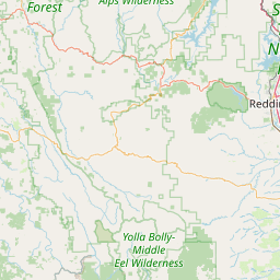

Leaflet | <a href="https://www.openstreetmap.org/copyright">© OpenStreetMap contributors</a>
Item
| Property | Value |
|---|---|
| id | 3325 |
| downstream_mainstem_id | |
| encompassing_mainstem_basins | |
| featuretype | ['https://www.opengis.net/def/schema/hy_features/hyf/HY_FlowPath', 'https://www.opengis.net/def/schema/hy_features/hyf/HY_WaterBody'] |
| fid | 34071 |
| head_2020huc12 | |
| head_nhdpv1_comid | 2766222 |
| head_nhdpv2_comid | https://geoconnex.us/nhdplusv2/comid/2766222 |
| head_nhdpv2huc12 | https://geoconnex.us/nhdplusv2/huc12/180201530202 |
| head_rf1id | 57440 |
| lengthkm | 50.1 |
| name_at_outlet | South Fork Battle Creek |
| name_at_outlet_gnis_id | 234966 |
| new_mainstemid | ['https://geoconnex.us/ref/mainstems/147712'] |
| outlet_2020huc12 | |
| outlet_drainagearea_sqkm | 319.5 |
| outlet_nhdpv1_comid | 2766098 |
| outlet_nhdpv2_comid | https://geoconnex.us/nhdplusv2/comid/2766098 |
| outlet_nhdpv2huc12 | https://geoconnex.us/nhdplusv2/huc12/180201530204 |
| outlet_rf1id | 57440 |
| superseded | True |
| uri | https://geoconnex.us/ref/mainstems/3325 |
Graph Results
| monitoringLocation | https://geoconnex.us/iow/wqp/CEDEN-507BTC269 |
|---|---|
| siteName | CEDEN-507BTC269 |
| datasetDescription | Measured reach length at CEDEN-507BTC269 |
| type | River/Stream |
| url | https://www.waterqualitydata.us/provider/STORET/CEDEN/CEDEN-507BTC269/ |
| variableMeasured | Measured reach length |
| variableUnit | meters |
| measurementTechnique | observation |
| temporalCoverage | 2017-01-01T00:00:00Z/2017-12-31T00:00:00Z |
| distributionName | Water Quality Portal |
| distributionURL | https://www.waterqualitydata.us/data/Result/search?siteid=CEDEN-507BTC269&CharacteristicName=Measured reach length&mimeType=csv |
| distributionFormat | text/comma-separated-values |
| wkt | POINT (-121.638 40.3539) |
| monitoringLocation | https://geoconnex.us/iow/wqp/CEDEN-507BTC269 |
|---|---|
| siteName | CEDEN-507BTC269 |
| datasetDescription | Count at CEDEN-507BTC269 |
| type | River/Stream |
| url | https://www.waterqualitydata.us/provider/STORET/CEDEN/CEDEN-507BTC269/ |
| variableMeasured | Count |
| variableUnit | count (no unit) |
| measurementTechnique | observation |
| temporalCoverage | 2012-01-01T00:00:00Z/2017-12-31T00:00:00Z |
| distributionName | Water Quality Portal |
| distributionURL | https://www.waterqualitydata.us/data/Result/search?siteid=CEDEN-507BTC269&CharacteristicName=Count&mimeType=csv |
| distributionFormat | text/comma-separated-values |
| wkt | POINT (-121.638 40.3539) |
| monitoringLocation | https://geoconnex.us/iow/wqp/CEDEN-507BTC269 |
|---|---|
| siteName | CEDEN-507BTC269 |
| datasetDescription | Embeddedness at CEDEN-507BTC269 |
| type | River/Stream |
| url | https://www.waterqualitydata.us/provider/STORET/CEDEN/CEDEN-507BTC269/ |
| variableMeasured | Embeddedness |
| variableUnit | percent |
| measurementTechnique | observation |
| temporalCoverage | 2017-01-01T00:00:00Z/2017-12-31T00:00:00Z |
| distributionName | Water Quality Portal |
| distributionURL | https://www.waterqualitydata.us/data/Result/search?siteid=CEDEN-507BTC269&CharacteristicName=Embeddedness&mimeType=csv |
| distributionFormat | text/comma-separated-values |
| wkt | POINT (-121.638 40.3539) |
| monitoringLocation | https://geoconnex.us/iow/wqp/CEDEN-507BTC269 |
|---|---|
| siteName | CEDEN-507BTC269 |
| datasetDescription | Stream wetted width at CEDEN-507BTC269 |
| type | River/Stream |
| url | https://www.waterqualitydata.us/provider/STORET/CEDEN/CEDEN-507BTC269/ |
| variableMeasured | Stream wetted width |
| variableUnit | meters |
| measurementTechnique | observation |
| temporalCoverage | 2017-01-01T00:00:00Z/2017-12-31T00:00:00Z |
| distributionName | Water Quality Portal |
| distributionURL | https://www.waterqualitydata.us/data/Result/search?siteid=CEDEN-507BTC269&CharacteristicName=Stream wetted width&mimeType=csv |
| distributionFormat | text/comma-separated-values |
| wkt | POINT (-121.638 40.3539) |
| monitoringLocation | https://geoconnex.us/iow/wqp/CEDEN-507BTC269 |
|---|---|
| siteName | CEDEN-507BTC269 |
| datasetDescription | Chloride at CEDEN-507BTC269 |
| type | River/Stream |
| url | https://www.waterqualitydata.us/provider/STORET/CEDEN/CEDEN-507BTC269/ |
| variableMeasured | Chloride |
| variableUnit | milligrams per liter |
| measurementTechnique | observation |
| temporalCoverage | 2020-01-01T00:00:00Z/2020-12-31T00:00:00Z |
| distributionName | Water Quality Portal |
| distributionURL | https://www.waterqualitydata.us/data/Result/search?siteid=CEDEN-507BTC269&CharacteristicName=Chloride&mimeType=csv |
| distributionFormat | text/comma-separated-values |
| wkt | POINT (-121.638 40.3539) |
| monitoringLocation | https://geoconnex.us/iow/wqp/CEDEN-507BTC269 |
|---|---|
| siteName | CEDEN-507BTC269 |
| datasetDescription | Canopy Cover at CEDEN-507BTC269 |
| type | River/Stream |
| url | https://www.waterqualitydata.us/provider/STORET/CEDEN/CEDEN-507BTC269/ |
| variableMeasured | Canopy Cover |
| variableUnit | count (no unit) |
| measurementTechnique | observation |
| temporalCoverage | 2017-01-01T00:00:00Z/2017-12-31T00:00:00Z |
| distributionName | Water Quality Portal |
| distributionURL | https://www.waterqualitydata.us/data/Result/search?siteid=CEDEN-507BTC269&CharacteristicName=Canopy Cover&mimeType=csv |
| distributionFormat | text/comma-separated-values |
| wkt | POINT (-121.638 40.3539) |
| monitoringLocation | https://geoconnex.us/iow/wqp/CEDEN-507BTC269 |
|---|---|
| siteName | CEDEN-507BTC269 |
| datasetDescription | Nitrate at CEDEN-507BTC269 |
| type | River/Stream |
| url | https://www.waterqualitydata.us/provider/STORET/CEDEN/CEDEN-507BTC269/ |
| variableMeasured | Nitrate |
| variableUnit | milligrams per liter as nitrogen |
| measurementTechnique | observation |
| temporalCoverage | 2020-01-01T00:00:00Z/2020-12-31T00:00:00Z |
| distributionName | Water Quality Portal |
| distributionURL | https://www.waterqualitydata.us/data/Result/search?siteid=CEDEN-507BTC269&CharacteristicName=Nitrate&mimeType=csv |
| distributionFormat | text/comma-separated-values |
| wkt | POINT (-121.638 40.3539) |
| monitoringLocation | https://geoconnex.us/iow/wqp/CEDEN-507BTC269 |
|---|---|
| siteName | CEDEN-507BTC269 |
| datasetDescription | Organic carbon at CEDEN-507BTC269 |
| type | River/Stream |
| url | https://www.waterqualitydata.us/provider/STORET/CEDEN/CEDEN-507BTC269/ |
| variableMeasured | Organic carbon |
| variableUnit | milligrams per liter |
| measurementTechnique | observation |
| temporalCoverage | 2020-01-01T00:00:00Z/2020-12-31T00:00:00Z |
| distributionName | Water Quality Portal |
| distributionURL | https://www.waterqualitydata.us/data/Result/search?siteid=CEDEN-507BTC269&CharacteristicName=Organic carbon&mimeType=csv |
| distributionFormat | text/comma-separated-values |
| wkt | POINT (-121.638 40.3539) |
| monitoringLocation | https://geoconnex.us/iow/wqp/CEDEN-507BTC269 |
|---|---|
| siteName | CEDEN-507BTC269 |
| datasetDescription | Phosphorus at CEDEN-507BTC269 |
| type | River/Stream |
| url | https://www.waterqualitydata.us/provider/STORET/CEDEN/CEDEN-507BTC269/ |
| variableMeasured | Phosphorus |
| variableUnit | parts per billion |
| measurementTechnique | observation |
| temporalCoverage | 2020-01-01T00:00:00Z/2020-12-31T00:00:00Z |
| distributionName | Water Quality Portal |
| distributionURL | https://www.waterqualitydata.us/data/Result/search?siteid=CEDEN-507BTC269&CharacteristicName=Phosphorus&mimeType=csv |
| distributionFormat | text/comma-separated-values |
| wkt | POINT (-121.638 40.3539) |
| monitoringLocation | https://geoconnex.us/iow/wqp/11NPSWRD_WQX-LAVO_USGS_US |
|---|---|
| siteName | 11NPSWRD_WQX-LAVO_USGS_US |
| datasetDescription | Sulfur Sulfate at 11NPSWRD_WQX-LAVO_USGS_US |
| type | Spring |
| url | https://www.waterqualitydata.us/provider/STORET/11NPSWRD_WQX/11NPSWRD_WQX-LAVO_USGS_US/ |
| variableMeasured | Sulfur Sulfate |
| variableUnit | milligrams per liter |
| measurementTechnique | observation |
| temporalCoverage | 1973-01-01T00:00:00Z/1973-12-31T00:00:00Z |
| distributionName | Water Quality Portal |
| distributionURL | https://www.waterqualitydata.us/data/Result/search?siteid=11NPSWRD_WQX-LAVO_USGS_US&CharacteristicName=Sulfur Sulfate&mimeType=csv |
| distributionFormat | text/comma-separated-values |
| wkt | POINT (-121.5783889 40.3534722) |
| monitoringLocation | https://geoconnex.us/iow/wqp/11NPSWRD_WQX-LAVO_USGS_US |
|---|---|
| siteName | 11NPSWRD_WQX-LAVO_USGS_US |
| datasetDescription | Hardness, non-carbonate at 11NPSWRD_WQX-LAVO_USGS_US |
| type | Spring |
| url | https://www.waterqualitydata.us/provider/STORET/11NPSWRD_WQX/11NPSWRD_WQX-LAVO_USGS_US/ |
| variableMeasured | Hardness, non-carbonate |
| variableUnit | milligrams per liter as calcium carbonate |
| measurementTechnique | observation |
| temporalCoverage | 1973-01-01T00:00:00Z/1973-12-31T00:00:00Z |
| distributionName | Water Quality Portal |
| distributionURL | https://www.waterqualitydata.us/data/Result/search?siteid=11NPSWRD_WQX-LAVO_USGS_US&CharacteristicName=Hardness, non-carbonate&mimeType=csv |
| distributionFormat | text/comma-separated-values |
| wkt | POINT (-121.5783889 40.3534722) |
| monitoringLocation | https://geoconnex.us/iow/wqp/11NPSWRD_WQX-LAVO_USGS_US |
|---|---|
| siteName | 11NPSWRD_WQX-LAVO_USGS_US |
| datasetDescription | Hardness, Ca, Mg at 11NPSWRD_WQX-LAVO_USGS_US |
| type | Spring |
| url | https://www.waterqualitydata.us/provider/STORET/11NPSWRD_WQX/11NPSWRD_WQX-LAVO_USGS_US/ |
| variableMeasured | Hardness, Ca, Mg |
| variableUnit | milligrams per liter as calcium carbonate |
| measurementTechnique | observation |
| temporalCoverage | 1973-01-01T00:00:00Z/1973-12-31T00:00:00Z |
| distributionName | Water Quality Portal |
| distributionURL | https://www.waterqualitydata.us/data/Result/search?siteid=11NPSWRD_WQX-LAVO_USGS_US&CharacteristicName=Hardness, Ca, Mg&mimeType=csv |
| distributionFormat | text/comma-separated-values |
| wkt | POINT (-121.5783889 40.3534722) |
| monitoringLocation | https://geoconnex.us/iow/wqp/11NPSWRD_WQX-LAVO_USGS_US |
|---|---|
| siteName | 11NPSWRD_WQX-LAVO_USGS_US |
| datasetDescription | Boron at 11NPSWRD_WQX-LAVO_USGS_US |
| type | Spring |
| url | https://www.waterqualitydata.us/provider/STORET/11NPSWRD_WQX/11NPSWRD_WQX-LAVO_USGS_US/ |
| variableMeasured | Boron |
| variableUnit | Unknown |
| measurementTechnique | observation |
| temporalCoverage | 1973-01-01T00:00:00Z/1973-12-31T00:00:00Z |
| distributionName | Water Quality Portal |
| distributionURL | https://www.waterqualitydata.us/data/Result/search?siteid=11NPSWRD_WQX-LAVO_USGS_US&CharacteristicName=Boron&mimeType=csv |
| distributionFormat | text/comma-separated-values |
| wkt | POINT (-121.5783889 40.3534722) |
| monitoringLocation | https://geoconnex.us/iow/wqp/11NPSWRD_WQX-LAVO_USGS_US |
|---|---|
| siteName | 11NPSWRD_WQX-LAVO_USGS_US |
| datasetDescription | Calcium at 11NPSWRD_WQX-LAVO_USGS_US |
| type | Spring |
| url | https://www.waterqualitydata.us/provider/STORET/11NPSWRD_WQX/11NPSWRD_WQX-LAVO_USGS_US/ |
| variableMeasured | Calcium |
| variableUnit | milligrams per liter |
| measurementTechnique | observation |
| temporalCoverage | 1973-01-01T00:00:00Z/1973-12-31T00:00:00Z |
| distributionName | Water Quality Portal |
| distributionURL | https://www.waterqualitydata.us/data/Result/search?siteid=11NPSWRD_WQX-LAVO_USGS_US&CharacteristicName=Calcium&mimeType=csv |
| distributionFormat | text/comma-separated-values |
| wkt | POINT (-121.5783889 40.3534722) |
| monitoringLocation | https://geoconnex.us/iow/wqp/11NPSWRD_WQX-LAVO_USGS_US |
|---|---|
| siteName | 11NPSWRD_WQX-LAVO_USGS_US |
| datasetDescription | Specific conductance at 11NPSWRD_WQX-LAVO_USGS_US |
| type | Spring |
| url | https://www.waterqualitydata.us/provider/STORET/11NPSWRD_WQX/11NPSWRD_WQX-LAVO_USGS_US/ |
| variableMeasured | Specific conductance |
| variableUnit | microsiemens per centimeter |
| measurementTechnique | observation |
| temporalCoverage | 1973-01-01T00:00:00Z/1973-12-31T00:00:00Z |
| distributionName | Water Quality Portal |
| distributionURL | https://www.waterqualitydata.us/data/Result/search?siteid=11NPSWRD_WQX-LAVO_USGS_US&CharacteristicName=Specific conductance&mimeType=csv |
| distributionFormat | text/comma-separated-values |
| wkt | POINT (-121.5783889 40.3534722) |
| monitoringLocation | https://geoconnex.us/iow/wqp/11NPSWRD_WQX-LAVO_USGS_US |
|---|---|
| siteName | 11NPSWRD_WQX-LAVO_USGS_US |
| datasetDescription | Temperature, water at 11NPSWRD_WQX-LAVO_USGS_US |
| type | Spring |
| url | https://www.waterqualitydata.us/provider/STORET/11NPSWRD_WQX/11NPSWRD_WQX-LAVO_USGS_US/ |
| variableMeasured | Temperature, water |
| variableUnit | degrees Celsius |
| measurementTechnique | observation |
| temporalCoverage | 1973-01-01T00:00:00Z/1973-12-31T00:00:00Z |
| distributionName | Water Quality Portal |
| distributionURL | https://www.waterqualitydata.us/data/Result/search?siteid=11NPSWRD_WQX-LAVO_USGS_US&CharacteristicName=Temperature, water&mimeType=csv |
| distributionFormat | text/comma-separated-values |
| wkt | POINT (-121.5783889 40.3534722) |
| monitoringLocation | https://geoconnex.us/iow/wqp/11NPSWRD_WQX-LAVO_USGS_US |
|---|---|
| siteName | 11NPSWRD_WQX-LAVO_USGS_US |
| datasetDescription | Silica at 11NPSWRD_WQX-LAVO_USGS_US |
| type | Spring |
| url | https://www.waterqualitydata.us/provider/STORET/11NPSWRD_WQX/11NPSWRD_WQX-LAVO_USGS_US/ |
| variableMeasured | Silica |
| variableUnit | milligrams per liter |
| measurementTechnique | observation |
| temporalCoverage | 1973-01-01T00:00:00Z/1973-12-31T00:00:00Z |
| distributionName | Water Quality Portal |
| distributionURL | https://www.waterqualitydata.us/data/Result/search?siteid=11NPSWRD_WQX-LAVO_USGS_US&CharacteristicName=Silica&mimeType=csv |
| distributionFormat | text/comma-separated-values |
| wkt | POINT (-121.5783889 40.3534722) |
| monitoringLocation | https://geoconnex.us/iow/wqp/11NPSWRD_WQX-LAVO_USGS_US |
|---|---|
| siteName | 11NPSWRD_WQX-LAVO_USGS_US |
| datasetDescription | Total dissolved solids at 11NPSWRD_WQX-LAVO_USGS_US |
| type | Spring |
| url | https://www.waterqualitydata.us/provider/STORET/11NPSWRD_WQX/11NPSWRD_WQX-LAVO_USGS_US/ |
| variableMeasured | Total dissolved solids |
| variableUnit | milligrams per liter |
| measurementTechnique | observation |
| temporalCoverage | 1973-01-01T00:00:00Z/1973-12-31T00:00:00Z |
| distributionName | Water Quality Portal |
| distributionURL | https://www.waterqualitydata.us/data/Result/search?siteid=11NPSWRD_WQX-LAVO_USGS_US&CharacteristicName=Total dissolved solids&mimeType=csv |
| distributionFormat | text/comma-separated-values |
| wkt | POINT (-121.5783889 40.3534722) |
| monitoringLocation | https://geoconnex.us/iow/wqp/11NPSWRD_WQX-LAVO_USGS_US |
|---|---|
| siteName | 11NPSWRD_WQX-LAVO_USGS_US |
| datasetDescription | Sodium at 11NPSWRD_WQX-LAVO_USGS_US |
| type | Spring |
| url | https://www.waterqualitydata.us/provider/STORET/11NPSWRD_WQX/11NPSWRD_WQX-LAVO_USGS_US/ |
| variableMeasured | Sodium |
| variableUnit | milligrams per liter |
| measurementTechnique | observation |
| temporalCoverage | 1973-01-01T00:00:00Z/1973-12-31T00:00:00Z |
| distributionName | Water Quality Portal |
| distributionURL | https://www.waterqualitydata.us/data/Result/search?siteid=11NPSWRD_WQX-LAVO_USGS_US&CharacteristicName=Sodium&mimeType=csv |
| distributionFormat | text/comma-separated-values |
| wkt | POINT (-121.5783889 40.3534722) |
| monitoringLocation | https://geoconnex.us/iow/wqp/11NPSWRD_WQX-LAVO_USGS_US |
|---|---|
| siteName | 11NPSWRD_WQX-LAVO_USGS_US |
| datasetDescription | Potassium at 11NPSWRD_WQX-LAVO_USGS_US |
| type | Spring |
| url | https://www.waterqualitydata.us/provider/STORET/11NPSWRD_WQX/11NPSWRD_WQX-LAVO_USGS_US/ |
| variableMeasured | Potassium |
| variableUnit | milligrams per liter |
| measurementTechnique | observation |
| temporalCoverage | 1973-01-01T00:00:00Z/1973-12-31T00:00:00Z |
| distributionName | Water Quality Portal |
| distributionURL | https://www.waterqualitydata.us/data/Result/search?siteid=11NPSWRD_WQX-LAVO_USGS_US&CharacteristicName=Potassium&mimeType=csv |
| distributionFormat | text/comma-separated-values |
| wkt | POINT (-121.5783889 40.3534722) |
| monitoringLocation | https://geoconnex.us/iow/wqp/11NPSWRD_WQX-LAVO_USGS_US |
|---|---|
| siteName | 11NPSWRD_WQX-LAVO_USGS_US |
| datasetDescription | Iron at 11NPSWRD_WQX-LAVO_USGS_US |
| type | Spring |
| url | https://www.waterqualitydata.us/provider/STORET/11NPSWRD_WQX/11NPSWRD_WQX-LAVO_USGS_US/ |
| variableMeasured | Iron |
| variableUnit | percent |
| measurementTechnique | observation |
| temporalCoverage | 1973-01-01T00:00:00Z/1973-12-31T00:00:00Z |
| distributionName | Water Quality Portal |
| distributionURL | https://www.waterqualitydata.us/data/Result/search?siteid=11NPSWRD_WQX-LAVO_USGS_US&CharacteristicName=Iron&mimeType=csv |
| distributionFormat | text/comma-separated-values |
| wkt | POINT (-121.5783889 40.3534722) |
| monitoringLocation | https://geoconnex.us/iow/wqp/11NPSWRD_WQX-LAVO_USGS_US |
|---|---|
| siteName | 11NPSWRD_WQX-LAVO_USGS_US |
| datasetDescription | Magnesium at 11NPSWRD_WQX-LAVO_USGS_US |
| type | Spring |
| url | https://www.waterqualitydata.us/provider/STORET/11NPSWRD_WQX/11NPSWRD_WQX-LAVO_USGS_US/ |
| variableMeasured | Magnesium |
| variableUnit | percent |
| measurementTechnique | observation |
| temporalCoverage | 1973-01-01T00:00:00Z/1973-12-31T00:00:00Z |
| distributionName | Water Quality Portal |
| distributionURL | https://www.waterqualitydata.us/data/Result/search?siteid=11NPSWRD_WQX-LAVO_USGS_US&CharacteristicName=Magnesium&mimeType=csv |
| distributionFormat | text/comma-separated-values |
| wkt | POINT (-121.5783889 40.3534722) |
| monitoringLocation | https://geoconnex.us/iow/wqp/11NPSWRD_WQX-LAVO_USGS_US |
|---|---|
| siteName | 11NPSWRD_WQX-LAVO_USGS_US |
| datasetDescription | Fluoride at 11NPSWRD_WQX-LAVO_USGS_US |
| type | Spring |
| url | https://www.waterqualitydata.us/provider/STORET/11NPSWRD_WQX/11NPSWRD_WQX-LAVO_USGS_US/ |
| variableMeasured | Fluoride |
| variableUnit | milligrams per liter |
| measurementTechnique | observation |
| temporalCoverage | 1973-01-01T00:00:00Z/1973-12-31T00:00:00Z |
| distributionName | Water Quality Portal |
| distributionURL | https://www.waterqualitydata.us/data/Result/search?siteid=11NPSWRD_WQX-LAVO_USGS_US&CharacteristicName=Fluoride&mimeType=csv |
| distributionFormat | text/comma-separated-values |
| wkt | POINT (-121.5783889 40.3534722) |
| monitoringLocation | https://geoconnex.us/iow/wqp/11NPSWRD_WQX-LAVO_USGS_US |
|---|---|
| siteName | 11NPSWRD_WQX-LAVO_USGS_US |
| datasetDescription | Chloride at 11NPSWRD_WQX-LAVO_USGS_US |
| type | Spring |
| url | https://www.waterqualitydata.us/provider/STORET/11NPSWRD_WQX/11NPSWRD_WQX-LAVO_USGS_US/ |
| variableMeasured | Chloride |
| variableUnit | milligrams per liter |
| measurementTechnique | observation |
| temporalCoverage | 1973-01-01T00:00:00Z/1973-12-31T00:00:00Z |
| distributionName | Water Quality Portal |
| distributionURL | https://www.waterqualitydata.us/data/Result/search?siteid=11NPSWRD_WQX-LAVO_USGS_US&CharacteristicName=Chloride&mimeType=csv |
| distributionFormat | text/comma-separated-values |
| wkt | POINT (-121.5783889 40.3534722) |
| monitoringLocation | https://geoconnex.us/iow/wqp/11NPSWRD_WQX-LAVO_USGS_US |
|---|---|
| siteName | 11NPSWRD_WQX-LAVO_USGS_US |
| datasetDescription | Alkalinity, total at 11NPSWRD_WQX-LAVO_USGS_US |
| type | Spring |
| url | https://www.waterqualitydata.us/provider/STORET/11NPSWRD_WQX/11NPSWRD_WQX-LAVO_USGS_US/ |
| variableMeasured | Alkalinity, total |
| variableUnit | milligrams per liter |
| measurementTechnique | observation |
| temporalCoverage | 1973-01-01T00:00:00Z/1973-12-31T00:00:00Z |
| distributionName | Water Quality Portal |
| distributionURL | https://www.waterqualitydata.us/data/Result/search?siteid=11NPSWRD_WQX-LAVO_USGS_US&CharacteristicName=Alkalinity, total&mimeType=csv |
| distributionFormat | text/comma-separated-values |
| wkt | POINT (-121.5783889 40.3534722) |
| monitoringLocation | https://geoconnex.us/iow/wqp/11NPSWRD_WQX-LAVO_USGS_US |
|---|---|
| siteName | 11NPSWRD_WQX-LAVO_USGS_US |
| datasetDescription | Carbonate at 11NPSWRD_WQX-LAVO_USGS_US |
| type | Spring |
| url | https://www.waterqualitydata.us/provider/STORET/11NPSWRD_WQX/11NPSWRD_WQX-LAVO_USGS_US/ |
| variableMeasured | Carbonate |
| variableUnit | milligrams per liter |
| measurementTechnique | observation |
| temporalCoverage | 1973-01-01T00:00:00Z/1973-12-31T00:00:00Z |
| distributionName | Water Quality Portal |
| distributionURL | https://www.waterqualitydata.us/data/Result/search?siteid=11NPSWRD_WQX-LAVO_USGS_US&CharacteristicName=Carbonate&mimeType=csv |
| distributionFormat | text/comma-separated-values |
| wkt | POINT (-121.5783889 40.3534722) |
| monitoringLocation | https://geoconnex.us/iow/wqp/11NPSWRD_WQX-LAVO_USGS_US |
|---|---|
| siteName | 11NPSWRD_WQX-LAVO_USGS_US |
| datasetDescription | pH at 11NPSWRD_WQX-LAVO_USGS_US |
| type | Spring |
| url | https://www.waterqualitydata.us/provider/STORET/11NPSWRD_WQX/11NPSWRD_WQX-LAVO_USGS_US/ |
| variableMeasured | pH |
| variableUnit | Unknown |
| measurementTechnique | observation |
| temporalCoverage | 1973-01-01T00:00:00Z/1973-12-31T00:00:00Z |
| distributionName | Water Quality Portal |
| distributionURL | https://www.waterqualitydata.us/data/Result/search?siteid=11NPSWRD_WQX-LAVO_USGS_US&CharacteristicName=pH&mimeType=csv |
| distributionFormat | text/comma-separated-values |
| wkt | POINT (-121.5783889 40.3534722) |
| monitoringLocation | https://geoconnex.us/iow/wqp/11NPSWRD_WQX-LAVO_USGS_US |
|---|---|
| siteName | 11NPSWRD_WQX-LAVO_USGS_US |
| datasetDescription | Alkalinity, bicarbonate at 11NPSWRD_WQX-LAVO_USGS_US |
| type | Spring |
| url | https://www.waterqualitydata.us/provider/STORET/11NPSWRD_WQX/11NPSWRD_WQX-LAVO_USGS_US/ |
| variableMeasured | Alkalinity, bicarbonate |
| variableUnit | milligrams per liter |
| measurementTechnique | observation |
| temporalCoverage | 1973-01-01T00:00:00Z/1973-12-31T00:00:00Z |
| distributionName | Water Quality Portal |
| distributionURL | https://www.waterqualitydata.us/data/Result/search?siteid=11NPSWRD_WQX-LAVO_USGS_US&CharacteristicName=Alkalinity, bicarbonate&mimeType=csv |
| distributionFormat | text/comma-separated-values |
| wkt | POINT (-121.5783889 40.3534722) |
| monitoringLocation | https://geoconnex.us/iow/wqp/CEDEN-507PS0122 |
|---|---|
| siteName | CEDEN-507PS0122 |
| datasetDescription | Phosphorus at CEDEN-507PS0122 |
| type | River/Stream |
| url | https://www.waterqualitydata.us/provider/STORET/CEDEN/CEDEN-507PS0122/ |
| variableMeasured | Phosphorus |
| variableUnit | parts per billion |
| measurementTechnique | observation |
| temporalCoverage | 2009-01-01T00:00:00Z/2009-12-31T00:00:00Z |
| distributionName | Water Quality Portal |
| distributionURL | https://www.waterqualitydata.us/data/Result/search?siteid=CEDEN-507PS0122&CharacteristicName=Phosphorus&mimeType=csv |
| distributionFormat | text/comma-separated-values |
| wkt | POINT (-121.936 40.3946) |
| monitoringLocation | https://geoconnex.us/iow/wqp/CEDEN-507PS0122 |
|---|---|
| siteName | CEDEN-507PS0122 |
| datasetDescription | Nitrogen at CEDEN-507PS0122 |
| type | River/Stream |
| url | https://www.waterqualitydata.us/provider/STORET/CEDEN/CEDEN-507PS0122/ |
| variableMeasured | Nitrogen |
| variableUnit | milligrams per liter |
| measurementTechnique | observation |
| temporalCoverage | 2009-01-01T00:00:00Z/2009-12-31T00:00:00Z |
| distributionName | Water Quality Portal |
| distributionURL | https://www.waterqualitydata.us/data/Result/search?siteid=CEDEN-507PS0122&CharacteristicName=Nitrogen&mimeType=csv |
| distributionFormat | text/comma-separated-values |
| wkt | POINT (-121.936 40.3946) |
| monitoringLocation | https://geoconnex.us/iow/wqp/CEDEN-507PS0122 |
|---|---|
| siteName | CEDEN-507PS0122 |
| datasetDescription | Organic carbon at CEDEN-507PS0122 |
| type | River/Stream |
| url | https://www.waterqualitydata.us/provider/STORET/CEDEN/CEDEN-507PS0122/ |
| variableMeasured | Organic carbon |
| variableUnit | milligrams per liter |
| measurementTechnique | observation |
| temporalCoverage | 2009-01-01T00:00:00Z/2009-12-31T00:00:00Z |
| distributionName | Water Quality Portal |
| distributionURL | https://www.waterqualitydata.us/data/Result/search?siteid=CEDEN-507PS0122&CharacteristicName=Organic carbon&mimeType=csv |
| distributionFormat | text/comma-separated-values |
| wkt | POINT (-121.936 40.3946) |
| monitoringLocation | https://geoconnex.us/iow/wqp/CEDEN-507PS0122 |
|---|---|
| siteName | CEDEN-507PS0122 |
| datasetDescription | Measured reach length at CEDEN-507PS0122 |
| type | River/Stream |
| url | https://www.waterqualitydata.us/provider/STORET/CEDEN/CEDEN-507PS0122/ |
| variableMeasured | Measured reach length |
| variableUnit | meters |
| measurementTechnique | observation |
| temporalCoverage | 2009-01-01T00:00:00Z/2009-12-31T00:00:00Z |
| distributionName | Water Quality Portal |
| distributionURL | https://www.waterqualitydata.us/data/Result/search?siteid=CEDEN-507PS0122&CharacteristicName=Measured reach length&mimeType=csv |
| distributionFormat | text/comma-separated-values |
| wkt | POINT (-121.936 40.3946) |
| monitoringLocation | https://geoconnex.us/iow/wqp/CEDEN-507PS0122 |
|---|---|
| siteName | CEDEN-507PS0122 |
| datasetDescription | Embeddedness at CEDEN-507PS0122 |
| type | River/Stream |
| url | https://www.waterqualitydata.us/provider/STORET/CEDEN/CEDEN-507PS0122/ |
| variableMeasured | Embeddedness |
| variableUnit | percent |
| measurementTechnique | observation |
| temporalCoverage | 2009-01-01T00:00:00Z/2009-12-31T00:00:00Z |
| distributionName | Water Quality Portal |
| distributionURL | https://www.waterqualitydata.us/data/Result/search?siteid=CEDEN-507PS0122&CharacteristicName=Embeddedness&mimeType=csv |
| distributionFormat | text/comma-separated-values |
| wkt | POINT (-121.936 40.3946) |
| monitoringLocation | https://geoconnex.us/iow/wqp/CEDEN-507PS0122 |
|---|---|
| siteName | CEDEN-507PS0122 |
| datasetDescription | Sulfate at CEDEN-507PS0122 |
| type | River/Stream |
| url | https://www.waterqualitydata.us/provider/STORET/CEDEN/CEDEN-507PS0122/ |
| variableMeasured | Sulfate |
| variableUnit | milligrams per liter |
| measurementTechnique | observation |
| temporalCoverage | 2009-01-01T00:00:00Z/2009-12-31T00:00:00Z |
| distributionName | Water Quality Portal |
| distributionURL | https://www.waterqualitydata.us/data/Result/search?siteid=CEDEN-507PS0122&CharacteristicName=Sulfate&mimeType=csv |
| distributionFormat | text/comma-separated-values |
| wkt | POINT (-121.936 40.3946) |
| monitoringLocation | https://geoconnex.us/iow/wqp/CEDEN-507PS0122 |
|---|---|
| siteName | CEDEN-507PS0122 |
| datasetDescription | Chloride at CEDEN-507PS0122 |
| type | River/Stream |
| url | https://www.waterqualitydata.us/provider/STORET/CEDEN/CEDEN-507PS0122/ |
| variableMeasured | Chloride |
| variableUnit | milligrams per liter |
| measurementTechnique | observation |
| temporalCoverage | 2009-01-01T00:00:00Z/2009-12-31T00:00:00Z |
| distributionName | Water Quality Portal |
| distributionURL | https://www.waterqualitydata.us/data/Result/search?siteid=CEDEN-507PS0122&CharacteristicName=Chloride&mimeType=csv |
| distributionFormat | text/comma-separated-values |
| wkt | POINT (-121.936 40.3946) |
| monitoringLocation | https://geoconnex.us/iow/wqp/CEDEN-507PS0122 |
|---|---|
| siteName | CEDEN-507PS0122 |
| datasetDescription | Total suspended solids at CEDEN-507PS0122 |
| type | River/Stream |
| url | https://www.waterqualitydata.us/provider/STORET/CEDEN/CEDEN-507PS0122/ |
| variableMeasured | Total suspended solids |
| variableUnit | milligrams per liter |
| measurementTechnique | observation |
| temporalCoverage | 2009-01-01T00:00:00Z/2009-12-31T00:00:00Z |
| distributionName | Water Quality Portal |
| distributionURL | https://www.waterqualitydata.us/data/Result/search?siteid=CEDEN-507PS0122&CharacteristicName=Total suspended solids&mimeType=csv |
| distributionFormat | text/comma-separated-values |
| wkt | POINT (-121.936 40.3946) |
| monitoringLocation | https://geoconnex.us/iow/wqp/CEDEN-507PS0122 |
|---|---|
| siteName | CEDEN-507PS0122 |
| datasetDescription | Count at CEDEN-507PS0122 |
| type | River/Stream |
| url | https://www.waterqualitydata.us/provider/STORET/CEDEN/CEDEN-507PS0122/ |
| variableMeasured | Count |
| variableUnit | count (no unit) |
| measurementTechnique | observation |
| temporalCoverage | 2009-01-01T00:00:00Z/2009-12-31T00:00:00Z |
| distributionName | Water Quality Portal |
| distributionURL | https://www.waterqualitydata.us/data/Result/search?siteid=CEDEN-507PS0122&CharacteristicName=Count&mimeType=csv |
| distributionFormat | text/comma-separated-values |
| wkt | POINT (-121.936 40.3946) |
| monitoringLocation | https://geoconnex.us/iow/wqp/CEDEN-507PS0122 |
|---|---|
| siteName | CEDEN-507PS0122 |
| datasetDescription | Stream wetted width at CEDEN-507PS0122 |
| type | River/Stream |
| url | https://www.waterqualitydata.us/provider/STORET/CEDEN/CEDEN-507PS0122/ |
| variableMeasured | Stream wetted width |
| variableUnit | meters |
| measurementTechnique | observation |
| temporalCoverage | 2009-01-01T00:00:00Z/2009-12-31T00:00:00Z |
| distributionName | Water Quality Portal |
| distributionURL | https://www.waterqualitydata.us/data/Result/search?siteid=CEDEN-507PS0122&CharacteristicName=Stream wetted width&mimeType=csv |
| distributionFormat | text/comma-separated-values |
| wkt | POINT (-121.936 40.3946) |
| monitoringLocation | https://geoconnex.us/iow/wqp/CALWR_WQX-A4771001 |
|---|---|
| siteName | CALWR_WQX-A4771001 |
| datasetDescription | Magnesium at CALWR_WQX-A4771001 |
| type | Other-Surface Water |
| url | https://www.waterqualitydata.us/provider/STORET/CALWR_WQX/CALWR_WQX-A4771001/ |
| variableMeasured | Magnesium |
| variableUnit | percent |
| measurementTechnique | observation |
| temporalCoverage | 2005-01-01T00:00:00Z/2005-12-31T00:00:00Z |
| distributionName | Water Quality Portal |
| distributionURL | https://www.waterqualitydata.us/data/Result/search?siteid=CALWR_WQX-A4771001&CharacteristicName=Magnesium&mimeType=csv |
| distributionFormat | text/comma-separated-values |
| wkt | POINT (-121.9623 40.4008) |
| monitoringLocation | https://geoconnex.us/iow/wqp/CALWR_WQX-A4771001 |
|---|---|
| siteName | CALWR_WQX-A4771001 |
| datasetDescription | Boron at CALWR_WQX-A4771001 |
| type | Other-Surface Water |
| url | https://www.waterqualitydata.us/provider/STORET/CALWR_WQX/CALWR_WQX-A4771001/ |
| variableMeasured | Boron |
| variableUnit | Unknown |
| measurementTechnique | observation |
| temporalCoverage | 2005-01-01T00:00:00Z/2005-12-31T00:00:00Z |
| distributionName | Water Quality Portal |
| distributionURL | https://www.waterqualitydata.us/data/Result/search?siteid=CALWR_WQX-A4771001&CharacteristicName=Boron&mimeType=csv |
| distributionFormat | text/comma-separated-values |
| wkt | POINT (-121.9623 40.4008) |
| monitoringLocation | https://geoconnex.us/iow/wqp/CALWR_WQX-A4771001 |
|---|---|
| siteName | CALWR_WQX-A4771001 |
| datasetDescription | Calcium at CALWR_WQX-A4771001 |
| type | Other-Surface Water |
| url | https://www.waterqualitydata.us/provider/STORET/CALWR_WQX/CALWR_WQX-A4771001/ |
| variableMeasured | Calcium |
| variableUnit | milligrams per liter |
| measurementTechnique | observation |
| temporalCoverage | 2005-01-01T00:00:00Z/2005-12-31T00:00:00Z |
| distributionName | Water Quality Portal |
| distributionURL | https://www.waterqualitydata.us/data/Result/search?siteid=CALWR_WQX-A4771001&CharacteristicName=Calcium&mimeType=csv |
| distributionFormat | text/comma-separated-values |
| wkt | POINT (-121.9623 40.4008) |
| monitoringLocation | https://geoconnex.us/iow/wqp/CALWR_WQX-A4771001 |
|---|---|
| siteName | CALWR_WQX-A4771001 |
| datasetDescription | Temperature, water at CALWR_WQX-A4771001 |
| type | Other-Surface Water |
| url | https://www.waterqualitydata.us/provider/STORET/CALWR_WQX/CALWR_WQX-A4771001/ |
| variableMeasured | Temperature, water |
| variableUnit | degrees Celsius |
| measurementTechnique | observation |
| temporalCoverage | 2005-01-01T00:00:00Z/2005-12-31T00:00:00Z |
| distributionName | Water Quality Portal |
| distributionURL | https://www.waterqualitydata.us/data/Result/search?siteid=CALWR_WQX-A4771001&CharacteristicName=Temperature, water&mimeType=csv |
| distributionFormat | text/comma-separated-values |
| wkt | POINT (-121.9623 40.4008) |
| monitoringLocation | https://geoconnex.us/iow/wqp/CALWR_WQX-A4771001 |
|---|---|
| siteName | CALWR_WQX-A4771001 |
| datasetDescription | Total dissolved solids at CALWR_WQX-A4771001 |
| type | Other-Surface Water |
| url | https://www.waterqualitydata.us/provider/STORET/CALWR_WQX/CALWR_WQX-A4771001/ |
| variableMeasured | Total dissolved solids |
| variableUnit | milligrams per liter |
| measurementTechnique | observation |
| temporalCoverage | 2005-01-01T00:00:00Z/2005-12-31T00:00:00Z |
| distributionName | Water Quality Portal |
| distributionURL | https://www.waterqualitydata.us/data/Result/search?siteid=CALWR_WQX-A4771001&CharacteristicName=Total dissolved solids&mimeType=csv |
| distributionFormat | text/comma-separated-values |
| wkt | POINT (-121.9623 40.4008) |
| monitoringLocation | https://geoconnex.us/iow/wqp/CALWR_WQX-A4771001 |
|---|---|
| siteName | CALWR_WQX-A4771001 |
| datasetDescription | Sulfate at CALWR_WQX-A4771001 |
| type | Other-Surface Water |
| url | https://www.waterqualitydata.us/provider/STORET/CALWR_WQX/CALWR_WQX-A4771001/ |
| variableMeasured | Sulfate |
| variableUnit | milligrams per liter |
| measurementTechnique | observation |
| temporalCoverage | 2005-01-01T00:00:00Z/2005-12-31T00:00:00Z |
| distributionName | Water Quality Portal |
| distributionURL | https://www.waterqualitydata.us/data/Result/search?siteid=CALWR_WQX-A4771001&CharacteristicName=Sulfate&mimeType=csv |
| distributionFormat | text/comma-separated-values |
| wkt | POINT (-121.9623 40.4008) |
| monitoringLocation | https://geoconnex.us/iow/wqp/CALWR_WQX-A4771001 |
|---|---|
| siteName | CALWR_WQX-A4771001 |
| datasetDescription | Hardness, carbonate at CALWR_WQX-A4771001 |
| type | Other-Surface Water |
| url | https://www.waterqualitydata.us/provider/STORET/CALWR_WQX/CALWR_WQX-A4771001/ |
| variableMeasured | Hardness, carbonate |
| variableUnit | milligrams per liter |
| measurementTechnique | observation |
| temporalCoverage | 2005-01-01T00:00:00Z/2005-12-31T00:00:00Z |
| distributionName | Water Quality Portal |
| distributionURL | https://www.waterqualitydata.us/data/Result/search?siteid=CALWR_WQX-A4771001&CharacteristicName=Hardness, carbonate&mimeType=csv |
| distributionFormat | text/comma-separated-values |
| wkt | POINT (-121.9623 40.4008) |
| monitoringLocation | https://geoconnex.us/iow/wqp/CALWR_WQX-A4771001 |
|---|---|
| siteName | CALWR_WQX-A4771001 |
| datasetDescription | pH at CALWR_WQX-A4771001 |
| type | Other-Surface Water |
| url | https://www.waterqualitydata.us/provider/STORET/CALWR_WQX/CALWR_WQX-A4771001/ |
| variableMeasured | pH |
| variableUnit | Unknown |
| measurementTechnique | observation |
| temporalCoverage | 2005-01-01T00:00:00Z/2005-12-31T00:00:00Z |
| distributionName | Water Quality Portal |
| distributionURL | https://www.waterqualitydata.us/data/Result/search?siteid=CALWR_WQX-A4771001&CharacteristicName=pH&mimeType=csv |
| distributionFormat | text/comma-separated-values |
| wkt | POINT (-121.9623 40.4008) |
| monitoringLocation | https://geoconnex.us/iow/wqp/CALWR_WQX-A4771001 |
|---|---|
| siteName | CALWR_WQX-A4771001 |
| datasetDescription | Chloride at CALWR_WQX-A4771001 |
| type | Other-Surface Water |
| url | https://www.waterqualitydata.us/provider/STORET/CALWR_WQX/CALWR_WQX-A4771001/ |
| variableMeasured | Chloride |
| variableUnit | milligrams per liter |
| measurementTechnique | observation |
| temporalCoverage | 2005-01-01T00:00:00Z/2005-12-31T00:00:00Z |
| distributionName | Water Quality Portal |
| distributionURL | https://www.waterqualitydata.us/data/Result/search?siteid=CALWR_WQX-A4771001&CharacteristicName=Chloride&mimeType=csv |
| distributionFormat | text/comma-separated-values |
| wkt | POINT (-121.9623 40.4008) |
| monitoringLocation | https://geoconnex.us/iow/wqp/CALWR_WQX-A4771001 |
|---|---|
| siteName | CALWR_WQX-A4771001 |
| datasetDescription | Sodium at CALWR_WQX-A4771001 |
| type | Other-Surface Water |
| url | https://www.waterqualitydata.us/provider/STORET/CALWR_WQX/CALWR_WQX-A4771001/ |
| variableMeasured | Sodium |
| variableUnit | milligrams per liter |
| measurementTechnique | observation |
| temporalCoverage | 2005-01-01T00:00:00Z/2005-12-31T00:00:00Z |
| distributionName | Water Quality Portal |
| distributionURL | https://www.waterqualitydata.us/data/Result/search?siteid=CALWR_WQX-A4771001&CharacteristicName=Sodium&mimeType=csv |
| distributionFormat | text/comma-separated-values |
| wkt | POINT (-121.9623 40.4008) |
| monitoringLocation | https://geoconnex.us/iow/wqp/CALWR_WQX-A4771001 |
|---|---|
| siteName | CALWR_WQX-A4771001 |
| datasetDescription | Potassium at CALWR_WQX-A4771001 |
| type | Other-Surface Water |
| url | https://www.waterqualitydata.us/provider/STORET/CALWR_WQX/CALWR_WQX-A4771001/ |
| variableMeasured | Potassium |
| variableUnit | milligrams per liter |
| measurementTechnique | observation |
| temporalCoverage | 2005-01-01T00:00:00Z/2005-12-31T00:00:00Z |
| distributionName | Water Quality Portal |
| distributionURL | https://www.waterqualitydata.us/data/Result/search?siteid=CALWR_WQX-A4771001&CharacteristicName=Potassium&mimeType=csv |
| distributionFormat | text/comma-separated-values |
| wkt | POINT (-121.9623 40.4008) |
| monitoringLocation | https://geoconnex.us/iow/wqp/CALWR_WQX-A4771001 |
|---|---|
| siteName | CALWR_WQX-A4771001 |
| datasetDescription | Specific conductance at CALWR_WQX-A4771001 |
| type | Other-Surface Water |
| url | https://www.waterqualitydata.us/provider/STORET/CALWR_WQX/CALWR_WQX-A4771001/ |
| variableMeasured | Specific conductance |
| variableUnit | microsiemens per centimeter |
| measurementTechnique | observation |
| temporalCoverage | 2005-01-01T00:00:00Z/2005-12-31T00:00:00Z |
| distributionName | Water Quality Portal |
| distributionURL | https://www.waterqualitydata.us/data/Result/search?siteid=CALWR_WQX-A4771001&CharacteristicName=Specific conductance&mimeType=csv |
| distributionFormat | text/comma-separated-values |
| wkt | POINT (-121.9623 40.4008) |
| monitoringLocation | https://geoconnex.us/iow/wqp/CALWR_WQX-A4730000 |
|---|---|
| siteName | CALWR_WQX-A4730000 |
| datasetDescription | Oxygen at CALWR_WQX-A4730000 |
| type | Other-Surface Water |
| url | https://www.waterqualitydata.us/provider/STORET/CALWR_WQX/CALWR_WQX-A4730000/ |
| variableMeasured | Oxygen |
| variableUnit | milligrams per liter |
| measurementTechnique | observation |
| temporalCoverage | 2014-01-01T00:00:00Z/2015-12-31T00:00:00Z |
| distributionName | Water Quality Portal |
| distributionURL | https://www.waterqualitydata.us/data/Result/search?siteid=CALWR_WQX-A4730000&CharacteristicName=Oxygen&mimeType=csv |
| distributionFormat | text/comma-separated-values |
| wkt | POINT (-121.6647 40.3513) |
| monitoringLocation | https://geoconnex.us/iow/wqp/CALWR_WQX-A4730000 |
|---|---|
| siteName | CALWR_WQX-A4730000 |
| datasetDescription | Iron at CALWR_WQX-A4730000 |
| type | Other-Surface Water |
| url | https://www.waterqualitydata.us/provider/STORET/CALWR_WQX/CALWR_WQX-A4730000/ |
| variableMeasured | Iron |
| variableUnit | percent |
| measurementTechnique | observation |
| temporalCoverage | 2014-01-01T00:00:00Z/2015-12-31T00:00:00Z |
| distributionName | Water Quality Portal |
| distributionURL | https://www.waterqualitydata.us/data/Result/search?siteid=CALWR_WQX-A4730000&CharacteristicName=Iron&mimeType=csv |
| distributionFormat | text/comma-separated-values |
| wkt | POINT (-121.6647 40.3513) |
| monitoringLocation | https://geoconnex.us/iow/wqp/CALWR_WQX-A4730000 |
|---|---|
| siteName | CALWR_WQX-A4730000 |
| datasetDescription | Sodium at CALWR_WQX-A4730000 |
| type | Other-Surface Water |
| url | https://www.waterqualitydata.us/provider/STORET/CALWR_WQX/CALWR_WQX-A4730000/ |
| variableMeasured | Sodium |
| variableUnit | milligrams per liter |
| measurementTechnique | observation |
| temporalCoverage | 2014-01-01T00:00:00Z/2015-12-31T00:00:00Z |
| distributionName | Water Quality Portal |
| distributionURL | https://www.waterqualitydata.us/data/Result/search?siteid=CALWR_WQX-A4730000&CharacteristicName=Sodium&mimeType=csv |
| distributionFormat | text/comma-separated-values |
| wkt | POINT (-121.6647 40.3513) |
| monitoringLocation | https://geoconnex.us/iow/wqp/CALWR_WQX-A4730000 |
|---|---|
| siteName | CALWR_WQX-A4730000 |
| datasetDescription | Magnesium at CALWR_WQX-A4730000 |
| type | Other-Surface Water |
| url | https://www.waterqualitydata.us/provider/STORET/CALWR_WQX/CALWR_WQX-A4730000/ |
| variableMeasured | Magnesium |
| variableUnit | percent |
| measurementTechnique | observation |
| temporalCoverage | 2014-01-01T00:00:00Z/2015-12-31T00:00:00Z |
| distributionName | Water Quality Portal |
| distributionURL | https://www.waterqualitydata.us/data/Result/search?siteid=CALWR_WQX-A4730000&CharacteristicName=Magnesium&mimeType=csv |
| distributionFormat | text/comma-separated-values |
| wkt | POINT (-121.6647 40.3513) |
| monitoringLocation | https://geoconnex.us/iow/wqp/CALWR_WQX-A4730000 |
|---|---|
| siteName | CALWR_WQX-A4730000 |
| datasetDescription | Total dissolved solids at CALWR_WQX-A4730000 |
| type | Other-Surface Water |
| url | https://www.waterqualitydata.us/provider/STORET/CALWR_WQX/CALWR_WQX-A4730000/ |
| variableMeasured | Total dissolved solids |
| variableUnit | milligrams per liter |
| measurementTechnique | observation |
| temporalCoverage | 2014-01-01T00:00:00Z/2015-12-31T00:00:00Z |
| distributionName | Water Quality Portal |
| distributionURL | https://www.waterqualitydata.us/data/Result/search?siteid=CALWR_WQX-A4730000&CharacteristicName=Total dissolved solids&mimeType=csv |
| distributionFormat | text/comma-separated-values |
| wkt | POINT (-121.6647 40.3513) |
| monitoringLocation | https://geoconnex.us/iow/wqp/CALWR_WQX-A4730000 |
|---|---|
| siteName | CALWR_WQX-A4730000 |
| datasetDescription | Arsenic at CALWR_WQX-A4730000 |
| type | Other-Surface Water |
| url | https://www.waterqualitydata.us/provider/STORET/CALWR_WQX/CALWR_WQX-A4730000/ |
| variableMeasured | Arsenic |
| variableUnit | parts per million |
| measurementTechnique | observation |
| temporalCoverage | 2014-01-01T00:00:00Z/2015-12-31T00:00:00Z |
| distributionName | Water Quality Portal |
| distributionURL | https://www.waterqualitydata.us/data/Result/search?siteid=CALWR_WQX-A4730000&CharacteristicName=Arsenic&mimeType=csv |
| distributionFormat | text/comma-separated-values |
| wkt | POINT (-121.6647 40.3513) |
| monitoringLocation | https://geoconnex.us/iow/wqp/CALWR_WQX-A4730000 |
|---|---|
| siteName | CALWR_WQX-A4730000 |
| datasetDescription | Potassium at CALWR_WQX-A4730000 |
| type | Other-Surface Water |
| url | https://www.waterqualitydata.us/provider/STORET/CALWR_WQX/CALWR_WQX-A4730000/ |
| variableMeasured | Potassium |
| variableUnit | milligrams per liter |
| measurementTechnique | observation |
| temporalCoverage | 2014-01-01T00:00:00Z/2015-12-31T00:00:00Z |
| distributionName | Water Quality Portal |
| distributionURL | https://www.waterqualitydata.us/data/Result/search?siteid=CALWR_WQX-A4730000&CharacteristicName=Potassium&mimeType=csv |
| distributionFormat | text/comma-separated-values |
| wkt | POINT (-121.6647 40.3513) |
| monitoringLocation | https://geoconnex.us/iow/wqp/CALWR_WQX-A4730000 |
|---|---|
| siteName | CALWR_WQX-A4730000 |
| datasetDescription | Mercury at CALWR_WQX-A4730000 |
| type | Other-Surface Water |
| url | https://www.waterqualitydata.us/provider/STORET/CALWR_WQX/CALWR_WQX-A4730000/ |
| variableMeasured | Mercury |
| variableUnit | Unknown |
| measurementTechnique | observation |
| temporalCoverage | 2015-01-01T00:00:00Z/2015-12-31T00:00:00Z |
| distributionName | Water Quality Portal |
| distributionURL | https://www.waterqualitydata.us/data/Result/search?siteid=CALWR_WQX-A4730000&CharacteristicName=Mercury&mimeType=csv |
| distributionFormat | text/comma-separated-values |
| wkt | POINT (-121.6647 40.3513) |
| monitoringLocation | https://geoconnex.us/iow/wqp/CALWR_WQX-A4730000 |
|---|---|
| siteName | CALWR_WQX-A4730000 |
| datasetDescription | Calcium at CALWR_WQX-A4730000 |
| type | Other-Surface Water |
| url | https://www.waterqualitydata.us/provider/STORET/CALWR_WQX/CALWR_WQX-A4730000/ |
| variableMeasured | Calcium |
| variableUnit | milligrams per liter |
| measurementTechnique | observation |
| temporalCoverage | 2014-01-01T00:00:00Z/2015-12-31T00:00:00Z |
| distributionName | Water Quality Portal |
| distributionURL | https://www.waterqualitydata.us/data/Result/search?siteid=CALWR_WQX-A4730000&CharacteristicName=Calcium&mimeType=csv |
| distributionFormat | text/comma-separated-values |
| wkt | POINT (-121.6647 40.3513) |
| monitoringLocation | https://geoconnex.us/iow/wqp/CALWR_WQX-A4730000 |
|---|---|
| siteName | CALWR_WQX-A4730000 |
| datasetDescription | Boron at CALWR_WQX-A4730000 |
| type | Other-Surface Water |
| url | https://www.waterqualitydata.us/provider/STORET/CALWR_WQX/CALWR_WQX-A4730000/ |
| variableMeasured | Boron |
| variableUnit | Unknown |
| measurementTechnique | observation |
| temporalCoverage | 2014-01-01T00:00:00Z/2015-12-31T00:00:00Z |
| distributionName | Water Quality Portal |
| distributionURL | https://www.waterqualitydata.us/data/Result/search?siteid=CALWR_WQX-A4730000&CharacteristicName=Boron&mimeType=csv |
| distributionFormat | text/comma-separated-values |
| wkt | POINT (-121.6647 40.3513) |
| monitoringLocation | https://geoconnex.us/iow/wqp/CALWR_WQX-A4730000 |
|---|---|
| siteName | CALWR_WQX-A4730000 |
| datasetDescription | Temperature, water at CALWR_WQX-A4730000 |
| type | Other-Surface Water |
| url | https://www.waterqualitydata.us/provider/STORET/CALWR_WQX/CALWR_WQX-A4730000/ |
| variableMeasured | Temperature, water |
| variableUnit | degrees Celsius |
| measurementTechnique | observation |
| temporalCoverage | 2014-01-01T00:00:00Z/2015-12-31T00:00:00Z |
| distributionName | Water Quality Portal |
| distributionURL | https://www.waterqualitydata.us/data/Result/search?siteid=CALWR_WQX-A4730000&CharacteristicName=Temperature, water&mimeType=csv |
| distributionFormat | text/comma-separated-values |
| wkt | POINT (-121.6647 40.3513) |
| monitoringLocation | https://geoconnex.us/iow/wqp/CALWR_WQX-A4730000 |
|---|---|
| siteName | CALWR_WQX-A4730000 |
| datasetDescription | Chloride at CALWR_WQX-A4730000 |
| type | Other-Surface Water |
| url | https://www.waterqualitydata.us/provider/STORET/CALWR_WQX/CALWR_WQX-A4730000/ |
| variableMeasured | Chloride |
| variableUnit | milligrams per liter |
| measurementTechnique | observation |
| temporalCoverage | 2014-01-01T00:00:00Z/2015-12-31T00:00:00Z |
| distributionName | Water Quality Portal |
| distributionURL | https://www.waterqualitydata.us/data/Result/search?siteid=CALWR_WQX-A4730000&CharacteristicName=Chloride&mimeType=csv |
| distributionFormat | text/comma-separated-values |
| wkt | POINT (-121.6647 40.3513) |
| monitoringLocation | https://geoconnex.us/iow/wqp/CALWR_WQX-A4730000 |
|---|---|
| siteName | CALWR_WQX-A4730000 |
| datasetDescription | Selenium at CALWR_WQX-A4730000 |
| type | Other-Surface Water |
| url | https://www.waterqualitydata.us/provider/STORET/CALWR_WQX/CALWR_WQX-A4730000/ |
| variableMeasured | Selenium |
| variableUnit | micrograms per liter |
| measurementTechnique | observation |
| temporalCoverage | 2014-01-01T00:00:00Z/2015-12-31T00:00:00Z |
| distributionName | Water Quality Portal |
| distributionURL | https://www.waterqualitydata.us/data/Result/search?siteid=CALWR_WQX-A4730000&CharacteristicName=Selenium&mimeType=csv |
| distributionFormat | text/comma-separated-values |
| wkt | POINT (-121.6647 40.3513) |
| monitoringLocation | https://geoconnex.us/iow/wqp/CALWR_WQX-A4730000 |
|---|---|
| siteName | CALWR_WQX-A4730000 |
| datasetDescription | Zinc at CALWR_WQX-A4730000 |
| type | Other-Surface Water |
| url | https://www.waterqualitydata.us/provider/STORET/CALWR_WQX/CALWR_WQX-A4730000/ |
| variableMeasured | Zinc |
| variableUnit | Unknown |
| measurementTechnique | observation |
| temporalCoverage | 2014-01-01T00:00:00Z/2015-12-31T00:00:00Z |
| distributionName | Water Quality Portal |
| distributionURL | https://www.waterqualitydata.us/data/Result/search?siteid=CALWR_WQX-A4730000&CharacteristicName=Zinc&mimeType=csv |
| distributionFormat | text/comma-separated-values |
| wkt | POINT (-121.6647 40.3513) |
| monitoringLocation | https://geoconnex.us/iow/wqp/CALWR_WQX-A4730000 |
|---|---|
| siteName | CALWR_WQX-A4730000 |
| datasetDescription | Silver at CALWR_WQX-A4730000 |
| type | Other-Surface Water |
| url | https://www.waterqualitydata.us/provider/STORET/CALWR_WQX/CALWR_WQX-A4730000/ |
| variableMeasured | Silver |
| variableUnit | Unknown |
| measurementTechnique | observation |
| temporalCoverage | 2014-01-01T00:00:00Z/2015-12-31T00:00:00Z |
| distributionName | Water Quality Portal |
| distributionURL | https://www.waterqualitydata.us/data/Result/search?siteid=CALWR_WQX-A4730000&CharacteristicName=Silver&mimeType=csv |
| distributionFormat | text/comma-separated-values |
| wkt | POINT (-121.6647 40.3513) |
| monitoringLocation | https://geoconnex.us/iow/wqp/CALWR_WQX-A4730000 |
|---|---|
| siteName | CALWR_WQX-A4730000 |
| datasetDescription | Alkalinity, total at CALWR_WQX-A4730000 |
| type | Other-Surface Water |
| url | https://www.waterqualitydata.us/provider/STORET/CALWR_WQX/CALWR_WQX-A4730000/ |
| variableMeasured | Alkalinity, total |
| variableUnit | milligrams per liter |
| measurementTechnique | observation |
| temporalCoverage | 2014-01-01T00:00:00Z/2015-12-31T00:00:00Z |
| distributionName | Water Quality Portal |
| distributionURL | https://www.waterqualitydata.us/data/Result/search?siteid=CALWR_WQX-A4730000&CharacteristicName=Alkalinity, total&mimeType=csv |
| distributionFormat | text/comma-separated-values |
| wkt | POINT (-121.6647 40.3513) |
| monitoringLocation | https://geoconnex.us/iow/wqp/CALWR_WQX-A4730000 |
|---|---|
| siteName | CALWR_WQX-A4730000 |
| datasetDescription | Cadmium at CALWR_WQX-A4730000 |
| type | Other-Surface Water |
| url | https://www.waterqualitydata.us/provider/STORET/CALWR_WQX/CALWR_WQX-A4730000/ |
| variableMeasured | Cadmium |
| variableUnit | micrograms per liter |
| measurementTechnique | observation |
| temporalCoverage | 2014-01-01T00:00:00Z/2015-12-31T00:00:00Z |
| distributionName | Water Quality Portal |
| distributionURL | https://www.waterqualitydata.us/data/Result/search?siteid=CALWR_WQX-A4730000&CharacteristicName=Cadmium&mimeType=csv |
| distributionFormat | text/comma-separated-values |
| wkt | POINT (-121.6647 40.3513) |
| monitoringLocation | https://geoconnex.us/iow/wqp/CALWR_WQX-A4730000 |
|---|---|
| siteName | CALWR_WQX-A4730000 |
| datasetDescription | Lead at CALWR_WQX-A4730000 |
| type | Other-Surface Water |
| url | https://www.waterqualitydata.us/provider/STORET/CALWR_WQX/CALWR_WQX-A4730000/ |
| variableMeasured | Lead |
| variableUnit | micrograms per liter |
| measurementTechnique | observation |
| temporalCoverage | 2014-01-01T00:00:00Z/2015-12-31T00:00:00Z |
| distributionName | Water Quality Portal |
| distributionURL | https://www.waterqualitydata.us/data/Result/search?siteid=CALWR_WQX-A4730000&CharacteristicName=Lead&mimeType=csv |
| distributionFormat | text/comma-separated-values |
| wkt | POINT (-121.6647 40.3513) |
| monitoringLocation | https://geoconnex.us/iow/wqp/CALWR_WQX-A4730000 |
|---|---|
| siteName | CALWR_WQX-A4730000 |
| datasetDescription | Copper at CALWR_WQX-A4730000 |
| type | Other-Surface Water |
| url | https://www.waterqualitydata.us/provider/STORET/CALWR_WQX/CALWR_WQX-A4730000/ |
| variableMeasured | Copper |
| variableUnit | Unknown |
| measurementTechnique | observation |
| temporalCoverage | 2014-01-01T00:00:00Z/2015-12-31T00:00:00Z |
| distributionName | Water Quality Portal |
| distributionURL | https://www.waterqualitydata.us/data/Result/search?siteid=CALWR_WQX-A4730000&CharacteristicName=Copper&mimeType=csv |
| distributionFormat | text/comma-separated-values |
| wkt | POINT (-121.6647 40.3513) |
| monitoringLocation | https://geoconnex.us/iow/wqp/CALWR_WQX-A4730000 |
|---|---|
| siteName | CALWR_WQX-A4730000 |
| datasetDescription | Specific conductance at CALWR_WQX-A4730000 |
| type | Other-Surface Water |
| url | https://www.waterqualitydata.us/provider/STORET/CALWR_WQX/CALWR_WQX-A4730000/ |
| variableMeasured | Specific conductance |
| variableUnit | microsiemens per centimeter |
| measurementTechnique | observation |
| temporalCoverage | 2014-01-01T00:00:00Z/2015-12-31T00:00:00Z |
| distributionName | Water Quality Portal |
| distributionURL | https://www.waterqualitydata.us/data/Result/search?siteid=CALWR_WQX-A4730000&CharacteristicName=Specific conductance&mimeType=csv |
| distributionFormat | text/comma-separated-values |
| wkt | POINT (-121.6647 40.3513) |
| monitoringLocation | https://geoconnex.us/iow/wqp/CALWR_WQX-A4730000 |
|---|---|
| siteName | CALWR_WQX-A4730000 |
| datasetDescription | Hardness, carbonate at CALWR_WQX-A4730000 |
| type | Other-Surface Water |
| url | https://www.waterqualitydata.us/provider/STORET/CALWR_WQX/CALWR_WQX-A4730000/ |
| variableMeasured | Hardness, carbonate |
| variableUnit | milligrams per liter |
| measurementTechnique | observation |
| temporalCoverage | 2014-01-01T00:00:00Z/2015-12-31T00:00:00Z |
| distributionName | Water Quality Portal |
| distributionURL | https://www.waterqualitydata.us/data/Result/search?siteid=CALWR_WQX-A4730000&CharacteristicName=Hardness, carbonate&mimeType=csv |
| distributionFormat | text/comma-separated-values |
| wkt | POINT (-121.6647 40.3513) |
| monitoringLocation | https://geoconnex.us/iow/wqp/CALWR_WQX-A4730000 |
|---|---|
| siteName | CALWR_WQX-A4730000 |
| datasetDescription | Aluminum at CALWR_WQX-A4730000 |
| type | Other-Surface Water |
| url | https://www.waterqualitydata.us/provider/STORET/CALWR_WQX/CALWR_WQX-A4730000/ |
| variableMeasured | Aluminum |
| variableUnit | Unknown |
| measurementTechnique | observation |
| temporalCoverage | 2014-01-01T00:00:00Z/2015-12-31T00:00:00Z |
| distributionName | Water Quality Portal |
| distributionURL | https://www.waterqualitydata.us/data/Result/search?siteid=CALWR_WQX-A4730000&CharacteristicName=Aluminum&mimeType=csv |
| distributionFormat | text/comma-separated-values |
| wkt | POINT (-121.6647 40.3513) |
| monitoringLocation | https://geoconnex.us/iow/wqp/CALWR_WQX-A4730000 |
|---|---|
| siteName | CALWR_WQX-A4730000 |
| datasetDescription | Manganese at CALWR_WQX-A4730000 |
| type | Other-Surface Water |
| url | https://www.waterqualitydata.us/provider/STORET/CALWR_WQX/CALWR_WQX-A4730000/ |
| variableMeasured | Manganese |
| variableUnit | micrograms per liter |
| measurementTechnique | observation |
| temporalCoverage | 2014-01-01T00:00:00Z/2015-12-31T00:00:00Z |
| distributionName | Water Quality Portal |
| distributionURL | https://www.waterqualitydata.us/data/Result/search?siteid=CALWR_WQX-A4730000&CharacteristicName=Manganese&mimeType=csv |
| distributionFormat | text/comma-separated-values |
| wkt | POINT (-121.6647 40.3513) |
| monitoringLocation | https://geoconnex.us/iow/wqp/CALWR_WQX-A4730000 |
|---|---|
| siteName | CALWR_WQX-A4730000 |
| datasetDescription | pH at CALWR_WQX-A4730000 |
| type | Other-Surface Water |
| url | https://www.waterqualitydata.us/provider/STORET/CALWR_WQX/CALWR_WQX-A4730000/ |
| variableMeasured | pH |
| variableUnit | Unknown |
| measurementTechnique | observation |
| temporalCoverage | 2014-01-01T00:00:00Z/2015-12-31T00:00:00Z |
| distributionName | Water Quality Portal |
| distributionURL | https://www.waterqualitydata.us/data/Result/search?siteid=CALWR_WQX-A4730000&CharacteristicName=pH&mimeType=csv |
| distributionFormat | text/comma-separated-values |
| wkt | POINT (-121.6647 40.3513) |
| monitoringLocation | https://geoconnex.us/iow/wqp/CALWR_WQX-A4730000 |
|---|---|
| siteName | CALWR_WQX-A4730000 |
| datasetDescription | Chromium at CALWR_WQX-A4730000 |
| type | Other-Surface Water |
| url | https://www.waterqualitydata.us/provider/STORET/CALWR_WQX/CALWR_WQX-A4730000/ |
| variableMeasured | Chromium |
| variableUnit | parts per billion |
| measurementTechnique | observation |
| temporalCoverage | 2014-01-01T00:00:00Z/2015-12-31T00:00:00Z |
| distributionName | Water Quality Portal |
| distributionURL | https://www.waterqualitydata.us/data/Result/search?siteid=CALWR_WQX-A4730000&CharacteristicName=Chromium&mimeType=csv |
| distributionFormat | text/comma-separated-values |
| wkt | POINT (-121.6647 40.3513) |
| monitoringLocation | https://geoconnex.us/iow/wqp/CALWR_WQX-A4730000 |
|---|---|
| siteName | CALWR_WQX-A4730000 |
| datasetDescription | Sulfate at CALWR_WQX-A4730000 |
| type | Other-Surface Water |
| url | https://www.waterqualitydata.us/provider/STORET/CALWR_WQX/CALWR_WQX-A4730000/ |
| variableMeasured | Sulfate |
| variableUnit | milligrams per liter |
| measurementTechnique | observation |
| temporalCoverage | 2014-01-01T00:00:00Z/2015-12-31T00:00:00Z |
| distributionName | Water Quality Portal |
| distributionURL | https://www.waterqualitydata.us/data/Result/search?siteid=CALWR_WQX-A4730000&CharacteristicName=Sulfate&mimeType=csv |
| distributionFormat | text/comma-separated-values |
| wkt | POINT (-121.6647 40.3513) |
| monitoringLocation | https://geoconnex.us/iow/wqp/CALWR_WQX-A4730000 |
|---|---|
| siteName | CALWR_WQX-A4730000 |
| datasetDescription | Nickel at CALWR_WQX-A4730000 |
| type | Other-Surface Water |
| url | https://www.waterqualitydata.us/provider/STORET/CALWR_WQX/CALWR_WQX-A4730000/ |
| variableMeasured | Nickel |
| variableUnit | parts per million |
| measurementTechnique | observation |
| temporalCoverage | 2014-01-01T00:00:00Z/2015-12-31T00:00:00Z |
| distributionName | Water Quality Portal |
| distributionURL | https://www.waterqualitydata.us/data/Result/search?siteid=CALWR_WQX-A4730000&CharacteristicName=Nickel&mimeType=csv |
| distributionFormat | text/comma-separated-values |
| wkt | POINT (-121.6647 40.3513) |
| monitoringLocation | https://geoconnex.us/iow/wqp/CALWR_WQX-A4772001 |
|---|---|
| siteName | CALWR_WQX-A4772001 |
| datasetDescription | Potassium at CALWR_WQX-A4772001 |
| type | Other-Surface Water |
| url | https://www.waterqualitydata.us/provider/STORET/CALWR_WQX/CALWR_WQX-A4772001/ |
| variableMeasured | Potassium |
| variableUnit | milligrams per liter |
| measurementTechnique | observation |
| temporalCoverage | 2005-01-01T00:00:00Z/2005-12-31T00:00:00Z |
| distributionName | Water Quality Portal |
| distributionURL | https://www.waterqualitydata.us/data/Result/search?siteid=CALWR_WQX-A4772001&CharacteristicName=Potassium&mimeType=csv |
| distributionFormat | text/comma-separated-values |
| wkt | POINT (-121.9606 40.3996) |
| monitoringLocation | https://geoconnex.us/iow/wqp/CALWR_WQX-A4772001 |
|---|---|
| siteName | CALWR_WQX-A4772001 |
| datasetDescription | Total dissolved solids at CALWR_WQX-A4772001 |
| type | Other-Surface Water |
| url | https://www.waterqualitydata.us/provider/STORET/CALWR_WQX/CALWR_WQX-A4772001/ |
| variableMeasured | Total dissolved solids |
| variableUnit | milligrams per liter |
| measurementTechnique | observation |
| temporalCoverage | 2005-01-01T00:00:00Z/2005-12-31T00:00:00Z |
| distributionName | Water Quality Portal |
| distributionURL | https://www.waterqualitydata.us/data/Result/search?siteid=CALWR_WQX-A4772001&CharacteristicName=Total dissolved solids&mimeType=csv |
| distributionFormat | text/comma-separated-values |
| wkt | POINT (-121.9606 40.3996) |
| monitoringLocation | https://geoconnex.us/iow/wqp/CALWR_WQX-A4772001 |
|---|---|
| siteName | CALWR_WQX-A4772001 |
| datasetDescription | Boron at CALWR_WQX-A4772001 |
| type | Other-Surface Water |
| url | https://www.waterqualitydata.us/provider/STORET/CALWR_WQX/CALWR_WQX-A4772001/ |
| variableMeasured | Boron |
| variableUnit | Unknown |
| measurementTechnique | observation |
| temporalCoverage | 2005-01-01T00:00:00Z/2005-12-31T00:00:00Z |
| distributionName | Water Quality Portal |
| distributionURL | https://www.waterqualitydata.us/data/Result/search?siteid=CALWR_WQX-A4772001&CharacteristicName=Boron&mimeType=csv |
| distributionFormat | text/comma-separated-values |
| wkt | POINT (-121.9606 40.3996) |
| monitoringLocation | https://geoconnex.us/iow/wqp/CALWR_WQX-A4772001 |
|---|---|
| siteName | CALWR_WQX-A4772001 |
| datasetDescription | Calcium at CALWR_WQX-A4772001 |
| type | Other-Surface Water |
| url | https://www.waterqualitydata.us/provider/STORET/CALWR_WQX/CALWR_WQX-A4772001/ |
| variableMeasured | Calcium |
| variableUnit | milligrams per liter |
| measurementTechnique | observation |
| temporalCoverage | 2005-01-01T00:00:00Z/2005-12-31T00:00:00Z |
| distributionName | Water Quality Portal |
| distributionURL | https://www.waterqualitydata.us/data/Result/search?siteid=CALWR_WQX-A4772001&CharacteristicName=Calcium&mimeType=csv |
| distributionFormat | text/comma-separated-values |
| wkt | POINT (-121.9606 40.3996) |
| monitoringLocation | https://geoconnex.us/iow/wqp/CALWR_WQX-A4772001 |
|---|---|
| siteName | CALWR_WQX-A4772001 |
| datasetDescription | Sodium at CALWR_WQX-A4772001 |
| type | Other-Surface Water |
| url | https://www.waterqualitydata.us/provider/STORET/CALWR_WQX/CALWR_WQX-A4772001/ |
| variableMeasured | Sodium |
| variableUnit | milligrams per liter |
| measurementTechnique | observation |
| temporalCoverage | 2005-01-01T00:00:00Z/2005-12-31T00:00:00Z |
| distributionName | Water Quality Portal |
| distributionURL | https://www.waterqualitydata.us/data/Result/search?siteid=CALWR_WQX-A4772001&CharacteristicName=Sodium&mimeType=csv |
| distributionFormat | text/comma-separated-values |
| wkt | POINT (-121.9606 40.3996) |
| monitoringLocation | https://geoconnex.us/iow/wqp/CALWR_WQX-A4772001 |
|---|---|
| siteName | CALWR_WQX-A4772001 |
| datasetDescription | Sulfate at CALWR_WQX-A4772001 |
| type | Other-Surface Water |
| url | https://www.waterqualitydata.us/provider/STORET/CALWR_WQX/CALWR_WQX-A4772001/ |
| variableMeasured | Sulfate |
| variableUnit | milligrams per liter |
| measurementTechnique | observation |
| temporalCoverage | 2005-01-01T00:00:00Z/2005-12-31T00:00:00Z |
| distributionName | Water Quality Portal |
| distributionURL | https://www.waterqualitydata.us/data/Result/search?siteid=CALWR_WQX-A4772001&CharacteristicName=Sulfate&mimeType=csv |
| distributionFormat | text/comma-separated-values |
| wkt | POINT (-121.9606 40.3996) |
| monitoringLocation | https://geoconnex.us/iow/wqp/CALWR_WQX-A4772001 |
|---|---|
| siteName | CALWR_WQX-A4772001 |
| datasetDescription | Chloride at CALWR_WQX-A4772001 |
| type | Other-Surface Water |
| url | https://www.waterqualitydata.us/provider/STORET/CALWR_WQX/CALWR_WQX-A4772001/ |
| variableMeasured | Chloride |
| variableUnit | milligrams per liter |
| measurementTechnique | observation |
| temporalCoverage | 2005-01-01T00:00:00Z/2005-12-31T00:00:00Z |
| distributionName | Water Quality Portal |
| distributionURL | https://www.waterqualitydata.us/data/Result/search?siteid=CALWR_WQX-A4772001&CharacteristicName=Chloride&mimeType=csv |
| distributionFormat | text/comma-separated-values |
| wkt | POINT (-121.9606 40.3996) |
| monitoringLocation | https://geoconnex.us/iow/wqp/CALWR_WQX-A4772001 |
|---|---|
| siteName | CALWR_WQX-A4772001 |
| datasetDescription | Hardness, carbonate at CALWR_WQX-A4772001 |
| type | Other-Surface Water |
| url | https://www.waterqualitydata.us/provider/STORET/CALWR_WQX/CALWR_WQX-A4772001/ |
| variableMeasured | Hardness, carbonate |
| variableUnit | milligrams per liter |
| measurementTechnique | observation |
| temporalCoverage | 2005-01-01T00:00:00Z/2005-12-31T00:00:00Z |
| distributionName | Water Quality Portal |
| distributionURL | https://www.waterqualitydata.us/data/Result/search?siteid=CALWR_WQX-A4772001&CharacteristicName=Hardness, carbonate&mimeType=csv |
| distributionFormat | text/comma-separated-values |
| wkt | POINT (-121.9606 40.3996) |
| monitoringLocation | https://geoconnex.us/iow/wqp/CALWR_WQX-A4772001 |
|---|---|
| siteName | CALWR_WQX-A4772001 |
| datasetDescription | pH at CALWR_WQX-A4772001 |
| type | Other-Surface Water |
| url | https://www.waterqualitydata.us/provider/STORET/CALWR_WQX/CALWR_WQX-A4772001/ |
| variableMeasured | pH |
| variableUnit | Unknown |
| measurementTechnique | observation |
| temporalCoverage | 2005-01-01T00:00:00Z/2005-12-31T00:00:00Z |
| distributionName | Water Quality Portal |
| distributionURL | https://www.waterqualitydata.us/data/Result/search?siteid=CALWR_WQX-A4772001&CharacteristicName=pH&mimeType=csv |
| distributionFormat | text/comma-separated-values |
| wkt | POINT (-121.9606 40.3996) |
| monitoringLocation | https://geoconnex.us/iow/wqp/CALWR_WQX-A4772001 |
|---|---|
| siteName | CALWR_WQX-A4772001 |
| datasetDescription | Temperature, water at CALWR_WQX-A4772001 |
| type | Other-Surface Water |
| url | https://www.waterqualitydata.us/provider/STORET/CALWR_WQX/CALWR_WQX-A4772001/ |
| variableMeasured | Temperature, water |
| variableUnit | degrees Celsius |
| measurementTechnique | observation |
| temporalCoverage | 2005-01-01T00:00:00Z/2005-12-31T00:00:00Z |
| distributionName | Water Quality Portal |
| distributionURL | https://www.waterqualitydata.us/data/Result/search?siteid=CALWR_WQX-A4772001&CharacteristicName=Temperature, water&mimeType=csv |
| distributionFormat | text/comma-separated-values |
| wkt | POINT (-121.9606 40.3996) |
| monitoringLocation | https://geoconnex.us/iow/wqp/CALWR_WQX-A4772001 |
|---|---|
| siteName | CALWR_WQX-A4772001 |
| datasetDescription | Specific conductance at CALWR_WQX-A4772001 |
| type | Other-Surface Water |
| url | https://www.waterqualitydata.us/provider/STORET/CALWR_WQX/CALWR_WQX-A4772001/ |
| variableMeasured | Specific conductance |
| variableUnit | microsiemens per centimeter |
| measurementTechnique | observation |
| temporalCoverage | 2005-01-01T00:00:00Z/2005-12-31T00:00:00Z |
| distributionName | Water Quality Portal |
| distributionURL | https://www.waterqualitydata.us/data/Result/search?siteid=CALWR_WQX-A4772001&CharacteristicName=Specific conductance&mimeType=csv |
| distributionFormat | text/comma-separated-values |
| wkt | POINT (-121.9606 40.3996) |
| monitoringLocation | https://geoconnex.us/iow/wqp/CALWR_WQX-A4772001 |
|---|---|
| siteName | CALWR_WQX-A4772001 |
| datasetDescription | Magnesium at CALWR_WQX-A4772001 |
| type | Other-Surface Water |
| url | https://www.waterqualitydata.us/provider/STORET/CALWR_WQX/CALWR_WQX-A4772001/ |
| variableMeasured | Magnesium |
| variableUnit | percent |
| measurementTechnique | observation |
| temporalCoverage | 2005-01-01T00:00:00Z/2005-12-31T00:00:00Z |
| distributionName | Water Quality Portal |
| distributionURL | https://www.waterqualitydata.us/data/Result/search?siteid=CALWR_WQX-A4772001&CharacteristicName=Magnesium&mimeType=csv |
| distributionFormat | text/comma-separated-values |
| wkt | POINT (-121.9606 40.3996) |
| monitoringLocation | https://geoconnex.us/iow/wqp/CALWR_WQX-29N01W03B001SM |
|---|---|
| siteName | CALWR_WQX-29N01W03B001SM |
| datasetDescription | Hardness, carbonate at CALWR_WQX-29N01W03B001SM |
| type | Other-Surface Water |
| url | https://www.waterqualitydata.us/provider/STORET/CALWR_WQX/CALWR_WQX-29N01W03B001SM/ |
| variableMeasured | Hardness, carbonate |
| variableUnit | milligrams per liter |
| measurementTechnique | observation |
| temporalCoverage | 2005-01-01T00:00:00Z/2005-12-31T00:00:00Z |
| distributionName | Water Quality Portal |
| distributionURL | https://www.waterqualitydata.us/data/Result/search?siteid=CALWR_WQX-29N01W03B001SM&CharacteristicName=Hardness, carbonate&mimeType=csv |
| distributionFormat | text/comma-separated-values |
| wkt | POINT (-121.95925 40.398) |
| monitoringLocation | https://geoconnex.us/iow/wqp/CALWR_WQX-29N01W03B001SM |
|---|---|
| siteName | CALWR_WQX-29N01W03B001SM |
| datasetDescription | Total dissolved solids at CALWR_WQX-29N01W03B001SM |
| type | Other-Surface Water |
| url | https://www.waterqualitydata.us/provider/STORET/CALWR_WQX/CALWR_WQX-29N01W03B001SM/ |
| variableMeasured | Total dissolved solids |
| variableUnit | milligrams per liter |
| measurementTechnique | observation |
| temporalCoverage | 2005-01-01T00:00:00Z/2005-12-31T00:00:00Z |
| distributionName | Water Quality Portal |
| distributionURL | https://www.waterqualitydata.us/data/Result/search?siteid=CALWR_WQX-29N01W03B001SM&CharacteristicName=Total dissolved solids&mimeType=csv |
| distributionFormat | text/comma-separated-values |
| wkt | POINT (-121.95925 40.398) |
| monitoringLocation | https://geoconnex.us/iow/wqp/CALWR_WQX-29N01W03B001SM |
|---|---|
| siteName | CALWR_WQX-29N01W03B001SM |
| datasetDescription | Potassium at CALWR_WQX-29N01W03B001SM |
| type | Other-Surface Water |
| url | https://www.waterqualitydata.us/provider/STORET/CALWR_WQX/CALWR_WQX-29N01W03B001SM/ |
| variableMeasured | Potassium |
| variableUnit | milligrams per liter |
| measurementTechnique | observation |
| temporalCoverage | 2005-01-01T00:00:00Z/2005-12-31T00:00:00Z |
| distributionName | Water Quality Portal |
| distributionURL | https://www.waterqualitydata.us/data/Result/search?siteid=CALWR_WQX-29N01W03B001SM&CharacteristicName=Potassium&mimeType=csv |
| distributionFormat | text/comma-separated-values |
| wkt | POINT (-121.95925 40.398) |
| monitoringLocation | https://geoconnex.us/iow/wqp/CALWR_WQX-29N01W03B001SM |
|---|---|
| siteName | CALWR_WQX-29N01W03B001SM |
| datasetDescription | Sulfate at CALWR_WQX-29N01W03B001SM |
| type | Other-Surface Water |
| url | https://www.waterqualitydata.us/provider/STORET/CALWR_WQX/CALWR_WQX-29N01W03B001SM/ |
| variableMeasured | Sulfate |
| variableUnit | milligrams per liter |
| measurementTechnique | observation |
| temporalCoverage | 2005-01-01T00:00:00Z/2005-12-31T00:00:00Z |
| distributionName | Water Quality Portal |
| distributionURL | https://www.waterqualitydata.us/data/Result/search?siteid=CALWR_WQX-29N01W03B001SM&CharacteristicName=Sulfate&mimeType=csv |
| distributionFormat | text/comma-separated-values |
| wkt | POINT (-121.95925 40.398) |
| monitoringLocation | https://geoconnex.us/iow/wqp/CALWR_WQX-29N01W03B001SM |
|---|---|
| siteName | CALWR_WQX-29N01W03B001SM |
| datasetDescription | Boron at CALWR_WQX-29N01W03B001SM |
| type | Other-Surface Water |
| url | https://www.waterqualitydata.us/provider/STORET/CALWR_WQX/CALWR_WQX-29N01W03B001SM/ |
| variableMeasured | Boron |
| variableUnit | Unknown |
| measurementTechnique | observation |
| temporalCoverage | 2005-01-01T00:00:00Z/2005-12-31T00:00:00Z |
| distributionName | Water Quality Portal |
| distributionURL | https://www.waterqualitydata.us/data/Result/search?siteid=CALWR_WQX-29N01W03B001SM&CharacteristicName=Boron&mimeType=csv |
| distributionFormat | text/comma-separated-values |
| wkt | POINT (-121.95925 40.398) |
| monitoringLocation | https://geoconnex.us/iow/wqp/CALWR_WQX-29N01W03B001SM |
|---|---|
| siteName | CALWR_WQX-29N01W03B001SM |
| datasetDescription | Specific conductance at CALWR_WQX-29N01W03B001SM |
| type | Other-Surface Water |
| url | https://www.waterqualitydata.us/provider/STORET/CALWR_WQX/CALWR_WQX-29N01W03B001SM/ |
| variableMeasured | Specific conductance |
| variableUnit | microsiemens per centimeter |
| measurementTechnique | observation |
| temporalCoverage | 2005-01-01T00:00:00Z/2005-12-31T00:00:00Z |
| distributionName | Water Quality Portal |
| distributionURL | https://www.waterqualitydata.us/data/Result/search?siteid=CALWR_WQX-29N01W03B001SM&CharacteristicName=Specific conductance&mimeType=csv |
| distributionFormat | text/comma-separated-values |
| wkt | POINT (-121.95925 40.398) |
| monitoringLocation | https://geoconnex.us/iow/wqp/CALWR_WQX-29N01W03B001SM |
|---|---|
| siteName | CALWR_WQX-29N01W03B001SM |
| datasetDescription | Chloride at CALWR_WQX-29N01W03B001SM |
| type | Other-Surface Water |
| url | https://www.waterqualitydata.us/provider/STORET/CALWR_WQX/CALWR_WQX-29N01W03B001SM/ |
| variableMeasured | Chloride |
| variableUnit | milligrams per liter |
| measurementTechnique | observation |
| temporalCoverage | 2005-01-01T00:00:00Z/2005-12-31T00:00:00Z |
| distributionName | Water Quality Portal |
| distributionURL | https://www.waterqualitydata.us/data/Result/search?siteid=CALWR_WQX-29N01W03B001SM&CharacteristicName=Chloride&mimeType=csv |
| distributionFormat | text/comma-separated-values |
| wkt | POINT (-121.95925 40.398) |
| monitoringLocation | https://geoconnex.us/iow/wqp/CALWR_WQX-29N01W03B001SM |
|---|---|
| siteName | CALWR_WQX-29N01W03B001SM |
| datasetDescription | pH at CALWR_WQX-29N01W03B001SM |
| type | Other-Surface Water |
| url | https://www.waterqualitydata.us/provider/STORET/CALWR_WQX/CALWR_WQX-29N01W03B001SM/ |
| variableMeasured | pH |
| variableUnit | Unknown |
| measurementTechnique | observation |
| temporalCoverage | 2005-01-01T00:00:00Z/2005-12-31T00:00:00Z |
| distributionName | Water Quality Portal |
| distributionURL | https://www.waterqualitydata.us/data/Result/search?siteid=CALWR_WQX-29N01W03B001SM&CharacteristicName=pH&mimeType=csv |
| distributionFormat | text/comma-separated-values |
| wkt | POINT (-121.95925 40.398) |
| monitoringLocation | https://geoconnex.us/iow/wqp/CALWR_WQX-29N01W03B001SM |
|---|---|
| siteName | CALWR_WQX-29N01W03B001SM |
| datasetDescription | Magnesium at CALWR_WQX-29N01W03B001SM |
| type | Other-Surface Water |
| url | https://www.waterqualitydata.us/provider/STORET/CALWR_WQX/CALWR_WQX-29N01W03B001SM/ |
| variableMeasured | Magnesium |
| variableUnit | percent |
| measurementTechnique | observation |
| temporalCoverage | 2005-01-01T00:00:00Z/2005-12-31T00:00:00Z |
| distributionName | Water Quality Portal |
| distributionURL | https://www.waterqualitydata.us/data/Result/search?siteid=CALWR_WQX-29N01W03B001SM&CharacteristicName=Magnesium&mimeType=csv |
| distributionFormat | text/comma-separated-values |
| wkt | POINT (-121.95925 40.398) |
| monitoringLocation | https://geoconnex.us/iow/wqp/CALWR_WQX-29N01W03B001SM |
|---|---|
| siteName | CALWR_WQX-29N01W03B001SM |
| datasetDescription | Sodium at CALWR_WQX-29N01W03B001SM |
| type | Other-Surface Water |
| url | https://www.waterqualitydata.us/provider/STORET/CALWR_WQX/CALWR_WQX-29N01W03B001SM/ |
| variableMeasured | Sodium |
| variableUnit | milligrams per liter |
| measurementTechnique | observation |
| temporalCoverage | 2005-01-01T00:00:00Z/2005-12-31T00:00:00Z |
| distributionName | Water Quality Portal |
| distributionURL | https://www.waterqualitydata.us/data/Result/search?siteid=CALWR_WQX-29N01W03B001SM&CharacteristicName=Sodium&mimeType=csv |
| distributionFormat | text/comma-separated-values |
| wkt | POINT (-121.95925 40.398) |
| monitoringLocation | https://geoconnex.us/iow/wqp/CALWR_WQX-29N01W03B001SM |
|---|---|
| siteName | CALWR_WQX-29N01W03B001SM |
| datasetDescription | Temperature, water at CALWR_WQX-29N01W03B001SM |
| type | Other-Surface Water |
| url | https://www.waterqualitydata.us/provider/STORET/CALWR_WQX/CALWR_WQX-29N01W03B001SM/ |
| variableMeasured | Temperature, water |
| variableUnit | degrees Celsius |
| measurementTechnique | observation |
| temporalCoverage | 2005-01-01T00:00:00Z/2005-12-31T00:00:00Z |
| distributionName | Water Quality Portal |
| distributionURL | https://www.waterqualitydata.us/data/Result/search?siteid=CALWR_WQX-29N01W03B001SM&CharacteristicName=Temperature, water&mimeType=csv |
| distributionFormat | text/comma-separated-values |
| wkt | POINT (-121.95925 40.398) |