Milk River
Map

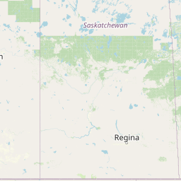


Leaflet | <a href="https://www.openstreetmap.org/copyright">© OpenStreetMap contributors</a>
Item
| Property | Value |
|---|---|
| id | 332734 |
| downstream_mainstem_id | https://geoconnex.us/ref/mainstems/312532 |
| encompassing_mainstem_basins | ['https://geoconnex.us/ref/mainstems/312532', 'https://geoconnex.us/ref/mainstems/312091'] |
| featuretype | ['https://www.opengis.net/def/schema/hy_features/hyf/HY_FlowPath', 'https://www.opengis.net/def/schema/hy_features/hyf/HY_WaterBody'] |
| fid | 15156 |
| head_2020huc12 | 100500010101 |
| head_nhdpv1_comid | 12345695 |
| head_nhdpv2_comid | https://geoconnex.us/nhdplusv2/comid/12345695 |
| head_nhdpv2huc12 | https://geoconnex.us/nhdplusv2/huc12/100500010101 |
| head_rf1id | 30386 |
| lengthkm | 946.4 |
| name_at_outlet | Milk River |
| name_at_outlet_gnis_id | 774213 |
| new_mainstemid | |
| outlet_2020huc12 | 100500121004 |
| outlet_drainagearea_sqkm | 54053.3 |
| outlet_nhdpv1_comid | 12312159 |
| outlet_nhdpv2_comid | https://geoconnex.us/nhdplusv2/comid/12312159 |
| outlet_nhdpv2huc12 | https://geoconnex.us/nhdplusv2/huc12/100500121004 |
| outlet_rf1id | 30616 |
| superseded | False |
| uri | https://geoconnex.us/ref/mainstems/332734 |
Graph Results
| monitoringLocation | https://sta.geoconnex.dev/collections/USGS/Things/items/'USGS-06140500' |
|---|---|
| siteName | USGS-06140500 |
| datasetDescription | Gage height / USGS-06140500-68cf1b7142c047e7ac476d5a9fbb5905 |
| type | Stream |
| url | https://waterdata.usgs.gov/monitoring-location/06140500/#parameterCode=00065 |
| variableMeasured | Gage height / USGS-06140500-68cf1b7142c047e7ac476d5a9fbb5905 |
| variableUnit | ft |
| measurementTechnique | observation |
| temporalCoverage | 2024-08-30T09:15:00Z/2024-09-09T18:15:00Z |
| distributionName | USGS Instantaneous Values Service |
| distributionURL | https://waterservices.usgs.gov/nwis/iv/?sites=USGS:06140500¶meterCd=00065&format=rdb |
| distributionFormat | text/tab-separated-values |
| wkt | POINT (-109.695955555556 48.5636861111111) |
| monitoringLocation | https://sta.geoconnex.dev/collections/USGS/Things/items/'USGS-06140500' |
|---|---|
| siteName | USGS-06140500 |
| datasetDescription | Gage height / USGS-06140500-68cf1b7142c047e7ac476d5a9fbb5905 |
| type | Stream |
| url | https://waterdata.usgs.gov/monitoring-location/06140500/#parameterCode=00065 |
| variableMeasured | Gage height / USGS-06140500-68cf1b7142c047e7ac476d5a9fbb5905 |
| variableUnit | ft |
| measurementTechnique | observation |
| temporalCoverage | 2024-08-30T09:15:00Z/2024-09-09T18:15:00Z |
| distributionName | USGS SensorThings API |
| distributionURL | https://labs.waterdata.usgs.gov/sta/v1.1/Datastreams('68cf1b7142c047e7ac476d5a9fbb5905')?$expand=Thing,Observations |
| distributionFormat | application/json |
| wkt | POINT (-109.695955555556 48.5636861111111) |
| monitoringLocation | https://sta.geoconnex.dev/collections/USGS/Things/items/'USGS-06140500' |
|---|---|
| siteName | USGS-06140500 |
| datasetDescription | Discharge / USGS-06140500-a7ea044f7e264c9696bc0f83412da5e6 |
| type | Stream |
| url | https://waterdata.usgs.gov/monitoring-location/06140500/#parameterCode=00060 |
| variableMeasured | Discharge / USGS-06140500-a7ea044f7e264c9696bc0f83412da5e6 |
| variableUnit | ft^3/s |
| measurementTechnique | observation |
| temporalCoverage | 2024-08-30T09:15:00Z/2024-09-09T18:15:00Z |
| distributionName | USGS Instantaneous Values Service |
| distributionURL | https://waterservices.usgs.gov/nwis/iv/?sites=USGS:06140500¶meterCd=00060&format=rdb |
| distributionFormat | text/tab-separated-values |
| wkt | POINT (-109.695955555556 48.5636861111111) |
| monitoringLocation | https://sta.geoconnex.dev/collections/USGS/Things/items/'USGS-06140500' |
|---|---|
| siteName | USGS-06140500 |
| datasetDescription | Discharge / USGS-06140500-a7ea044f7e264c9696bc0f83412da5e6 |
| type | Stream |
| url | https://waterdata.usgs.gov/monitoring-location/06140500/#parameterCode=00060 |
| variableMeasured | Discharge / USGS-06140500-a7ea044f7e264c9696bc0f83412da5e6 |
| variableUnit | ft^3/s |
| measurementTechnique | observation |
| temporalCoverage | 2024-08-30T09:15:00Z/2024-09-09T18:15:00Z |
| distributionName | USGS SensorThings API |
| distributionURL | https://labs.waterdata.usgs.gov/sta/v1.1/Datastreams('a7ea044f7e264c9696bc0f83412da5e6')?$expand=Thing,Observations |
| distributionFormat | application/json |
| wkt | POINT (-109.695955555556 48.5636861111111) |
| monitoringLocation | https://sta.geoconnex.dev/collections/USGS/Things/items/'USGS-06172310' |
|---|---|
| siteName | USGS-06172310 |
| datasetDescription | Gage height / USGS-06172310-6781b63e46d848ea88fe889da5589917 |
| type | Stream |
| url | https://waterdata.usgs.gov/monitoring-location/06172310/#parameterCode=00065 |
| variableMeasured | Gage height / USGS-06172310-6781b63e46d848ea88fe889da5589917 |
| variableUnit | ft |
| measurementTechnique | observation |
| temporalCoverage | 2024-08-30T09:15:00Z/2024-09-09T18:30:00Z |
| distributionName | USGS SensorThings API |
| distributionURL | https://labs.waterdata.usgs.gov/sta/v1.1/Datastreams('6781b63e46d848ea88fe889da5589917')?$expand=Thing,Observations |
| distributionFormat | application/json |
| wkt | POINT (-106.822316666667 48.3079055555555) |
| monitoringLocation | https://sta.geoconnex.dev/collections/USGS/Things/items/'USGS-06172310' |
|---|---|
| siteName | USGS-06172310 |
| datasetDescription | Gage height / USGS-06172310-6781b63e46d848ea88fe889da5589917 |
| type | Stream |
| url | https://waterdata.usgs.gov/monitoring-location/06172310/#parameterCode=00065 |
| variableMeasured | Gage height / USGS-06172310-6781b63e46d848ea88fe889da5589917 |
| variableUnit | ft |
| measurementTechnique | observation |
| temporalCoverage | 2024-08-30T09:15:00Z/2024-09-09T18:30:00Z |
| distributionName | USGS Instantaneous Values Service |
| distributionURL | https://waterservices.usgs.gov/nwis/iv/?sites=USGS:06172310¶meterCd=00065&format=rdb |
| distributionFormat | text/tab-separated-values |
| wkt | POINT (-106.822316666667 48.3079055555555) |
| monitoringLocation | https://sta.geoconnex.dev/collections/USGS/Things/items/'USGS-06172310' |
|---|---|
| siteName | USGS-06172310 |
| datasetDescription | Discharge / USGS-06172310-71aaa8555b784a65bbb3b56ef97f1ec8 |
| type | Stream |
| url | https://waterdata.usgs.gov/monitoring-location/06172310/#parameterCode=00060 |
| variableMeasured | Discharge / USGS-06172310-71aaa8555b784a65bbb3b56ef97f1ec8 |
| variableUnit | ft^3/s |
| measurementTechnique | observation |
| temporalCoverage | 2024-08-30T09:15:00Z/2024-09-09T18:30:00Z |
| distributionName | USGS Instantaneous Values Service |
| distributionURL | https://waterservices.usgs.gov/nwis/iv/?sites=USGS:06172310¶meterCd=00060&format=rdb |
| distributionFormat | text/tab-separated-values |
| wkt | POINT (-106.822316666667 48.3079055555555) |
| monitoringLocation | https://sta.geoconnex.dev/collections/USGS/Things/items/'USGS-06172310' |
|---|---|
| siteName | USGS-06172310 |
| datasetDescription | Discharge / USGS-06172310-71aaa8555b784a65bbb3b56ef97f1ec8 |
| type | Stream |
| url | https://waterdata.usgs.gov/monitoring-location/06172310/#parameterCode=00060 |
| variableMeasured | Discharge / USGS-06172310-71aaa8555b784a65bbb3b56ef97f1ec8 |
| variableUnit | ft^3/s |
| measurementTechnique | observation |
| temporalCoverage | 2024-08-30T09:15:00Z/2024-09-09T18:30:00Z |
| distributionName | USGS SensorThings API |
| distributionURL | https://labs.waterdata.usgs.gov/sta/v1.1/Datastreams('71aaa8555b784a65bbb3b56ef97f1ec8')?$expand=Thing,Observations |
| distributionFormat | application/json |
| wkt | POINT (-106.822316666667 48.3079055555555) |
| monitoringLocation | https://sta.geoconnex.dev/collections/USGS/Things/items/'USGS-06135000' |
|---|---|
| siteName | USGS-06135000 |
| datasetDescription | Gage height / USGS-06135000-354ecab92a1a4898942c29a03e385dc3 |
| type | Stream |
| url | https://waterdata.usgs.gov/monitoring-location/06135000/#parameterCode=00065 |
| variableMeasured | Gage height / USGS-06135000-354ecab92a1a4898942c29a03e385dc3 |
| variableUnit | ft |
| measurementTechnique | observation |
| temporalCoverage | 2024-08-30T09:15:00Z/2024-09-09T18:15:00Z |
| distributionName | USGS Instantaneous Values Service |
| distributionURL | https://waterservices.usgs.gov/nwis/iv/?sites=USGS:06135000¶meterCd=00065&format=rdb |
| distributionFormat | text/tab-separated-values |
| wkt | POINT (-110.421777777778 48.9748194444444) |
| monitoringLocation | https://sta.geoconnex.dev/collections/USGS/Things/items/'USGS-06135000' |
|---|---|
| siteName | USGS-06135000 |
| datasetDescription | Gage height / USGS-06135000-354ecab92a1a4898942c29a03e385dc3 |
| type | Stream |
| url | https://waterdata.usgs.gov/monitoring-location/06135000/#parameterCode=00065 |
| variableMeasured | Gage height / USGS-06135000-354ecab92a1a4898942c29a03e385dc3 |
| variableUnit | ft |
| measurementTechnique | observation |
| temporalCoverage | 2024-08-30T09:15:00Z/2024-09-09T18:15:00Z |
| distributionName | USGS SensorThings API |
| distributionURL | https://labs.waterdata.usgs.gov/sta/v1.1/Datastreams('354ecab92a1a4898942c29a03e385dc3')?$expand=Thing,Observations |
| distributionFormat | application/json |
| wkt | POINT (-110.421777777778 48.9748194444444) |
| monitoringLocation | https://sta.geoconnex.dev/collections/USGS/Things/items/'USGS-06135000' |
|---|---|
| siteName | USGS-06135000 |
| datasetDescription | Discharge cubic feet per second / USGS-06135000-bc9a443f6e954eb3879feb6c497463d9 |
| type | Stream |
| url | https://waterdata.usgs.gov/monitoring-location/06135000/#parameterCode=00060 |
| variableMeasured | Discharge |
| variableUnit | ft^3/s |
| measurementTechnique | observation |
| temporalCoverage | 2024-08-30T09:15:00Z/2024-09-09T18:15:00Z |
| distributionName | USGS SensorThings API |
| distributionURL | https://labs.waterdata.usgs.gov/sta/v1.1/Datastreams('bc9a443f6e954eb3879feb6c497463d9')?$expand=Thing,Observations |
| distributionFormat | application/json |
| wkt | POINT (-110.421777777778 48.9748194444444) |
| monitoringLocation | https://sta.geoconnex.dev/collections/USGS/Things/items/'USGS-06135000' |
|---|---|
| siteName | USGS-06135000 |
| datasetDescription | Discharge cubic feet per second / USGS-06135000-bc9a443f6e954eb3879feb6c497463d9 |
| type | Stream |
| url | https://waterdata.usgs.gov/monitoring-location/06135000/#parameterCode=00060 |
| variableMeasured | Discharge |
| variableUnit | ft^3/s |
| measurementTechnique | observation |
| temporalCoverage | 2024-08-30T09:15:00Z/2024-09-09T18:15:00Z |
| distributionName | USGS Instantaneous Values Service |
| distributionURL | https://waterservices.usgs.gov/nwis/iv/?sites=USGS:06135000¶meterCd=00060&format=rdb |
| distributionFormat | text/tab-separated-values |
| wkt | POINT (-110.421777777778 48.9748194444444) |
| monitoringLocation | https://sta.geoconnex.dev/collections/USGS/Things/items/'USGS-06155500' |
|---|---|
| siteName | USGS-06155500 |
| datasetDescription | Gage height feet / USGS-06155500-fb8bf3ea8dc14ffaa94630a18b59e501 |
| type | Stream |
| url | https://waterdata.usgs.gov/monitoring-location/06155500/#parameterCode=00065 |
| variableMeasured | Gage height |
| variableUnit | ft |
| measurementTechnique | observation |
| temporalCoverage | 2024-08-30T09:15:00Z/2024-09-09T18:45:00Z |
| distributionName | USGS Instantaneous Values Service |
| distributionURL | https://waterservices.usgs.gov/nwis/iv/?sites=USGS:06155500¶meterCd=00065&format=rdb |
| distributionFormat | text/tab-separated-values |
| wkt | POINT (-107.876375 48.3621944444444) |
| monitoringLocation | https://sta.geoconnex.dev/collections/USGS/Things/items/'USGS-06155500' |
|---|---|
| siteName | USGS-06155500 |
| datasetDescription | Gage height feet / USGS-06155500-fb8bf3ea8dc14ffaa94630a18b59e501 |
| type | Stream |
| url | https://waterdata.usgs.gov/monitoring-location/06155500/#parameterCode=00065 |
| variableMeasured | Gage height |
| variableUnit | ft |
| measurementTechnique | observation |
| temporalCoverage | 2024-08-30T09:15:00Z/2024-09-09T18:45:00Z |
| distributionName | USGS SensorThings API |
| distributionURL | https://labs.waterdata.usgs.gov/sta/v1.1/Datastreams('fb8bf3ea8dc14ffaa94630a18b59e501')?$expand=Thing,Observations |
| distributionFormat | application/json |
| wkt | POINT (-107.876375 48.3621944444444) |
| monitoringLocation | https://sta.geoconnex.dev/collections/USGS/Things/items/'USGS-06155500' |
|---|---|
| siteName | USGS-06155500 |
| datasetDescription | Discharge / USGS-06155500-ba9456f18cfb40c1921e045a7edd359d |
| type | Stream |
| url | https://waterdata.usgs.gov/monitoring-location/06155500/#parameterCode=00060 |
| variableMeasured | Discharge / USGS-06155500-ba9456f18cfb40c1921e045a7edd359d |
| variableUnit | ft^3/s |
| measurementTechnique | observation |
| temporalCoverage | 2024-08-30T09:15:00Z/2024-09-09T18:45:00Z |
| distributionName | USGS Instantaneous Values Service |
| distributionURL | https://waterservices.usgs.gov/nwis/iv/?sites=USGS:06155500¶meterCd=00060&format=rdb |
| distributionFormat | text/tab-separated-values |
| wkt | POINT (-107.876375 48.3621944444444) |
| monitoringLocation | https://sta.geoconnex.dev/collections/USGS/Things/items/'USGS-06155500' |
|---|---|
| siteName | USGS-06155500 |
| datasetDescription | Discharge / USGS-06155500-ba9456f18cfb40c1921e045a7edd359d |
| type | Stream |
| url | https://waterdata.usgs.gov/monitoring-location/06155500/#parameterCode=00060 |
| variableMeasured | Discharge / USGS-06155500-ba9456f18cfb40c1921e045a7edd359d |
| variableUnit | ft^3/s |
| measurementTechnique | observation |
| temporalCoverage | 2024-08-30T09:15:00Z/2024-09-09T18:45:00Z |
| distributionName | USGS SensorThings API |
| distributionURL | https://labs.waterdata.usgs.gov/sta/v1.1/Datastreams('ba9456f18cfb40c1921e045a7edd359d')?$expand=Thing,Observations |
| distributionFormat | application/json |
| wkt | POINT (-107.876375 48.3621944444444) |
| monitoringLocation | https://sta.geoconnex.dev/collections/USGS/Things/items/'USGS-06154100' |
|---|---|
| siteName | USGS-06154100 |
| datasetDescription | Discharge / USGS-06154100-696d559384884a5891538286259b0ebc |
| type | Stream |
| url | https://waterdata.usgs.gov/monitoring-location/06154100/#parameterCode=00060 |
| variableMeasured | Discharge / USGS-06154100-696d559384884a5891538286259b0ebc |
| variableUnit | ft^3/s |
| measurementTechnique | observation |
| temporalCoverage | 2024-08-30T09:15:00Z/2024-09-09T18:30:00Z |
| distributionName | USGS Instantaneous Values Service |
| distributionURL | https://waterservices.usgs.gov/nwis/iv/?sites=USGS:06154100¶meterCd=00060&format=rdb |
| distributionFormat | text/tab-separated-values |
| wkt | POINT (-108.75895 48.4896416666667) |
| monitoringLocation | https://sta.geoconnex.dev/collections/USGS/Things/items/'USGS-06154100' |
|---|---|
| siteName | USGS-06154100 |
| datasetDescription | Discharge / USGS-06154100-696d559384884a5891538286259b0ebc |
| type | Stream |
| url | https://waterdata.usgs.gov/monitoring-location/06154100/#parameterCode=00060 |
| variableMeasured | Discharge / USGS-06154100-696d559384884a5891538286259b0ebc |
| variableUnit | ft^3/s |
| measurementTechnique | observation |
| temporalCoverage | 2024-08-30T09:15:00Z/2024-09-09T18:30:00Z |
| distributionName | USGS SensorThings API |
| distributionURL | https://labs.waterdata.usgs.gov/sta/v1.1/Datastreams('696d559384884a5891538286259b0ebc')?$expand=Thing,Observations |
| distributionFormat | application/json |
| wkt | POINT (-108.75895 48.4896416666667) |
| monitoringLocation | https://sta.geoconnex.dev/collections/USGS/Things/items/'USGS-06154100' |
|---|---|
| siteName | USGS-06154100 |
| datasetDescription | Gage height feet / USGS-06154100-45fa12e558074064a0f7b84569e385bd |
| type | Stream |
| url | https://waterdata.usgs.gov/monitoring-location/06154100/#parameterCode=00065 |
| variableMeasured | Gage height |
| variableUnit | ft |
| measurementTechnique | observation |
| temporalCoverage | 2024-08-30T09:15:00Z/2024-09-09T18:30:00Z |
| distributionName | USGS Instantaneous Values Service |
| distributionURL | https://waterservices.usgs.gov/nwis/iv/?sites=USGS:06154100¶meterCd=00065&format=rdb |
| distributionFormat | text/tab-separated-values |
| wkt | POINT (-108.75895 48.4896416666667) |
| monitoringLocation | https://sta.geoconnex.dev/collections/USGS/Things/items/'USGS-06154100' |
|---|---|
| siteName | USGS-06154100 |
| datasetDescription | Gage height feet / USGS-06154100-45fa12e558074064a0f7b84569e385bd |
| type | Stream |
| url | https://waterdata.usgs.gov/monitoring-location/06154100/#parameterCode=00065 |
| variableMeasured | Gage height |
| variableUnit | ft |
| measurementTechnique | observation |
| temporalCoverage | 2024-08-30T09:15:00Z/2024-09-09T18:30:00Z |
| distributionName | USGS SensorThings API |
| distributionURL | https://labs.waterdata.usgs.gov/sta/v1.1/Datastreams('45fa12e558074064a0f7b84569e385bd')?$expand=Thing,Observations |
| distributionFormat | application/json |
| wkt | POINT (-108.75895 48.4896416666667) |
| monitoringLocation | https://sta.geoconnex.dev/collections/USGS/Things/items/'USGS-06174500' |
|---|---|
| siteName | USGS-06174500 |
| datasetDescription | Phycocyanin relative fluorescence (fPC) water in situ relative fluorescence units (RFU) / USGS-06174500-89985222fb644204bebc49892f318e28 |
| type | Stream |
| url | https://waterdata.usgs.gov/monitoring-location/06174500/#parameterCode=32321 |
| variableMeasured | Phycocyanin relative fluorescence (fPC) |
| variableUnit | RFU |
| measurementTechnique | observation |
| temporalCoverage | 2024-08-30T09:15:00Z/2024-09-09T18:00:00Z |
| distributionName | USGS Instantaneous Values Service |
| distributionURL | https://waterservices.usgs.gov/nwis/iv/?sites=USGS:06174500¶meterCd=32321&format=rdb |
| distributionFormat | text/tab-separated-values |
| wkt | POINT (-106.364313888889 48.1300527777778) |
| monitoringLocation | https://sta.geoconnex.dev/collections/USGS/Things/items/'USGS-06174500' |
|---|---|
| siteName | USGS-06174500 |
| datasetDescription | Phycocyanin relative fluorescence (fPC) water in situ relative fluorescence units (RFU) / USGS-06174500-89985222fb644204bebc49892f318e28 |
| type | Stream |
| url | https://waterdata.usgs.gov/monitoring-location/06174500/#parameterCode=32321 |
| variableMeasured | Phycocyanin relative fluorescence (fPC) |
| variableUnit | RFU |
| measurementTechnique | observation |
| temporalCoverage | 2024-08-30T09:15:00Z/2024-09-09T18:00:00Z |
| distributionName | USGS SensorThings API |
| distributionURL | https://labs.waterdata.usgs.gov/sta/v1.1/Datastreams('89985222fb644204bebc49892f318e28')?$expand=Thing,Observations |
| distributionFormat | application/json |
| wkt | POINT (-106.364313888889 48.1300527777778) |
| monitoringLocation | https://sta.geoconnex.dev/collections/USGS/Things/items/'USGS-06174500' |
|---|---|
| siteName | USGS-06174500 |
| datasetDescription | Discharge / USGS-06174500-df324a9a8c004aedbaa995d3a14549de |
| type | Stream |
| url | https://waterdata.usgs.gov/monitoring-location/06174500/#parameterCode=00060 |
| variableMeasured | Discharge / USGS-06174500-df324a9a8c004aedbaa995d3a14549de |
| variableUnit | ft^3/s |
| measurementTechnique | observation |
| temporalCoverage | 2024-08-30T09:15:00Z/2024-09-09T18:00:00Z |
| distributionName | USGS Instantaneous Values Service |
| distributionURL | https://waterservices.usgs.gov/nwis/iv/?sites=USGS:06174500¶meterCd=00060&format=rdb |
| distributionFormat | text/tab-separated-values |
| wkt | POINT (-106.364313888889 48.1300527777778) |
| monitoringLocation | https://sta.geoconnex.dev/collections/USGS/Things/items/'USGS-06174500' |
|---|---|
| siteName | USGS-06174500 |
| datasetDescription | Discharge / USGS-06174500-df324a9a8c004aedbaa995d3a14549de |
| type | Stream |
| url | https://waterdata.usgs.gov/monitoring-location/06174500/#parameterCode=00060 |
| variableMeasured | Discharge / USGS-06174500-df324a9a8c004aedbaa995d3a14549de |
| variableUnit | ft^3/s |
| measurementTechnique | observation |
| temporalCoverage | 2024-08-30T09:15:00Z/2024-09-09T18:00:00Z |
| distributionName | USGS SensorThings API |
| distributionURL | https://labs.waterdata.usgs.gov/sta/v1.1/Datastreams('df324a9a8c004aedbaa995d3a14549de')?$expand=Thing,Observations |
| distributionFormat | application/json |
| wkt | POINT (-106.364313888889 48.1300527777778) |
| monitoringLocation | https://sta.geoconnex.dev/collections/USGS/Things/items/'USGS-06174500' |
|---|---|
| siteName | USGS-06174500 |
| datasetDescription | Oxidation reduction potential reference electrode not specified millivolts / USGS-06174500-a742158796a84e8584524607627e0301 |
| type | Stream |
| url | https://waterdata.usgs.gov/monitoring-location/06174500/#parameterCode=00090 |
| variableMeasured | Oxidation reduction potential |
| variableUnit | mV |
| measurementTechnique | observation |
| temporalCoverage | 2024-08-30T09:15:00Z/2024-09-09T18:00:00Z |
| distributionName | USGS SensorThings API |
| distributionURL | https://labs.waterdata.usgs.gov/sta/v1.1/Datastreams('a742158796a84e8584524607627e0301')?$expand=Thing,Observations |
| distributionFormat | application/json |
| wkt | POINT (-106.364313888889 48.1300527777778) |
| monitoringLocation | https://sta.geoconnex.dev/collections/USGS/Things/items/'USGS-06174500' |
|---|---|
| siteName | USGS-06174500 |
| datasetDescription | Oxidation reduction potential reference electrode not specified millivolts / USGS-06174500-a742158796a84e8584524607627e0301 |
| type | Stream |
| url | https://waterdata.usgs.gov/monitoring-location/06174500/#parameterCode=00090 |
| variableMeasured | Oxidation reduction potential |
| variableUnit | mV |
| measurementTechnique | observation |
| temporalCoverage | 2024-08-30T09:15:00Z/2024-09-09T18:00:00Z |
| distributionName | USGS Instantaneous Values Service |
| distributionURL | https://waterservices.usgs.gov/nwis/iv/?sites=USGS:06174500¶meterCd=00090&format=rdb |
| distributionFormat | text/tab-separated-values |
| wkt | POINT (-106.364313888889 48.1300527777778) |
| monitoringLocation | https://sta.geoconnex.dev/collections/USGS/Things/items/'USGS-06174500' |
|---|---|
| siteName | USGS-06174500 |
| datasetDescription | Turbidity water unfiltered monochrome near infra-red LED light 780-900 nm detection angle 90 +-2.5 degrees formazin nephelometric units (FNU) / USGS-06174500-747552fbc87b463999ed80bcfca7159c |
| type | Stream |
| url | https://waterdata.usgs.gov/monitoring-location/06174500/#parameterCode=63680 |
| variableMeasured | Turbidity |
| variableUnit | _FNU |
| measurementTechnique | observation |
| temporalCoverage | 2024-08-30T09:15:00Z/2024-09-09T18:00:00Z |
| distributionName | USGS Instantaneous Values Service |
| distributionURL | https://waterservices.usgs.gov/nwis/iv/?sites=USGS:06174500¶meterCd=63680&format=rdb |
| distributionFormat | text/tab-separated-values |
| wkt | POINT (-106.364313888889 48.1300527777778) |
| monitoringLocation | https://sta.geoconnex.dev/collections/USGS/Things/items/'USGS-06174500' |
|---|---|
| siteName | USGS-06174500 |
| datasetDescription | Turbidity water unfiltered monochrome near infra-red LED light 780-900 nm detection angle 90 +-2.5 degrees formazin nephelometric units (FNU) / USGS-06174500-747552fbc87b463999ed80bcfca7159c |
| type | Stream |
| url | https://waterdata.usgs.gov/monitoring-location/06174500/#parameterCode=63680 |
| variableMeasured | Turbidity |
| variableUnit | _FNU |
| measurementTechnique | observation |
| temporalCoverage | 2024-08-30T09:15:00Z/2024-09-09T18:00:00Z |
| distributionName | USGS SensorThings API |
| distributionURL | https://labs.waterdata.usgs.gov/sta/v1.1/Datastreams('747552fbc87b463999ed80bcfca7159c')?$expand=Thing,Observations |
| distributionFormat | application/json |
| wkt | POINT (-106.364313888889 48.1300527777778) |
| monitoringLocation | https://sta.geoconnex.dev/collections/USGS/Things/items/'USGS-06174500' |
|---|---|
| siteName | USGS-06174500 |
| datasetDescription | Gage height feet / USGS-06174500-65f227af2203448d84839ddd412c933c |
| type | Stream |
| url | https://waterdata.usgs.gov/monitoring-location/06174500/#parameterCode=00065 |
| variableMeasured | Gage height |
| variableUnit | ft |
| measurementTechnique | observation |
| temporalCoverage | 2024-08-30T09:15:00Z/2024-09-09T18:00:00Z |
| distributionName | USGS SensorThings API |
| distributionURL | https://labs.waterdata.usgs.gov/sta/v1.1/Datastreams('65f227af2203448d84839ddd412c933c')?$expand=Thing,Observations |
| distributionFormat | application/json |
| wkt | POINT (-106.364313888889 48.1300527777778) |
| monitoringLocation | https://sta.geoconnex.dev/collections/USGS/Things/items/'USGS-06174500' |
|---|---|
| siteName | USGS-06174500 |
| datasetDescription | Gage height feet / USGS-06174500-65f227af2203448d84839ddd412c933c |
| type | Stream |
| url | https://waterdata.usgs.gov/monitoring-location/06174500/#parameterCode=00065 |
| variableMeasured | Gage height |
| variableUnit | ft |
| measurementTechnique | observation |
| temporalCoverage | 2024-08-30T09:15:00Z/2024-09-09T18:00:00Z |
| distributionName | USGS Instantaneous Values Service |
| distributionURL | https://waterservices.usgs.gov/nwis/iv/?sites=USGS:06174500¶meterCd=00065&format=rdb |
| distributionFormat | text/tab-separated-values |
| wkt | POINT (-106.364313888889 48.1300527777778) |
| monitoringLocation | https://sta.geoconnex.dev/collections/USGS/Things/items/'USGS-06174500' |
|---|---|
| siteName | USGS-06174500 |
| datasetDescription | Temperature water degrees Celsius / USGS-06174500-1bc3e9d36fe9446ea23c37c1acfd2c4f |
| type | Stream |
| url | https://waterdata.usgs.gov/monitoring-location/06174500/#parameterCode=00010 |
| variableMeasured | Temperature |
| variableUnit | degC |
| measurementTechnique | observation |
| temporalCoverage | 2024-08-30T09:15:00Z/2024-09-09T18:00:00Z |
| distributionName | USGS SensorThings API |
| distributionURL | https://labs.waterdata.usgs.gov/sta/v1.1/Datastreams('1bc3e9d36fe9446ea23c37c1acfd2c4f')?$expand=Thing,Observations |
| distributionFormat | application/json |
| wkt | POINT (-106.364313888889 48.1300527777778) |
| monitoringLocation | https://sta.geoconnex.dev/collections/USGS/Things/items/'USGS-06174500' |
|---|---|
| siteName | USGS-06174500 |
| datasetDescription | Temperature water degrees Celsius / USGS-06174500-1bc3e9d36fe9446ea23c37c1acfd2c4f |
| type | Stream |
| url | https://waterdata.usgs.gov/monitoring-location/06174500/#parameterCode=00010 |
| variableMeasured | Temperature |
| variableUnit | degC |
| measurementTechnique | observation |
| temporalCoverage | 2024-08-30T09:15:00Z/2024-09-09T18:00:00Z |
| distributionName | USGS Instantaneous Values Service |
| distributionURL | https://waterservices.usgs.gov/nwis/iv/?sites=USGS:06174500¶meterCd=00010&format=rdb |
| distributionFormat | text/tab-separated-values |
| wkt | POINT (-106.364313888889 48.1300527777778) |
| monitoringLocation | https://sta.geoconnex.dev/collections/USGS/Things/items/'USGS-06174500' |
|---|---|
| siteName | USGS-06174500 |
| datasetDescription | Dissolved oxygen water unfiltered milligrams per liter / USGS-06174500-448725652db24ab993cadf051e135de6 |
| type | Stream |
| url | https://waterdata.usgs.gov/monitoring-location/06174500/#parameterCode=00300 |
| variableMeasured | Dissolved oxygen |
| variableUnit | mg/l |
| measurementTechnique | observation |
| temporalCoverage | 2024-08-30T09:15:00Z/2024-09-09T18:00:00Z |
| distributionName | USGS Instantaneous Values Service |
| distributionURL | https://waterservices.usgs.gov/nwis/iv/?sites=USGS:06174500¶meterCd=00300&format=rdb |
| distributionFormat | text/tab-separated-values |
| wkt | POINT (-106.364313888889 48.1300527777778) |
| monitoringLocation | https://sta.geoconnex.dev/collections/USGS/Things/items/'USGS-06174500' |
|---|---|
| siteName | USGS-06174500 |
| datasetDescription | Dissolved oxygen water unfiltered milligrams per liter / USGS-06174500-448725652db24ab993cadf051e135de6 |
| type | Stream |
| url | https://waterdata.usgs.gov/monitoring-location/06174500/#parameterCode=00300 |
| variableMeasured | Dissolved oxygen |
| variableUnit | mg/l |
| measurementTechnique | observation |
| temporalCoverage | 2024-08-30T09:15:00Z/2024-09-09T18:00:00Z |
| distributionName | USGS SensorThings API |
| distributionURL | https://labs.waterdata.usgs.gov/sta/v1.1/Datastreams('448725652db24ab993cadf051e135de6')?$expand=Thing,Observations |
| distributionFormat | application/json |
| wkt | POINT (-106.364313888889 48.1300527777778) |
| monitoringLocation | https://sta.geoconnex.dev/collections/USGS/Things/items/'USGS-06174500' |
|---|---|
| siteName | USGS-06174500 |
| datasetDescription | Specific conductance water unfiltered microsiemens per centimeter at 25 degrees Celsius / USGS-06174500-9e1639c12aa94ea89c4106b2f4810bc8 |
| type | Stream |
| url | https://waterdata.usgs.gov/monitoring-location/06174500/#parameterCode=00095 |
| variableMeasured | Specific conductance |
| variableUnit | uS/cm |
| measurementTechnique | observation |
| temporalCoverage | 2024-08-30T09:15:00Z/2024-09-09T18:00:00Z |
| distributionName | USGS Instantaneous Values Service |
| distributionURL | https://waterservices.usgs.gov/nwis/iv/?sites=USGS:06174500¶meterCd=00095&format=rdb |
| distributionFormat | text/tab-separated-values |
| wkt | POINT (-106.364313888889 48.1300527777778) |
| monitoringLocation | https://sta.geoconnex.dev/collections/USGS/Things/items/'USGS-06174500' |
|---|---|
| siteName | USGS-06174500 |
| datasetDescription | Specific conductance water unfiltered microsiemens per centimeter at 25 degrees Celsius / USGS-06174500-9e1639c12aa94ea89c4106b2f4810bc8 |
| type | Stream |
| url | https://waterdata.usgs.gov/monitoring-location/06174500/#parameterCode=00095 |
| variableMeasured | Specific conductance |
| variableUnit | uS/cm |
| measurementTechnique | observation |
| temporalCoverage | 2024-08-30T09:15:00Z/2024-09-09T18:00:00Z |
| distributionName | USGS SensorThings API |
| distributionURL | https://labs.waterdata.usgs.gov/sta/v1.1/Datastreams('9e1639c12aa94ea89c4106b2f4810bc8')?$expand=Thing,Observations |
| distributionFormat | application/json |
| wkt | POINT (-106.364313888889 48.1300527777778) |
| monitoringLocation | https://sta.geoconnex.dev/collections/USGS/Things/items/'USGS-06174500' |
|---|---|
| siteName | USGS-06174500 |
| datasetDescription | Dissolved organic matter fluorescence (fDOM) water in situ concentration estimated from reference material micrograms per liter as quinine sulfate equivalents (QSE) / USGS-06174500-ce9e58ef098c4eefb4112f2bd794f5d8 |
| type | Stream |
| url | https://waterdata.usgs.gov/monitoring-location/06174500/#parameterCode=32295 |
| variableMeasured | Dissolved organic matter fluorescence (fDOM) |
| variableUnit | QSE |
| measurementTechnique | observation |
| temporalCoverage | 2024-08-30T09:15:00Z/2024-09-09T18:00:00Z |
| distributionName | USGS Instantaneous Values Service |
| distributionURL | https://waterservices.usgs.gov/nwis/iv/?sites=USGS:06174500¶meterCd=32295&format=rdb |
| distributionFormat | text/tab-separated-values |
| wkt | POINT (-106.364313888889 48.1300527777778) |
| monitoringLocation | https://sta.geoconnex.dev/collections/USGS/Things/items/'USGS-06174500' |
|---|---|
| siteName | USGS-06174500 |
| datasetDescription | Dissolved organic matter fluorescence (fDOM) water in situ concentration estimated from reference material micrograms per liter as quinine sulfate equivalents (QSE) / USGS-06174500-ce9e58ef098c4eefb4112f2bd794f5d8 |
| type | Stream |
| url | https://waterdata.usgs.gov/monitoring-location/06174500/#parameterCode=32295 |
| variableMeasured | Dissolved organic matter fluorescence (fDOM) |
| variableUnit | QSE |
| measurementTechnique | observation |
| temporalCoverage | 2024-08-30T09:15:00Z/2024-09-09T18:00:00Z |
| distributionName | USGS SensorThings API |
| distributionURL | https://labs.waterdata.usgs.gov/sta/v1.1/Datastreams('ce9e58ef098c4eefb4112f2bd794f5d8')?$expand=Thing,Observations |
| distributionFormat | application/json |
| wkt | POINT (-106.364313888889 48.1300527777778) |
| monitoringLocation | https://sta.geoconnex.dev/collections/USGS/Things/items/'USGS-06174500' |
|---|---|
| siteName | USGS-06174500 |
| datasetDescription | Chlorophyll relative fluorescence (fChl) water in situ relative fluorescence units (RFU) / USGS-06174500-b5bb62e062e04245b3d61173a2c1ae5f |
| type | Stream |
| url | https://waterdata.usgs.gov/monitoring-location/06174500/#parameterCode=32315 |
| variableMeasured | Chlorophyll relative fluorescence (fChl) |
| variableUnit | RFU |
| measurementTechnique | observation |
| temporalCoverage | 2024-08-30T09:15:00Z/2024-09-09T18:00:00Z |
| distributionName | USGS SensorThings API |
| distributionURL | https://labs.waterdata.usgs.gov/sta/v1.1/Datastreams('b5bb62e062e04245b3d61173a2c1ae5f')?$expand=Thing,Observations |
| distributionFormat | application/json |
| wkt | POINT (-106.364313888889 48.1300527777778) |
| monitoringLocation | https://sta.geoconnex.dev/collections/USGS/Things/items/'USGS-06174500' |
|---|---|
| siteName | USGS-06174500 |
| datasetDescription | Chlorophyll relative fluorescence (fChl) water in situ relative fluorescence units (RFU) / USGS-06174500-b5bb62e062e04245b3d61173a2c1ae5f |
| type | Stream |
| url | https://waterdata.usgs.gov/monitoring-location/06174500/#parameterCode=32315 |
| variableMeasured | Chlorophyll relative fluorescence (fChl) |
| variableUnit | RFU |
| measurementTechnique | observation |
| temporalCoverage | 2024-08-30T09:15:00Z/2024-09-09T18:00:00Z |
| distributionName | USGS Instantaneous Values Service |
| distributionURL | https://waterservices.usgs.gov/nwis/iv/?sites=USGS:06174500¶meterCd=32315&format=rdb |
| distributionFormat | text/tab-separated-values |
| wkt | POINT (-106.364313888889 48.1300527777778) |
| monitoringLocation | https://sta.geoconnex.dev/collections/USGS/Things/items/'USGS-06174500' |
|---|---|
| siteName | USGS-06174500 |
| datasetDescription | pH water unfiltered field standard units / USGS-06174500-1b29884b9ade4622856e2918d52338c0 |
| type | Stream |
| url | https://waterdata.usgs.gov/monitoring-location/06174500/#parameterCode=00400 |
| variableMeasured | pH |
| variableUnit | pH Units |
| measurementTechnique | observation |
| temporalCoverage | 2024-08-30T09:15:00Z/2024-09-09T18:00:00Z |
| distributionName | USGS SensorThings API |
| distributionURL | https://labs.waterdata.usgs.gov/sta/v1.1/Datastreams('1b29884b9ade4622856e2918d52338c0')?$expand=Thing,Observations |
| distributionFormat | application/json |
| wkt | POINT (-106.364313888889 48.1300527777778) |
| monitoringLocation | https://sta.geoconnex.dev/collections/USGS/Things/items/'USGS-06174500' |
|---|---|
| siteName | USGS-06174500 |
| datasetDescription | pH water unfiltered field standard units / USGS-06174500-1b29884b9ade4622856e2918d52338c0 |
| type | Stream |
| url | https://waterdata.usgs.gov/monitoring-location/06174500/#parameterCode=00400 |
| variableMeasured | pH |
| variableUnit | pH Units |
| measurementTechnique | observation |
| temporalCoverage | 2024-08-30T09:15:00Z/2024-09-09T18:00:00Z |
| distributionName | USGS Instantaneous Values Service |
| distributionURL | https://waterservices.usgs.gov/nwis/iv/?sites=USGS:06174500¶meterCd=00400&format=rdb |
| distributionFormat | text/tab-separated-values |
| wkt | POINT (-106.364313888889 48.1300527777778) |
| monitoringLocation | https://sta.geoconnex.dev/collections/USGS/Things/items/'USGS-06155030' |
|---|---|
| siteName | USGS-06155030 |
| datasetDescription | Gage height / USGS-06155030-094be384a1014676b0984e4047e0a8e1 |
| type | Stream |
| url | https://waterdata.usgs.gov/monitoring-location/06155030/#parameterCode=00065 |
| variableMeasured | Gage height / USGS-06155030-094be384a1014676b0984e4047e0a8e1 |
| variableUnit | ft |
| measurementTechnique | observation |
| temporalCoverage | 2024-08-30T09:15:00Z/2024-09-09T18:15:00Z |
| distributionName | USGS Instantaneous Values Service |
| distributionURL | https://waterservices.usgs.gov/nwis/iv/?sites=USGS:06155030¶meterCd=00065&format=rdb |
| distributionFormat | text/tab-separated-values |
| wkt | POINT (-108.294094444444 48.4027777777778) |
| monitoringLocation | https://sta.geoconnex.dev/collections/USGS/Things/items/'USGS-06155030' |
|---|---|
| siteName | USGS-06155030 |
| datasetDescription | Gage height / USGS-06155030-094be384a1014676b0984e4047e0a8e1 |
| type | Stream |
| url | https://waterdata.usgs.gov/monitoring-location/06155030/#parameterCode=00065 |
| variableMeasured | Gage height / USGS-06155030-094be384a1014676b0984e4047e0a8e1 |
| variableUnit | ft |
| measurementTechnique | observation |
| temporalCoverage | 2024-08-30T09:15:00Z/2024-09-09T18:15:00Z |
| distributionName | USGS SensorThings API |
| distributionURL | https://labs.waterdata.usgs.gov/sta/v1.1/Datastreams('094be384a1014676b0984e4047e0a8e1')?$expand=Thing,Observations |
| distributionFormat | application/json |
| wkt | POINT (-108.294094444444 48.4027777777778) |
| monitoringLocation | https://sta.geoconnex.dev/collections/USGS/Things/items/'USGS-06155030' |
|---|---|
| siteName | USGS-06155030 |
| datasetDescription | Discharge / USGS-06155030-52987c1683404ad18a98a361d71429c7 |
| type | Stream |
| url | https://waterdata.usgs.gov/monitoring-location/06155030/#parameterCode=00060 |
| variableMeasured | Discharge / USGS-06155030-52987c1683404ad18a98a361d71429c7 |
| variableUnit | ft^3/s |
| measurementTechnique | observation |
| temporalCoverage | 2024-08-30T09:15:00Z/2024-09-09T18:15:00Z |
| distributionName | USGS Instantaneous Values Service |
| distributionURL | https://waterservices.usgs.gov/nwis/iv/?sites=USGS:06155030¶meterCd=00060&format=rdb |
| distributionFormat | text/tab-separated-values |
| wkt | POINT (-108.294094444444 48.4027777777778) |
| monitoringLocation | https://sta.geoconnex.dev/collections/USGS/Things/items/'USGS-06155030' |
|---|---|
| siteName | USGS-06155030 |
| datasetDescription | Discharge / USGS-06155030-52987c1683404ad18a98a361d71429c7 |
| type | Stream |
| url | https://waterdata.usgs.gov/monitoring-location/06155030/#parameterCode=00060 |
| variableMeasured | Discharge / USGS-06155030-52987c1683404ad18a98a361d71429c7 |
| variableUnit | ft^3/s |
| measurementTechnique | observation |
| temporalCoverage | 2024-08-30T09:15:00Z/2024-09-09T18:15:00Z |
| distributionName | USGS SensorThings API |
| distributionURL | https://labs.waterdata.usgs.gov/sta/v1.1/Datastreams('52987c1683404ad18a98a361d71429c7')?$expand=Thing,Observations |
| distributionFormat | application/json |
| wkt | POINT (-108.294094444444 48.4027777777778) |