Fordyce Creek
Map
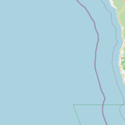
Leaflet | <a href="https://www.openstreetmap.org/copyright">© OpenStreetMap contributors</a>
Item
| Property | Value |
|---|---|
| id | 3462 |
| downstream_mainstem_id | https://geoconnex.us/ref/mainstems/1555 |
| encompassing_mainstem_basins | ['https://geoconnex.us/ref/mainstems/1555', 'https://geoconnex.us/ref/mainstems/490', 'https://geoconnex.us/ref/mainstems/322', 'https://geoconnex.us/ref/mainstems/1'] |
| featuretype | ['https://www.opengis.net/def/schema/hy_features/hyf/HY_FlowPath', 'https://www.opengis.net/def/schema/hy_features/hyf/HY_WaterBody'] |
| fid | 32498 |
| head_2020huc12 | 180201250601 |
| head_nhdpv1_comid | 8063515 |
| head_nhdpv2_comid | https://geoconnex.us/nhdplusv2/comid/8063515 |
| head_nhdpv2huc12 | https://geoconnex.us/nhdplusv2/huc12/180201250601 |
| head_rf1id | 58750 |
| lengthkm | 24.9 |
| name_at_outlet | Fordyce Creek |
| name_at_outlet_gnis_id | 260248 |
| new_mainstemid | |
| outlet_2020huc12 | 180201250601 |
| outlet_drainagearea_sqkm | 139.4 |
| outlet_nhdpv1_comid | 8064695 |
| outlet_nhdpv2_comid | https://geoconnex.us/nhdplusv2/comid/8064695 |
| outlet_nhdpv2huc12 | https://geoconnex.us/nhdplusv2/huc12/180201250601 |
| outlet_rf1id | 58753 |
| superseded | False |
| uri | https://geoconnex.us/ref/mainstems/3462 |
Graph Results
| monitoringLocation | https://geoconnex.us/iow/wqp/USGS-392122120364501 |
|---|---|
| siteName | USGS-392122120364501 |
| datasetDescription | Total volatile solids at USGS-392122120364501 |
| type | Stream |
| url | https://www.waterqualitydata.us/provider/NWIS/USGS-CA/USGS-392122120364501/ |
| variableMeasured | Total volatile solids |
| variableUnit | milligrams per liter |
| measurementTechnique | observation |
| temporalCoverage | 2012-01-01T00:00:00Z/2012-12-31T00:00:00Z |
| distributionName | Water Quality Portal |
| distributionURL | https://www.waterqualitydata.us/data/Result/search?siteid=USGS-392122120364501&CharacteristicName=Total volatile solids&mimeType=csv |
| distributionFormat | text/comma-separated-values |
| wkt | POINT (-120.6125 39.3561111) |
| monitoringLocation | https://geoconnex.us/iow/wqp/USGS-392122120364501 |
|---|---|
| siteName | USGS-392122120364501 |
| datasetDescription | Manganese at USGS-392122120364501 |
| type | Stream |
| url | https://www.waterqualitydata.us/provider/NWIS/USGS-CA/USGS-392122120364501/ |
| variableMeasured | Manganese |
| variableUnit | micrograms per liter |
| measurementTechnique | observation |
| temporalCoverage | 2012-01-01T00:00:00Z/2012-12-31T00:00:00Z |
| distributionName | Water Quality Portal |
| distributionURL | https://www.waterqualitydata.us/data/Result/search?siteid=USGS-392122120364501&CharacteristicName=Manganese&mimeType=csv |
| distributionFormat | text/comma-separated-values |
| wkt | POINT (-120.6125 39.3561111) |
| monitoringLocation | https://geoconnex.us/iow/wqp/USGS-392122120364501 |
|---|---|
| siteName | USGS-392122120364501 |
| datasetDescription | Nitrogen, mixed forms (NH3), (NH4), organic, (NO2) and (NO3) at USGS-392122120364501 |
| type | Stream |
| url | https://www.waterqualitydata.us/provider/NWIS/USGS-CA/USGS-392122120364501/ |
| variableMeasured | Nitrogen, mixed forms (NH3), (NH4), organic, (NO2) and (NO3) |
| variableUnit | milligrams per liter |
| measurementTechnique | observation |
| temporalCoverage | 2012-01-01T00:00:00Z/2012-12-31T00:00:00Z |
| distributionName | Water Quality Portal |
| distributionURL | https://www.waterqualitydata.us/data/Result/search?siteid=USGS-392122120364501&CharacteristicName=Nitrogen, mixed forms (NH3), (NH4), organic, (NO2) and (NO3)&mimeType=csv |
| distributionFormat | text/comma-separated-values |
| wkt | POINT (-120.6125 39.3561111) |
| monitoringLocation | https://geoconnex.us/iow/wqp/USGS-392122120364501 |
|---|---|
| siteName | USGS-392122120364501 |
| datasetDescription | Lanthanum at USGS-392122120364501 |
| type | Stream |
| url | https://www.waterqualitydata.us/provider/NWIS/USGS-CA/USGS-392122120364501/ |
| variableMeasured | Lanthanum |
| variableUnit | milligrams per liter |
| measurementTechnique | observation |
| temporalCoverage | 2012-01-01T00:00:00Z/2012-12-31T00:00:00Z |
| distributionName | Water Quality Portal |
| distributionURL | https://www.waterqualitydata.us/data/Result/search?siteid=USGS-392122120364501&CharacteristicName=Lanthanum&mimeType=csv |
| distributionFormat | text/comma-separated-values |
| wkt | POINT (-120.6125 39.3561111) |
| monitoringLocation | https://geoconnex.us/iow/wqp/USGS-392122120364501 |
|---|---|
| siteName | USGS-392122120364501 |
| datasetDescription | Total suspended solids at USGS-392122120364501 |
| type | Stream |
| url | https://www.waterqualitydata.us/provider/NWIS/USGS-CA/USGS-392122120364501/ |
| variableMeasured | Total suspended solids |
| variableUnit | milligrams per liter |
| measurementTechnique | observation |
| temporalCoverage | 2012-01-01T00:00:00Z/2012-12-31T00:00:00Z |
| distributionName | Water Quality Portal |
| distributionURL | https://www.waterqualitydata.us/data/Result/search?siteid=USGS-392122120364501&CharacteristicName=Total suspended solids&mimeType=csv |
| distributionFormat | text/comma-separated-values |
| wkt | POINT (-120.6125 39.3561111) |
| monitoringLocation | https://geoconnex.us/iow/wqp/USGS-392122120364501 |
|---|---|
| siteName | USGS-392122120364501 |
| datasetDescription | Erbium at USGS-392122120364501 |
| type | Stream |
| url | https://www.waterqualitydata.us/provider/NWIS/USGS-CA/USGS-392122120364501/ |
| variableMeasured | Erbium |
| variableUnit | Unknown |
| measurementTechnique | observation |
| temporalCoverage | 2012-01-01T00:00:00Z/2012-12-31T00:00:00Z |
| distributionName | Water Quality Portal |
| distributionURL | https://www.waterqualitydata.us/data/Result/search?siteid=USGS-392122120364501&CharacteristicName=Erbium&mimeType=csv |
| distributionFormat | text/comma-separated-values |
| wkt | POINT (-120.6125 39.3561111) |
| monitoringLocation | https://geoconnex.us/iow/wqp/USGS-392122120364501 |
|---|---|
| siteName | USGS-392122120364501 |
| datasetDescription | Cadmium at USGS-392122120364501 |
| type | Stream |
| url | https://www.waterqualitydata.us/provider/NWIS/USGS-CA/USGS-392122120364501/ |
| variableMeasured | Cadmium |
| variableUnit | micrograms per liter |
| measurementTechnique | observation |
| temporalCoverage | 2012-01-01T00:00:00Z/2012-12-31T00:00:00Z |
| distributionName | Water Quality Portal |
| distributionURL | https://www.waterqualitydata.us/data/Result/search?siteid=USGS-392122120364501&CharacteristicName=Cadmium&mimeType=csv |
| distributionFormat | text/comma-separated-values |
| wkt | POINT (-120.6125 39.3561111) |
| monitoringLocation | https://geoconnex.us/iow/wqp/USGS-392122120364501 |
|---|---|
| siteName | USGS-392122120364501 |
| datasetDescription | Chromium at USGS-392122120364501 |
| type | Stream |
| url | https://www.waterqualitydata.us/provider/NWIS/USGS-CA/USGS-392122120364501/ |
| variableMeasured | Chromium |
| variableUnit | parts per billion |
| measurementTechnique | observation |
| temporalCoverage | 2012-01-01T00:00:00Z/2012-12-31T00:00:00Z |
| distributionName | Water Quality Portal |
| distributionURL | https://www.waterqualitydata.us/data/Result/search?siteid=USGS-392122120364501&CharacteristicName=Chromium&mimeType=csv |
| distributionFormat | text/comma-separated-values |
| wkt | POINT (-120.6125 39.3561111) |
| monitoringLocation | https://geoconnex.us/iow/wqp/USGS-392122120364501 |
|---|---|
| siteName | USGS-392122120364501 |
| datasetDescription | Potassium at USGS-392122120364501 |
| type | Stream |
| url | https://www.waterqualitydata.us/provider/NWIS/USGS-CA/USGS-392122120364501/ |
| variableMeasured | Potassium |
| variableUnit | milligrams per liter |
| measurementTechnique | observation |
| temporalCoverage | 2012-01-01T00:00:00Z/2012-12-31T00:00:00Z |
| distributionName | Water Quality Portal |
| distributionURL | https://www.waterqualitydata.us/data/Result/search?siteid=USGS-392122120364501&CharacteristicName=Potassium&mimeType=csv |
| distributionFormat | text/comma-separated-values |
| wkt | POINT (-120.6125 39.3561111) |
| monitoringLocation | https://geoconnex.us/iow/wqp/USGS-392122120364501 |
|---|---|
| siteName | USGS-392122120364501 |
| datasetDescription | Carbon dioxide at USGS-392122120364501 |
| type | Stream |
| url | https://www.waterqualitydata.us/provider/NWIS/USGS-CA/USGS-392122120364501/ |
| variableMeasured | Carbon dioxide |
| variableUnit | milligrams per liter |
| measurementTechnique | observation |
| temporalCoverage | 2012-01-01T00:00:00Z/2012-12-31T00:00:00Z |
| distributionName | Water Quality Portal |
| distributionURL | https://www.waterqualitydata.us/data/Result/search?siteid=USGS-392122120364501&CharacteristicName=Carbon dioxide&mimeType=csv |
| distributionFormat | text/comma-separated-values |
| wkt | POINT (-120.6125 39.3561111) |
| monitoringLocation | https://geoconnex.us/iow/wqp/USGS-392122120364501 |
|---|---|
| siteName | USGS-392122120364501 |
| datasetDescription | Praseodymium at USGS-392122120364501 |
| type | Stream |
| url | https://www.waterqualitydata.us/provider/NWIS/USGS-CA/USGS-392122120364501/ |
| variableMeasured | Praseodymium |
| variableUnit | milligrams per kilogram |
| measurementTechnique | observation |
| temporalCoverage | 2012-01-01T00:00:00Z/2012-12-31T00:00:00Z |
| distributionName | Water Quality Portal |
| distributionURL | https://www.waterqualitydata.us/data/Result/search?siteid=USGS-392122120364501&CharacteristicName=Praseodymium&mimeType=csv |
| distributionFormat | text/comma-separated-values |
| wkt | POINT (-120.6125 39.3561111) |
| monitoringLocation | https://geoconnex.us/iow/wqp/USGS-392122120364501 |
|---|---|
| siteName | USGS-392122120364501 |
| datasetDescription | Sulfate at USGS-392122120364501 |
| type | Stream |
| url | https://www.waterqualitydata.us/provider/NWIS/USGS-CA/USGS-392122120364501/ |
| variableMeasured | Sulfate |
| variableUnit | milligrams per liter |
| measurementTechnique | observation |
| temporalCoverage | 2012-01-01T00:00:00Z/2012-12-31T00:00:00Z |
| distributionName | Water Quality Portal |
| distributionURL | https://www.waterqualitydata.us/data/Result/search?siteid=USGS-392122120364501&CharacteristicName=Sulfate&mimeType=csv |
| distributionFormat | text/comma-separated-values |
| wkt | POINT (-120.6125 39.3561111) |
| monitoringLocation | https://geoconnex.us/iow/wqp/USGS-392122120364501 |
|---|---|
| siteName | USGS-392122120364501 |
| datasetDescription | Lithium at USGS-392122120364501 |
| type | Stream |
| url | https://www.waterqualitydata.us/provider/NWIS/USGS-CA/USGS-392122120364501/ |
| variableMeasured | Lithium |
| variableUnit | micrograms per liter |
| measurementTechnique | observation |
| temporalCoverage | 2012-01-01T00:00:00Z/2012-12-31T00:00:00Z |
| distributionName | Water Quality Portal |
| distributionURL | https://www.waterqualitydata.us/data/Result/search?siteid=USGS-392122120364501&CharacteristicName=Lithium&mimeType=csv |
| distributionFormat | text/comma-separated-values |
| wkt | POINT (-120.6125 39.3561111) |
| monitoringLocation | https://geoconnex.us/iow/wqp/USGS-392122120364501 |
|---|---|
| siteName | USGS-392122120364501 |
| datasetDescription | Tellurium at USGS-392122120364501 |
| type | Stream |
| url | https://www.waterqualitydata.us/provider/NWIS/USGS-CA/USGS-392122120364501/ |
| variableMeasured | Tellurium |
| variableUnit | Unknown |
| measurementTechnique | observation |
| temporalCoverage | 2012-01-01T00:00:00Z/2012-12-31T00:00:00Z |
| distributionName | Water Quality Portal |
| distributionURL | https://www.waterqualitydata.us/data/Result/search?siteid=USGS-392122120364501&CharacteristicName=Tellurium&mimeType=csv |
| distributionFormat | text/comma-separated-values |
| wkt | POINT (-120.6125 39.3561111) |
| monitoringLocation | https://geoconnex.us/iow/wqp/USGS-392122120364501 |
|---|---|
| siteName | USGS-392122120364501 |
| datasetDescription | Phosphorus at USGS-392122120364501 |
| type | Stream |
| url | https://www.waterqualitydata.us/provider/NWIS/USGS-CA/USGS-392122120364501/ |
| variableMeasured | Phosphorus |
| variableUnit | parts per billion |
| measurementTechnique | observation |
| temporalCoverage | 2012-01-01T00:00:00Z/2012-12-31T00:00:00Z |
| distributionName | Water Quality Portal |
| distributionURL | https://www.waterqualitydata.us/data/Result/search?siteid=USGS-392122120364501&CharacteristicName=Phosphorus&mimeType=csv |
| distributionFormat | text/comma-separated-values |
| wkt | POINT (-120.6125 39.3561111) |
| monitoringLocation | https://geoconnex.us/iow/wqp/USGS-392122120364501 |
|---|---|
| siteName | USGS-392122120364501 |
| datasetDescription | Cerium at USGS-392122120364501 |
| type | Stream |
| url | https://www.waterqualitydata.us/provider/NWIS/USGS-CA/USGS-392122120364501/ |
| variableMeasured | Cerium |
| variableUnit | parts per million |
| measurementTechnique | observation |
| temporalCoverage | 2012-01-01T00:00:00Z/2012-12-31T00:00:00Z |
| distributionName | Water Quality Portal |
| distributionURL | https://www.waterqualitydata.us/data/Result/search?siteid=USGS-392122120364501&CharacteristicName=Cerium&mimeType=csv |
| distributionFormat | text/comma-separated-values |
| wkt | POINT (-120.6125 39.3561111) |
| monitoringLocation | https://geoconnex.us/iow/wqp/USGS-392122120364501 |
|---|---|
| siteName | USGS-392122120364501 |
| datasetDescription | Organic carbon at USGS-392122120364501 |
| type | Stream |
| url | https://www.waterqualitydata.us/provider/NWIS/USGS-CA/USGS-392122120364501/ |
| variableMeasured | Organic carbon |
| variableUnit | milligrams per liter |
| measurementTechnique | observation |
| temporalCoverage | 2012-01-01T00:00:00Z/2012-12-31T00:00:00Z |
| distributionName | Water Quality Portal |
| distributionURL | https://www.waterqualitydata.us/data/Result/search?siteid=USGS-392122120364501&CharacteristicName=Organic carbon&mimeType=csv |
| distributionFormat | text/comma-separated-values |
| wkt | POINT (-120.6125 39.3561111) |
| monitoringLocation | https://geoconnex.us/iow/wqp/USGS-392122120364501 |
|---|---|
| siteName | USGS-392122120364501 |
| datasetDescription | Vanadium at USGS-392122120364501 |
| type | Stream |
| url | https://www.waterqualitydata.us/provider/NWIS/USGS-CA/USGS-392122120364501/ |
| variableMeasured | Vanadium |
| variableUnit | milligrams per kilogram |
| measurementTechnique | observation |
| temporalCoverage | 2012-01-01T00:00:00Z/2012-12-31T00:00:00Z |
| distributionName | Water Quality Portal |
| distributionURL | https://www.waterqualitydata.us/data/Result/search?siteid=USGS-392122120364501&CharacteristicName=Vanadium&mimeType=csv |
| distributionFormat | text/comma-separated-values |
| wkt | POINT (-120.6125 39.3561111) |
| monitoringLocation | https://geoconnex.us/iow/wqp/USGS-392122120364501 |
|---|---|
| siteName | USGS-392122120364501 |
| datasetDescription | Total solids at USGS-392122120364501 |
| type | Stream |
| url | https://www.waterqualitydata.us/provider/NWIS/USGS-CA/USGS-392122120364501/ |
| variableMeasured | Total solids |
| variableUnit | milligrams per liter |
| measurementTechnique | observation |
| temporalCoverage | 2012-01-01T00:00:00Z/2012-12-31T00:00:00Z |
| distributionName | Water Quality Portal |
| distributionURL | https://www.waterqualitydata.us/data/Result/search?siteid=USGS-392122120364501&CharacteristicName=Total solids&mimeType=csv |
| distributionFormat | text/comma-separated-values |
| wkt | POINT (-120.6125 39.3561111) |
| monitoringLocation | https://geoconnex.us/iow/wqp/USGS-392122120364501 |
|---|---|
| siteName | USGS-392122120364501 |
| datasetDescription | Thulium at USGS-392122120364501 |
| type | Stream |
| url | https://www.waterqualitydata.us/provider/NWIS/USGS-CA/USGS-392122120364501/ |
| variableMeasured | Thulium |
| variableUnit | parts per billion |
| measurementTechnique | observation |
| temporalCoverage | 2012-01-01T00:00:00Z/2012-12-31T00:00:00Z |
| distributionName | Water Quality Portal |
| distributionURL | https://www.waterqualitydata.us/data/Result/search?siteid=USGS-392122120364501&CharacteristicName=Thulium&mimeType=csv |
| distributionFormat | text/comma-separated-values |
| wkt | POINT (-120.6125 39.3561111) |
| monitoringLocation | https://geoconnex.us/iow/wqp/USGS-392122120364501 |
|---|---|
| siteName | USGS-392122120364501 |
| datasetDescription | Cesium at USGS-392122120364501 |
| type | Stream |
| url | https://www.waterqualitydata.us/provider/NWIS/USGS-CA/USGS-392122120364501/ |
| variableMeasured | Cesium |
| variableUnit | parts per million |
| measurementTechnique | observation |
| temporalCoverage | 2012-01-01T00:00:00Z/2012-12-31T00:00:00Z |
| distributionName | Water Quality Portal |
| distributionURL | https://www.waterqualitydata.us/data/Result/search?siteid=USGS-392122120364501&CharacteristicName=Cesium&mimeType=csv |
| distributionFormat | text/comma-separated-values |
| wkt | POINT (-120.6125 39.3561111) |
| monitoringLocation | https://geoconnex.us/iow/wqp/USGS-392122120364501 |
|---|---|
| siteName | USGS-392122120364501 |
| datasetDescription | Lead at USGS-392122120364501 |
| type | Stream |
| url | https://www.waterqualitydata.us/provider/NWIS/USGS-CA/USGS-392122120364501/ |
| variableMeasured | Lead |
| variableUnit | micrograms per liter |
| measurementTechnique | observation |
| temporalCoverage | 2012-01-01T00:00:00Z/2012-12-31T00:00:00Z |
| distributionName | Water Quality Portal |
| distributionURL | https://www.waterqualitydata.us/data/Result/search?siteid=USGS-392122120364501&CharacteristicName=Lead&mimeType=csv |
| distributionFormat | text/comma-separated-values |
| wkt | POINT (-120.6125 39.3561111) |
| monitoringLocation | https://geoconnex.us/iow/wqp/USGS-392122120364501 |
|---|---|
| siteName | USGS-392122120364501 |
| datasetDescription | Mercury at USGS-392122120364501 |
| type | Stream |
| url | https://www.waterqualitydata.us/provider/NWIS/USGS-CA/USGS-392122120364501/ |
| variableMeasured | Mercury |
| variableUnit | Unknown |
| measurementTechnique | observation |
| temporalCoverage | 2012-01-01T00:00:00Z/2012-12-31T00:00:00Z |
| distributionName | Water Quality Portal |
| distributionURL | https://www.waterqualitydata.us/data/Result/search?siteid=USGS-392122120364501&CharacteristicName=Mercury&mimeType=csv |
| distributionFormat | text/comma-separated-values |
| wkt | POINT (-120.6125 39.3561111) |
| monitoringLocation | https://geoconnex.us/iow/wqp/USGS-392122120364501 |
|---|---|
| siteName | USGS-392122120364501 |
| datasetDescription | Rubidium at USGS-392122120364501 |
| type | Stream |
| url | https://www.waterqualitydata.us/provider/NWIS/USGS-CA/USGS-392122120364501/ |
| variableMeasured | Rubidium |
| variableUnit | parts per million |
| measurementTechnique | observation |
| temporalCoverage | 2012-01-01T00:00:00Z/2012-12-31T00:00:00Z |
| distributionName | Water Quality Portal |
| distributionURL | https://www.waterqualitydata.us/data/Result/search?siteid=USGS-392122120364501&CharacteristicName=Rubidium&mimeType=csv |
| distributionFormat | text/comma-separated-values |
| wkt | POINT (-120.6125 39.3561111) |
| monitoringLocation | https://geoconnex.us/iow/wqp/USGS-392122120364501 |
|---|---|
| siteName | USGS-392122120364501 |
| datasetDescription | Silica at USGS-392122120364501 |
| type | Stream |
| url | https://www.waterqualitydata.us/provider/NWIS/USGS-CA/USGS-392122120364501/ |
| variableMeasured | Silica |
| variableUnit | milligrams per liter |
| measurementTechnique | observation |
| temporalCoverage | 2012-01-01T00:00:00Z/2012-12-31T00:00:00Z |
| distributionName | Water Quality Portal |
| distributionURL | https://www.waterqualitydata.us/data/Result/search?siteid=USGS-392122120364501&CharacteristicName=Silica&mimeType=csv |
| distributionFormat | text/comma-separated-values |
| wkt | POINT (-120.6125 39.3561111) |
| monitoringLocation | https://geoconnex.us/iow/wqp/USGS-392122120364501 |
|---|---|
| siteName | USGS-392122120364501 |
| datasetDescription | Nitrogen at USGS-392122120364501 |
| type | Stream |
| url | https://www.waterqualitydata.us/provider/NWIS/USGS-CA/USGS-392122120364501/ |
| variableMeasured | Nitrogen |
| variableUnit | milligrams per liter |
| measurementTechnique | observation |
| temporalCoverage | 2012-01-01T00:00:00Z/2012-12-31T00:00:00Z |
| distributionName | Water Quality Portal |
| distributionURL | https://www.waterqualitydata.us/data/Result/search?siteid=USGS-392122120364501&CharacteristicName=Nitrogen&mimeType=csv |
| distributionFormat | text/comma-separated-values |
| wkt | POINT (-120.6125 39.3561111) |
| monitoringLocation | https://geoconnex.us/iow/wqp/USGS-392122120364501 |
|---|---|
| siteName | USGS-392122120364501 |
| datasetDescription | Rhenium at USGS-392122120364501 |
| type | Stream |
| url | https://www.waterqualitydata.us/provider/NWIS/USGS-CA/USGS-392122120364501/ |
| variableMeasured | Rhenium |
| variableUnit | micrograms per liter |
| measurementTechnique | observation |
| temporalCoverage | 2012-01-01T00:00:00Z/2012-12-31T00:00:00Z |
| distributionName | Water Quality Portal |
| distributionURL | https://www.waterqualitydata.us/data/Result/search?siteid=USGS-392122120364501&CharacteristicName=Rhenium&mimeType=csv |
| distributionFormat | text/comma-separated-values |
| wkt | POINT (-120.6125 39.3561111) |
| monitoringLocation | https://geoconnex.us/iow/wqp/USGS-392122120364501 |
|---|---|
| siteName | USGS-392122120364501 |
| datasetDescription | Absorbance at 370 nanometers at USGS-392122120364501 |
| type | Stream |
| url | https://www.waterqualitydata.us/provider/NWIS/USGS-CA/USGS-392122120364501/ |
| variableMeasured | Absorbance at 370 nanometers |
| variableUnit | absorbance units per centimeter |
| measurementTechnique | observation |
| temporalCoverage | 2012-01-01T00:00:00Z/2012-12-31T00:00:00Z |
| distributionName | Water Quality Portal |
| distributionURL | https://www.waterqualitydata.us/data/Result/search?siteid=USGS-392122120364501&CharacteristicName=Absorbance at 370 nanometers&mimeType=csv |
| distributionFormat | text/comma-separated-values |
| wkt | POINT (-120.6125 39.3561111) |
| monitoringLocation | https://geoconnex.us/iow/wqp/USGS-392122120364501 |
|---|---|
| siteName | USGS-392122120364501 |
| datasetDescription | Strontium at USGS-392122120364501 |
| type | Stream |
| url | https://www.waterqualitydata.us/provider/NWIS/USGS-CA/USGS-392122120364501/ |
| variableMeasured | Strontium |
| variableUnit | micrograms per liter |
| measurementTechnique | observation |
| temporalCoverage | 2012-01-01T00:00:00Z/2012-12-31T00:00:00Z |
| distributionName | Water Quality Portal |
| distributionURL | https://www.waterqualitydata.us/data/Result/search?siteid=USGS-392122120364501&CharacteristicName=Strontium&mimeType=csv |
| distributionFormat | text/comma-separated-values |
| wkt | POINT (-120.6125 39.3561111) |
| monitoringLocation | https://geoconnex.us/iow/wqp/USGS-392122120364501 |
|---|---|
| siteName | USGS-392122120364501 |
| datasetDescription | Uranium at USGS-392122120364501 |
| type | Stream |
| url | https://www.waterqualitydata.us/provider/NWIS/USGS-CA/USGS-392122120364501/ |
| variableMeasured | Uranium |
| variableUnit | micrograms per liter |
| measurementTechnique | observation |
| temporalCoverage | 2012-01-01T00:00:00Z/2012-12-31T00:00:00Z |
| distributionName | Water Quality Portal |
| distributionURL | https://www.waterqualitydata.us/data/Result/search?siteid=USGS-392122120364501&CharacteristicName=Uranium&mimeType=csv |
| distributionFormat | text/comma-separated-values |
| wkt | POINT (-120.6125 39.3561111) |
| monitoringLocation | https://geoconnex.us/iow/wqp/USGS-392122120364501 |
|---|---|
| siteName | USGS-392122120364501 |
| datasetDescription | Dysprosium at USGS-392122120364501 |
| type | Stream |
| url | https://www.waterqualitydata.us/provider/NWIS/USGS-CA/USGS-392122120364501/ |
| variableMeasured | Dysprosium |
| variableUnit | parts per million |
| measurementTechnique | observation |
| temporalCoverage | 2012-01-01T00:00:00Z/2012-12-31T00:00:00Z |
| distributionName | Water Quality Portal |
| distributionURL | https://www.waterqualitydata.us/data/Result/search?siteid=USGS-392122120364501&CharacteristicName=Dysprosium&mimeType=csv |
| distributionFormat | text/comma-separated-values |
| wkt | POINT (-120.6125 39.3561111) |
| monitoringLocation | https://geoconnex.us/iow/wqp/USGS-392122120364501 |
|---|---|
| siteName | USGS-392122120364501 |
| datasetDescription | Weight at USGS-392122120364501 |
| type | Stream |
| url | https://www.waterqualitydata.us/provider/NWIS/USGS-CA/USGS-392122120364501/ |
| variableMeasured | Weight |
| variableUnit | grams per square meter |
| measurementTechnique | observation |
| temporalCoverage | 2012-01-01T00:00:00Z/2012-12-31T00:00:00Z |
| distributionName | Water Quality Portal |
| distributionURL | https://www.waterqualitydata.us/data/Result/search?siteid=USGS-392122120364501&CharacteristicName=Weight&mimeType=csv |
| distributionFormat | text/comma-separated-values |
| wkt | POINT (-120.6125 39.3561111) |
| monitoringLocation | https://geoconnex.us/iow/wqp/USGS-392122120364501 |
|---|---|
| siteName | USGS-392122120364501 |
| datasetDescription | Density at USGS-392122120364501 |
| type | Stream |
| url | https://www.waterqualitydata.us/provider/NWIS/USGS-CA/USGS-392122120364501/ |
| variableMeasured | Density |
| variableUnit | number per square foot |
| measurementTechnique | observation |
| temporalCoverage | 2012-01-01T00:00:00Z/2012-12-31T00:00:00Z |
| distributionName | Water Quality Portal |
| distributionURL | https://www.waterqualitydata.us/data/Result/search?siteid=USGS-392122120364501&CharacteristicName=Density&mimeType=csv |
| distributionFormat | text/comma-separated-values |
| wkt | POINT (-120.6125 39.3561111) |
| monitoringLocation | https://geoconnex.us/iow/wqp/USGS-392122120364501 |
|---|---|
| siteName | USGS-392122120364501 |
| datasetDescription | Copper at USGS-392122120364501 |
| type | Stream |
| url | https://www.waterqualitydata.us/provider/NWIS/USGS-CA/USGS-392122120364501/ |
| variableMeasured | Copper |
| variableUnit | Unknown |
| measurementTechnique | observation |
| temporalCoverage | 2012-01-01T00:00:00Z/2012-12-31T00:00:00Z |
| distributionName | Water Quality Portal |
| distributionURL | https://www.waterqualitydata.us/data/Result/search?siteid=USGS-392122120364501&CharacteristicName=Copper&mimeType=csv |
| distributionFormat | text/comma-separated-values |
| wkt | POINT (-120.6125 39.3561111) |
| monitoringLocation | https://geoconnex.us/iow/wqp/USGS-392122120364501 |
|---|---|
| siteName | USGS-392122120364501 |
| datasetDescription | Ammonia and ammonium at USGS-392122120364501 |
| type | Stream |
| url | https://www.waterqualitydata.us/provider/NWIS/USGS-CA/USGS-392122120364501/ |
| variableMeasured | Ammonia and ammonium |
| variableUnit | Unknown |
| measurementTechnique | observation |
| temporalCoverage | 2012-01-01T00:00:00Z/2012-12-31T00:00:00Z |
| distributionName | Water Quality Portal |
| distributionURL | https://www.waterqualitydata.us/data/Result/search?siteid=USGS-392122120364501&CharacteristicName=Ammonia and ammonium&mimeType=csv |
| distributionFormat | text/comma-separated-values |
| wkt | POINT (-120.6125 39.3561111) |
| monitoringLocation | https://geoconnex.us/iow/wqp/USGS-392122120364501 |
|---|---|
| siteName | USGS-392122120364501 |
| datasetDescription | Porosity at USGS-392122120364501 |
| type | Stream |
| url | https://www.waterqualitydata.us/provider/NWIS/USGS-CA/USGS-392122120364501/ |
| variableMeasured | Porosity |
| variableUnit | percent |
| measurementTechnique | observation |
| temporalCoverage | 2012-01-01T00:00:00Z/2012-12-31T00:00:00Z |
| distributionName | Water Quality Portal |
| distributionURL | https://www.waterqualitydata.us/data/Result/search?siteid=USGS-392122120364501&CharacteristicName=Porosity&mimeType=csv |
| distributionFormat | text/comma-separated-values |
| wkt | POINT (-120.6125 39.3561111) |
| monitoringLocation | https://geoconnex.us/iow/wqp/USGS-392122120364501 |
|---|---|
| siteName | USGS-392122120364501 |
| datasetDescription | Boron at USGS-392122120364501 |
| type | Stream |
| url | https://www.waterqualitydata.us/provider/NWIS/USGS-CA/USGS-392122120364501/ |
| variableMeasured | Boron |
| variableUnit | Unknown |
| measurementTechnique | observation |
| temporalCoverage | 2012-01-01T00:00:00Z/2012-12-31T00:00:00Z |
| distributionName | Water Quality Portal |
| distributionURL | https://www.waterqualitydata.us/data/Result/search?siteid=USGS-392122120364501&CharacteristicName=Boron&mimeType=csv |
| distributionFormat | text/comma-separated-values |
| wkt | POINT (-120.6125 39.3561111) |
| monitoringLocation | https://geoconnex.us/iow/wqp/USGS-392122120364501 |
|---|---|
| siteName | USGS-392122120364501 |
| datasetDescription | Yttrium at USGS-392122120364501 |
| type | Stream |
| url | https://www.waterqualitydata.us/provider/NWIS/USGS-CA/USGS-392122120364501/ |
| variableMeasured | Yttrium |
| variableUnit | parts per million |
| measurementTechnique | observation |
| temporalCoverage | 2012-01-01T00:00:00Z/2012-12-31T00:00:00Z |
| distributionName | Water Quality Portal |
| distributionURL | https://www.waterqualitydata.us/data/Result/search?siteid=USGS-392122120364501&CharacteristicName=Yttrium&mimeType=csv |
| distributionFormat | text/comma-separated-values |
| wkt | POINT (-120.6125 39.3561111) |
| monitoringLocation | https://geoconnex.us/iow/wqp/USGS-392122120364501 |
|---|---|
| siteName | USGS-392122120364501 |
| datasetDescription | Sodium at USGS-392122120364501 |
| type | Stream |
| url | https://www.waterqualitydata.us/provider/NWIS/USGS-CA/USGS-392122120364501/ |
| variableMeasured | Sodium |
| variableUnit | milligrams per liter |
| measurementTechnique | observation |
| temporalCoverage | 2012-01-01T00:00:00Z/2012-12-31T00:00:00Z |
| distributionName | Water Quality Portal |
| distributionURL | https://www.waterqualitydata.us/data/Result/search?siteid=USGS-392122120364501&CharacteristicName=Sodium&mimeType=csv |
| distributionFormat | text/comma-separated-values |
| wkt | POINT (-120.6125 39.3561111) |
| monitoringLocation | https://geoconnex.us/iow/wqp/USGS-392122120364501 |
|---|---|
| siteName | USGS-392122120364501 |
| datasetDescription | Aluminum at USGS-392122120364501 |
| type | Stream |
| url | https://www.waterqualitydata.us/provider/NWIS/USGS-CA/USGS-392122120364501/ |
| variableMeasured | Aluminum |
| variableUnit | Unknown |
| measurementTechnique | observation |
| temporalCoverage | 2012-01-01T00:00:00Z/2012-12-31T00:00:00Z |
| distributionName | Water Quality Portal |
| distributionURL | https://www.waterqualitydata.us/data/Result/search?siteid=USGS-392122120364501&CharacteristicName=Aluminum&mimeType=csv |
| distributionFormat | text/comma-separated-values |
| wkt | POINT (-120.6125 39.3561111) |
| monitoringLocation | https://geoconnex.us/iow/wqp/USGS-392122120364501 |
|---|---|
| siteName | USGS-392122120364501 |
| datasetDescription | Specific conductance at USGS-392122120364501 |
| type | Stream |
| url | https://www.waterqualitydata.us/provider/NWIS/USGS-CA/USGS-392122120364501/ |
| variableMeasured | Specific conductance |
| variableUnit | microsiemens per centimeter |
| measurementTechnique | observation |
| temporalCoverage | 2012-01-01T00:00:00Z/2012-12-31T00:00:00Z |
| distributionName | Water Quality Portal |
| distributionURL | https://www.waterqualitydata.us/data/Result/search?siteid=USGS-392122120364501&CharacteristicName=Specific conductance&mimeType=csv |
| distributionFormat | text/comma-separated-values |
| wkt | POINT (-120.6125 39.3561111) |
| monitoringLocation | https://geoconnex.us/iow/wqp/USGS-392122120364501 |
|---|---|
| siteName | USGS-392122120364501 |
| datasetDescription | Orthophosphate at USGS-392122120364501 |
| type | Stream |
| url | https://www.waterqualitydata.us/provider/NWIS/USGS-CA/USGS-392122120364501/ |
| variableMeasured | Orthophosphate |
| variableUnit | milligrams per liter as phosphate |
| measurementTechnique | observation |
| temporalCoverage | 2012-01-01T00:00:00Z/2012-12-31T00:00:00Z |
| distributionName | Water Quality Portal |
| distributionURL | https://www.waterqualitydata.us/data/Result/search?siteid=USGS-392122120364501&CharacteristicName=Orthophosphate&mimeType=csv |
| distributionFormat | text/comma-separated-values |
| wkt | POINT (-120.6125 39.3561111) |
| monitoringLocation | https://geoconnex.us/iow/wqp/USGS-392122120364501 |
|---|---|
| siteName | USGS-392122120364501 |
| datasetDescription | Holmium at USGS-392122120364501 |
| type | Stream |
| url | https://www.waterqualitydata.us/provider/NWIS/USGS-CA/USGS-392122120364501/ |
| variableMeasured | Holmium |
| variableUnit | Unknown |
| measurementTechnique | observation |
| temporalCoverage | 2012-01-01T00:00:00Z/2012-12-31T00:00:00Z |
| distributionName | Water Quality Portal |
| distributionURL | https://www.waterqualitydata.us/data/Result/search?siteid=USGS-392122120364501&CharacteristicName=Holmium&mimeType=csv |
| distributionFormat | text/comma-separated-values |
| wkt | POINT (-120.6125 39.3561111) |
| monitoringLocation | https://geoconnex.us/iow/wqp/USGS-392122120364501 |
|---|---|
| siteName | USGS-392122120364501 |
| datasetDescription | Ferric ion at USGS-392122120364501 |
| type | Stream |
| url | https://www.waterqualitydata.us/provider/NWIS/USGS-CA/USGS-392122120364501/ |
| variableMeasured | Ferric ion |
| variableUnit | Unknown |
| measurementTechnique | observation |
| temporalCoverage | 2012-01-01T00:00:00Z/2012-12-31T00:00:00Z |
| distributionName | Water Quality Portal |
| distributionURL | https://www.waterqualitydata.us/data/Result/search?siteid=USGS-392122120364501&CharacteristicName=Ferric ion&mimeType=csv |
| distributionFormat | text/comma-separated-values |
| wkt | POINT (-120.6125 39.3561111) |
| monitoringLocation | https://geoconnex.us/iow/wqp/USGS-392122120364501 |
|---|---|
| siteName | USGS-392122120364501 |
| datasetDescription | Nickel at USGS-392122120364501 |
| type | Stream |
| url | https://www.waterqualitydata.us/provider/NWIS/USGS-CA/USGS-392122120364501/ |
| variableMeasured | Nickel |
| variableUnit | parts per million |
| measurementTechnique | observation |
| temporalCoverage | 2012-01-01T00:00:00Z/2012-12-31T00:00:00Z |
| distributionName | Water Quality Portal |
| distributionURL | https://www.waterqualitydata.us/data/Result/search?siteid=USGS-392122120364501&CharacteristicName=Nickel&mimeType=csv |
| distributionFormat | text/comma-separated-values |
| wkt | POINT (-120.6125 39.3561111) |
| monitoringLocation | https://geoconnex.us/iow/wqp/USGS-392122120364501 |
|---|---|
| siteName | USGS-392122120364501 |
| datasetDescription | Thallium at USGS-392122120364501 |
| type | Stream |
| url | https://www.waterqualitydata.us/provider/NWIS/USGS-CA/USGS-392122120364501/ |
| variableMeasured | Thallium |
| variableUnit | parts per million |
| measurementTechnique | observation |
| temporalCoverage | 2012-01-01T00:00:00Z/2012-12-31T00:00:00Z |
| distributionName | Water Quality Portal |
| distributionURL | https://www.waterqualitydata.us/data/Result/search?siteid=USGS-392122120364501&CharacteristicName=Thallium&mimeType=csv |
| distributionFormat | text/comma-separated-values |
| wkt | POINT (-120.6125 39.3561111) |
| monitoringLocation | https://geoconnex.us/iow/wqp/USGS-392122120364501 |
|---|---|
| siteName | USGS-392122120364501 |
| datasetDescription | Length at USGS-392122120364501 |
| type | Stream |
| url | https://www.waterqualitydata.us/provider/NWIS/USGS-CA/USGS-392122120364501/ |
| variableMeasured | Length |
| variableUnit | millimeters |
| measurementTechnique | observation |
| temporalCoverage | 2012-01-01T00:00:00Z/2012-12-31T00:00:00Z |
| distributionName | Water Quality Portal |
| distributionURL | https://www.waterqualitydata.us/data/Result/search?siteid=USGS-392122120364501&CharacteristicName=Length&mimeType=csv |
| distributionFormat | text/comma-separated-values |
| wkt | POINT (-120.6125 39.3561111) |
| monitoringLocation | https://geoconnex.us/iow/wqp/USGS-392122120364501 |
|---|---|
| siteName | USGS-392122120364501 |
| datasetDescription | Iron at USGS-392122120364501 |
| type | Stream |
| url | https://www.waterqualitydata.us/provider/NWIS/USGS-CA/USGS-392122120364501/ |
| variableMeasured | Iron |
| variableUnit | percent |
| measurementTechnique | observation |
| temporalCoverage | 2012-01-01T00:00:00Z/2012-12-31T00:00:00Z |
| distributionName | Water Quality Portal |
| distributionURL | https://www.waterqualitydata.us/data/Result/search?siteid=USGS-392122120364501&CharacteristicName=Iron&mimeType=csv |
| distributionFormat | text/comma-separated-values |
| wkt | POINT (-120.6125 39.3561111) |
| monitoringLocation | https://geoconnex.us/iow/wqp/USGS-392122120364501 |
|---|---|
| siteName | USGS-392122120364501 |
| datasetDescription | Methylmercury(1+) at USGS-392122120364501 |
| type | Stream |
| url | https://www.waterqualitydata.us/provider/NWIS/USGS-CA/USGS-392122120364501/ |
| variableMeasured | Methylmercury(1+) |
| variableUnit | Unknown |
| measurementTechnique | observation |
| temporalCoverage | 2012-01-01T00:00:00Z/2012-12-31T00:00:00Z |
| distributionName | Water Quality Portal |
| distributionURL | https://www.waterqualitydata.us/data/Result/search?siteid=USGS-392122120364501&CharacteristicName=Methylmercury(1+)&mimeType=csv |
| distributionFormat | text/comma-separated-values |
| wkt | POINT (-120.6125 39.3561111) |
| monitoringLocation | https://geoconnex.us/iow/wqp/USGS-392122120364501 |
|---|---|
| siteName | USGS-392122120364501 |
| datasetDescription | Cobalt at USGS-392122120364501 |
| type | Stream |
| url | https://www.waterqualitydata.us/provider/NWIS/USGS-CA/USGS-392122120364501/ |
| variableMeasured | Cobalt |
| variableUnit | milligrams per liter |
| measurementTechnique | observation |
| temporalCoverage | 2012-01-01T00:00:00Z/2012-12-31T00:00:00Z |
| distributionName | Water Quality Portal |
| distributionURL | https://www.waterqualitydata.us/data/Result/search?siteid=USGS-392122120364501&CharacteristicName=Cobalt&mimeType=csv |
| distributionFormat | text/comma-separated-values |
| wkt | POINT (-120.6125 39.3561111) |
| monitoringLocation | https://geoconnex.us/iow/wqp/USGS-392122120364501 |
|---|---|
| siteName | USGS-392122120364501 |
| datasetDescription | Kjeldahl nitrogen at USGS-392122120364501 |
| type | Stream |
| url | https://www.waterqualitydata.us/provider/NWIS/USGS-CA/USGS-392122120364501/ |
| variableMeasured | Kjeldahl nitrogen |
| variableUnit | milligrams per liter |
| measurementTechnique | observation |
| temporalCoverage | 2012-01-01T00:00:00Z/2012-12-31T00:00:00Z |
| distributionName | Water Quality Portal |
| distributionURL | https://www.waterqualitydata.us/data/Result/search?siteid=USGS-392122120364501&CharacteristicName=Kjeldahl nitrogen&mimeType=csv |
| distributionFormat | text/comma-separated-values |
| wkt | POINT (-120.6125 39.3561111) |
| monitoringLocation | https://geoconnex.us/iow/wqp/USGS-392122120364501 |
|---|---|
| siteName | USGS-392122120364501 |
| datasetDescription | Barometric pressure at USGS-392122120364501 |
| type | Stream |
| url | https://www.waterqualitydata.us/provider/NWIS/USGS-CA/USGS-392122120364501/ |
| variableMeasured | Barometric pressure |
| variableUnit | millimeters of mercury |
| measurementTechnique | observation |
| temporalCoverage | 2012-01-01T00:00:00Z/2012-12-31T00:00:00Z |
| distributionName | Water Quality Portal |
| distributionURL | https://www.waterqualitydata.us/data/Result/search?siteid=USGS-392122120364501&CharacteristicName=Barometric pressure&mimeType=csv |
| distributionFormat | text/comma-separated-values |
| wkt | POINT (-120.6125 39.3561111) |
| monitoringLocation | https://geoconnex.us/iow/wqp/USGS-392122120364501 |
|---|---|
| siteName | USGS-392122120364501 |
| datasetDescription | pH at USGS-392122120364501 |
| type | Stream |
| url | https://www.waterqualitydata.us/provider/NWIS/USGS-CA/USGS-392122120364501/ |
| variableMeasured | pH |
| variableUnit | Unknown |
| measurementTechnique | observation |
| temporalCoverage | 2012-01-01T00:00:00Z/2012-12-31T00:00:00Z |
| distributionName | Water Quality Portal |
| distributionURL | https://www.waterqualitydata.us/data/Result/search?siteid=USGS-392122120364501&CharacteristicName=pH&mimeType=csv |
| distributionFormat | text/comma-separated-values |
| wkt | POINT (-120.6125 39.3561111) |
| monitoringLocation | https://geoconnex.us/iow/wqp/USGS-392122120364501 |
|---|---|
| siteName | USGS-392122120364501 |
| datasetDescription | Terbium at USGS-392122120364501 |
| type | Stream |
| url | https://www.waterqualitydata.us/provider/NWIS/USGS-CA/USGS-392122120364501/ |
| variableMeasured | Terbium |
| variableUnit | parts per million |
| measurementTechnique | observation |
| temporalCoverage | 2012-01-01T00:00:00Z/2012-12-31T00:00:00Z |
| distributionName | Water Quality Portal |
| distributionURL | https://www.waterqualitydata.us/data/Result/search?siteid=USGS-392122120364501&CharacteristicName=Terbium&mimeType=csv |
| distributionFormat | text/comma-separated-values |
| wkt | POINT (-120.6125 39.3561111) |
| monitoringLocation | https://geoconnex.us/iow/wqp/USGS-392122120364501 |
|---|---|
| siteName | USGS-392122120364501 |
| datasetDescription | Chloride at USGS-392122120364501 |
| type | Stream |
| url | https://www.waterqualitydata.us/provider/NWIS/USGS-CA/USGS-392122120364501/ |
| variableMeasured | Chloride |
| variableUnit | milligrams per liter |
| measurementTechnique | observation |
| temporalCoverage | 2012-01-01T00:00:00Z/2012-12-31T00:00:00Z |
| distributionName | Water Quality Portal |
| distributionURL | https://www.waterqualitydata.us/data/Result/search?siteid=USGS-392122120364501&CharacteristicName=Chloride&mimeType=csv |
| distributionFormat | text/comma-separated-values |
| wkt | POINT (-120.6125 39.3561111) |
| monitoringLocation | https://geoconnex.us/iow/wqp/USGS-392122120364501 |
|---|---|
| siteName | USGS-392122120364501 |
| datasetDescription | Zirconium at USGS-392122120364501 |
| type | Stream |
| url | https://www.waterqualitydata.us/provider/NWIS/USGS-CA/USGS-392122120364501/ |
| variableMeasured | Zirconium |
| variableUnit | parts per million |
| measurementTechnique | observation |
| temporalCoverage | 2012-01-01T00:00:00Z/2012-12-31T00:00:00Z |
| distributionName | Water Quality Portal |
| distributionURL | https://www.waterqualitydata.us/data/Result/search?siteid=USGS-392122120364501&CharacteristicName=Zirconium&mimeType=csv |
| distributionFormat | text/comma-separated-values |
| wkt | POINT (-120.6125 39.3561111) |
| monitoringLocation | https://geoconnex.us/iow/wqp/USGS-392122120364501 |
|---|---|
| siteName | USGS-392122120364501 |
| datasetDescription | Ytterbium at USGS-392122120364501 |
| type | Stream |
| url | https://www.waterqualitydata.us/provider/NWIS/USGS-CA/USGS-392122120364501/ |
| variableMeasured | Ytterbium |
| variableUnit | parts per million |
| measurementTechnique | observation |
| temporalCoverage | 2012-01-01T00:00:00Z/2012-12-31T00:00:00Z |
| distributionName | Water Quality Portal |
| distributionURL | https://www.waterqualitydata.us/data/Result/search?siteid=USGS-392122120364501&CharacteristicName=Ytterbium&mimeType=csv |
| distributionFormat | text/comma-separated-values |
| wkt | POINT (-120.6125 39.3561111) |
| monitoringLocation | https://geoconnex.us/iow/wqp/USGS-392122120364501 |
|---|---|
| siteName | USGS-392122120364501 |
| datasetDescription | Absorbance at 280 nanometers at USGS-392122120364501 |
| type | Stream |
| url | https://www.waterqualitydata.us/provider/NWIS/USGS-CA/USGS-392122120364501/ |
| variableMeasured | Absorbance at 280 nanometers |
| variableUnit | Unknown |
| measurementTechnique | observation |
| temporalCoverage | 2012-01-01T00:00:00Z/2012-12-31T00:00:00Z |
| distributionName | Water Quality Portal |
| distributionURL | https://www.waterqualitydata.us/data/Result/search?siteid=USGS-392122120364501&CharacteristicName=Absorbance at 280 nanometers&mimeType=csv |
| distributionFormat | text/comma-separated-values |
| wkt | POINT (-120.6125 39.3561111) |
| monitoringLocation | https://geoconnex.us/iow/wqp/USGS-392122120364501 |
|---|---|
| siteName | USGS-392122120364501 |
| datasetDescription | Inorganic nitrogen (nitrate and nitrite) at USGS-392122120364501 |
| type | Stream |
| url | https://www.waterqualitydata.us/provider/NWIS/USGS-CA/USGS-392122120364501/ |
| variableMeasured | Inorganic nitrogen (nitrate and nitrite) |
| variableUnit | milligrams per liter as nitrogen |
| measurementTechnique | observation |
| temporalCoverage | 2012-01-01T00:00:00Z/2012-12-31T00:00:00Z |
| distributionName | Water Quality Portal |
| distributionURL | https://www.waterqualitydata.us/data/Result/search?siteid=USGS-392122120364501&CharacteristicName=Inorganic nitrogen (nitrate and nitrite)&mimeType=csv |
| distributionFormat | text/comma-separated-values |
| wkt | POINT (-120.6125 39.3561111) |
| monitoringLocation | https://geoconnex.us/iow/wqp/USGS-392122120364501 |
|---|---|
| siteName | USGS-392122120364501 |
| datasetDescription | Samarium at USGS-392122120364501 |
| type | Stream |
| url | https://www.waterqualitydata.us/provider/NWIS/USGS-CA/USGS-392122120364501/ |
| variableMeasured | Samarium |
| variableUnit | parts per million |
| measurementTechnique | observation |
| temporalCoverage | 2012-01-01T00:00:00Z/2012-12-31T00:00:00Z |
| distributionName | Water Quality Portal |
| distributionURL | https://www.waterqualitydata.us/data/Result/search?siteid=USGS-392122120364501&CharacteristicName=Samarium&mimeType=csv |
| distributionFormat | text/comma-separated-values |
| wkt | POINT (-120.6125 39.3561111) |
| monitoringLocation | https://geoconnex.us/iow/wqp/USGS-392122120364501 |
|---|---|
| siteName | USGS-392122120364501 |
| datasetDescription | Ferrous ion at USGS-392122120364501 |
| type | Stream |
| url | https://www.waterqualitydata.us/provider/NWIS/USGS-CA/USGS-392122120364501/ |
| variableMeasured | Ferrous ion |
| variableUnit | micrograms per liter |
| measurementTechnique | observation |
| temporalCoverage | 2012-01-01T00:00:00Z/2012-12-31T00:00:00Z |
| distributionName | Water Quality Portal |
| distributionURL | https://www.waterqualitydata.us/data/Result/search?siteid=USGS-392122120364501&CharacteristicName=Ferrous ion&mimeType=csv |
| distributionFormat | text/comma-separated-values |
| wkt | POINT (-120.6125 39.3561111) |
| monitoringLocation | https://geoconnex.us/iow/wqp/USGS-392122120364501 |
|---|---|
| siteName | USGS-392122120364501 |
| datasetDescription | Titanium at USGS-392122120364501 |
| type | Stream |
| url | https://www.waterqualitydata.us/provider/NWIS/USGS-CA/USGS-392122120364501/ |
| variableMeasured | Titanium |
| variableUnit | milligrams per kilogram |
| measurementTechnique | observation |
| temporalCoverage | 2012-01-01T00:00:00Z/2012-12-31T00:00:00Z |
| distributionName | Water Quality Portal |
| distributionURL | https://www.waterqualitydata.us/data/Result/search?siteid=USGS-392122120364501&CharacteristicName=Titanium&mimeType=csv |
| distributionFormat | text/comma-separated-values |
| wkt | POINT (-120.6125 39.3561111) |
| monitoringLocation | https://geoconnex.us/iow/wqp/USGS-392122120364501 |
|---|---|
| siteName | USGS-392122120364501 |
| datasetDescription | Temperature, water at USGS-392122120364501 |
| type | Stream |
| url | https://www.waterqualitydata.us/provider/NWIS/USGS-CA/USGS-392122120364501/ |
| variableMeasured | Temperature, water |
| variableUnit | degrees Celsius |
| measurementTechnique | observation |
| temporalCoverage | 2012-01-01T00:00:00Z/2012-12-31T00:00:00Z |
| distributionName | Water Quality Portal |
| distributionURL | https://www.waterqualitydata.us/data/Result/search?siteid=USGS-392122120364501&CharacteristicName=Temperature, water&mimeType=csv |
| distributionFormat | text/comma-separated-values |
| wkt | POINT (-120.6125 39.3561111) |
| monitoringLocation | https://geoconnex.us/iow/wqp/USGS-392122120364501 |
|---|---|
| siteName | USGS-392122120364501 |
| datasetDescription | Magnesium at USGS-392122120364501 |
| type | Stream |
| url | https://www.waterqualitydata.us/provider/NWIS/USGS-CA/USGS-392122120364501/ |
| variableMeasured | Magnesium |
| variableUnit | percent |
| measurementTechnique | observation |
| temporalCoverage | 2012-01-01T00:00:00Z/2012-12-31T00:00:00Z |
| distributionName | Water Quality Portal |
| distributionURL | https://www.waterqualitydata.us/data/Result/search?siteid=USGS-392122120364501&CharacteristicName=Magnesium&mimeType=csv |
| distributionFormat | text/comma-separated-values |
| wkt | POINT (-120.6125 39.3561111) |
| monitoringLocation | https://geoconnex.us/iow/wqp/USGS-392122120364501 |
|---|---|
| siteName | USGS-392122120364501 |
| datasetDescription | Gallium at USGS-392122120364501 |
| type | Stream |
| url | https://www.waterqualitydata.us/provider/NWIS/USGS-CA/USGS-392122120364501/ |
| variableMeasured | Gallium |
| variableUnit | micrograms per liter |
| measurementTechnique | observation |
| temporalCoverage | 2012-01-01T00:00:00Z/2012-12-31T00:00:00Z |
| distributionName | Water Quality Portal |
| distributionURL | https://www.waterqualitydata.us/data/Result/search?siteid=USGS-392122120364501&CharacteristicName=Gallium&mimeType=csv |
| distributionFormat | text/comma-separated-values |
| wkt | POINT (-120.6125 39.3561111) |
| monitoringLocation | https://geoconnex.us/iow/wqp/USGS-392122120364501 |
|---|---|
| siteName | USGS-392122120364501 |
| datasetDescription | Barium at USGS-392122120364501 |
| type | Stream |
| url | https://www.waterqualitydata.us/provider/NWIS/USGS-CA/USGS-392122120364501/ |
| variableMeasured | Barium |
| variableUnit | micrograms per liter |
| measurementTechnique | observation |
| temporalCoverage | 2012-01-01T00:00:00Z/2012-12-31T00:00:00Z |
| distributionName | Water Quality Portal |
| distributionURL | https://www.waterqualitydata.us/data/Result/search?siteid=USGS-392122120364501&CharacteristicName=Barium&mimeType=csv |
| distributionFormat | text/comma-separated-values |
| wkt | POINT (-120.6125 39.3561111) |
| monitoringLocation | https://geoconnex.us/iow/wqp/USGS-392122120364501 |
|---|---|
| siteName | USGS-392122120364501 |
| datasetDescription | Lutetium at USGS-392122120364501 |
| type | Stream |
| url | https://www.waterqualitydata.us/provider/NWIS/USGS-CA/USGS-392122120364501/ |
| variableMeasured | Lutetium |
| variableUnit | parts per million |
| measurementTechnique | observation |
| temporalCoverage | 2012-01-01T00:00:00Z/2012-12-31T00:00:00Z |
| distributionName | Water Quality Portal |
| distributionURL | https://www.waterqualitydata.us/data/Result/search?siteid=USGS-392122120364501&CharacteristicName=Lutetium&mimeType=csv |
| distributionFormat | text/comma-separated-values |
| wkt | POINT (-120.6125 39.3561111) |
| monitoringLocation | https://geoconnex.us/iow/wqp/USGS-392122120364501 |
|---|---|
| siteName | USGS-392122120364501 |
| datasetDescription | Tungsten at USGS-392122120364501 |
| type | Stream |
| url | https://www.waterqualitydata.us/provider/NWIS/USGS-CA/USGS-392122120364501/ |
| variableMeasured | Tungsten |
| variableUnit | parts per million |
| measurementTechnique | observation |
| temporalCoverage | 2012-01-01T00:00:00Z/2012-12-31T00:00:00Z |
| distributionName | Water Quality Portal |
| distributionURL | https://www.waterqualitydata.us/data/Result/search?siteid=USGS-392122120364501&CharacteristicName=Tungsten&mimeType=csv |
| distributionFormat | text/comma-separated-values |
| wkt | POINT (-120.6125 39.3561111) |
| monitoringLocation | https://geoconnex.us/iow/wqp/USGS-392122120364501 |
|---|---|
| siteName | USGS-392122120364501 |
| datasetDescription | Antimony at USGS-392122120364501 |
| type | Stream |
| url | https://www.waterqualitydata.us/provider/NWIS/USGS-CA/USGS-392122120364501/ |
| variableMeasured | Antimony |
| variableUnit | parts per million |
| measurementTechnique | observation |
| temporalCoverage | 2012-01-01T00:00:00Z/2012-12-31T00:00:00Z |
| distributionName | Water Quality Portal |
| distributionURL | https://www.waterqualitydata.us/data/Result/search?siteid=USGS-392122120364501&CharacteristicName=Antimony&mimeType=csv |
| distributionFormat | text/comma-separated-values |
| wkt | POINT (-120.6125 39.3561111) |
| monitoringLocation | https://geoconnex.us/iow/wqp/USGS-392122120364501 |
|---|---|
| siteName | USGS-392122120364501 |
| datasetDescription | Nitrate at USGS-392122120364501 |
| type | Stream |
| url | https://www.waterqualitydata.us/provider/NWIS/USGS-CA/USGS-392122120364501/ |
| variableMeasured | Nitrate |
| variableUnit | milligrams per liter as nitrogen |
| measurementTechnique | observation |
| temporalCoverage | 2012-01-01T00:00:00Z/2012-12-31T00:00:00Z |
| distributionName | Water Quality Portal |
| distributionURL | https://www.waterqualitydata.us/data/Result/search?siteid=USGS-392122120364501&CharacteristicName=Nitrate&mimeType=csv |
| distributionFormat | text/comma-separated-values |
| wkt | POINT (-120.6125 39.3561111) |
| monitoringLocation | https://geoconnex.us/iow/wqp/USGS-392122120364501 |
|---|---|
| siteName | USGS-392122120364501 |
| datasetDescription | Zinc at USGS-392122120364501 |
| type | Stream |
| url | https://www.waterqualitydata.us/provider/NWIS/USGS-CA/USGS-392122120364501/ |
| variableMeasured | Zinc |
| variableUnit | Unknown |
| measurementTechnique | observation |
| temporalCoverage | 2012-01-01T00:00:00Z/2012-12-31T00:00:00Z |
| distributionName | Water Quality Portal |
| distributionURL | https://www.waterqualitydata.us/data/Result/search?siteid=USGS-392122120364501&CharacteristicName=Zinc&mimeType=csv |
| distributionFormat | text/comma-separated-values |
| wkt | POINT (-120.6125 39.3561111) |
| monitoringLocation | https://geoconnex.us/iow/wqp/USGS-392122120364501 |
|---|---|
| siteName | USGS-392122120364501 |
| datasetDescription | Oxygen at USGS-392122120364501 |
| type | Stream |
| url | https://www.waterqualitydata.us/provider/NWIS/USGS-CA/USGS-392122120364501/ |
| variableMeasured | Oxygen |
| variableUnit | milligrams per liter |
| measurementTechnique | observation |
| temporalCoverage | 2012-01-01T00:00:00Z/2012-12-31T00:00:00Z |
| distributionName | Water Quality Portal |
| distributionURL | https://www.waterqualitydata.us/data/Result/search?siteid=USGS-392122120364501&CharacteristicName=Oxygen&mimeType=csv |
| distributionFormat | text/comma-separated-values |
| wkt | POINT (-120.6125 39.3561111) |
| monitoringLocation | https://geoconnex.us/iow/wqp/USGS-392122120364501 |
|---|---|
| siteName | USGS-392122120364501 |
| datasetDescription | Sulfur at USGS-392122120364501 |
| type | Stream |
| url | https://www.waterqualitydata.us/provider/NWIS/USGS-CA/USGS-392122120364501/ |
| variableMeasured | Sulfur |
| variableUnit | percent |
| measurementTechnique | observation |
| temporalCoverage | 2012-01-01T00:00:00Z/2012-12-31T00:00:00Z |
| distributionName | Water Quality Portal |
| distributionURL | https://www.waterqualitydata.us/data/Result/search?siteid=USGS-392122120364501&CharacteristicName=Sulfur&mimeType=csv |
| distributionFormat | text/comma-separated-values |
| wkt | POINT (-120.6125 39.3561111) |
| monitoringLocation | https://geoconnex.us/iow/wqp/USGS-392122120364501 |
|---|---|
| siteName | USGS-392122120364501 |
| datasetDescription | Suspended Sediment Concentration (SSC) at USGS-392122120364501 |
| type | Stream |
| url | https://www.waterqualitydata.us/provider/NWIS/USGS-CA/USGS-392122120364501/ |
| variableMeasured | Suspended Sediment Concentration (SSC) |
| variableUnit | milligrams per liter |
| measurementTechnique | observation |
| temporalCoverage | 2012-01-01T00:00:00Z/2012-12-31T00:00:00Z |
| distributionName | Water Quality Portal |
| distributionURL | https://www.waterqualitydata.us/data/Result/search?siteid=USGS-392122120364501&CharacteristicName=Suspended Sediment Concentration (SSC)&mimeType=csv |
| distributionFormat | text/comma-separated-values |
| wkt | POINT (-120.6125 39.3561111) |
| monitoringLocation | https://geoconnex.us/iow/wqp/USGS-392122120364501 |
|---|---|
| siteName | USGS-392122120364501 |
| datasetDescription | Neodymium at USGS-392122120364501 |
| type | Stream |
| url | https://www.waterqualitydata.us/provider/NWIS/USGS-CA/USGS-392122120364501/ |
| variableMeasured | Neodymium |
| variableUnit | micrograms per liter |
| measurementTechnique | observation |
| temporalCoverage | 2012-01-01T00:00:00Z/2012-12-31T00:00:00Z |
| distributionName | Water Quality Portal |
| distributionURL | https://www.waterqualitydata.us/data/Result/search?siteid=USGS-392122120364501&CharacteristicName=Neodymium&mimeType=csv |
| distributionFormat | text/comma-separated-values |
| wkt | POINT (-120.6125 39.3561111) |
| monitoringLocation | https://geoconnex.us/iow/wqp/USGS-392122120364501 |
|---|---|
| siteName | USGS-392122120364501 |
| datasetDescription | Total dissolved solids at USGS-392122120364501 |
| type | Stream |
| url | https://www.waterqualitydata.us/provider/NWIS/USGS-CA/USGS-392122120364501/ |
| variableMeasured | Total dissolved solids |
| variableUnit | milligrams per liter |
| measurementTechnique | observation |
| temporalCoverage | 2012-01-01T00:00:00Z/2012-12-31T00:00:00Z |
| distributionName | Water Quality Portal |
| distributionURL | https://www.waterqualitydata.us/data/Result/search?siteid=USGS-392122120364501&CharacteristicName=Total dissolved solids&mimeType=csv |
| distributionFormat | text/comma-separated-values |
| wkt | POINT (-120.6125 39.3561111) |
| monitoringLocation | https://geoconnex.us/iow/wqp/USGS-392122120364501 |
|---|---|
| siteName | USGS-392122120364501 |
| datasetDescription | Gadolinium at USGS-392122120364501 |
| type | Stream |
| url | https://www.waterqualitydata.us/provider/NWIS/USGS-CA/USGS-392122120364501/ |
| variableMeasured | Gadolinium |
| variableUnit | Unknown |
| measurementTechnique | observation |
| temporalCoverage | 2012-01-01T00:00:00Z/2012-12-31T00:00:00Z |
| distributionName | Water Quality Portal |
| distributionURL | https://www.waterqualitydata.us/data/Result/search?siteid=USGS-392122120364501&CharacteristicName=Gadolinium&mimeType=csv |
| distributionFormat | text/comma-separated-values |
| wkt | POINT (-120.6125 39.3561111) |
| monitoringLocation | https://geoconnex.us/iow/wqp/USGS-392122120364501 |
|---|---|
| siteName | USGS-392122120364501 |
| datasetDescription | Molybdenum at USGS-392122120364501 |
| type | Stream |
| url | https://www.waterqualitydata.us/provider/NWIS/USGS-CA/USGS-392122120364501/ |
| variableMeasured | Molybdenum |
| variableUnit | parts per billion |
| measurementTechnique | observation |
| temporalCoverage | 2012-01-01T00:00:00Z/2012-12-31T00:00:00Z |
| distributionName | Water Quality Portal |
| distributionURL | https://www.waterqualitydata.us/data/Result/search?siteid=USGS-392122120364501&CharacteristicName=Molybdenum&mimeType=csv |
| distributionFormat | text/comma-separated-values |
| wkt | POINT (-120.6125 39.3561111) |
| monitoringLocation | https://geoconnex.us/iow/wqp/USGS-392122120364501 |
|---|---|
| siteName | USGS-392122120364501 |
| datasetDescription | Selenium at USGS-392122120364501 |
| type | Stream |
| url | https://www.waterqualitydata.us/provider/NWIS/USGS-CA/USGS-392122120364501/ |
| variableMeasured | Selenium |
| variableUnit | micrograms per liter |
| measurementTechnique | observation |
| temporalCoverage | 2012-01-01T00:00:00Z/2012-12-31T00:00:00Z |
| distributionName | Water Quality Portal |
| distributionURL | https://www.waterqualitydata.us/data/Result/search?siteid=USGS-392122120364501&CharacteristicName=Selenium&mimeType=csv |
| distributionFormat | text/comma-separated-values |
| wkt | POINT (-120.6125 39.3561111) |
| monitoringLocation | https://geoconnex.us/iow/wqp/USGS-392122120364501 |
|---|---|
| siteName | USGS-392122120364501 |
| datasetDescription | Calcium at USGS-392122120364501 |
| type | Stream |
| url | https://www.waterqualitydata.us/provider/NWIS/USGS-CA/USGS-392122120364501/ |
| variableMeasured | Calcium |
| variableUnit | milligrams per liter |
| measurementTechnique | observation |
| temporalCoverage | 2012-01-01T00:00:00Z/2012-12-31T00:00:00Z |
| distributionName | Water Quality Portal |
| distributionURL | https://www.waterqualitydata.us/data/Result/search?siteid=USGS-392122120364501&CharacteristicName=Calcium&mimeType=csv |
| distributionFormat | text/comma-separated-values |
| wkt | POINT (-120.6125 39.3561111) |
| monitoringLocation | https://geoconnex.us/iow/wqp/USGS-392122120364501 |
|---|---|
| siteName | USGS-392122120364501 |
| datasetDescription | Alkalinity at USGS-392122120364501 |
| type | Stream |
| url | https://www.waterqualitydata.us/provider/NWIS/USGS-CA/USGS-392122120364501/ |
| variableMeasured | Alkalinity |
| variableUnit | milligrams per liter as calcium carbonate |
| measurementTechnique | observation |
| temporalCoverage | 2012-01-01T00:00:00Z/2012-12-31T00:00:00Z |
| distributionName | Water Quality Portal |
| distributionURL | https://www.waterqualitydata.us/data/Result/search?siteid=USGS-392122120364501&CharacteristicName=Alkalinity&mimeType=csv |
| distributionFormat | text/comma-separated-values |
| wkt | POINT (-120.6125 39.3561111) |
| monitoringLocation | https://geoconnex.us/iow/wqp/USGS-392122120364501 |
|---|---|
| siteName | USGS-392122120364501 |
| datasetDescription | UV 254 at USGS-392122120364501 |
| type | Stream |
| url | https://www.waterqualitydata.us/provider/NWIS/USGS-CA/USGS-392122120364501/ |
| variableMeasured | UV 254 |
| variableUnit | units per centimeter |
| measurementTechnique | observation |
| temporalCoverage | 2012-01-01T00:00:00Z/2012-12-31T00:00:00Z |
| distributionName | Water Quality Portal |
| distributionURL | https://www.waterqualitydata.us/data/Result/search?siteid=USGS-392122120364501&CharacteristicName=UV 254&mimeType=csv |
| distributionFormat | text/comma-separated-values |
| wkt | POINT (-120.6125 39.3561111) |
| monitoringLocation | https://geoconnex.us/iow/wqp/USGS-392122120364501 |
|---|---|
| siteName | USGS-392122120364501 |
| datasetDescription | Carbon at USGS-392122120364501 |
| type | Stream |
| url | https://www.waterqualitydata.us/provider/NWIS/USGS-CA/USGS-392122120364501/ |
| variableMeasured | Carbon |
| variableUnit | milligrams per liter |
| measurementTechnique | observation |
| temporalCoverage | 2012-01-01T00:00:00Z/2012-12-31T00:00:00Z |
| distributionName | Water Quality Portal |
| distributionURL | https://www.waterqualitydata.us/data/Result/search?siteid=USGS-392122120364501&CharacteristicName=Carbon&mimeType=csv |
| distributionFormat | text/comma-separated-values |
| wkt | POINT (-120.6125 39.3561111) |
| monitoringLocation | https://geoconnex.us/iow/wqp/USGS-392122120364501 |
|---|---|
| siteName | USGS-392122120364501 |
| datasetDescription | Thorium-232 at USGS-392122120364501 |
| type | Stream |
| url | https://www.waterqualitydata.us/provider/NWIS/USGS-CA/USGS-392122120364501/ |
| variableMeasured | Thorium-232 |
| variableUnit | parts per million |
| measurementTechnique | observation |
| temporalCoverage | 2012-01-01T00:00:00Z/2012-12-31T00:00:00Z |
| distributionName | Water Quality Portal |
| distributionURL | https://www.waterqualitydata.us/data/Result/search?siteid=USGS-392122120364501&CharacteristicName=Thorium-232&mimeType=csv |
| distributionFormat | text/comma-separated-values |
| wkt | POINT (-120.6125 39.3561111) |
| monitoringLocation | https://geoconnex.us/iow/wqp/USGS-392122120364501 |
|---|---|
| siteName | USGS-392122120364501 |
| datasetDescription | Arsenic at USGS-392122120364501 |
| type | Stream |
| url | https://www.waterqualitydata.us/provider/NWIS/USGS-CA/USGS-392122120364501/ |
| variableMeasured | Arsenic |
| variableUnit | parts per million |
| measurementTechnique | observation |
| temporalCoverage | 2012-01-01T00:00:00Z/2012-12-31T00:00:00Z |
| distributionName | Water Quality Portal |
| distributionURL | https://www.waterqualitydata.us/data/Result/search?siteid=USGS-392122120364501&CharacteristicName=Arsenic&mimeType=csv |
| distributionFormat | text/comma-separated-values |
| wkt | POINT (-120.6125 39.3561111) |
| monitoringLocation | https://geoconnex.us/iow/wqp/USGS-392122120364501 |
|---|---|
| siteName | USGS-392122120364501 |
| datasetDescription | Turbidity at USGS-392122120364501 |
| type | Stream |
| url | https://www.waterqualitydata.us/provider/NWIS/USGS-CA/USGS-392122120364501/ |
| variableMeasured | Turbidity |
| variableUnit | Jackson turbidity units |
| measurementTechnique | observation |
| temporalCoverage | 2012-01-01T00:00:00Z/2012-12-31T00:00:00Z |
| distributionName | Water Quality Portal |
| distributionURL | https://www.waterqualitydata.us/data/Result/search?siteid=USGS-392122120364501&CharacteristicName=Turbidity&mimeType=csv |
| distributionFormat | text/comma-separated-values |
| wkt | POINT (-120.6125 39.3561111) |
| monitoringLocation | https://geoconnex.us/iow/wqp/USGS-392122120364501 |
|---|---|
| siteName | USGS-392122120364501 |
| datasetDescription | Inorganic carbon at USGS-392122120364501 |
| type | Stream |
| url | https://www.waterqualitydata.us/provider/NWIS/USGS-CA/USGS-392122120364501/ |
| variableMeasured | Inorganic carbon |
| variableUnit | Unknown |
| measurementTechnique | observation |
| temporalCoverage | 2012-01-01T00:00:00Z/2012-12-31T00:00:00Z |
| distributionName | Water Quality Portal |
| distributionURL | https://www.waterqualitydata.us/data/Result/search?siteid=USGS-392122120364501&CharacteristicName=Inorganic carbon&mimeType=csv |
| distributionFormat | text/comma-separated-values |
| wkt | POINT (-120.6125 39.3561111) |
| monitoringLocation | https://geoconnex.us/iow/wqp/USGS-392122120364501 |
|---|---|
| siteName | USGS-392122120364501 |
| datasetDescription | Europium at USGS-392122120364501 |
| type | Stream |
| url | https://www.waterqualitydata.us/provider/NWIS/USGS-CA/USGS-392122120364501/ |
| variableMeasured | Europium |
| variableUnit | parts per million |
| measurementTechnique | observation |
| temporalCoverage | 2012-01-01T00:00:00Z/2012-12-31T00:00:00Z |
| distributionName | Water Quality Portal |
| distributionURL | https://www.waterqualitydata.us/data/Result/search?siteid=USGS-392122120364501&CharacteristicName=Europium&mimeType=csv |
| distributionFormat | text/comma-separated-values |
| wkt | POINT (-120.6125 39.3561111) |
| monitoringLocation | https://geoconnex.us/iow/wqp/USGS-392122120364501 |
|---|---|
| siteName | USGS-392122120364501 |
| datasetDescription | Fluorescence index at USGS-392122120364501 |
| type | Stream |
| url | https://www.waterqualitydata.us/provider/NWIS/USGS-CA/USGS-392122120364501/ |
| variableMeasured | Fluorescence index |
| variableUnit | Unknown |
| measurementTechnique | observation |
| temporalCoverage | 2012-01-01T00:00:00Z/2012-12-31T00:00:00Z |
| distributionName | Water Quality Portal |
| distributionURL | https://www.waterqualitydata.us/data/Result/search?siteid=USGS-392122120364501&CharacteristicName=Fluorescence index&mimeType=csv |
| distributionFormat | text/comma-separated-values |
| wkt | POINT (-120.6125 39.3561111) |
| monitoringLocation | https://geoconnex.us/iow/wqp/USGS-392122120364501 |
|---|---|
| siteName | USGS-392122120364501 |
| datasetDescription | Sodium, percent total cations at USGS-392122120364501 |
| type | Stream |
| url | https://www.waterqualitydata.us/provider/NWIS/USGS-CA/USGS-392122120364501/ |
| variableMeasured | Sodium, percent total cations |
| variableUnit | percent |
| measurementTechnique | observation |
| temporalCoverage | 2012-01-01T00:00:00Z/2012-12-31T00:00:00Z |
| distributionName | Water Quality Portal |
| distributionURL | https://www.waterqualitydata.us/data/Result/search?siteid=USGS-392122120364501&CharacteristicName=Sodium, percent total cations&mimeType=csv |
| distributionFormat | text/comma-separated-values |
| wkt | POINT (-120.6125 39.3561111) |
| monitoringLocation | https://geoconnex.us/iow/wqp/USGS-392122120364501 |
|---|---|
| siteName | USGS-392122120364501 |
| datasetDescription | Hardness, Ca, Mg at USGS-392122120364501 |
| type | Stream |
| url | https://www.waterqualitydata.us/provider/NWIS/USGS-CA/USGS-392122120364501/ |
| variableMeasured | Hardness, Ca, Mg |
| variableUnit | milligrams per liter as calcium carbonate |
| measurementTechnique | observation |
| temporalCoverage | 2012-01-01T00:00:00Z/2012-12-31T00:00:00Z |
| distributionName | Water Quality Portal |
| distributionURL | https://www.waterqualitydata.us/data/Result/search?siteid=USGS-392122120364501&CharacteristicName=Hardness, Ca, Mg&mimeType=csv |
| distributionFormat | text/comma-separated-values |
| wkt | POINT (-120.6125 39.3561111) |
| monitoringLocation | https://geoconnex.us/iow/wqp/USGS-392122120364501 |
|---|---|
| siteName | USGS-392122120364501 |
| datasetDescription | Beryllium at USGS-392122120364501 |
| type | Stream |
| url | https://www.waterqualitydata.us/provider/NWIS/USGS-CA/USGS-392122120364501/ |
| variableMeasured | Beryllium |
| variableUnit | parts per million |
| measurementTechnique | observation |
| temporalCoverage | 2012-01-01T00:00:00Z/2012-12-31T00:00:00Z |
| distributionName | Water Quality Portal |
| distributionURL | https://www.waterqualitydata.us/data/Result/search?siteid=USGS-392122120364501&CharacteristicName=Beryllium&mimeType=csv |
| distributionFormat | text/comma-separated-values |
| wkt | POINT (-120.6125 39.3561111) |
| monitoringLocation | https://geoconnex.us/iow/wqp/USGS-392122120364501 |
|---|---|
| siteName | USGS-392122120364501 |
| datasetDescription | Organic Nitrogen at USGS-392122120364501 |
| type | Stream |
| url | https://www.waterqualitydata.us/provider/NWIS/USGS-CA/USGS-392122120364501/ |
| variableMeasured | Organic Nitrogen |
| variableUnit | milligrams per liter |
| measurementTechnique | observation |
| temporalCoverage | 2012-01-01T00:00:00Z/2012-12-31T00:00:00Z |
| distributionName | Water Quality Portal |
| distributionURL | https://www.waterqualitydata.us/data/Result/search?siteid=USGS-392122120364501&CharacteristicName=Organic Nitrogen&mimeType=csv |
| distributionFormat | text/comma-separated-values |
| wkt | POINT (-120.6125 39.3561111) |
| monitoringLocation | https://geoconnex.us/iow/wqp/USGS-392122120364501 |
|---|---|
| siteName | USGS-392122120364501 |
| datasetDescription | Tin at USGS-392122120364501 |
| type | Stream |
| url | https://www.waterqualitydata.us/provider/NWIS/USGS-CA/USGS-392122120364501/ |
| variableMeasured | Tin |
| variableUnit | micrograms per gram |
| measurementTechnique | observation |
| temporalCoverage | 2012-01-01T00:00:00Z/2012-12-31T00:00:00Z |
| distributionName | Water Quality Portal |
| distributionURL | https://www.waterqualitydata.us/data/Result/search?siteid=USGS-392122120364501&CharacteristicName=Tin&mimeType=csv |
| distributionFormat | text/comma-separated-values |
| wkt | POINT (-120.6125 39.3561111) |
| monitoringLocation | https://geoconnex.us/iow/wqp/USGS-392122120364501 |
|---|---|
| siteName | USGS-392122120364501 |
| datasetDescription | Nitrite at USGS-392122120364501 |
| type | Stream |
| url | https://www.waterqualitydata.us/provider/NWIS/USGS-CA/USGS-392122120364501/ |
| variableMeasured | Nitrite |
| variableUnit | milligrams per liter |
| measurementTechnique | observation |
| temporalCoverage | 2012-01-01T00:00:00Z/2012-12-31T00:00:00Z |
| distributionName | Water Quality Portal |
| distributionURL | https://www.waterqualitydata.us/data/Result/search?siteid=USGS-392122120364501&CharacteristicName=Nitrite&mimeType=csv |
| distributionFormat | text/comma-separated-values |
| wkt | POINT (-120.6125 39.3561111) |
| monitoringLocation | https://geoconnex.us/iow/wqp/USGS-392122120364501 |
|---|---|
| siteName | USGS-392122120364501 |
| datasetDescription | Bismuth at USGS-392122120364501 |
| type | Stream |
| url | https://www.waterqualitydata.us/provider/NWIS/USGS-CA/USGS-392122120364501/ |
| variableMeasured | Bismuth |
| variableUnit | micrograms per liter |
| measurementTechnique | observation |
| temporalCoverage | 2012-01-01T00:00:00Z/2012-12-31T00:00:00Z |
| distributionName | Water Quality Portal |
| distributionURL | https://www.waterqualitydata.us/data/Result/search?siteid=USGS-392122120364501&CharacteristicName=Bismuth&mimeType=csv |
| distributionFormat | text/comma-separated-values |
| wkt | POINT (-120.6125 39.3561111) |