Beaver Creek
Map
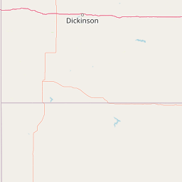
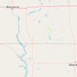
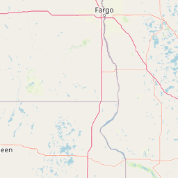

Leaflet | <a href="https://www.openstreetmap.org/copyright">© OpenStreetMap contributors</a>
Item
| Property | Value |
|---|---|
| id | 349703 |
| downstream_mainstem_id | https://geoconnex.us/ref/mainstems/312532 |
| encompassing_mainstem_basins | ['https://geoconnex.us/ref/mainstems/312532', 'https://geoconnex.us/ref/mainstems/312091'] |
| featuretype | ['https://www.opengis.net/def/schema/hy_features/hyf/HY_FlowPath', 'https://www.opengis.net/def/schema/hy_features/hyf/HY_WaterBody'] |
| fid | 16845 |
| head_2020huc12 | 101301040202 |
| head_nhdpv1_comid | 14668065 |
| head_nhdpv2_comid | https://geoconnex.us/nhdplusv2/comid/14668065 |
| head_nhdpv2huc12 | https://geoconnex.us/nhdplusv2/huc12/101301040202 |
| head_rf1id | 26528 |
| lengthkm | 210.1 |
| name_at_outlet | Beaver Creek |
| name_at_outlet_gnis_id | 1027849 |
| new_mainstemid | |
| outlet_2020huc12 | 101301040606 |
| outlet_drainagearea_sqkm | 2549.2 |
| outlet_nhdpv1_comid | 14485746 |
| outlet_nhdpv2_comid | https://geoconnex.us/nhdplusv2/comid/14485746 |
| outlet_nhdpv2huc12 | https://geoconnex.us/nhdplusv2/huc12/101301040606 |
| outlet_rf1id | 28254 |
| superseded | False |
| uri | https://geoconnex.us/ref/mainstems/349703 |
Graph Results
| monitoringLocation | https://sta.geoconnex.dev/collections/USGS/Things/items/'USGS-06354490' |
|---|---|
| siteName | USGS-06354490 |
| datasetDescription | None / USGS-06354490-d6bb3765fffa49dab571ab8e026cec1c |
| type | Stream |
| url | https://waterdata.usgs.gov/monitoring-location/06354490/#parameterCode=63160 |
| variableMeasured | None / USGS-06354490-d6bb3765fffa49dab571ab8e026cec1c |
| variableUnit | ft |
| measurementTechnique | observation |
| temporalCoverage | 2024-08-30T09:15:00Z/2024-09-09T16:00:00Z |
| distributionName | USGS Instantaneous Values Service |
| distributionURL | https://waterservices.usgs.gov/nwis/iv/?sites=USGS:06354490¶meterCd=63160&format=rdb |
| distributionFormat | text/tab-separated-values |
| wkt | POINT (-99.9827777777778 46.2280555555556) |
| monitoringLocation | https://sta.geoconnex.dev/collections/USGS/Things/items/'USGS-06354490' |
|---|---|
| siteName | USGS-06354490 |
| datasetDescription | None / USGS-06354490-d6bb3765fffa49dab571ab8e026cec1c |
| type | Stream |
| url | https://waterdata.usgs.gov/monitoring-location/06354490/#parameterCode=63160 |
| variableMeasured | None / USGS-06354490-d6bb3765fffa49dab571ab8e026cec1c |
| variableUnit | ft |
| measurementTechnique | observation |
| temporalCoverage | 2024-08-30T09:15:00Z/2024-09-09T16:00:00Z |
| distributionName | USGS SensorThings API |
| distributionURL | https://labs.waterdata.usgs.gov/sta/v1.1/Datastreams('d6bb3765fffa49dab571ab8e026cec1c')?$expand=Thing,Observations |
| distributionFormat | application/json |
| wkt | POINT (-99.9827777777778 46.2280555555556) |
| monitoringLocation | https://sta.geoconnex.dev/collections/USGS/Things/items/'USGS-06354490' |
|---|---|
| siteName | USGS-06354490 |
| datasetDescription | Gage height / USGS-06354490-85eadc1d41e64a0a867217d1e21eb14c |
| type | Stream |
| url | https://waterdata.usgs.gov/monitoring-location/06354490/#parameterCode=00065 |
| variableMeasured | Gage height / USGS-06354490-85eadc1d41e64a0a867217d1e21eb14c |
| variableUnit | ft |
| measurementTechnique | observation |
| temporalCoverage | 2024-08-30T09:15:00Z/2024-09-09T16:00:00Z |
| distributionName | USGS Instantaneous Values Service |
| distributionURL | https://waterservices.usgs.gov/nwis/iv/?sites=USGS:06354490¶meterCd=00065&format=rdb |
| distributionFormat | text/tab-separated-values |
| wkt | POINT (-99.9827777777778 46.2280555555556) |
| monitoringLocation | https://sta.geoconnex.dev/collections/USGS/Things/items/'USGS-06354490' |
|---|---|
| siteName | USGS-06354490 |
| datasetDescription | Gage height / USGS-06354490-85eadc1d41e64a0a867217d1e21eb14c |
| type | Stream |
| url | https://waterdata.usgs.gov/monitoring-location/06354490/#parameterCode=00065 |
| variableMeasured | Gage height / USGS-06354490-85eadc1d41e64a0a867217d1e21eb14c |
| variableUnit | ft |
| measurementTechnique | observation |
| temporalCoverage | 2024-08-30T09:15:00Z/2024-09-09T16:00:00Z |
| distributionName | USGS SensorThings API |
| distributionURL | https://labs.waterdata.usgs.gov/sta/v1.1/Datastreams('85eadc1d41e64a0a867217d1e21eb14c')?$expand=Thing,Observations |
| distributionFormat | application/json |
| wkt | POINT (-99.9827777777778 46.2280555555556) |